The Mother of Rivers: J. Norman Collie and the Discovery of the Columbia Icefield
On August 18, 1898, Scottish chemist and mountaineer J. Norman Collie climbed Mount Athabasca and beheld for the first time in human history the colossal expanse of the Columbia Icefield.
Mountain Safety & Conditions Disclaimer: High-altitude climbing, glacial travel, and technical ascents entail severe objective risks including avalanches, serac collapses, rapid weather collapse, and altitude illness. Historical route descriptions and summit claims on Mountanity reflect documented archival sources and must not be used as live operational safety assessments. Local regulations, permits, and physical glacial topography change continuously.
Peer Review: Senior Editorial Board & Historical Reviewers • Editorial Standards
The Great Unknown Beyond the Bow
In the late nineteenth century, the Canadian Pacific Railway had driven its steel tracks through the Bow Valley and across Kicking Horse Pass, opening the luxury hotels of Banff and Lake Louise to world travelers. But barely fifty miles north of the railway corridor lay a vast, terra incognita of jagged limestone ranges, roaring glacial rivers, and dense sub-alpine forests that remained entirely unmapped.
Among the early pioneers drawn to this wilderness was Professor John Norman Collie. A world-renowned Scottish professor of organic chemistry at University College London, Collie was also an accomplished alpine explorer who had climbed extensively with Albert F. Mummery in the Alps and on the tragic 1895 attempt on Nanga Parbat in the Himalayas.
Collie was possessed by a singular geographic curiosity. Trappers and First Nations guides told rumors of two enormous, mythical mountains—Mount Brown and Mount Hooker—supposedly rising more than 16,000 feet near the Athabasca Pass. Collie was determined to lead an expedition north into the unknown wilderness to find them.
The Pack Train through Trackless Muskeg
In July 1898, Collie organized a small, self-contained expedition departing from Lake Louise. Joining him were fellow British climbers Hermann Woolley and Hugh Stutfield, along with the legendary Canadian outfitter and frontiersman Bill Peyto.
Leading twenty heavily laden pack horses, the party slashed through fallen timber, waded across freezing glacial rivers, and battled swarms of mosquitoes as they pushed north along the Bow, Mistaya, and Sunwapta rivers.
As they ascended toward Sunwapta Pass, the landscape opened into a stark alpine valley dominated by towering limestone massifs draped in hanging ice tongues. Dominating the head of the valley rose a sharp, symmetrical peak of snow and rock: Mount Athabasca (3,491 m).
The Ascent of Mount Athabasca
On the morning of August 18, 1898, Collie and Woolley departed their camp at dawn to attempt the first ascent of Mount Athabasca.
The climbing was steep and exposed. Navigating around gaping crevasses on the lower glacier, the men reached the base of an icy snow couloir. Kicking steps with their hobnailed boots and cutting handholds with their ice axes, they worked their way up the steep headwall onto the sharp knife-edge of the summit arête.
The wind howled out of the west, driving stinging snow pellets against their tweed coats. Step by step, Collie led the rope along the corniced crest until they stood upon the highest snow dome.
Beholding the Continental Apex
As Collie and Woolley reached the summit, the passing storm clouds suddenly parted, illuminated by blinding northern sunlight.
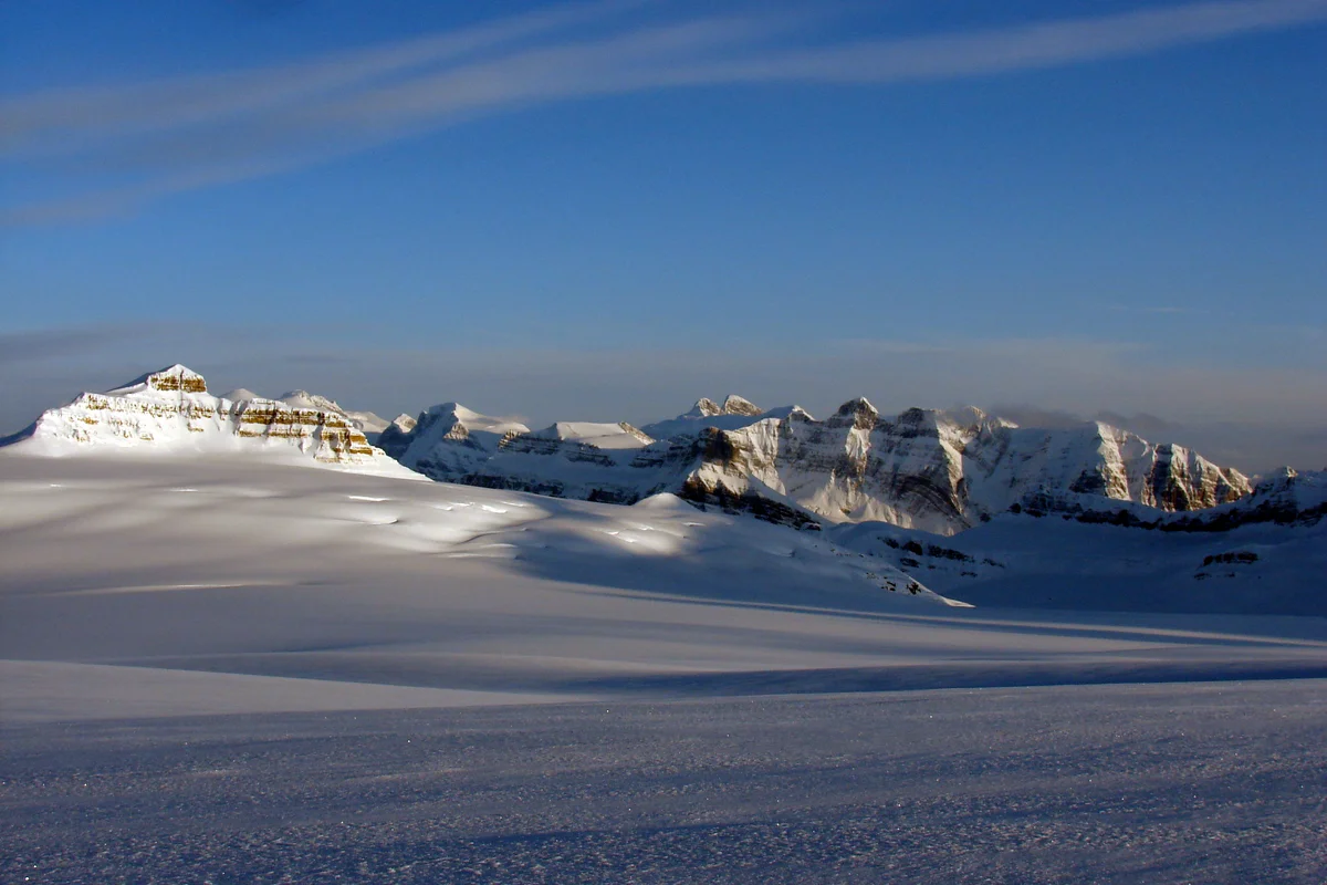
Collie turned his gaze westward and froze in awe. Expecting to see forested valleys or isolated ridges, he beheld instead an ocean of pure, undulating white ice stretching toward the western horizon as far as the eye could see—a colossal, unbroken ice cap spanning over one hundred square miles, from which immense glaciated peaks protruded like lonely islands in an arctic sea.
Collie wrote in his journal of that transformative moment:
“A new world was spread out at our feet. To the westward, an enormous ice-field stretched away to the horizon, a grand snowy amphitheater surrounded by peaks of majestic stature.”
Collie realized with profound scientific insight that they were standing upon the hydrological apex of the entire North American continent. From this massive sheet of ice—which he christened the Columbia Icefield—meltwaters flowed into three separate oceans: west into the Columbia River and the Pacific Ocean; north into the Athabasca, Slave, and Mackenzie rivers and the Arctic Ocean; and east into the Saskatchewan River and the Atlantic via Hudson Bay.
Mapping a New Realm
From the summit of Athabasca, Collie sketched the first accurate topographic map of the region, naming Mount Columbia (3,747 m)—the second-highest peak in the Canadian Rockies—as well as Mount Bryce, Mount Alberta, and Mount King Edward.
Collie’s 1898 expedition demolished the nineteenth-century myth of Mount Brown and Mount Hooker’s exaggerated 16,000-foot altitudes, replacing folklore with precise, scientific cartography.
His subsequent book, Climbs and Exploration in the Canadian Rockies, became the foundational guidebook for generations of alpinists. J. Norman Collie’s discovery of the Columbia Icefield remains one of the crowning geographic triumphs in the exploration of Western Canada.
Key Statistics & Topographic Figures
- Category
- Pioneering Exploration & Cartography
Archival Subject
- Reading Time
- 15 min read
Narrative Length
- Key Mountain
- the high mountains
Objective
- Ascent Route
- the ascent route
Topography
- Verification
- Editorially Verified
Archival Standard
Archival Primary Source Quotations
“In the mountains, truth is etched in ice and granite; every step requires unwavering respect for the heights.”
Defined Alpine Terminology & Concepts
- Summit Push
- The final continuous climbing effort from the highest established camp to the mountain apex and back.
- Death Zone Chronicle
- A verified, research-backed historical narrative documenting the human, technical, and environmental realities of an alpine expedition.
Frequently Asked Questions: The Mother of Rivers: J. Norman Collie and the Discovery of the Columbia Icefield
What is the core chronicle and subject of "The Mother of Rivers: J. Norman Collie and the Discovery of the Columbia Icefield"?
On August 18, 1898, Scottish chemist and mountaineer J. Norman Collie climbed Mount Athabasca and beheld for the first time in human history the colossal expanse of the Columbia Icefield.
Which mountain peaks and routes are featured in "The Mother of Rivers: J. Norman Collie and the Discovery of the Columbia Icefield"?
This narrative documents climbs on the high mountains along the the ascent route in Canada.
Which documented expedition is chronicled in this story?
This historical chronicle captures the events of the 1898-collie-columbia-icefield-discovery, verified through contemporary journals and archival records.
Who authored and researched this archival chronicle?
Authored and researched by Mountainity Historical Research Desk, drawing on primary eyewitness testimonies, alpine club registries, and verified summit logs.
What makes this high-altitude chronicle historically significant?
Categorized under "Pioneering Exploration & Cartography", this chronicle preserves critical lessons in alpine leadership, survival, tactical speed, and human endurance in the death zone.
Documented Sources & Archival Citations
- Climbs and Exploration in the Canadian Rockies(Hugh E. M. Stutfield and J. Norman Collie / Longmans, Green, and Co.)
Supporting claim: Primary chronicle of the 1898 discovery of the Columbia Icefield and Mount Athabasca first ascent
Accessed/Documented: 2026 - The Canadian Alps(Robert W. Sandford / Rocky Mountain Books)
Supporting claim: Historical analysis of Collie's cartographic impact on Western Canada
Accessed/Documented: 2026