1952 Swiss Everest Expedition: The 8,595m Breakthrough
How Tenzing Norgay and Raymond Lambert forged the South Col route and climbed to 8,595m, blazing the trail for Everest's conquest.
Mountain Safety & Conditions Disclaimer: High-altitude climbing, glacial travel, and technical ascents entail severe objective risks including avalanches, serac collapses, rapid weather collapse, and altitude illness. Historical route descriptions and summit claims on Mountanity reflect documented archival sources and must not be used as live operational safety assessments. Local regulations, permits, and physical glacial topography change continuously.
Peer Review: Senior Editorial Board & Historical Reviewers • Editorial Standards
The Gateway Through Nepal
Prior to 1950, all attempts on Mount Everest approached from the north through Tibet. When China closed Tibet to foreign travelers and Nepal opened its borders, international mountaineers faced an unsolved puzzle: could Mount Everest be climbed from the south?
In the spring of 1952, the Swiss Foundation for Alpine Research sent an elite team of Genevan climbers led by Edouard Wyss-Dunant. For their sirdar and lead high-altitude climber, they chose Tenzing Norgay—already a veteran of six Everest expeditions.
Forging the Khumbu and Lhotse Face
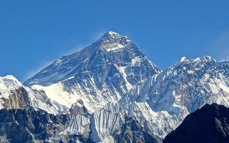
Tenzing led the route-finding through the chaotic towers of the Khumbu Icefall, discovering the precarious snow bridge into the Western Cwm. Working in close partnership with Swiss guide Raymond Lambert, Tenzing pushed the route up the steep blue ice of the Lhotse Face and established the first camp on the wind-blasted South Col (7,900m).
On May 27, 1952, Tenzing and Lambert set out with an emergency three-man tent and primitive, malfunctioning open-circuit oxygen sets. Clinging to the Southeast Ridge above 8,400 meters, they endured an agonizing, freezing night without sleeping bags or stoves, melting snow over a candle flame to wet their parched lips.
The Record at 8,595 Meters
On the morning of May 28, despite oxygen starvation and dragging limbs, Tenzing and Lambert pushed upward step by step along the knife-edge ridge. They reached an altitude of 8,595 meters (28,210 ft)—higher than any human had ever stood on Earth.
Turned back only by total physical exhaustion and malfunctioning oxygen gear, their descent was a masterpiece of survival. The Swiss expedition proved definitively that the South Col route was viable, directly laying down the blueprint that Hillary and Tenzing would successfully follow to the summit twelve months later.
Key Statistics & Topographic Figures
- Category
- Pioneering Reconnaissance
Archival Subject
- Reading Time
- 8 min read
Narrative Length
- Key Mountain
- mount-everest
Objective
- Ascent Route
- south-col-route
Topography
- Verification
- Editorially Verified
Archival Standard
Archival Primary Source Quotations
“In the mountains, truth is etched in ice and granite; every step requires unwavering respect for the heights.”
Defined Alpine Terminology & Concepts
- Summit Push
- The final continuous climbing effort from the highest established camp to the mountain apex and back.
- Death Zone Chronicle
- A verified, research-backed historical narrative documenting the human, technical, and environmental realities of an alpine expedition.
Frequently Asked Questions: 1952 Swiss Everest Expedition: The 8,595m Breakthrough
What is the core chronicle and subject of "1952 Swiss Everest Expedition: The 8,595m Breakthrough"?
How Tenzing Norgay and Raymond Lambert forged the South Col route and climbed to 8,595m, blazing the trail for Everest's conquest.
Which mountain peaks and routes are featured in "1952 Swiss Everest Expedition: The 8,595m Breakthrough"?
This narrative documents climbs on mount-everest along the south-col-route in Nepal.
Which documented expedition is chronicled in this story?
This historical chronicle captures the events of the 1952-swiss-everest, verified through contemporary journals and archival records.
Who authored and researched this archival chronicle?
Authored and researched by Mountanity Research Desk, drawing on primary eyewitness testimonies, alpine club registries, and verified summit logs.
What makes this high-altitude chronicle historically significant?
Categorized under "Pioneering Reconnaissance", this chronicle preserves critical lessons in alpine leadership, survival, tactical speed, and human endurance in the death zone.
Related Mountains


Mount Everest
Mount Everest is the highest mountain above sea level on Earth, standing at an official elevation of 8,848.86 meters (29,031.7 ft). Straddling the international frontier between Nepal and China, it is known locally as Sagarmatha in Nepali ('Goddess of the Sky') and Chomolungma in Tibetan ('Mother Goddess of the World'). The peak rises into the extreme upper troposphere, where oxygen levels drop to barely one-third of sea-level pressure. Climbers face hurricane-force jet stream winds, severe frostbite conditions, shifting ice crevasses in the Khumbu Icefall, and the dangerous Death Zone above 8,000 meters.