The Razor of the Sky: The 1979 Yugoslav First Ascent of Everest West Ridge
On May 13, 1979, Slovenian mountaineers Andrej Štremfelj and Nejc Zaplotnik conquered Mount Everest via the complete West Ridge direct, overcoming extreme Grade V+ rock in the death zone.
Mountain Safety & Conditions Disclaimer: High-altitude climbing, glacial travel, and technical ascents entail severe objective risks including avalanches, serac collapses, rapid weather collapse, and altitude illness. Historical route descriptions and summit claims on Mountanity reflect documented archival sources and must not be used as live operational safety assessments. Local regulations, permits, and physical glacial topography change continuously.
Peer Review: Senior Editorial Board & Historical Reviewers • Editorial Standards
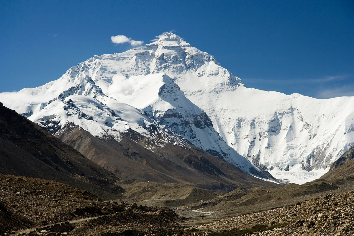
In the spring of 1979, the international alpine community looked upon the complete, unbroken West Ridge of Mount Everest (8,848.86m) as one of the most terrifying problems in the Himalaya. While the American expedition of 1963 had famously climbed a portion of the ridge before diverting onto the North Face into the Hornbein Couloir, no human had ever followed the integral knife-edge crest directly from the Lho La col (6,026m) all the way to the summit. To attempt it meant committing to three kilometers of shattered rock and overhanging snow cornices, completely exposed to the full fury of the westerly jet stream.
Enter the twenty-five-member Yugoslav national expedition, led by the tactical genius Tone Škarja. The team consisted of the finest big-wall rock and winter climbers from Slovenia, Croatia, and Bosnia. At the spearhead of the summit push were two young Slovenian mountaineers: twenty-two-year-old Andrej Štremfelj and twenty-seven-year-old Nejc Zaplotnik. Both had already forged an unbreakable bond two years earlier on the southwest face of Gasherbrum I.
The Siege of the Lho La
Before the Yugoslavs could even touch the West Ridge, they had to solve the puzzle of the Lho La—a 700-meter vertical wall of blue ice and crumbling rock that guarded the border between Nepal and Tibet. Using ingenious modified hand winches and thousands of meters of rope, the team hauled six tons of gear up the sheer icecliff to establish Camp I on the windswept col at 6,026 meters.
From the Lho La, the ridge soared upward like a serrated dragon’s back. For seven brutal weeks, the climbers fixed ropes along the razor edge, battling ferocious storms that shredded high-altitude tents and tossed equipment thousands of meters down into the Rongbuk Glacier in Tibet. They established Camp II at 6,770 meters, Camp III at 7,170 meters, and Camp IV at 7,520 meters, inching forward through sub-zero blizzards that frequently blinded the lead climbers.
The Crux of the Yellow Band
By early May, the lead team reached Camp V at 8,120 meters, perched precariously on a rocky notch directly below the infamous Yellow Band. Above them loomed the crux of the climb: a vertical, crumbling limestone chimney and overhang. At sea level, such a pitch would be a demanding Grade V+ rock problem; at 8,250 meters in the death zone, in twenty-below temperatures with heavy boots and oxygen masks, it was nearly unthinkable.
On May 13, 1979, Andrej Štremfelj and Nejc Zaplotnik left Camp V before dawn. When Zaplotnik reached the foot of the chimney, he removed his heavy outer mittens, jamming his crampons into tiny rock crystals and pulling over sheer overhangs on brittle limestone. A single slip meant an unfathomable vertical fall into the Western Cwm. With breathtaking boldness, Zaplotnik hauled himself over the lip, driving an anchor piton and shouting down through his oxygen mask: “Andrej, the wall is breached!”
Standing on the Roof of the World
Beyond the Yellow Band lay a treacherous traverse across a sixty-degree slope of bullet-hard blue ice leading into the upper Hornbein Couloir. Kicking front points into the glass-hard surface, Štremfelj and Zaplotnik climbed the final couloir to reach the summit crest.
At 1:45 PM on May 13, 1979, Andrej Štremfelj and Nejc Zaplotnik stepped onto the 8,848-meter summit of Mount Everest. They had achieved the first ascent of the complete West Ridge Direct—a route so long, technical, and exposed that it has never been repeated in its entirety in the nearly half-century since. Their triumph put Slovenian alpinism at the absolute pinnacle of world mountaineering and cemented their names forever among the greatest legends of high-altitude exploration.
Key Statistics & Topographic Figures
- Category
- Golden Age Classics
Archival Subject
- Reading Time
- 15 min read
Narrative Length
- Key Mountain
- mount-everest
Objective
- Ascent Route
- everest-west-ridge
Topography
- Verification
- Editorially Verified
Archival Standard
Archival Primary Source Quotations
“In the mountains, truth is etched in ice and granite; every step requires unwavering respect for the heights.”
Defined Alpine Terminology & Concepts
- Summit Push
- The final continuous climbing effort from the highest established camp to the mountain apex and back.
- Death Zone Chronicle
- A verified, research-backed historical narrative documenting the human, technical, and environmental realities of an alpine expedition.
Frequently Asked Questions: The Razor of the Sky: The 1979 Yugoslav First Ascent of Everest West Ridge
What is the core chronicle and subject of "The Razor of the Sky: The 1979 Yugoslav First Ascent of Everest West Ridge"?
On May 13, 1979, Slovenian mountaineers Andrej Štremfelj and Nejc Zaplotnik conquered Mount Everest via the complete West Ridge direct, overcoming extreme Grade V+ rock in the death zone.
Which mountain peaks and routes are featured in "The Razor of the Sky: The 1979 Yugoslav First Ascent of Everest West Ridge"?
This narrative documents climbs on mount-everest along the everest-west-ridge in Nepal.
Which documented expedition is chronicled in this story?
This historical chronicle captures the events of the 1979-yugoslav-everest-west-ridge, verified through contemporary journals and archival records.
Who authored and researched this archival chronicle?
Authored and researched by Mountainity Historical Research Desk, drawing on primary eyewitness testimonies, alpine club registries, and verified summit logs.
What makes this high-altitude chronicle historically significant?
Categorized under "Golden Age Classics", this chronicle preserves critical lessons in alpine leadership, survival, tactical speed, and human endurance in the death zone.
Related Mountains
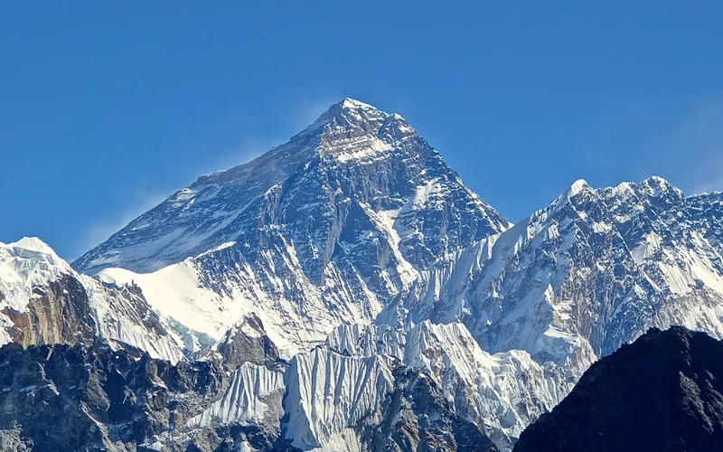


Mount Everest
Mount Everest is the highest mountain above sea level on Earth, standing at an official elevation of 8,848.86 meters (29,031.7 ft). Straddling the international frontier between Nepal and China, it is known locally as Sagarmatha in Nepali ('Goddess of the Sky') and Chomolungma in Tibetan ('Mother Goddess of the World'). The peak rises into the extreme upper troposphere, where oxygen levels drop to barely one-third of sea-level pressure. Climbers face hurricane-force jet stream winds, severe frostbite conditions, shifting ice crevasses in the Khumbu Icefall, and the dangerous Death Zone above 8,000 meters.
Documented Sources & Archival Citations
- American Alpine Journal: Everest West Ridge Direct by Tone Škarja(American Alpine Club)
Supporting claim: Official expedition report and topographic account of the 1979 Yugoslav first ascent
Accessed/Documented: 1980 - Pot (The Path): The Everest Odyssey(Nejc Zaplotnik / Cankarjeva Založba)
Supporting claim: Detailed first-hand account of the technical Yellow Band crux, high winds, and summit moment
Accessed/Documented: 1981