Cho Oyu: Opening the Final Tibetan Phase of the Project
Nirmal Purja attacks Cho Oyu from Tibet, conquering the Turquoise Goddess at lightning speed to launch Phase Three.
Mountain Safety & Conditions Disclaimer: High-altitude climbing, glacial travel, and technical ascents entail severe objective risks including avalanches, serac collapses, rapid weather collapse, and altitude illness. Historical route descriptions and summit claims on Mountanity reflect documented archival sources and must not be used as live operational safety assessments. Local regulations, permits, and physical glacial topography change continuously.
Peer Review: Senior Editorial Board & Historical Reviewers • Editorial Standards
Entering the High Tibetan Plateau
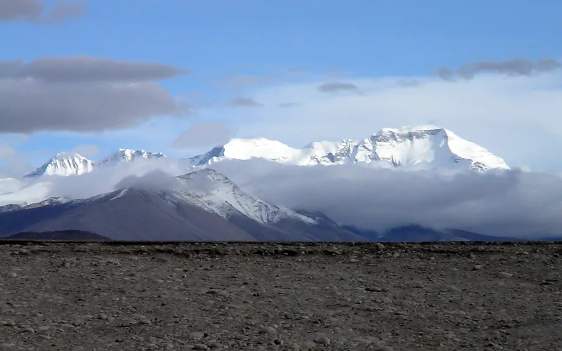
In September 2019, after brief rest and family reunions in Kathmandu, Nirmal Purja initiated Phase Three: the final three peaks—Cho Oyu, Manaslu, and Shishapangma. Crossing the border into the Tibet Autonomous Region of China, the expedition established Base Camp on the northern side of Cho Oyu (8,188m), the ‘Turquoise Goddess’.
While often characterized as the most accessible eight-thousander, Cho Oyu in autumn presents fierce gale-force winds sweeping off the arid Tibetan plateau, sub-zero temperatures, and vast, energy-sapping snowfields above 7,500 meters.
A Lightning Alpine Strike
Purja had zero interest in protracted acclimatization. Accompanied by Mingma David Sherpa and Gesman Tamang, he launched an alpine-style push from the lower camps directly through the yellow rock band. Moving through sustained 50 km/h winds, the team ascended the wide glaciated Northwest Ridge with machine-like rhythm.
On September 23, 2019, Nirmal Purja stood on the broad, flat summit plateau of Cho Oyu, looking southward toward the distant pyramid of Everest. Peak number twelve was secured.
Turning Toward Nepal
Within minutes of confirming their summit with base camp radio, the team began their descent. They immediately packed their expedition vehicles, crossed the border back into Nepal, and chartered a helicopter for the immediate assault on Manaslu.
Key Statistics & Topographic Figures
- Category
- Tibetan Expeditions
Archival Subject
- Reading Time
- 7 min read
Narrative Length
- Key Mountain
- cho-oyu
Objective
- Ascent Route
- cho-oyu-normal-route
Topography
- Verification
- Editorially Verified
Archival Standard
Archival Primary Source Quotations
“In the mountains, truth is etched in ice and granite; every step requires unwavering respect for the heights.”
Defined Alpine Terminology & Concepts
- Summit Push
- The final continuous climbing effort from the highest established camp to the mountain apex and back.
- Death Zone Chronicle
- A verified, research-backed historical narrative documenting the human, technical, and environmental realities of an alpine expedition.
Frequently Asked Questions: Cho Oyu: Opening the Final Tibetan Phase of the Project
What is the core chronicle and subject of "Cho Oyu: Opening the Final Tibetan Phase of the Project"?
Nirmal Purja attacks Cho Oyu from Tibet, conquering the Turquoise Goddess at lightning speed to launch Phase Three.
Which mountain peaks and routes are featured in "Cho Oyu: Opening the Final Tibetan Phase of the Project"?
This narrative documents climbs on cho-oyu along the cho-oyu-normal-route in China.
Which documented expedition is chronicled in this story?
This historical chronicle captures the events of the 2019-purja-cho-oyu, verified through contemporary journals and archival records.
Who authored and researched this archival chronicle?
Authored and researched by Mountanity Research Desk, drawing on primary eyewitness testimonies, alpine club registries, and verified summit logs.
What makes this high-altitude chronicle historically significant?
Categorized under "Tibetan Expeditions", this chronicle preserves critical lessons in alpine leadership, survival, tactical speed, and human endurance in the death zone.
Related Mountains


Cho Oyu
Cho Oyu, at 8,188 meters (26,864 ft), is the sixth-highest mountain in the world, situated 20 km west of Mount Everest. Meaning 'Turquoise Goddess' in Tibetan, it stands on the glaciated Nangpa La trade route between Nepal and Tibet. Its moderate northwest slopes make it the most accessible 8,000-meter peak.