Nuptse
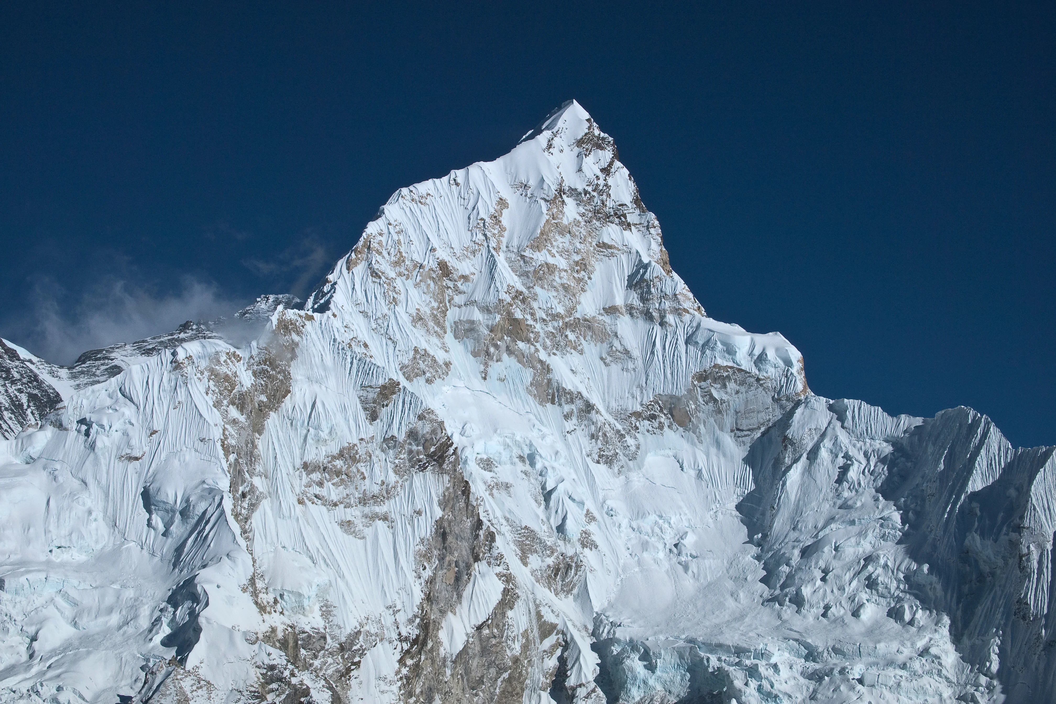
Nuptse is a dramatic 7,861-meter mountain in the Khumbu region of the Nepalese Himalayas, lying two kilometers west-southwest of Mount Everest and forming the formidable southwestern wall of the Western Cwm. In Tibetan, its name translates directly to 'West Peak', signifying its position in the monumental Everest-Lhotse-Nuptse horseshoe.
 Nepal
Mountain Safety & Conditions Disclaimer: High-altitude climbing, glacial travel, and technical ascents entail severe objective risks including avalanches, serac collapses, rapid weather collapse, and altitude illness. Historical route descriptions and summit claims on Mountanity reflect documented archival sources and must not be used as live operational safety assessments. Local regulations, permits, and physical glacial topography change continuously.
Peer Review: Senior Editorial Board & Historical Reviewers • Editorial Standards
Geographical Setting & Topography
Khumbu region of eastern Nepal, forming the dramatic southern rampart of the Western Cwm opposite Mount Everest and Lhotse.
Historic First Ascent
Date: May 16, 1961
Ascent Team: Dennis Davis and Tashi Sherpa (British-Nepali Nuptse Expedition)
Key Statistics & Topographic Figures
- Official Elevation
- 7,861 m (25,791 ft)
Topographic Survey
- Topographic Prominence
- 319 m
Relief Metric
- First Ascent
- May 16, 1961
Dennis Davis and Tashi Sherpa (British-Nepali Nuptse Expedition)
- Territory Codes
- NP
Sovereignty
Archival Primary Source Quotations
“The mountains are calling, and we must honor their grandeur with truth and historical precision.”
Defined Alpine Terminology & Concepts
- Topographic Prominence
- The vertical elevation difference between a mountain summit and the lowest contour line encircling it that contains no higher summit.
- Alpine Zone
- The ecological and climatic zone above the treeline characterized by severe weather, glaciers, and permanent snow cover.
Nuptse Mountain Weather Forecast
Detailed 14-Day Summit Window & Weather Timeline
Explore day-by-day summit push safety windows, wind shear analysis, and extended multi-day forecasts for Nuptse.
Explore Nuptse (7,861 m) in Interactive 3D
Inspect steep glacial walls, hanging seracs, ridge approaches, and elevation relief with 360° rotation and terrain tilt in WebGL.
Documented Climbing Routes (1)
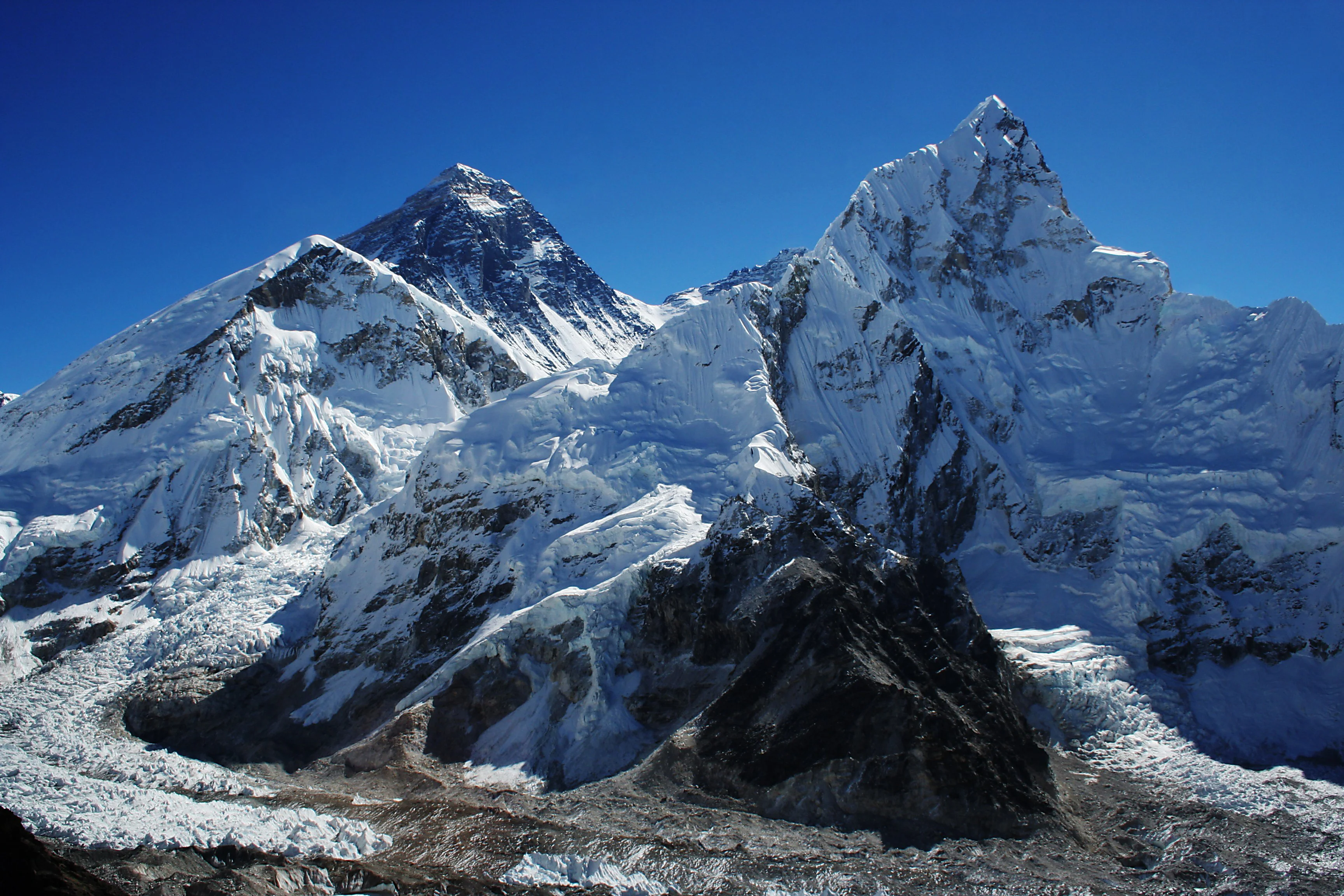
Nuptse South Face
The South Face of Nuptse is an awe-inspiring 2,500-meter wall of mixed ice flutes, vertical granite pillars, and hanging glaciers rising above the Khumbu Glacier. Widely acclaimed as one of the ultimate mountaineering challenges in the Himalayas, it demands sustained technical climbing at extreme high altitude between 5,300 and 7,861 meters. The face has inspired legendary alpine ascents, including the 2003 Piolet d'Or-winning route on Nuptse East by Valeri Babanov and Yuri Koshelenko, and the 2017 French direct alpine ascent by Benjamin Guigonnet, Hélias Millerioux, and Frédéric Degoulet.
Frequently Asked Questions: Nuptse
What is the verified elevation of Nuptse?
Nuptse has an official elevation of 7,861 meters (25,791 feet) above sea level.
When was Nuptse first climbed?
Nuptse was first summited on May 16, 1961 by Dennis Davis and Tashi Sherpa (British-Nepali Nuptse Expedition).
What mountain range and territories encompass Nuptse?
Nuptse is situated in Khumbu, Solukhumbu District, Sagarmatha National Park, Mahalangur Himal across territory codes NP.
Documented Sources & Archival Citations
- The Ascent of Nuptse(Alpine Journal / Joe Walmsley)
Supporting claim: Official account of the 1961 British-Nepali expedition and first ascent by Dennis Davis and Tashi Sherpa
Accessed/Documented: 1962 - Himalayan Database: Nuptse Records(Elizabeth Hawley / Himalayan Database)
Supporting claim: Comprehensive historical ascent logs, route variations, and summit verifications for Nuptse
Accessed/Documented: 2024