Nuptse South Face
The South Face of Nuptse is an awe-inspiring 2,500-meter wall of mixed ice flutes, vertical granite pillars, and hanging glaciers rising above the Khumbu Glacier. Widely acclaimed as one of the ultimate mountaineering challenges in the Himalayas, it demands sustained technical climbing at extreme high altitude between 5,300 and 7,861 meters.
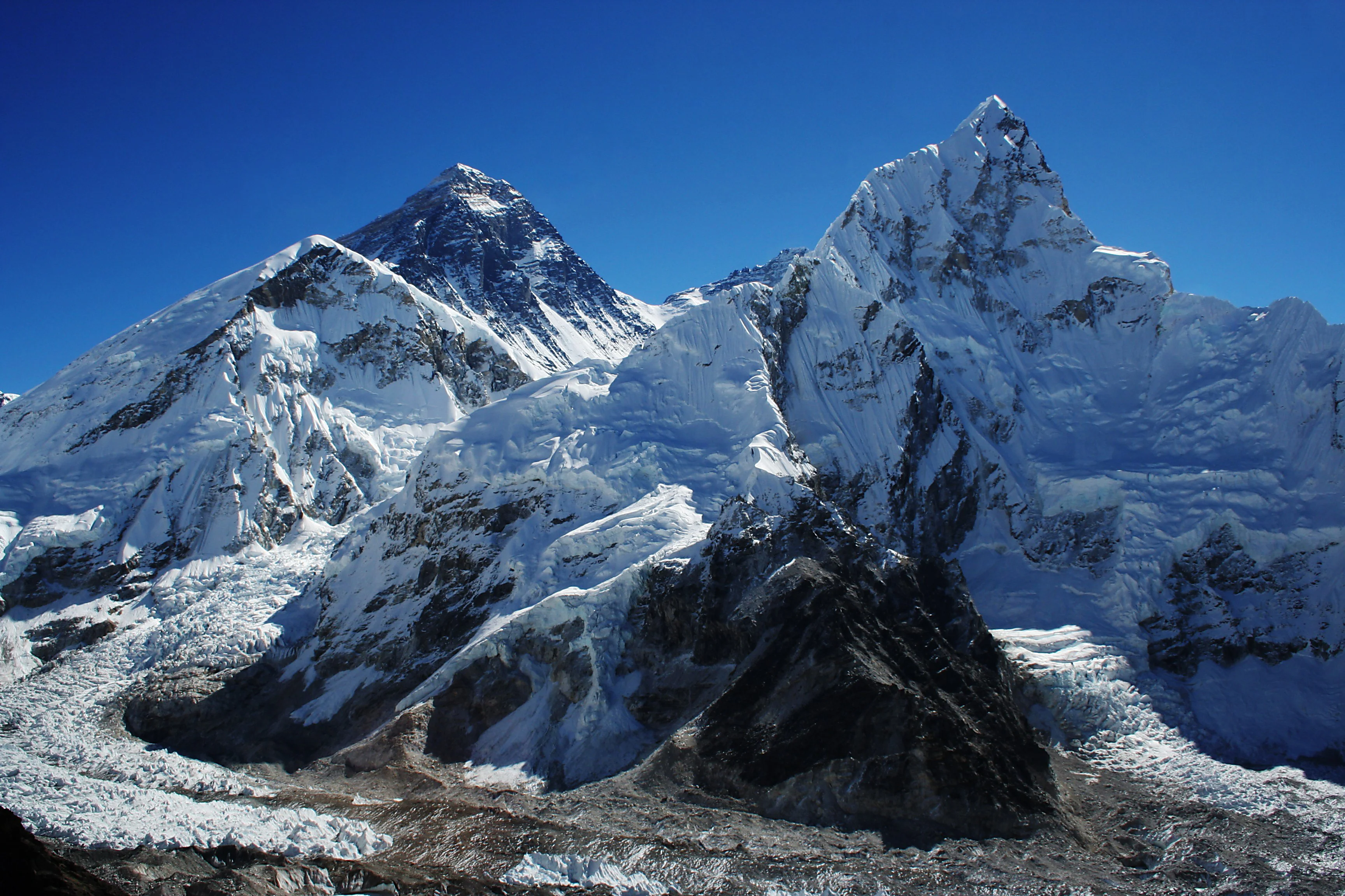
Ascent line, technical cruxes & camp topography profile for Nuptse South Face
Mountain Safety & Conditions Disclaimer: High-altitude climbing, glacial travel, and technical ascents entail severe objective risks including avalanches, serac collapses, rapid weather collapse, and altitude illness. Historical route descriptions and summit claims on Mountanity reflect documented archival sources and must not be used as live operational safety assessments. Local regulations, permits, and physical glacial topography change continuously.
Peer Review: Senior Editorial Board & Historical Reviewers • Editorial Standards
Tactical & Camp Notes
Requires world-class high-altitude endurance, flawless mixed and ice climbing technique, rapid alpine-style movement to minimize objective hazard exposure, and expert bivouac management on hanging stances.
Identified Objective Hazards
- •Frequent massive serac collapses and powder-snow avalanches sweeping down the central couloirs
- •Continuous rockfall and dislodged ice triggered by sun exposure on the upper buttresses
- •Extreme high-altitude cerebral and pulmonary edema risks without fixed camps or supplementary oxygen
- •Fierce jet stream winds scouring the upper knife-edge ridges leading to the summit
Historical Context
First envisioned by British teams in the 1960s and 1970s, the face saw visionary breakthrough lines established in lightweight alpine style across the 2000s and 2010s.
Interactive Elevation Profile
Vertical profile, technical cruxes, and camp staging progression for Nuptse South Face on Nuptse.
Staging base camp on the lateral moraine of the Khumbu Glacier.
Camp-by-Camp Topography
Key staging altitudes, technical cruxes, and terrain transitions for Nuptse South Face.
Nuptse Base Camp
Staging base camp on the lateral moraine of the Khumbu Glacier.
Camp I / Advanced Bivouac
Snow platform carved below the central ice couloir.
Camp II / Mid-Face Stance
Exposed rocky ledge tucked beneath the upper headwall granite buttress.
Camp III / Upper Ridge Bivouac
Hanging tent stance on the razor-sharp knife-edge summit crest.
Nuptse Main Summit
The heavily corniced summit crest of Nuptse overlooking Mount Everest and the Western Cwm.
Topographic Location & Terrain Map
Cartographic datum, massif coordinates, and terrain context for Nuptse South Face on Nuptse.
Interactive Topographic Terrain Map
Click below to load live cartographic contours, glacier approaches, and geographic markers for Nuptse (27°57′59″ N, 86°53′27″ E).
Key Statistics & Topographic Figures
- Route Type
- Himalayan Big Wall / Technical Mixed Alpine Face
Topography
- Technical Difficulty
- Extremely Demanding / Grade VI, WI5, M6, 2,500m Himalayan Big Wall
Grade VI, mixed climbing up to M6, vertical water ice to WI5, sustained high-altitude exposure to 7,861m
- Country / Region
- Nepal (Khumbu / Mahalangur Himal)
Location
Archival Primary Source Quotations
“A mountain route is not merely a path of rock and ice; it is a test of human endurance, judgment, and humility.”
Defined Alpine Terminology & Concepts
- Crux
- The most difficult and technically demanding pitch or section of a climbing route.
- Normal Route (Voie Normale)
- The most frequently climbed, least technical, and historically standard path to a mountain summit.
Frequently Asked Questions: Nuptse South Face
What is the climbing difficulty and grade of Nuptse South Face?
Nuptse South Face on nuptse is graded as Extremely Demanding / Grade VI, WI5, M6, 2,500m Himalayan Big Wall, with technical climbing requirements including Grade VI, mixed climbing up to M6, vertical water ice to WI5, sustained high-altitude exposure to 7,861m.
What are the primary hazards on the Nuptse South Face?
Climbers on Nuptse South Face must navigate severe objective hazards including Frequent massive serac collapses and powder-snow avalanches sweeping down the central couloirs, Continuous rockfall and dislodged ice triggered by sun exposure on the upper buttresses, Extreme high-altitude cerebral and pulmonary edema risks without fixed camps or supplementary oxygen, Fierce jet stream winds scouring the upper knife-edge ridges leading to the summit.
What camps are established on Nuptse South Face?
Nuptse South Face typically features 5 staging camps, progressing from Nuptse Base Camp (5300m) up toward the summit.
Mountain Ascended
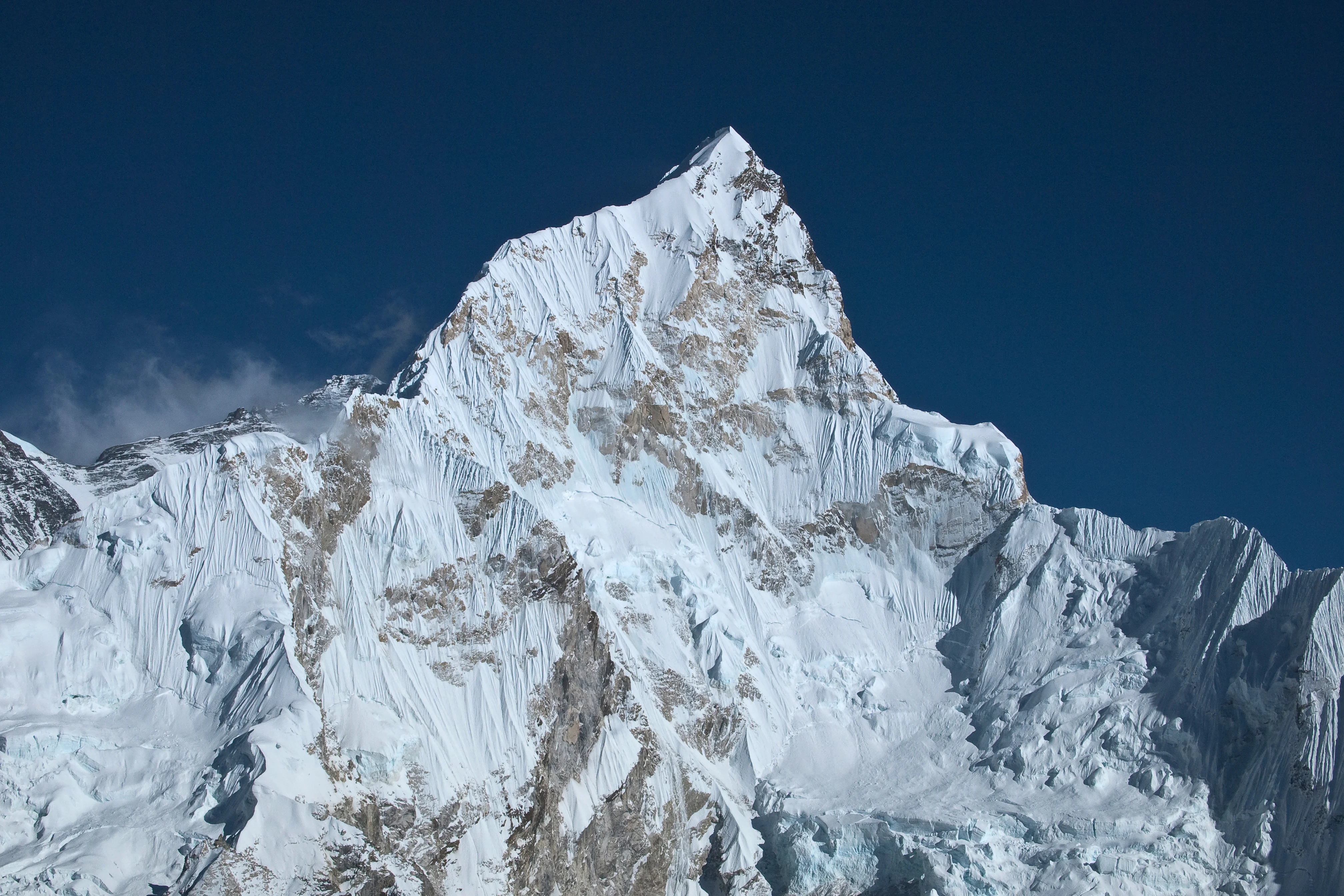

Nuptse
Nuptse is a dramatic 7,861-meter mountain in the Khumbu region of the Nepalese Himalayas, lying two kilometers west-southwest of Mount Everest and forming the formidable southwestern wall of the Western Cwm. In Tibetan, its name translates directly to 'West Peak', signifying its position in the monumental Everest-Lhotse-Nuptse horseshoe. The south face of Nuptse is an extraordinarily steep 2,500-meter wall of ice flutes, vertical rock buttresses, and hanging glaciers that is considered one of the greatest alpine climbing challenges on Earth. The mountain was first climbed on May 16, 1961, by British mountaineer Dennis Davis and Sherpa legend Tashi Sherpa via the North Ridge.
Documented Sources & Archival Citations
- American Alpine Journal: Nuptse South Face Alpine Ascents(American Alpine Club)
Supporting claim: Detailed technical analysis of modern alpine-style routes up the 2,500m South Face
Accessed/Documented: 2018 - Piolet d'Or Technical Chronicles: Nuptse(Groupe de Haute Montagne)
Supporting claim: Official citation and documentation for the breakthrough ascents on the Nuptse wall
Accessed/Documented: 2004