Pumori
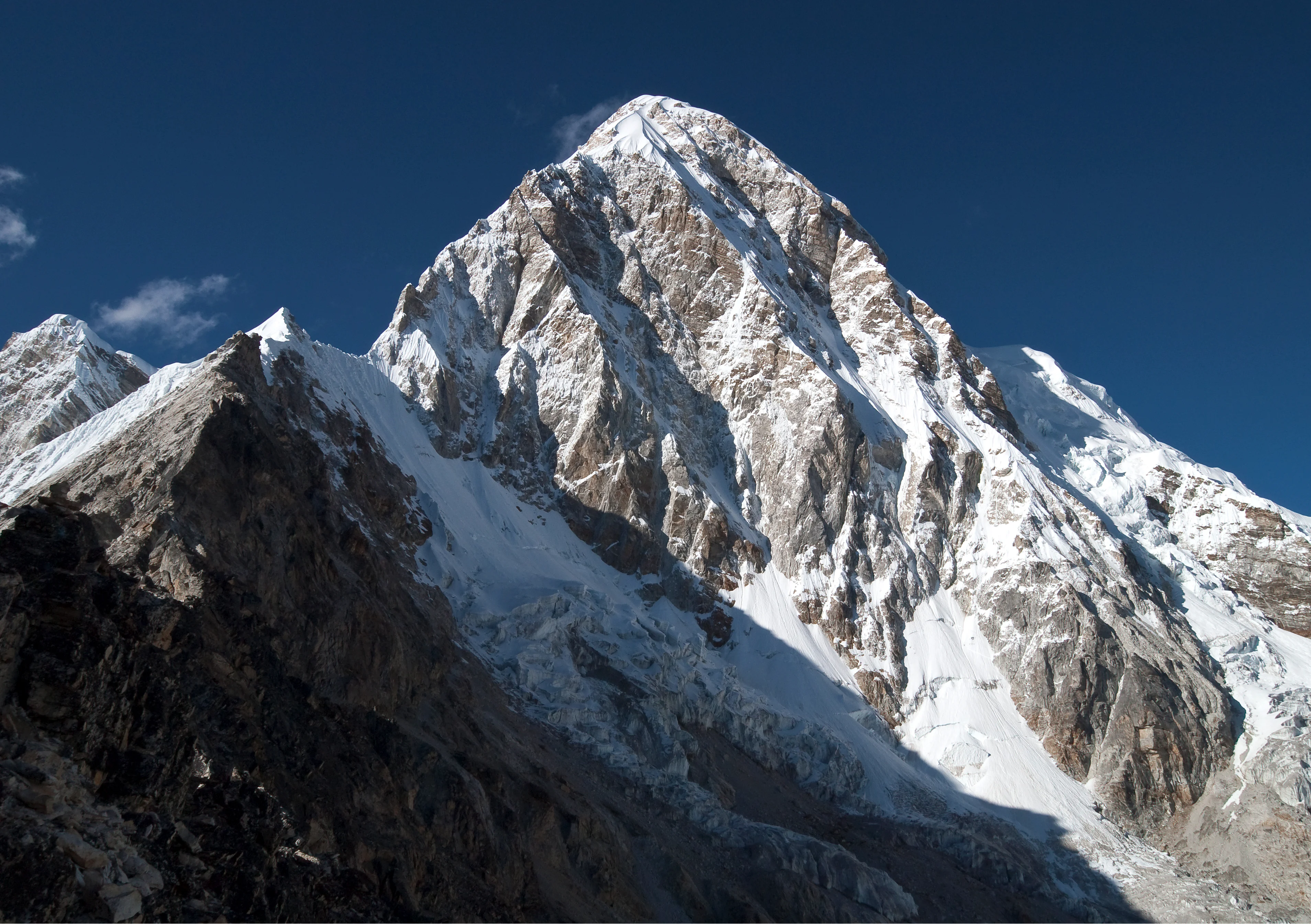
Pumori is a majestic 7,161-meter pyramidal mountain in the Mahalangur section of the Himalayas, rising eight kilometers west of Mount Everest on the international border between Nepal and Tibet. George Mallory bestowed its name, which translates in the Sherpa language to 'Mountain Daughter' or 'Unmarried Daughter', honoring its geographic proximity to Everest.


Mountain Safety & Conditions Disclaimer: High-altitude climbing, glacial travel, and technical ascents entail severe objective risks including avalanches, serac collapses, rapid weather collapse, and altitude illness. Historical route descriptions and summit claims on Mountanity reflect documented archival sources and must not be used as live operational safety assessments. Local regulations, permits, and physical glacial topography change continuously.
Peer Review: Senior Editorial Board & Historical Reviewers • Editorial Standards
Geographical Setting & Topography
Upper Khumbu region on the Nepal-Tibet border, rising prominently above Gorak Shep and the Khumbu Glacier west of Mount Everest.
Historic First Ascent
Date: May 17, 1962
Ascent Team: Gerhard Lenser (German-Swiss Pumori Expedition)
Key Statistics & Topographic Figures
- Official Elevation
- 7,161 m (23,494 ft)
Topographic Survey
- Topographic Prominence
- 1,278 m
Relief Metric
- First Ascent
- May 17, 1962
Gerhard Lenser (German-Swiss Pumori Expedition)
- Territory Codes
- NP / CN
Sovereignty
Archival Primary Source Quotations
“The mountains are calling, and we must honor their grandeur with truth and historical precision.”
Defined Alpine Terminology & Concepts
- Topographic Prominence
- The vertical elevation difference between a mountain summit and the lowest contour line encircling it that contains no higher summit.
- Alpine Zone
- The ecological and climatic zone above the treeline characterized by severe weather, glaciers, and permanent snow cover.
Pumori Mountain Weather Forecast
Detailed 14-Day Summit Window & Weather Timeline
Explore day-by-day summit push safety windows, wind shear analysis, and extended multi-day forecasts for Pumori.
Explore Pumori (7,161 m) in Interactive 3D
Inspect steep glacial walls, hanging seracs, ridge approaches, and elevation relief with 360° rotation and terrain tilt in WebGL.
Documented Climbing Routes (1)
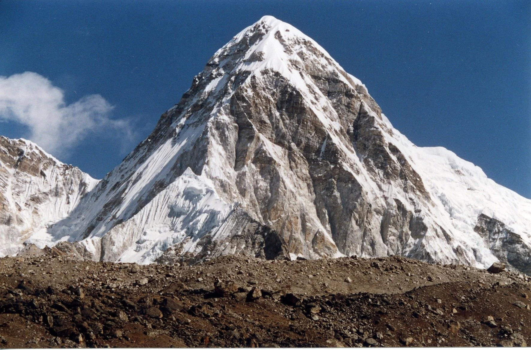
Pumori Southeast Ridge
The Southeast Ridge is the classic normal route up Pumori (7,161m), rising steeply from the Pumori Base Camp near Gorak Shep to the sharp pyramid summit. The route ascends moraines to an advanced camp, tackles a steep rock rib and glacier headwall to Camp II, and negotiates sustained 50-degree ice slopes and intricate crevasses guarding the final shoulder and summit crest. While technically accessible compared to neighboring big walls, it demands serious respect due to exposure to unpredictable serac avalanches.
Frequently Asked Questions: Pumori
What is the verified elevation of Pumori?
Pumori has an official elevation of 7,161 meters (23,494 feet) above sea level.
When was Pumori first climbed?
Pumori was first summited on May 17, 1962 by Gerhard Lenser (German-Swiss Pumori Expedition).
What mountain range and territories encompass Pumori?
Pumori is situated in Khumbu, Solukhumbu District, Tingri County, Sagarmatha National Park, Mahalangur Himal across territory codes NP, CN.
Documented Sources & Archival Citations
- First Ascent of Pumori(Alpine Journal / Gerhard Lenser)
Supporting claim: Detailed field dispatch of the 1962 German-Swiss first ascent of Pumori via the Southeast Ridge
Accessed/Documented: 1963 - Himalayan Database: Pumori Chronology(Elizabeth Hawley / Himalayan Database)
Supporting claim: Official expedition records, route variations, and summit outcomes on Pumori
Accessed/Documented: 2024