Into the Kibo Caldera: Hans Meyer's 1898 Glaciological Odyssey
The Scientist Returns to His Mountain...
Mountain Safety & Conditions Disclaimer: High-altitude climbing, glacial travel, and technical ascents entail severe objective risks including avalanches, serac collapses, rapid weather collapse, and altitude illness. Historical route descriptions and summit claims on Mountanity reflect documented archival sources and must not be used as live operational safety assessments. Local regulations, permits, and physical glacial topography change continuously.
Peer Review: Senior Editorial Board & Historical Reviewers • Editorial Standards
Into the Kibo Caldera: Hans Meyer’s 1898 Glaciological Odyssey
The Scientist Returns to His Mountain
Nine years after his triumphant 1889 first ascent, Dr. Hans Meyer found himself drawn back to the frozen heights of Mount Kilimanjaro. While his first ascent had proven that human beings could stand on Africa’s highest summit, Meyer knew that the vast, glaciated interior of the Kibo caldera held profound scientific secrets.
In the summer of 1898, Meyer organized a specialized scientific expedition focused entirely on glaciology, geology, and high-altitude photography.
“To stand on the crater rim is merely to begin; the true soul of Kilimanjaro lies down in the icy belly of its crater.” — Dr. Hans Meyer, Der Kilimandscharo, 1900
Camping on the Roof of Africa
Equipped with precise barometers, theodolites, and photographic apparatus, Meyer established a fortified camp directly upon the high Saddle at 4,400 metres with seasoned Chagga porters from Marangu.
Over several weeks of arduous field research, Meyer climbed Kibo multiple times. Unlike modern trekking groups that spend minutes on the crater rim, Meyer donned crampons and descended directly into the volcanic caldera, exploring the labyrinth of the Northern and Southern Icefields. He documented the sheer vertical ice walls—some towering over thirty metres high—that ringed the crater floor, noting how the equatorial sun sculpted them into bizarre fluted pillars and crystalline organ pipes.
Founding Tropical Glaciology
Meyer’s meticulous 1898 survey produced the first accurate 1:50,000 topographical maps of Kilimanjaro’s summit cone. Crucially, Meyer recorded the exact positions of the glacier snouts and measured the thickness of the ice cap.
A century later, Meyer’s 1898 photographs and field notebooks became invaluable historical benchmarks for climatologists. By comparing Meyer’s 1898 baseline against modern satellite imagery, scientists around the globe have tracked the dramatic retreat of Kilimanjaro’s equatorial ice cap, making Meyer’s 1898 expedition a cornerstone of modern planetary climate science.
Key Statistics & Topographic Figures
- Category
- African Pioneers
Archival Subject
- Reading Time
- 15 min read
Narrative Length
- Key Mountain
- mount-kilimanjaro
Objective
- Ascent Route
- kilimanjaro-marangu-route
Topography
- Verification
- Editorially Verified
Archival Standard
Archival Primary Source Quotations
“In the mountains, truth is etched in ice and granite; every step requires unwavering respect for the heights.”
Defined Alpine Terminology & Concepts
- Summit Push
- The final continuous climbing effort from the highest established camp to the mountain apex and back.
- Death Zone Chronicle
- A verified, research-backed historical narrative documenting the human, technical, and environmental realities of an alpine expedition.
Frequently Asked Questions: Into the Kibo Caldera: Hans Meyer's 1898 Glaciological Odyssey
What is the core chronicle and subject of "Into the Kibo Caldera: Hans Meyer's 1898 Glaciological Odyssey"?
The Scientist Returns to His Mountain...
Which mountain peaks and routes are featured in "Into the Kibo Caldera: Hans Meyer's 1898 Glaciological Odyssey"?
This narrative documents climbs on mount-kilimanjaro along the kilimanjaro-marangu-route in Tanzania.
Which documented expedition is chronicled in this story?
This historical chronicle captures the events of the 1898-hans-meyer-kilimanjaro-crater-survey, verified through contemporary journals and archival records.
Who authored and researched this archival chronicle?
Authored and researched by Mountainity Historical Research Desk, drawing on primary eyewitness testimonies, alpine club registries, and verified summit logs.
What makes this high-altitude chronicle historically significant?
Categorized under "African Pioneers", this chronicle preserves critical lessons in alpine leadership, survival, tactical speed, and human endurance in the death zone.
Related Mountains
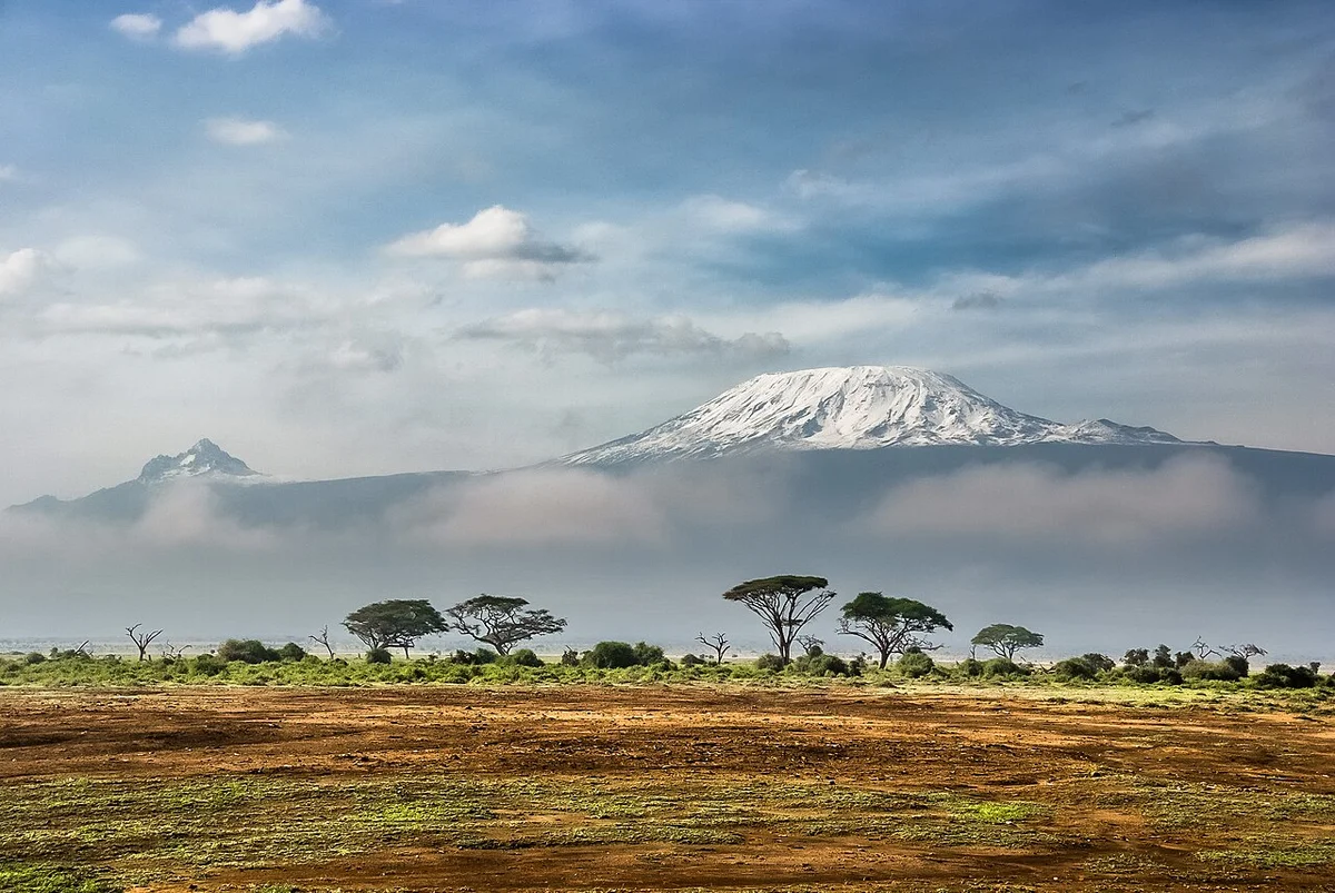

Mount Kilimanjaro
Mount Kilimanjaro is the highest mountain in Africa, the highest free-standing mountain in the world, and one of the Seven Summits, soaring to 5,895 metres (19,341 ft) above the plains of northeastern Tanzania. Consisting of three distinct volcanic cones—Kibo, Mawenzi (5,149 m), and Shira (4,005 m)—its summit at Uhuru Peak was first reached on October 6, 1889, by German geographer Hans Meyer, Austrian alpine pioneer Ludwig Purtscheller, and local Chagga mountain scout Yohani Lauwo.
Documented Sources & Archival Citations
- Across East African Glaciers(Hans Meyer / George Philip & Son)
Supporting claim: Primary historical source documentation
Accessed/Documented: 1891 - The Geographical Journal(Royal Geographical Society)
Supporting claim: Official expedition chronicle
Accessed/Documented: 1900