Mount Everest North Face (Hornbein Couloir Direct)
The North Face of Mount Everest via the Japanese Couloir and the sheer Hornbein Couloir is one of the most direct and formidable ice lines in the Himalayas. Rising 3,000 vertical meters from the Rongbuk Glacier to the summit, it funnels through a narrow 60-degree snow-and-ice cleft slicing straight through the Yellow Band and upper limestone cliffs of the North Face.
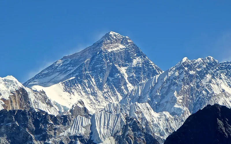
Ascent line, technical cruxes & camp topography profile for Mount Everest North Face (Hornbein Couloir Direct)
Mountain Safety & Conditions Disclaimer: High-altitude climbing, glacial travel, and technical ascents entail severe objective risks including avalanches, serac collapses, rapid weather collapse, and altitude illness. Historical route descriptions and summit claims on Mountanity reflect documented archival sources and must not be used as live operational safety assessments. Local regulations, permits, and physical glacial topography change continuously.
Peer Review: Senior Editorial Board & Historical Reviewers • Editorial Standards
Tactical & Camp Notes
A radical speed line. Climbers climb strictly by night when sub-zero temperatures freeze stonefall and avalanches. Daytime ascent is suicidal due to rock bombardment.
Identified Objective Hazards
- •Severe stonefall and ice avalanches tearing down the narrow couloir once touched by the sun
- •Extreme hypoxia and rapid cerebral/pulmonary edema from speed climbing at extreme altitude without oxygen
- •Absolute vulnerability: zero tent, zero sleeping bag, zero radio communication with base
- •High velocity glissade descent with high risk of losing control on hard water-ice patches
Historical Context
First completed in 43-hour alpine style by Erhard Loretan and Jean Troillet on August 28–30, 1986. Their descent via sitting glissade on their anoraks and rucksacks remains an iconic legend of high-altitude speed climbing.
Interactive Elevation Profile
Vertical profile, technical cruxes, and camp staging progression for Mount Everest North Face (Hornbein Couloir Direct) on Mount Everest.
Base on the lateral moraine of the Rongbuk Glacier beneath the soaring North Face.
Camp-by-Camp Topography
Key staging altitudes, technical cruxes, and terrain transitions for Mount Everest North Face (Hornbein Couloir Direct).
Rongbuk Glacier Advanced Base
Base on the lateral moraine of the Rongbuk Glacier beneath the soaring North Face.
Bergschrund Bivouac
Brief rest in the snow at the entry to the Japanese Couloir.
Yellow Band Cleft Bivouac
A 90-minute sit-bivy in a shallow snow trench to melt snow and drink before the final couloir narrows.
Summit of Mount Everest
The highest point on Earth, reached at 1:30 PM on August 30, 1986.
Topographic Location & Terrain Map
Cartographic datum, massif coordinates, and terrain context for Mount Everest North Face (Hornbein Couloir Direct) on Mount Everest.
Interactive Topographic Terrain Map
Click below to load live cartographic contours, glacier approaches, and geographic markers for Mount Everest (27°59′17″ N, 86°55′30″ E).
Key Statistics & Topographic Figures
- Route Type
- Extreme Alpine Style Speed Blitz / Supercouloir
Topography
- Technical Difficulty
- Extreme High-Altitude Speed / Grade VI, WI4+, 60° ice, UIAA V
Sustained 50°–65° hard ice and neve in the couloir bottleneck, UIAA V mixed rock through the Yellow Band at 8,400–8,600m
- Country / Region
- China (Tibet / Tingri County)
Location
Archival Primary Source Quotations
“A mountain route is not merely a path of rock and ice; it is a test of human endurance, judgment, and humility.”
Defined Alpine Terminology & Concepts
- Crux
- The most difficult and technically demanding pitch or section of a climbing route.
- Normal Route (Voie Normale)
- The most frequently climbed, least technical, and historically standard path to a mountain summit.
Frequently Asked Questions: Mount Everest North Face (Hornbein Couloir Direct)
What is the climbing difficulty and grade of Mount Everest North Face (Hornbein Couloir Direct)?
Mount Everest North Face (Hornbein Couloir Direct) on mount-everest is graded as Extreme High-Altitude Speed / Grade VI, WI4+, 60° ice, UIAA V, with technical climbing requirements including Sustained 50°–65° hard ice and neve in the couloir bottleneck, UIAA V mixed rock through the Yellow Band at 8,400–8,600m.
What are the primary hazards on the Mount Everest North Face (Hornbein Couloir Direct)?
Climbers on Mount Everest North Face (Hornbein Couloir Direct) must navigate severe objective hazards including Severe stonefall and ice avalanches tearing down the narrow couloir once touched by the sun, Extreme hypoxia and rapid cerebral/pulmonary edema from speed climbing at extreme altitude without oxygen, Absolute vulnerability: zero tent, zero sleeping bag, zero radio communication with base, High velocity glissade descent with high risk of losing control on hard water-ice patches.
What camps are established on Mount Everest North Face (Hornbein Couloir Direct)?
Mount Everest North Face (Hornbein Couloir Direct) typically features 4 staging camps, progressing from Rongbuk Glacier Advanced Base (5850m) up toward the summit.
Mountain Ascended
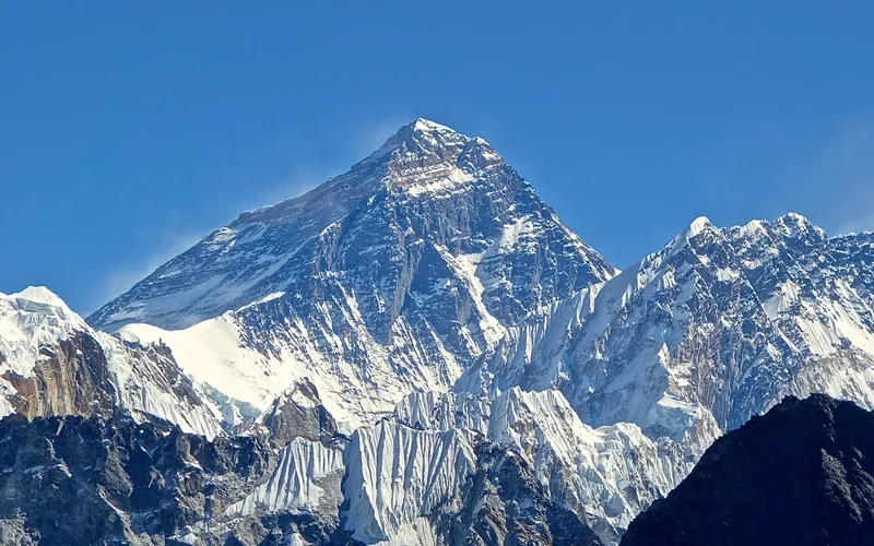


Mount Everest
Mount Everest is the highest mountain above sea level on Earth, standing at an official elevation of 8,848.86 meters (29,031.7 ft). Straddling the international frontier between Nepal and China, it is known locally as Sagarmatha in Nepali ('Goddess of the Sky') and Chomolungma in Tibetan ('Mother Goddess of the World'). The peak rises into the extreme upper troposphere, where oxygen levels drop to barely one-third of sea-level pressure. Climbers face hurricane-force jet stream winds, severe frostbite conditions, shifting ice crevasses in the Khumbu Icefall, and the dangerous Death Zone above 8,000 meters.
Documented Expeditions on this Route (1)
Verified historical summits, siege campaigns, and pioneer attempts recorded on Mount Everest North Face (Hornbein Couloir Direct).

1986 Swiss Mount Everest North Face (Hornbein Couloir) Speed Expedition
The revolutionary August 1986 expedition in which Swiss speed alpinists Erhard Loretan and Jean Troillet scaled Mount Everest's North Face via the Hornbein Couloir in a continuous 31-hour push without supplemental oxygen, tents, or fixed ropes, returning to base in 43 hours.
Archival Chronicles & Stories on this Route (1)
In-depth longform historical narratives, harrowing survival accounts, and firsthand alpine journals on Mount Everest North Face (Hornbein Couloir Direct).

Everest 1986: Erhard Loretan and Jean Troillet's 43-Hour Alpine Blitz
In August 1986, Swiss speed alpinists Erhard Loretan and Jean Troillet climbed Mount Everest's North Face in a 31-hour night push without oxygen or tents, glissading down in 3.5 hours for a 43-hour round trip.
Documented Sources & Archival Citations
- Les 8000 rugissants (The Roaring 8000s)(Erhard Loretan & Jean Ammann / Éditions de la Sarine)
Supporting claim: Autobiographical memoirs describing the 43-hour night sprint on Everest
Accessed/Documented: 1996 - American Alpine Journal: Mount Everest North Face, Hornbein Couloir in Alpine Style(American Alpine Club)
Supporting claim: Official expedition report and timeline of the 43-hour round trip
Accessed/Documented: 1987