East Ridge (1975 First Ascent Route)
The East Ridge of Gasherbrum III is the historic pioneer line that unlocked the highest unclimbed mountain in the world on August 11, 1975. Ascending from the high col between Gasherbrum II and Gasherbrum III, the route traverses treacherous crevassed icefields, knife-edge cornices, and crumbly limestone rock bands to reach the 7,952-metre summit pyramid.
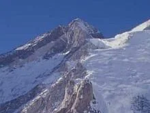
Ascent line, technical cruxes & camp topography profile for East Ridge (1975 First Ascent Route)
Mountain Safety & Conditions Disclaimer: High-altitude climbing, glacial travel, and technical ascents entail severe objective risks including avalanches, serac collapses, rapid weather collapse, and altitude illness. Historical route descriptions and summit claims on Mountanity reflect documented archival sources and must not be used as live operational safety assessments. Local regulations, permits, and physical glacial topography change continuously.
Peer Review: Senior Editorial Board & Historical Reviewers • Editorial Standards
Tactical & Camp Notes
Requires navigating complex crevasses on the South Gasherbrum Glacier, establishing a high assault camp above 7,300 metres, and overcoming delicate limestone slabs near 7,900 metres.
Identified Objective Hazards
- •Massive ice avalanches and collapsing seracs sweeping the approach icefalls
- •Hurricane-force Karakoram winds tearing across the high East Ridge
- •Severe hypoxia and altitude deterioration just forty-eight metres below the 8,000m threshold
- •Friable limestone rock offering minimal reliable anchor protection
Historical Context
First climbed on August 11, 1975, by Wanda Rutkiewicz, Alison Chadwick-Onyszkiewicz, Janusz Onyszkiewicz, and Krzysztof Żurek on a legendary Polish expedition.
Interactive Elevation Profile
Vertical profile, technical cruxes, and camp staging progression for East Ridge (1975 First Ascent Route) on Gasherbrum III.
Staged on the main Baltoro Glacier moraines looking up at the Gasherbrum amphitheatre.
Camp-by-Camp Topography
Key staging altitudes, technical cruxes, and terrain transitions for East Ridge (1975 First Ascent Route).
Base Camp
Staged on the main Baltoro Glacier moraines looking up at the Gasherbrum amphitheatre.
Camp I
Pitched at the foot of the South Gasherbrum Glacier icefall.
Camp II
Established on the upper snow basin between Gasherbrum II and Gasherbrum III.
Camp III (Gasherbrum Col)
High camp perched on the wind-raked saddle connecting Gasherbrum II and III.
Gasherbrum III Summit
The wind-scoured snowy pyramid reached via the sharp East Ridge crest.
Topographic Location & Terrain Map
Cartographic datum, massif coordinates, and terrain context for East Ridge (1975 First Ascent Route) on Gasherbrum III.
Interactive Topographic Terrain Map
Click below to load live cartographic contours, glacier approaches, and geographic markers for Gasherbrum III (35°45′34″ N, 76°38′36″ E).
Key Statistics & Topographic Figures
- Route Type
- High-Altitude Glaciated Ridge Route
Topography
- Technical Difficulty
- Extremely Severe / Grade V, 5.7, AI3
Grade V, 5.7 rock, AI3 steep alpine ice at 7,950m
- Country / Region
- Pakistan / China (Gilgit-Baltistan & Xinjiang / Karakoram)
Location
Archival Primary Source Quotations
“A mountain route is not merely a path of rock and ice; it is a test of human endurance, judgment, and humility.”
Defined Alpine Terminology & Concepts
- Crux
- The most difficult and technically demanding pitch or section of a climbing route.
- Normal Route (Voie Normale)
- The most frequently climbed, least technical, and historically standard path to a mountain summit.
Frequently Asked Questions: East Ridge (1975 First Ascent Route)
What is the climbing difficulty and grade of East Ridge (1975 First Ascent Route)?
East Ridge (1975 First Ascent Route) on gasherbrum-3 is graded as Extremely Severe / Grade V, 5.7, AI3, with technical climbing requirements including Grade V, 5.7 rock, AI3 steep alpine ice at 7,950m.
What are the primary hazards on the East Ridge (1975 First Ascent Route)?
Climbers on East Ridge (1975 First Ascent Route) must navigate severe objective hazards including Massive ice avalanches and collapsing seracs sweeping the approach icefalls, Hurricane-force Karakoram winds tearing across the high East Ridge, Severe hypoxia and altitude deterioration just forty-eight metres below the 8,000m threshold, Friable limestone rock offering minimal reliable anchor protection.
What camps are established on East Ridge (1975 First Ascent Route)?
East Ridge (1975 First Ascent Route) typically features 5 staging camps, progressing from Base Camp (5200m) up toward the summit.
Mountain Ascended
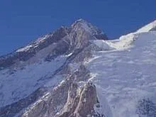


Gasherbrum III
Gasherbrum III is a colossal 7,952-meter (26,089 ft) mountain nestled between Gasherbrum II and Gasherbrum IV in the Baltoro Muztagh of the Karakoram range. Ranking as the fifteenth-highest peak on Earth, it holds a legendary place in mountaineering history as the highest unclimbed mountain in the world until August 11, 1975. On that historic day, a trailblazing Polish expedition led by Wanda Rutkiewicz achieved the first ascent via the East Ridge, with summiters Wanda Rutkiewicz, Alison Chadwick-Onyszkiewicz, Janusz Onyszkiewicz, and Krzysztof Żurek.
Documented Expeditions on this Route (1)
Verified historical summits, siege campaigns, and pioneer attempts recorded on East Ridge (1975 First Ascent Route).
1975 Polish Gasherbrum III First Ascent Expedition
In August 1975, a Polish expedition organized by Wanda Rutkiewicz achieved the historic first ascent of Gasherbrum III (7,952m), the highest unclimbed peak on Earth, when Krzysztof Zurek, Wanda Rutkiewicz, Alison Chadwick-Onyszkiewicz, and Janusz Onyszkiewicz summited via the East Ridge.
Archival Chronicles & Stories on this Route (1)
In-depth longform historical narratives, harrowing survival accounts, and firsthand alpine journals on East Ridge (1975 First Ascent Route).
The Unconquered Citadel: The 1975 Polish First Ascent of Gasherbrum III
In August 1975, a Polish team led by Wanda Rutkiewicz conquered Gasherbrum III (7,952m), the highest unclimbed peak on Earth, via the treacherous East Ridge.
Documented Sources & Archival Citations
- Gasherbrum II and III, 1975(The Alpine Journal / Wanda Rutkiewicz)
Supporting claim: Official expedition dispatch and technical route description of the 1975 first ascent
Accessed/Documented: 1976 - American Alpine Journal: Gasherbrum III(American Alpine Club)
Supporting claim: Technical appraisal of the East Ridge line and historical significance
Accessed/Documented: 1976