Jungfrau Rottalgrat (Rottal Ridge)
The Jungfrau Rottalgrat (Rottal Ridge) is the classic mountaineer's route to the Jungfrau summit (4,158 m), ascending from the Jungfraujoch railway station (3,454 m) via the Rottalsattel and the exposed south-west ridge to the summit snowfield.
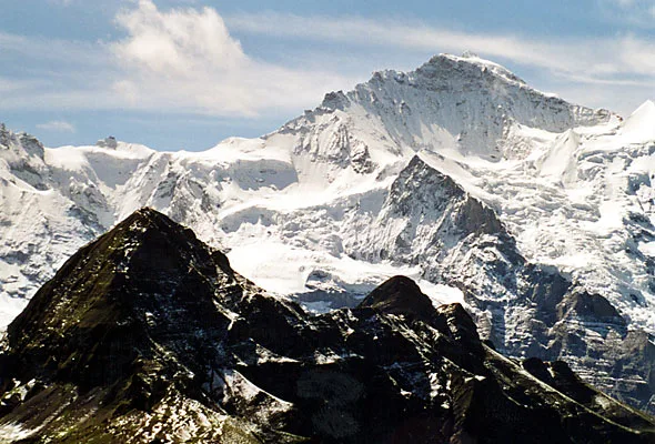
Ascent line, technical cruxes & camp topography profile for Jungfrau Rottalgrat (Rottal Ridge)
Mountain Safety & Conditions Disclaimer: High-altitude climbing, glacial travel, and technical ascents entail severe objective risks including avalanches, serac collapses, rapid weather collapse, and altitude illness. Historical route descriptions and summit claims on Mountanity reflect documented archival sources and must not be used as live operational safety assessments. Local regulations, permits, and physical glacial topography change continuously.
Peer Review: Senior Editorial Board & Historical Reviewers • Editorial Standards
Tactical & Camp Notes
Beginning from the Jungfraujoch (3,454 m) railway station — the highest in Europe — climbers cross the upper Jungfraufirn glacier (with crevasse hazard) to reach the Rottalsattel at approximately 3,891 m. From the saddle, the Rottalgrat climbs exposed rock and mixed terrain at UIAA III to the upper snowfield and summit ridge. The final approach to the summit involves steep snow slopes of 35-45 degrees. Strong wind and storm can develop rapidly at this altitude, and the remote position of the summit means retreat is serious in deteriorating conditions.
Interactive Elevation Profile
Vertical profile, technical cruxes, and camp staging progression for Jungfrau Rottalgrat (Rottal Ridge) on Jungfrau.
The highest railway station in Europe, reached by the Jungfrau Railway through the heart of the Eiger and Mönch. Starting point for the Rottalgrat mountaineer's ascent.
Camp-by-Camp Topography
Key staging altitudes, technical cruxes, and terrain transitions for Jungfrau Rottalgrat (Rottal Ridge).
Jungfraujoch Station (Top of Europe)
The highest railway station in Europe, reached by the Jungfrau Railway through the heart of the Eiger and Mönch. Starting point for the Rottalgrat mountaineer's ascent.
Rottalsattel
The key col on the south-west ridge where the glacier section ends and the steep rocky Rottalgrat begins.
Jungfrau Summit
The airy snow summit of the Jungfrau with panoramic views from the Black Forest to the Monte Rosa massif and Monte Viso.
Topographic Location & Terrain Map
Cartographic datum, massif coordinates, and terrain context for Jungfrau Rottalgrat (Rottal Ridge) on Jungfrau.
Interactive Topographic Terrain Map
Click below to load live cartographic contours, glacier approaches, and geographic markers for Jungfrau (46°32′13″ N, 7°57′45″ E).
Key Statistics & Topographic Figures
- Technical Grade
- AD (Alpine Difficile) / UIAA III
- Elevation Gain
- 1,400 m from Rottalhütte to summit
- Summit Altitude
- 4,158 m (13,642 ft)
- Ice Angle
- 35–45 degrees on Rottalsattel slope
Archival Primary Source Quotations
“On the knife-edge of the Rottalgrat, the mountaineer finds the true, untamed spirit of the Bernese Oberland.”
Defined Alpine Terminology & Concepts
- Rottalsattel
- The exposed snow and ice pass at 3,891 m connecting the Rottalgrat to the upper Jungfrau summit cap.
- Rottalhütte
- A historic SAC stone mountain hut perched at 2,755 m on the sheer west face above Lauterbrunnen.
Frequently Asked Questions: Jungfrau Rottalgrat (Rottal Ridge)
What is the Jungfrau Rottalgrat?
The Rottalgrat is the classic southwestern rock and mixed ridge route to the summit of the Jungfrau (4,158 m) in the Bernese Alps.
How is the Jungfrau Rottalgrat graded?
The Rottalgrat is graded AD (Alpine Difficile) with UIAA III rock climbing and 45-degree snow and ice slopes.
Where does the Rottalgrat route originate?
The climb starts from the Rottalhütte (2,755 m) in the Lauterbrunnen valley or from the high Jungfraujoch plateau.
What key col does the Rottalgrat traverse?
The route crests the Rottalsattel at 3,891 m before ascending the final steep summit ice slopes.
What are the primary hazards on the Jungfrau Rottalgrat?
Cornices on the summit ridge, high-altitude verglas on rock steps, and wind-scoured ice slopes on the Rottalsattel are key hazards.
How long does the Rottalgrat ascent take?
The ascent typically requires 6 to 8 hours of sustained climbing from the Rottalhütte to the summit.
What view opens from the top of the Rottalgrat?
The summit affords views across the Aletsch Glacier, the Bernese Oberland peaks, and the Valais Alps to Mont Blanc.
Why is the Rottalgrat historically significant?
It represents the purest traditional alpine route on the Jungfrau, untouched by tourist railway crowds.
Mountain Ascended
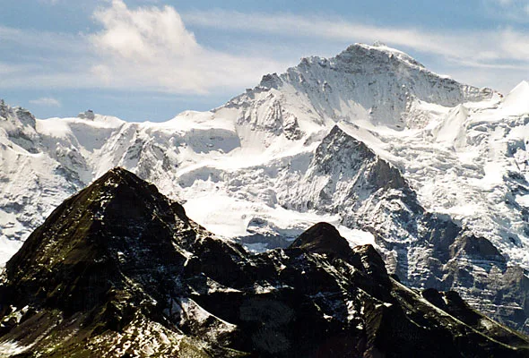

Jungfrau
The Jungfrau (4,158 m / 13,642 ft) is the third-highest peak in the Bernese Oberland and one of the most iconic mountains in the world, forming the spectacular triumvirate with the Eiger and the Mönch above Grindelwald. Its name, meaning 'Young Woman' or 'Virgin,' was given by medieval monks who saw in the long white snowfields of its south face the outline of a white veil. First climbed on August 3, 1811, by Rudolf and Hieronymus Meyer guided by local chamois hunters Joseph Bortis and Alois Volker, the Jungfrau now hosts the Jungfraujoch, at 3,454 m the highest railway station in Europe, designated a UNESCO World Heritage Site.
Documented Sources & Archival Citations
- The Alpine Journal: Routes on the Jungfrau(The Alpine Club, London)
Supporting claim: Historical route descriptions and grade evaluations for all Jungfrau approaches including the Rottalgrat
Accessed/Documented: 2026 - The Bernese Alps West: An Alpine Club Guide(Kev Reynolds / Cicerone Press)
Supporting claim: Detailed technical route notes for the Jungfrau Rottalgrat including approach from Jungfraujoch, crevasse hazards, and conditions
Accessed/Documented: 2026