West Ridge (Japanese Route)
The West Ridge of K2 is one of the most formidable and sustained technical lines in high-altitude mountaineering. Pioneered in August 1981 by a joint Japanese-Pakistani expedition, it ascends directly from the Savoia Glacier along the exposed western crest before negotiating the severe Southwest Face directly into the Death Zone.
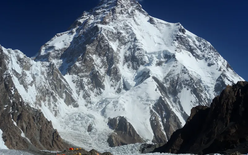
Ascent line, technical cruxes & camp topography profile for West Ridge (Japanese Route)
Mountain Safety & Conditions Disclaimer: High-altitude climbing, glacial travel, and technical ascents entail severe objective risks including avalanches, serac collapses, rapid weather collapse, and altitude illness. Historical route descriptions and summit claims on Mountanity reflect documented archival sources and must not be used as live operational safety assessments. Local regulations, permits, and physical glacial topography change continuously.
Peer Review: Senior Editorial Board & Historical Reviewers • Editorial Standards
Tactical & Camp Notes
Unlike the standard Abruzzi Spur, the West Ridge is exposed to prevailing westerly storms and requires heavy technical rock and mixed ice climbing across knife-edge crests and sheer towers.
Identified Objective Hazards
- •Violent, unpredictable jet stream storms striking the exposed western flank
- •Extreme technical climbing above 8,000 meters requiring unroped mixed scrambling
- •Severe frostbite risk during unavoidable open bivouacs near 8,500 meters
- •Continuous rockfall and powder snow avalanches sweeping the Savoia approach
Historical Context
First climbed on August 7, 1981, by Nazir Sabir and Eiho Ohtani (Waseda University Expedition), remaining a benchmark of Karakoram alpine exploration.
Interactive Elevation Profile
Vertical profile, technical cruxes, and camp staging progression for West Ridge (Japanese Route) on K2.
Pitched at the foot of the sheer western ramparts beneath the Savoia Pass.
Camp-by-Camp Topography
Key staging altitudes, technical cruxes, and terrain transitions for West Ridge (Japanese Route).
Advance Base Camp (Savoia Glacier)
Pitched at the foot of the sheer western ramparts beneath the Savoia Pass.
Camp I
Established on the initial rock crest of the West Ridge above the Savoia icefall.
Camp II
Positioned on narrow rock platforms along the jagged western arête exposed to high winds.
Camp III
Located at the foot of the technical rock towers on the upper western ridge.
Camp IV & Upper Bivouac
High camp perched near the threshold of the Southwest Face, where climbers stage final summit attempts.
K2 Summit
The summit plateau of K2, reached via steep mixed couloirs connecting into the upper summit slopes.
Topographic Location & Terrain Map
Cartographic datum, massif coordinates, and terrain context for West Ridge (Japanese Route) on K2.
Interactive Topographic Terrain Map
Click below to load live cartographic contours, glacier approaches, and geographic markers for K2 (35°52′53″ N, 76°30′48″ E).
Key Statistics & Topographic Figures
- Route Type
- Ridge Traverse / Direct Face
Topography
- Technical Difficulty
- Extremely Demanding / Grade VI, ED2
Alpine VI+, Scottish IV mixed ice, 75° headwalls
- Country / Region
- Pakistan (Gilgit-Baltistan / Karakoram)
Location
Archival Primary Source Quotations
“A mountain route is not merely a path of rock and ice; it is a test of human endurance, judgment, and humility.”
Defined Alpine Terminology & Concepts
- Crux
- The most difficult and technically demanding pitch or section of a climbing route.
- Normal Route (Voie Normale)
- The most frequently climbed, least technical, and historically standard path to a mountain summit.
Frequently Asked Questions: West Ridge (Japanese Route)
What is the climbing difficulty and grade of West Ridge (Japanese Route)?
West Ridge (Japanese Route) on k2 is graded as Extremely Demanding / Grade VI, ED2, with technical climbing requirements including Alpine VI+, Scottish IV mixed ice, 75° headwalls.
What are the primary hazards on the West Ridge (Japanese Route)?
Climbers on West Ridge (Japanese Route) must navigate severe objective hazards including Violent, unpredictable jet stream storms striking the exposed western flank, Extreme technical climbing above 8,000 meters requiring unroped mixed scrambling, Severe frostbite risk during unavoidable open bivouacs near 8,500 meters, Continuous rockfall and powder snow avalanches sweeping the Savoia approach.
What camps are established on West Ridge (Japanese Route)?
West Ridge (Japanese Route) typically features 6 staging camps, progressing from Advance Base Camp (Savoia Glacier) (5300m) up toward the summit.
Mountain Ascended
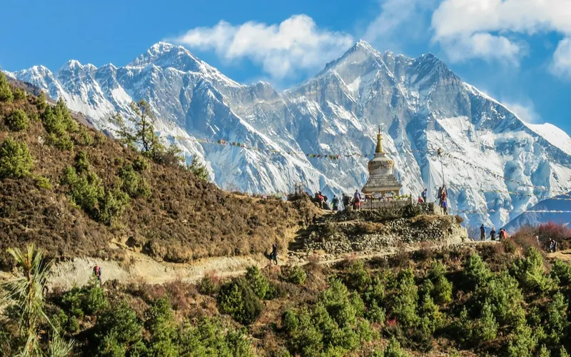


K2
K2, at 8,611 meters (28,251 ft), is the second-highest mountain on Earth and widely regarded as the most technically demanding and lethal 8,000-meter peak. Located in the heart of the Karakoram on the border between Pakistan and China, K2 is characterized by sheer relief, severe weather anomalies, and persistent objective hazards including the notorious Bottleneck couloir.
Documented Expeditions on this Route (1)
Verified historical summits, siege campaigns, and pioneer attempts recorded on West Ridge (Japanese Route).
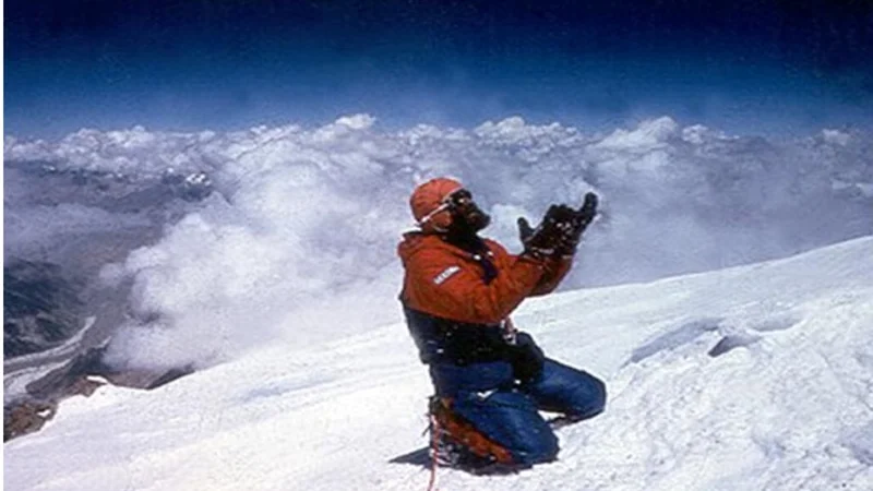
1981 K2 West Ridge Expedition
Joint expedition between Waseda University Alpine Club of Japan and Pakistan, pioneering the formidable West Ridge of K2 to the summit on August 7, 1981.
Archival Chronicles & Stories on this Route (1)
In-depth longform historical narratives, harrowing survival accounts, and firsthand alpine journals on West Ridge (Japanese Route).
1981 K2 West Ridge: The Epic Himalayan Wall Ascent
The verified story of Nazir Sabir and the Japanese Waseda University team conquering the formidable West Ridge of K2 in 1981.
Documented Sources & Archival Citations
- American Alpine Journal: K2 West Ridge(American Alpine Club)
Supporting claim: Detailed chronicle of the 1981 Japanese-Pakistani first ascent
Accessed/Documented: 1982 - Karakoram Himalayan Database(Alpine Club of Pakistan)
Supporting claim: Route verification and historical timeline
Accessed/Documented: 2026