The Arctic Highway: Bradford and Barbara Washburn's West Buttress Revolution on Denali
In June 1951, Bradford and Barbara Washburn revolutionized high-altitude exploration by landing on the Kahiltna Glacier with bush pilot Don Sheldon and pioneering Denali's classic West Buttress route.
Mountain Safety & Conditions Disclaimer: High-altitude climbing, glacial travel, and technical ascents entail severe objective risks including avalanches, serac collapses, rapid weather collapse, and altitude illness. Historical route descriptions and summit claims on Mountanity reflect documented archival sources and must not be used as live operational safety assessments. Local regulations, permits, and physical glacial topography change continuously.
Peer Review: Senior Editorial Board & Historical Reviewers • Editorial Standards
Re-Imagining the Mountain from the Sky
For nearly four decades following the historic 1913 first ascent, every expedition attempting Denali followed the grueling, storm-battered northern approach via Wonder Lake, McGonagall Pass, and the Muldrow Glacier. It was an expedition model requiring weeks of brutal sled-hauling across muskeg and river crossings before climbing even began, leaving teams battered by fatigue before setting foot on the mountain proper.
Bradford Washburn, director of the Boston Museum of Science and an intrepid Harvard-educated explorer, viewed the mountain through a radically different lens. Hanging out the open cargo doorways of vintage bush airplanes with heavy Fairchild aerial cameras strapped to his chest, Washburn had spent years photographing the colossal peaks and glaciers of the Alaska Range from above.
Studying his crystal-sharp aerial negatives with magnifying lenses in Boston, Washburn noticed a magnificent architectural feature that ground-level climbers had overlooked: a sweeping, rounded granite and snow spur extending down from the 17,200-foot plateau directly into the upper basin of the Kahiltna Glacier.
Washburn recognized that this natural ramp—the West Buttress—offered an elegant, safe, and vastly more direct passage to the summit of North America, avoiding the crumbling icefalls of Karstens Ridge entirely.
Touchdown on the Kahiltna
To unlock the route, Washburn needed a revolutionary logistical breakthrough: landing ski-equipped airplanes directly onto the high glacier. In the early 1950s, landing a fixed-wing aircraft onto an unmaintained, crevasse-riddled glacier in the high Alaska Range was widely considered suicidal.
Washburn found his aerial partner in legendary Talkeetna bush pilot Don Sheldon. Piloting a fabric-winged Piper Super Cub and a ski-equipped Norseman, Sheldon performed breathtaking low-level reconnaissance flights over the Kahiltna Glacier, touching his skis down to test snow consistency before executing the historic first landing on the Southeast Fork at 7,700 feet.
In early June 1951, the expedition flew in: Bradford Washburn, his wife Barbara Washburn—already the first woman in history to have summitted Denali in 1947—along with experienced mountaineers Jim Gale, Bill Hackett, and Henry Buchtel. Within hours of leaving civilization, the team was established in a comfortable base camp directly beneath the towering walls of the peak.
Engineering the West Buttress
From the Kahiltna base, the climbers methodically pushed their route up the glacier. Dragging heavily laden freight sleds, they traversed the expansive snowfields of Ski Hill and Kahiltna Pass, establishing intermediate camps protected from Arctic winds behind fortified snow-block walls.
Above 14,000 feet, the team confronted the primary technical obstacle of the route: the Headwall, a sheer 1,000-foot face of 55-degree blue ice leading to the knife-edge crest of the West Buttress at 16,200 feet. Working in freezing conditions, Washburn and Gale fixed hundreds of feet of braided rope, carving bucket steps to secure safe passage for heavy packs.
At 16,200 feet, the climbers stepped onto the crest of the buttress. To their left, the tremendous North Face plummeted 10,000 vertical feet to the Peters Glacier; to their right, the sheer granite walls dropped toward the Kahiltna basin. Walking this exposed, wind-whipped arête, the team navigated around massive granite gendarmes, including the dramatic promontory known today as the Washburn Thumb.
Theodolites on the High Plateau
At 17,200 feet, the party excavated a fortified high camp in the snow basin below Denali Pass. Here, Barbara Washburn proved an indispensable asset to the scientific mission. While the men prepared ropes and high-altitude equipment, Barbara manned delicate theodolite instruments in howling sub-zero winds, sighting survey markers across dozens of surrounding peaks to lay the mathematical foundation for the Boston Museum of Science’s iconic 1:50,000 map of Denali.
On July 10, 1951, under a brilliant arctic sun, Bradford Washburn, Jim Gale, and Bill Hackett set off from high camp. Traversing Denali Pass and the wide summit basin of the Football Field, they ascended the airy snow knife-edge of the Kahiltna Horn.
At mid-afternoon, they stood upon the 20,310-foot summit of Denali. They then descended to the lower plateau and pushed across to the North Peak, completing an unprecedented double-summit sweep of the entire massif.
The Global Standard
The 1951 expedition changed high-altitude mountaineering forever. By demonstrating the efficacy of glacier ski-plane landings and establishing the West Buttress, Bradford and Barbara Washburn created what became the international standard route up Denali.
Today, more than ninety percent of all climbers who attempt North America’s highest peak follow the exact footsteps pioneered by the Washburns in 1951. Their visionary synthesis of aerial photography, aviation daring, and cartographic rigor remains one of the finest triumphs in the history of American alpine exploration.
Key Statistics & Topographic Figures
- Category
- Pioneering Routes & Cartography
Archival Subject
- Reading Time
- 16 min read
Narrative Length
- Key Mountain
- denali
Objective
- Ascent Route
- denali-west-buttress
Topography
- Verification
- Editorially Verified
Archival Standard
Archival Primary Source Quotations
“In the mountains, truth is etched in ice and granite; every step requires unwavering respect for the heights.”
Defined Alpine Terminology & Concepts
- Summit Push
- The final continuous climbing effort from the highest established camp to the mountain apex and back.
- Death Zone Chronicle
- A verified, research-backed historical narrative documenting the human, technical, and environmental realities of an alpine expedition.
Frequently Asked Questions: The Arctic Highway: Bradford and Barbara Washburn's West Buttress Revolution on Denali
What is the core chronicle and subject of "The Arctic Highway: Bradford and Barbara Washburn's West Buttress Revolution on Denali"?
In June 1951, Bradford and Barbara Washburn revolutionized high-altitude exploration by landing on the Kahiltna Glacier with bush pilot Don Sheldon and pioneering Denali's classic West Buttress route.
Which mountain peaks and routes are featured in "The Arctic Highway: Bradford and Barbara Washburn's West Buttress Revolution on Denali"?
This narrative documents climbs on denali along the denali-west-buttress in United States.
Which documented expedition is chronicled in this story?
This historical chronicle captures the events of the 1951-washburn-denali-west-buttress, verified through contemporary journals and archival records.
Who authored and researched this archival chronicle?
Authored and researched by Mountainity Historical Research Desk, drawing on primary eyewitness testimonies, alpine club registries, and verified summit logs.
What makes this high-altitude chronicle historically significant?
Categorized under "Pioneering Routes & Cartography", this chronicle preserves critical lessons in alpine leadership, survival, tactical speed, and human endurance in the death zone.
Related Mountains
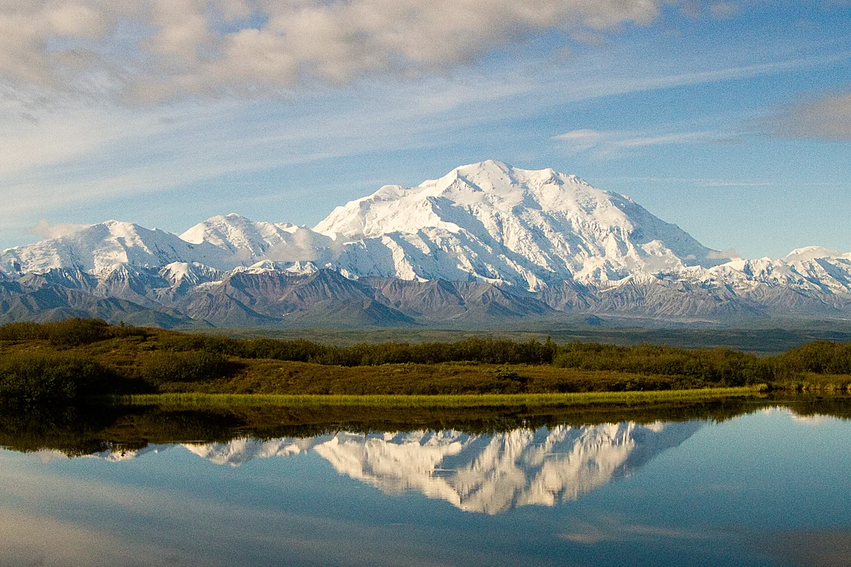

Denali
Denali is the highest mountain peak in North America, soaring to an elevation of 6,190 metres in south-central Alaska. Ranked third among the world's most topographically prominent summits, it possesses greater vertical base-to-peak relief than Mount Everest, rising over 5,500 vertical metres above the surrounding glacial plains amidst severe Arctic storms and extreme sub-zero temperatures.
Documented Sources & Archival Citations
- Mount McKinley: The Conquest of Denali(Bradford Washburn and David Roberts / Harry N. Abrams)
Supporting claim: Comprehensive chronicle of the 1951 West Buttress pioneering expedition
Accessed/Documented: 2026 - The Accidental Adventurer: Memoir of the First Woman to Climb Mt. McKinley(Barbara Washburn / Epicenter Press)
Supporting claim: Biographical account of Barbara Washburn's high-altitude surveys on Denali
Accessed/Documented: 2026