Gasherbrum II 1956: The Austrian Conquest of the Shining Mountain
On July 7, 1956, Fritz Moravec, Josef Larch, and Hans Willenpart conquered the formidable Southwest Ridge of Gasherbrum II (8,035m), triumphing without supplemental oxygen over lost depots, shattered seracs, and the razor crest of the Banana Ridge.
Mountain Safety & Conditions Disclaimer: High-altitude climbing, glacial travel, and technical ascents entail severe objective risks including avalanches, serac collapses, rapid weather collapse, and altitude illness. Historical route descriptions and summit claims on Mountanity reflect documented archival sources and must not be used as live operational safety assessments. Local regulations, permits, and physical glacial topography change continuously.
Peer Review: Senior Editorial Board & Historical Reviewers • Editorial Standards
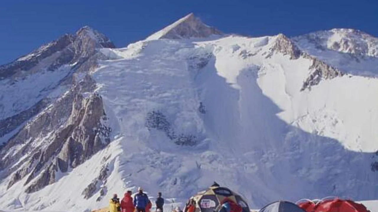
Standing secluded at the head of the Baltoro Glacier near the remote borderlands between Pakistan and China, the Gasherbrum massif represents one of the most formidable concentrations of high-altitude rock and ice on Earth. The local Balti name Rgasha Brum translates poetically to “Beautiful Mountain” or “Shining Mountain,” an ode to the golden glow reflected from its massive granite headwalls at sunset. Among its towering summits, Gasherbrum II (8,035m, originally surveyed as K4) rises as an austere, four-sided glaciated pyramid, flanked by steep ice gullies and hanging serac shelves.
In the mid-1950s, while national teams from Britain, France, and Italy deployed heavy industrial siege tactics on Everest, Annapurna, and K2, the Austrian Alpine Club (Österreichischer Alpenverein) championed an entirely different ethos: small, highly mobile teams relying on technical skill, physical resilience, and pure oxygen-free climbing. In the spring of 1956, veteran Viennese alpinist Fritz Moravec assembled a compact team of five Austrian climbers, including technical rock and ice masters Josef “Sepp” Larch (an early conqueror of the Eiger North Face) and Hans Willenpart.
The Treacherous Approach of the South Gasherbrum Glacier
Marching 200 kilometers from Skardu through the barren gorges of the Shigar and Braldu rivers, the Austrians reached Concordia in late May. Turning south off the main Baltoro trunk, they pushed into the uncharted maze of the South Gasherbrum Glacier. Establishing Base Camp at 5,100 meters, Moravec confronted an intimidating labyrinth of shattered ice towers and yawning crevasses guarding the entrance to the upper basin.
Working in brutal heat that softened snow bridges during the day and sub-zero blizzards that froze their boots solid overnight, Larch and Willenpart methodically pioneered a safe pathway through the lower icefall. They established Camp I at 5,900 meters on the broad glacial plateau, stocking it with high-altitude rations, tents, and assault gear.
Disaster in the Cwm: The Lost Depots
Just as the expedition began its rhythm of load-ferrying to higher altitudes, disaster struck. In mid-June, an unseasonal Karakoram tempest battered the range for four consecutive days. Trapped in lower camps, the climbers listened in horror as massive slab avalanches swept the slopes above. When the skies finally cleared, Moravec and his men ascended to Camp I only to find total devastation: a massive ice avalanche had completely engulfed their primary supply cache. Tents, stoves, sleeping bags, and essential provisions were buried under tons of compacted ice.
In traditional siege expeditions, such a catastrophic loss would have triggered an immediate retreat. But Moravec refused to abandon the mountain. Gathering his team, he held a vote; unanimously, the Austrians decided to pool their remaining equipment, ration their food strictly, and press forward with a stripped-down, lightning push.
The Banana Ridge Crux
Above the upper cwm rose the formidable technical barrier of Gasherbrum II: a steep, curving spur of knife-edge ice and shattered granite known as the “Banana Ridge.” Between 6,400 meters and 6,900 meters, the ridge falls away thousands of vertical feet on either side into the South Gasherbrum basin.
Leading on steep 55-degree blue ice, Sepp Larch utilized cutting-edge 12-point crampon front-pointing and hammered ice pitons into frozen fissures. Step by step, Larch and Willenpart carved a narrow staircase into the sky, fixing lightweight manila ropes across the knife-edge crest. By early July, they had established Camp III at 6,900 meters perched on an icy notch above the technical mixed ground, and pushed forward to set Camp IV—a solitary assault tent—at 7,400 meters in the Death Zone.
The Summit Push of July 7, 1956
On the evening of July 6, Fritz Moravec, Sepp Larch, and Hans Willenpart squeezed into their small tent at Camp IV. Temperatures plummeted to minus thirty degrees Celsius, and howling winds threatened to tear the tent fabric from its anchors. The climbers melted snow over a tiny petrol stove, drinking warm tea and resting without supplemental oxygen canisters.
At 3:00 AM on July 7, 1956, in bitter pitch darkness, the three Austrians stepped out into the freeze. Navigating by the faint glow of dawn over the Tibetan plateau, they traversed the expansive upper snow amphitheater, angling diagonally toward a steep, narrow snow couloir cutting through the final rock band of the summit pyramid.
Breathing heavily in the thin air, rotating the grueling lead every twenty paces, they kicked steps through deep, wind-crusted powder. At 7,800 meters, fatigue was overwhelming, but their acclimatization held. At 11:30 AM, breaking out of the shadowed couloir into brilliant, blinding sunlight, Moravec, Larch, and Willenpart stepped together onto the razor-sharp crest of the 8,035-meter summit of Gasherbrum II.
An Unspoiled Victory
Standing on top of the world’s thirteenth-highest peak, the three men were treated to an astonishing panoramic vista: the black pyramid of K2 loomed to the northwest, Broad Peak stretched across the northern horizon, and the massive fortress of Gasherbrum I rose immediately to the southeast. Planted on the highest point, Moravec raised the Austrian pennant and took archival photographs of his exhausted, triumphant teammates.
Descending carefully back down the couloir before afternoon avalanches could release, all three climbers reached Camp IV safely and returned to Base Camp without frostbite or serious injury. Achieved with minimal resources, no high-altitude porters on the upper mountain, and without bottled oxygen, the 1956 Austrian first ascent of Gasherbrum II stands as an enduring masterpiece of elegant, courageous, and authentic mountaineering.
Key Statistics & Topographic Figures
- Category
- Historic Expeditions
Archival Subject
- Reading Time
- 12 min read
Narrative Length
- Key Mountain
- gasherbrum-2
Objective
- Ascent Route
- gasherbrum-2-southwest-ridge
Topography
- Verification
- Editorially Verified
Archival Standard
Archival Primary Source Quotations
“In the mountains, truth is etched in ice and granite; every step requires unwavering respect for the heights.”
Defined Alpine Terminology & Concepts
- Summit Push
- The final continuous climbing effort from the highest established camp to the mountain apex and back.
- Death Zone Chronicle
- A verified, research-backed historical narrative documenting the human, technical, and environmental realities of an alpine expedition.
Frequently Asked Questions: Gasherbrum II 1956: The Austrian Conquest of the Shining Mountain
What is the core chronicle and subject of "Gasherbrum II 1956: The Austrian Conquest of the Shining Mountain"?
On July 7, 1956, Fritz Moravec, Josef Larch, and Hans Willenpart conquered the formidable Southwest Ridge of Gasherbrum II (8,035m), triumphing without supplemental oxygen over lost depots, shattered seracs, and the razor crest of the Banana Ridge.
Which mountain peaks and routes are featured in "Gasherbrum II 1956: The Austrian Conquest of the Shining Mountain"?
This narrative documents climbs on gasherbrum-2 along the gasherbrum-2-southwest-ridge in Pakistan.
Which documented expedition is chronicled in this story?
This historical chronicle captures the events of the 1956-austrian-gasherbrum-2, verified through contemporary journals and archival records.
Who authored and researched this archival chronicle?
Authored and researched by Mountainity Historical Research Desk, drawing on primary eyewitness testimonies, alpine club registries, and verified summit logs.
What makes this high-altitude chronicle historically significant?
Categorized under "Historic Expeditions", this chronicle preserves critical lessons in alpine leadership, survival, tactical speed, and human endurance in the death zone.
Related Mountains


Gasherbrum II
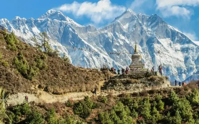
Gasherbrum II, standing at 8,035 meters (26,362 ft), is the thirteenth-highest mountain on Earth and the third-highest peak of the Gasherbrum massif in the Karakoram. Located at the head of the Baltoro Glacier on the Pakistan-China frontier, it features a classic pyramidal profile with challenging ice couloirs. First summited in 1956 by an Austrian team, it was famously climbed in pure alpine style in 1982 by Reinhold Messner, Nazir Sabir, and Sher Khan.
Documented Sources & Archival Citations
- Weiße Berge, schwarze Menschen: Zur Erstbesteigung des Gasherbrum II(Fritz Moravec / Österreichischer Bundesverlag)
Supporting claim: Official expedition leader chronicle of the 1956 Gasherbrum II first ascent
Accessed/Documented: 1958 - The Himalayan Database: Gasherbrum II 1956 Archive(Elizabeth Hawley Archive)
Supporting claim: Official expedition verification and summit registration
Accessed/Documented: 2026 - American Alpine Journal: 1956 Karakoram Ascents(American Alpine Club)
Supporting claim: International alpine record and route analysis of the Moravec expedition
Accessed/Documented: 1957