Khumbu Glacier
Also known as: Everest Khumbu Ice Stream
Multi-Decadal Satellite Observation Viewer

Glaciological Setting & Morphology
The Khumbu Glacier is the highest glacier in the world, originating in the colossal Western Cwm amphitheatre beneath the summit pyramid of Mount Everest and Lhotse Face. Spanning 12 kilometres, it tumbles through the notorious Khumbu Icefall—a chaotic maze of moving ice seracs and crevasses—before terminating above Dughla in Nepal.
Documented Environmental & Terminus Trends
Accelerated thinning of the ablation zone, formation of expanding supraglacial melt ponds, and gradual downwasting of the lower debris-covered tongue.
Scientific Observations & Flow Dynamics
Repeated satellite altimetry and field surveys show significant surface downwasting (thinning by approximately 1.5 to 2.0 metres per year in the lower section). While the glacier's heavy moraine debris impedes rapid terminus retreat, interior melting has created interconnected supraglacial ponds and ice cliffs, increasing risks of glacial lake outburst hazards throughout the lower Dudh Koshi catchment.
Surrounding Mountain Summits (5)
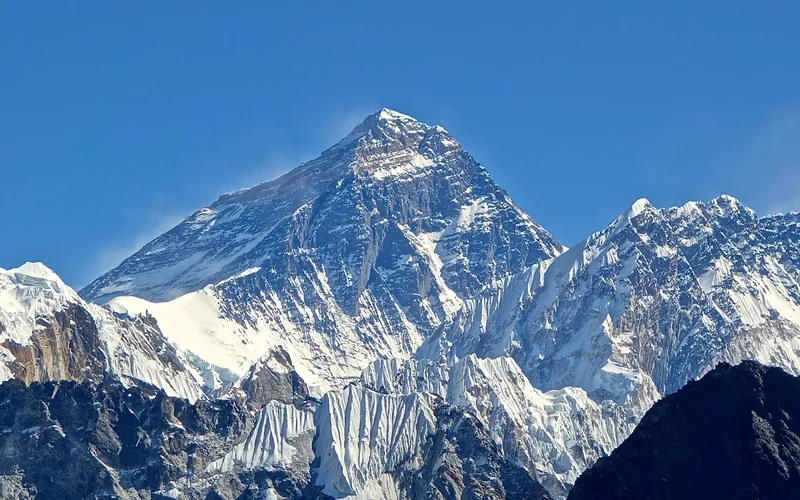


Mount Everest
Mount Everest is the highest mountain above sea level on Earth, standing at an official elevation of 8,848.86 meters (29,031.7 ft). Straddling the international frontier between Nepal and China, it is known locally as Sagarmatha in Nepali ('Goddess of the Sky') and Chomolungma in Tibetan ('Mother Goddess of the World'). The peak rises into the extreme upper troposphere, where oxygen levels drop to barely one-third of sea-level pressure. Climbers face hurricane-force jet stream winds, severe frostbite conditions, shifting ice crevasses in the Khumbu Icefall, and the dangerous Death Zone above 8,000 meters.
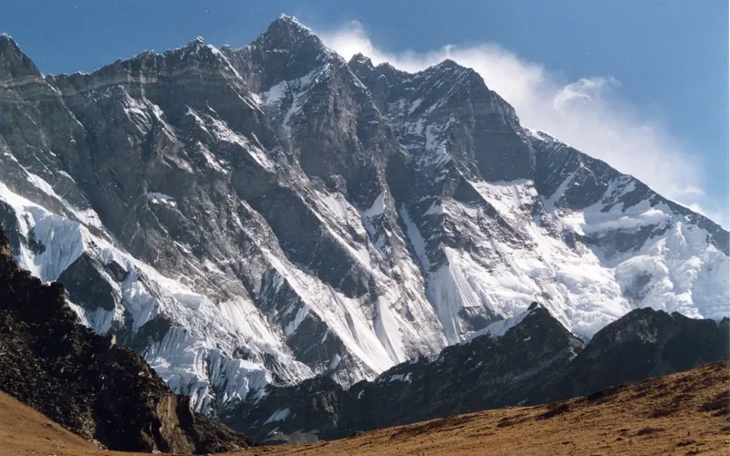
Lhotse
Lhotse, at 8,516 meters (27,940 ft), is the fourth-highest mountain on Earth, connected directly to Mount Everest via the South Col. Renowned for its sheer 3,200-meter South Face, one of the most imposing rock and ice walls in alpinism, the standard route tackles the grueling Lhotse Couloir from the Western Cwm.
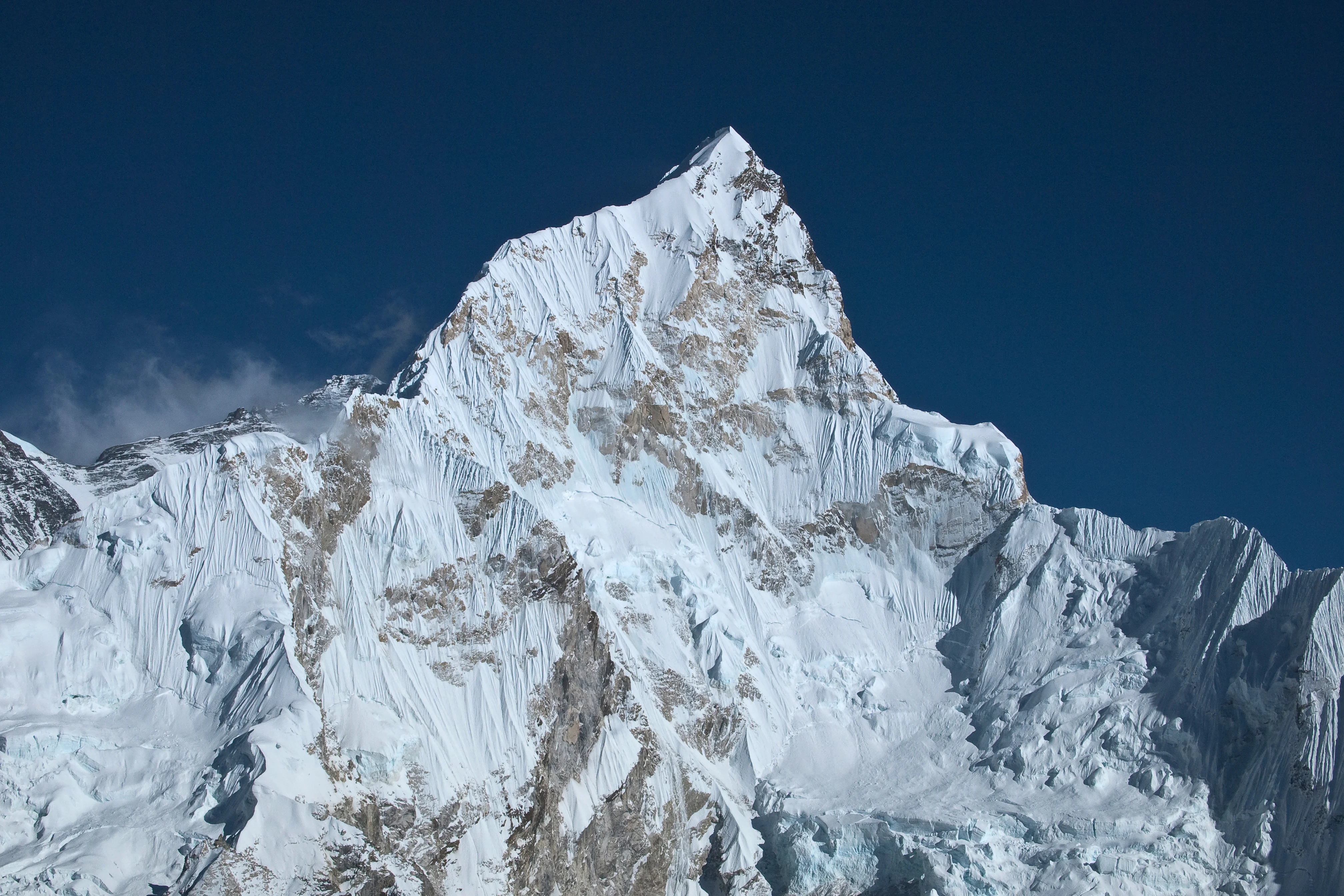
Nuptse
Nuptse is a dramatic 7,861-meter mountain in the Khumbu region of the Nepalese Himalayas, lying two kilometers west-southwest of Mount Everest and forming the formidable southwestern wall of the Western Cwm. In Tibetan, its name translates directly to 'West Peak', signifying its position in the monumental Everest-Lhotse-Nuptse horseshoe. The south face of Nuptse is an extraordinarily steep 2,500-meter wall of ice flutes, vertical rock buttresses, and hanging glaciers that is considered one of the greatest alpine climbing challenges on Earth. The mountain was first climbed on May 16, 1961, by British mountaineer Dennis Davis and Sherpa legend Tashi Sherpa via the North Ridge.
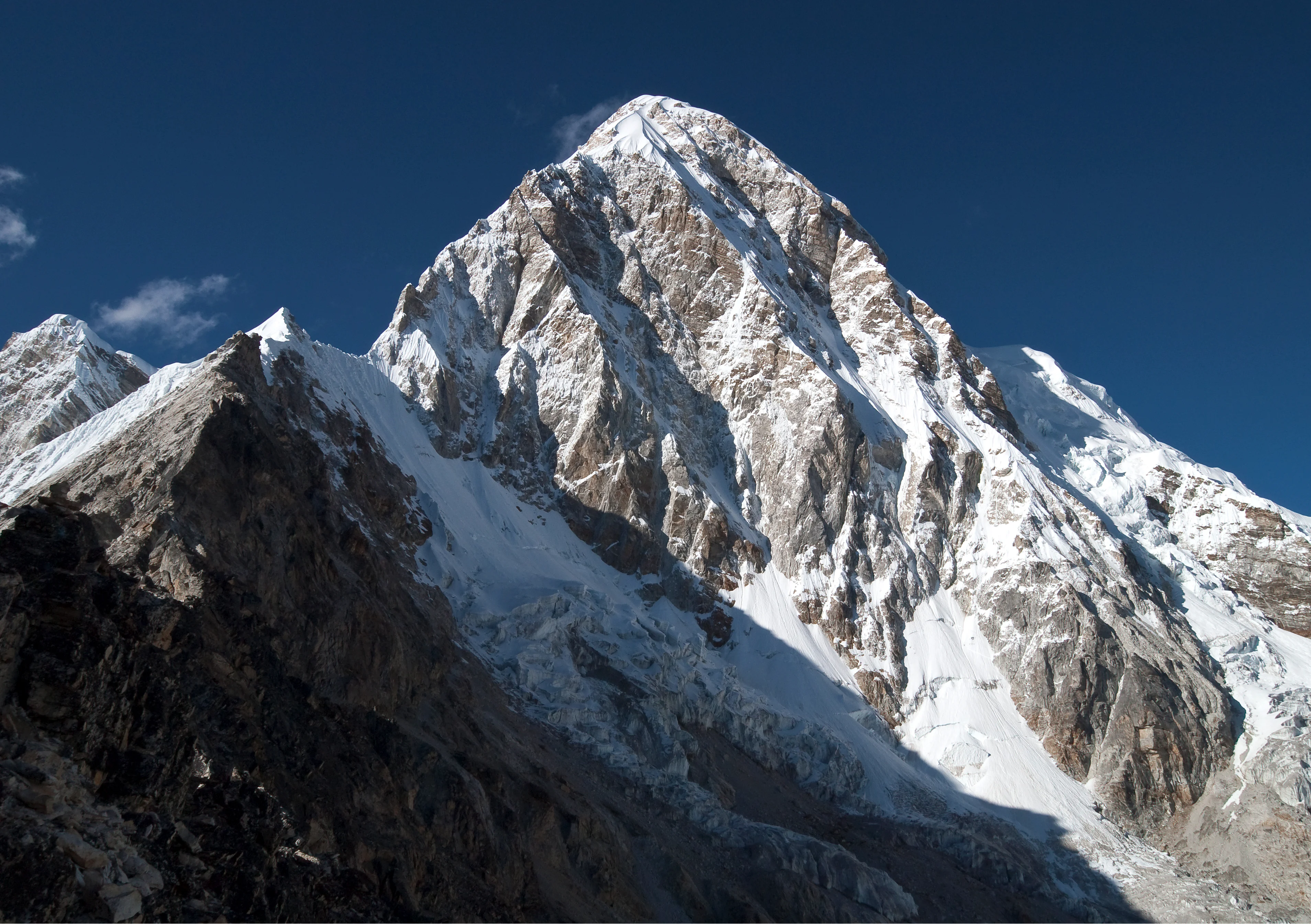
Pumori
Pumori is a majestic 7,161-meter pyramidal mountain in the Mahalangur section of the Himalayas, rising eight kilometers west of Mount Everest on the international border between Nepal and Tibet. George Mallory bestowed its name, which translates in the Sherpa language to 'Mountain Daughter' or 'Unmarried Daughter', honoring its geographic proximity to Everest. Standing directly opposite Kala Patthar and Gorak Shep, Pumori presents an iconic triangular spire of ice and granite that dominates the upper Khumbu Valley. The summit was first reached on May 17, 1962, by German alpinist Gerhard Lenser as part of a German-Swiss expedition via the Southeast Ridge.
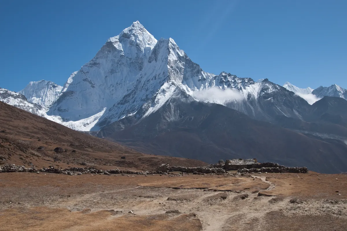
Ama Dablam
Ama Dablam is an iconic 6,812-meter (22,349 ft) mountain in the eastern Himalayan region of Nepal. Renowned worldwide for its soaring granite ridges and hanging glaciers, it is often called the Matterhorn of the Himalayas. Its name translates as 'Mother's Necklace', referring to the hanging serac resembling a traditional Sherpa pendant. Sir Edmund Hillary conceived and led the 1960–1961 Silver Hut Expedition that unlocked the mountain. On January 15, 1961, Hillary's assault team achieved the historic first ascent via the Southwest Ridge. It remains one of the most aesthetic and technically demanding alpine ascents in the world.
Documented Sources & Archival Citations
- Decadal changes of glaciers in the Everest region (1962–2020)(The Cryosphere)
Supporting claim: Downwasting rates and supraglacial lake expansion measurements
Accessed/Documented: 2026 - Randolph Glacier Inventory 7.0: High Mountain Asia ↗(GLIMS / NSIDC)
Supporting claim: Morphological boundary data for RGI70-15.03410
Accessed/Documented: 2026