Mount Everest Southwest Face (Bonington Route)
The Southwest Face of Mount Everest (8,848. 86m) rises 2,300 vertical meters from the Western Cwm to the summit, presenting one of the largest and most forbidding rock and ice faces in the world.
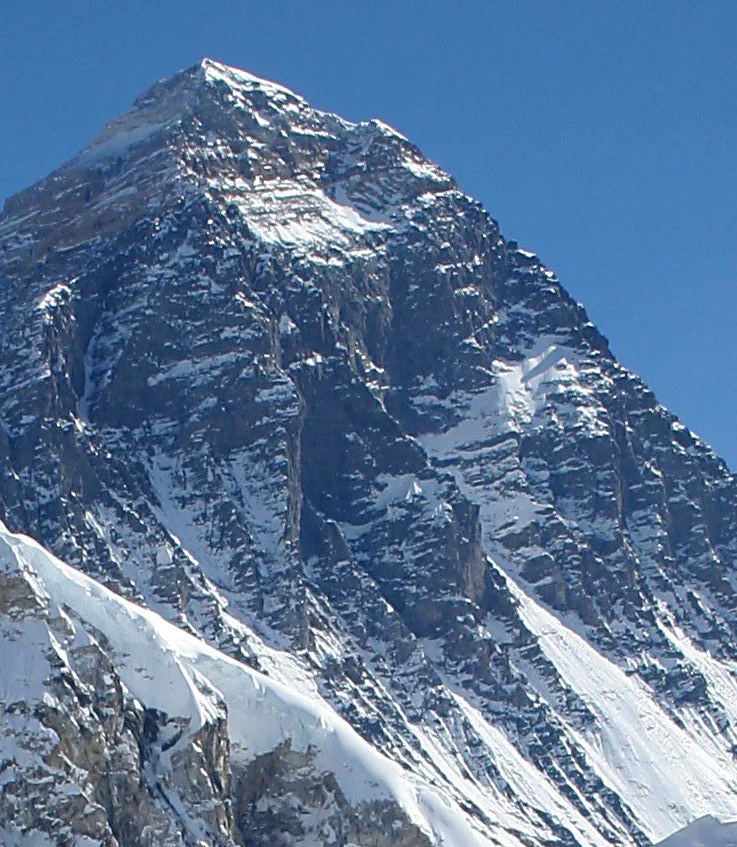
Ascent line, technical cruxes & camp topography profile for Mount Everest Southwest Face (Bonington Route)
Mountain Safety & Conditions Disclaimer: High-altitude climbing, glacial travel, and technical ascents entail severe objective risks including avalanches, serac collapses, rapid weather collapse, and altitude illness. Historical route descriptions and summit claims on Mountanity reflect documented archival sources and must not be used as live operational safety assessments. Local regulations, permits, and physical glacial topography change continuously.
Peer Review: Senior Editorial Board & Historical Reviewers • Editorial Standards
Tactical & Camp Notes
Requires heavy siege tactics or elite alpine big-wall expertise. The upper face funnels severe spindrift, and high winds above the Rock Band can trap climbers in the Death Zone.
Identified Objective Hazards
- •Violent spindrift avalanches cascading down the central couloir and sweeping the upper face
- •Extreme technical rock and aid climbing required at extreme altitudes above 8,200 meters
- •Hurricane-force jet stream winds stripping tents and exposing climbers to hypothermia
- •Severe crevasse hazards traversing the Western Cwm to access the base of the face
Historical Context
First climbed on September 24, 1975, by Doug Scott and Dougal Haston, followed on September 26 by Peter Boardman and Pertemba Sherpa (along with Mick Burke, who went missing near the summit in whiteout). It marked Britain's first successful Everest ascent and remains a landmark achievement in big-wall mountaineering.
Interactive Elevation Profile
Vertical profile, technical cruxes, and camp staging progression for Mount Everest Southwest Face (Bonington Route) on Mount Everest.
Central logistics hub situated in the upper Western Cwm below the Southwest Face.
Camp-by-Camp Topography
Key staging altitudes, technical cruxes, and terrain transitions for Mount Everest Southwest Face (Bonington Route).
Camp II (Advance Base Camp)
Central logistics hub situated in the upper Western Cwm below the Southwest Face.
Camp IV (Lower Face)
Box tents anchored onto excavated ice terraces below the great central gully.
Camp V (Under the Rock Band)
Camp positioned at the base of the towering yellow limestone barrier.
Camp VI (Above the Rock Band)
Highest fixed camp established on the steep upper snowfields leading toward the South Summit.
South Summit Bivouac Cave
Emergency snow cave excavated by Scott and Haston during their historic sub-zero bivouac.
Summit of Mount Everest
The highest point on Earth, reached at 6:00 PM on September 24, 1975.
Topographic Location & Terrain Map
Cartographic datum, massif coordinates, and terrain context for Mount Everest Southwest Face (Bonington Route) on Mount Everest.
Interactive Topographic Terrain Map
Click below to load live cartographic contours, glacier approaches, and geographic markers for Mount Everest (27°59′17″ N, 86°55′30″ E).
Key Statistics & Topographic Figures
- Route Type
- Colossal High-Altitude Big Wall / Siege Route
Topography
- Technical Difficulty
- Extreme Technical Wall / Grade VI, 5.9, A2, 85° ice
5.9 rock and A2 aid climbing through the vertical Rock Band gully at 8,300m, sustained 50°–70° hard ice flutings
- Country / Region
- Nepal (Khumbu / Mahalangur Himal)
Location
Archival Primary Source Quotations
“A mountain route is not merely a path of rock and ice; it is a test of human endurance, judgment, and humility.”
Defined Alpine Terminology & Concepts
- Crux
- The most difficult and technically demanding pitch or section of a climbing route.
- Normal Route (Voie Normale)
- The most frequently climbed, least technical, and historically standard path to a mountain summit.
Frequently Asked Questions: Mount Everest Southwest Face (Bonington Route)
What is the climbing difficulty and grade of Mount Everest Southwest Face (Bonington Route)?
Mount Everest Southwest Face (Bonington Route) on mount-everest is graded as Extreme Technical Wall / Grade VI, 5.9, A2, 85° ice, with technical climbing requirements including 5.9 rock and A2 aid climbing through the vertical Rock Band gully at 8,300m, sustained 50°–70° hard ice flutings.
What are the primary hazards on the Mount Everest Southwest Face (Bonington Route)?
Climbers on Mount Everest Southwest Face (Bonington Route) must navigate severe objective hazards including Violent spindrift avalanches cascading down the central couloir and sweeping the upper face, Extreme technical rock and aid climbing required at extreme altitudes above 8,200 meters, Hurricane-force jet stream winds stripping tents and exposing climbers to hypothermia, Severe crevasse hazards traversing the Western Cwm to access the base of the face.
What camps are established on Mount Everest Southwest Face (Bonington Route)?
Mount Everest Southwest Face (Bonington Route) typically features 6 staging camps, progressing from Camp II (Advance Base Camp) (6500m) up toward the summit.
Mountain Ascended
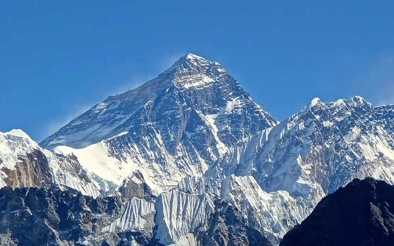


Mount Everest
Mount Everest is the highest mountain above sea level on Earth, standing at an official elevation of 8,848.86 meters (29,031.7 ft). Straddling the international frontier between Nepal and China, it is known locally as Sagarmatha in Nepali ('Goddess of the Sky') and Chomolungma in Tibetan ('Mother Goddess of the World'). The peak rises into the extreme upper troposphere, where oxygen levels drop to barely one-third of sea-level pressure. Climbers face hurricane-force jet stream winds, severe frostbite conditions, shifting ice crevasses in the Khumbu Icefall, and the dangerous Death Zone above 8,000 meters.
Documented Expeditions on this Route (1)
Verified historical summits, siege campaigns, and pioneer attempts recorded on Mount Everest Southwest Face (Bonington Route).
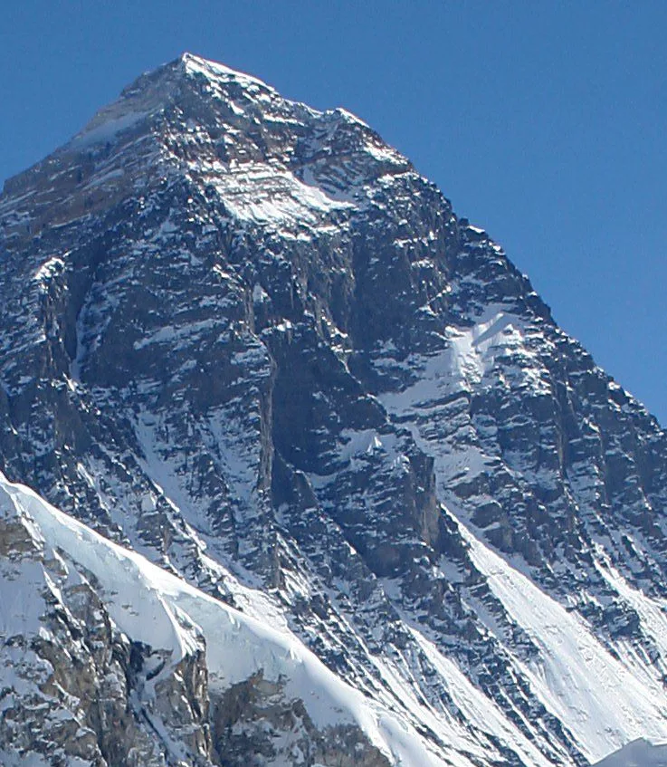
1975 British Mount Everest Southwest Face Expedition
The landmark autumn 1975 British expedition led by Chris Bonington that solved the 'Last Great Problem of the Himalayas' by conquering Mount Everest's colossal 2,300-meter Southwest Face, culminating in Doug Scott and Dougal Haston's summit and their legendary 8,760m survival bivouac.
Archival Chronicles & Stories on this Route (1)
In-depth longform historical narratives, harrowing survival accounts, and firsthand alpine journals on Mount Everest Southwest Face (Bonington Route).
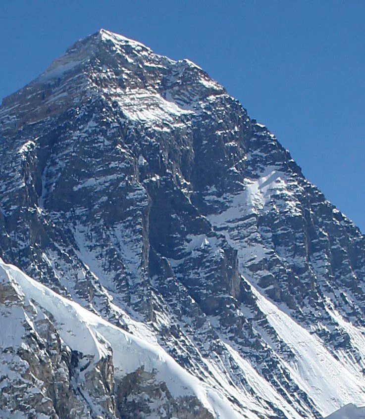
Everest 1975: The Southwest Face Rock Band and the 8,760m Survival Bivouac
On September 24, 1975, Doug Scott and Dougal Haston unlocked the vertical 300-meter Rock Band on Mount Everest's Southwest Face, standing atop the world and surviving a historic 8,760m open-air bivouac.
Documented Sources & Archival Citations
- Everest the Hard Way(Chris Bonington / Hodder & Stoughton)
Supporting claim: Official definitive expedition book documenting the siege, routes, and summit bivouac
Accessed/Documented: 1976 - Up and About: The Hard Road to Everest(Doug Scott / Vertebrate Publishing)
Supporting claim: Autobiographical account of the Rock Band climb and 8,760m survival bivouac
Accessed/Documented: 2015