Mount Kazbek Normal Route via Gergeti Glacier & Betlemi Hut
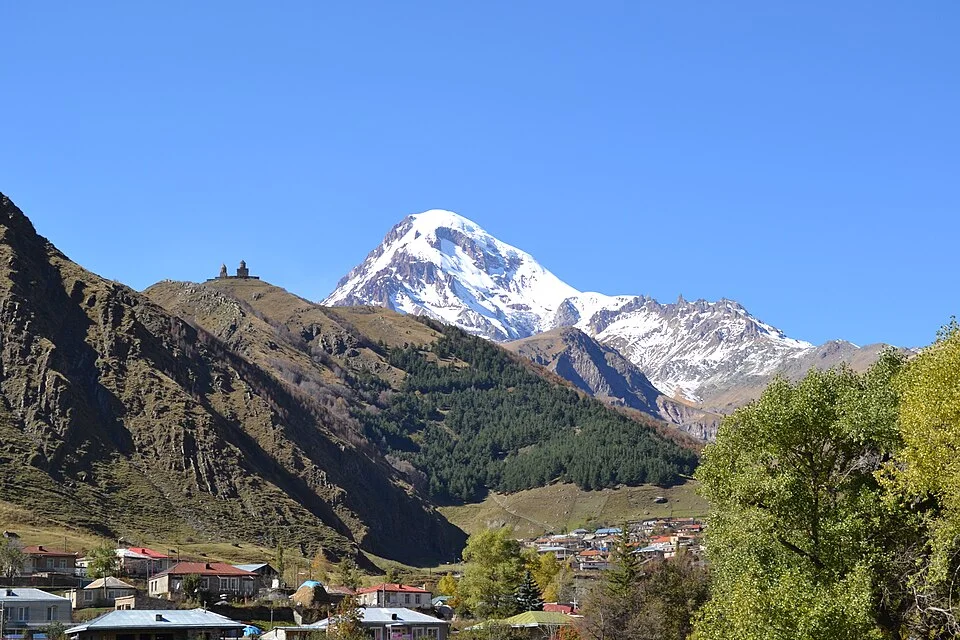
The historic normal route up Mount Kazbek begins from the village of Stepantsminda, passing the iconic 14th-century Gergeti Trinity Church. Climbers cross the Gergeti Glacier to reach the historic Betlemi Hut (3,650 m).
Ascent line, technical cruxes & camp topography profile for Mount Kazbek Normal Route via Gergeti Glacier & Betlemi Hut
Mountain Safety & Conditions Disclaimer: High-altitude climbing, glacial travel, and technical ascents entail severe objective risks including avalanches, serac collapses, rapid weather collapse, and altitude illness. Historical route descriptions and summit claims on Mountanity reflect documented archival sources and must not be used as live operational safety assessments. Local regulations, permits, and physical glacial topography change continuously.
Peer Review: Senior Editorial Board & Historical Reviewers • Editorial Standards
Tactical & Camp Notes
Starting from the village of Stepantsminda (1,750 m), hikers ascend through alpine pastures past the historic Gergeti Trinity Church (2,170 m) and Sabertse Pass to the snout of the Gergeti Glacier. Crossing the glacier brings climbers to Betlemi Hut (Meteo Station, 3,650 m). On summit day, climbers navigate the upper crevassed glacier basin to reach the saddle between Kazbek's summits at 4,900 metres, followed by an exposed 40-degree snow/ice headwall to the 5,054-metre volcanic summit dome.
Interactive Elevation Profile
Vertical profile, technical cruxes, and camp staging progression for Mount Kazbek Normal Route via Gergeti Glacier & Betlemi Hut on Mount Kazbek.
Mountain village base along the Georgian Military Road.
Camp-by-Camp Topography
Key staging altitudes, technical cruxes, and terrain transitions for Mount Kazbek Normal Route via Gergeti Glacier & Betlemi Hut.
Stepantsminda Trailhead
Mountain village base along the Georgian Military Road.
Betlemi Hut (Meteo Station)
Historic stone refuge serving as base camp, equipped with dormitories and tent pads.
Kazbek Saddle
Glaciated snow col between the eastern and western volcanic summits.
Mount Kazbek Summit
Highest volcanic peak in Georgia, commanding views across the Caucasus.
Topographic Location & Terrain Map
Cartographic datum, massif coordinates, and terrain context for Mount Kazbek Normal Route via Gergeti Glacier & Betlemi Hut on Mount Kazbek.
Interactive Topographic Terrain Map
Click below to load live cartographic contours, glacier approaches, and geographic markers for Mount Kazbek (42°41′43″ N, 44°30′58″ E).
Key Statistics & Topographic Figures
- Route Difficulty
- PD / Russian 2B
- Elevation Gain
- 3,300 m from Stepantsminda
- Key Refuge
- Betlemi Hut (3,650 m)
- Crux Section
- 40° Firn Headwall above Saddle
Archival Primary Source Quotations
“Climbing across the Gergeti Glacier beneath Kazbek felt like stepping into an ancient biblical painting.”
Defined Alpine Terminology & Concepts
- Betlemi Hut (Meteo Station)
- A historic stone refuge at 3,650 metres on the flanks of Mount Kazbek, originally built as a Soviet meteorological observatory.
- Gergeti Plateau
- The vast upper glacial basin feeding the Gergeti Glacier, traversed during the summit day push on Mount Kazbek.
Frequently Asked Questions: Mount Kazbek Normal Route via Gergeti Glacier & Betlemi Hut
What is the Normal Route on Mount Kazbek?
It is the classic climbing route ascending from Stepantsminda past Gergeti Trinity Church, crossing the Gergeti Glacier to Betlemi Hut and the summit.
What is the difficulty of the Mount Kazbek Normal Route?
The route is graded PD (Peu Difficile) or Russian 2B, involving glacier travel, crevasse rescue skills, and a 40-degree summit ice slope.
Where do climbers stay on Mount Kazbek?
Most climbers stay at the Betlemi Hut (formerly the Meteo Station) at 3,650 metres, or camp in tents nearby on the moraine.
What is the best season to climb Mount Kazbek?
The prime climbing season runs from late June through September, when glaciers are stable and weather windows are most frequent.
Mountain Ascended
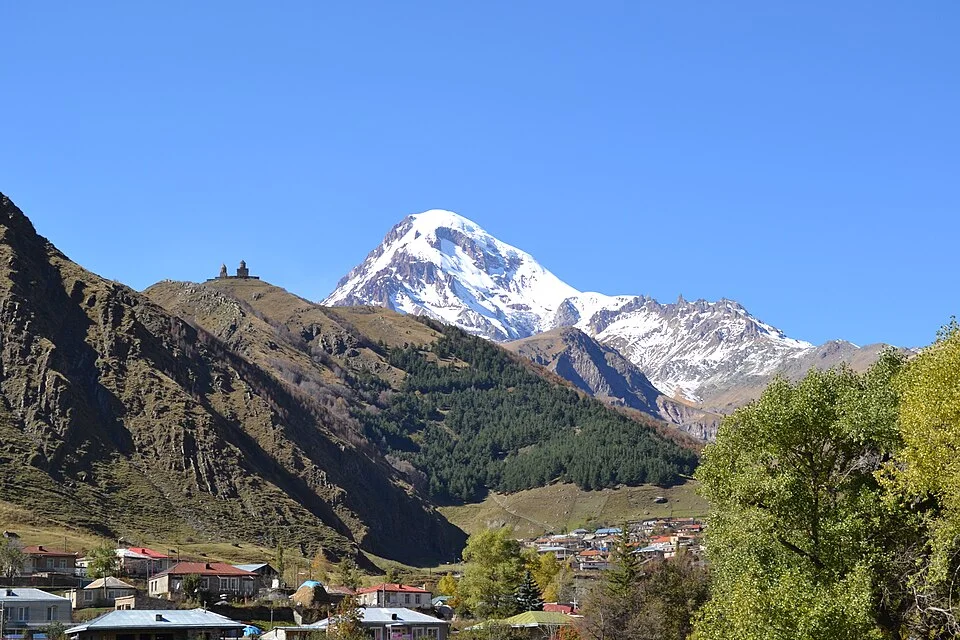

Mount Kazbek
Mount Kazbek (known in Georgian as Mqinvartsveri, meaning 'Glacier Peak') is a magnificent 5,054-metre dormant stratovolcano situated in northeastern Georgia just south of the Russian border. The third-highest summit in Georgia and the second-highest volcanic cone in the Caucasus after Elbrus, Kazbek towers majestically above the town of Stepantsminda and the historic Georgian Military Highway. Rich in mythology as the legendary peak where the Titan Amirani (the Georgian Prometheus) was chained for gifting fire to mortals, Kazbek was first climbed in 1868 by Douglas Freshfield, Adolphus Moore, Charles Tucker, and Chamonix guide François Devouassoud.
Documented Expeditions on this Route (1)
Verified historical summits, siege campaigns, and pioneer attempts recorded on Mount Kazbek Normal Route via Gergeti Glacier & Betlemi Hut.
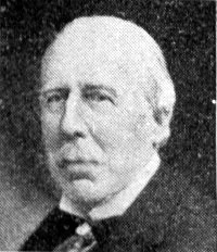
1868 Douglas Freshfield and François Devouassoud Mount Kazbek Historic First Ascent Expedition
On July 1, 1868, British alpine explorer Douglas William Freshfield, companions Adolphus Moore and Charles Tucker, and Chamonix master guide François Devouassoud completed the historic first ascent of Mount Kazbek (5,054 m) in Georgia. Traversing the Gergeti Glacier, they opened the high era of Western mountaineering in the Caucasus.
Archival Chronicles & Stories on this Route (1)
In-depth longform historical narratives, harrowing survival accounts, and firsthand alpine journals on Mount Kazbek Normal Route via Gergeti Glacier & Betlemi Hut.
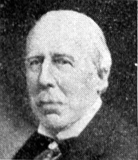
Prometheus Unbound: Douglas Freshfield and the 1868 First Ascent of Mount Kazbek
On July 1, 1868, Douglas Freshfield and François Devouassoud conquered Mount Kazbek (5,054 m), unleashing the Golden Age of Caucasian mountaineering.
Documented Sources & Archival Citations
- Travels in the Central Caucasus and Bashan(Douglas William Freshfield / Longmans, Green, and Co.)
Supporting claim: Firsthand technical route log of the 1868 first ascent
Accessed/Documented: 1869