Caldera Rim & Fang Ridge Route of Mount Erebus
The Caldera Rim Route is the historic ascent line up Mount Erebus (3,794 m), the southernmost active volcano on Earth. Ascending from Cape Royds across the slopes of Fang Glacier and the shattered remnants of the caldera wall known as Fang Ridge, the route traverses vast fields of spectacular, geothermal ice fumaroles (ice chimneys) before reaching the outer caldera rim at 3,500 metres.
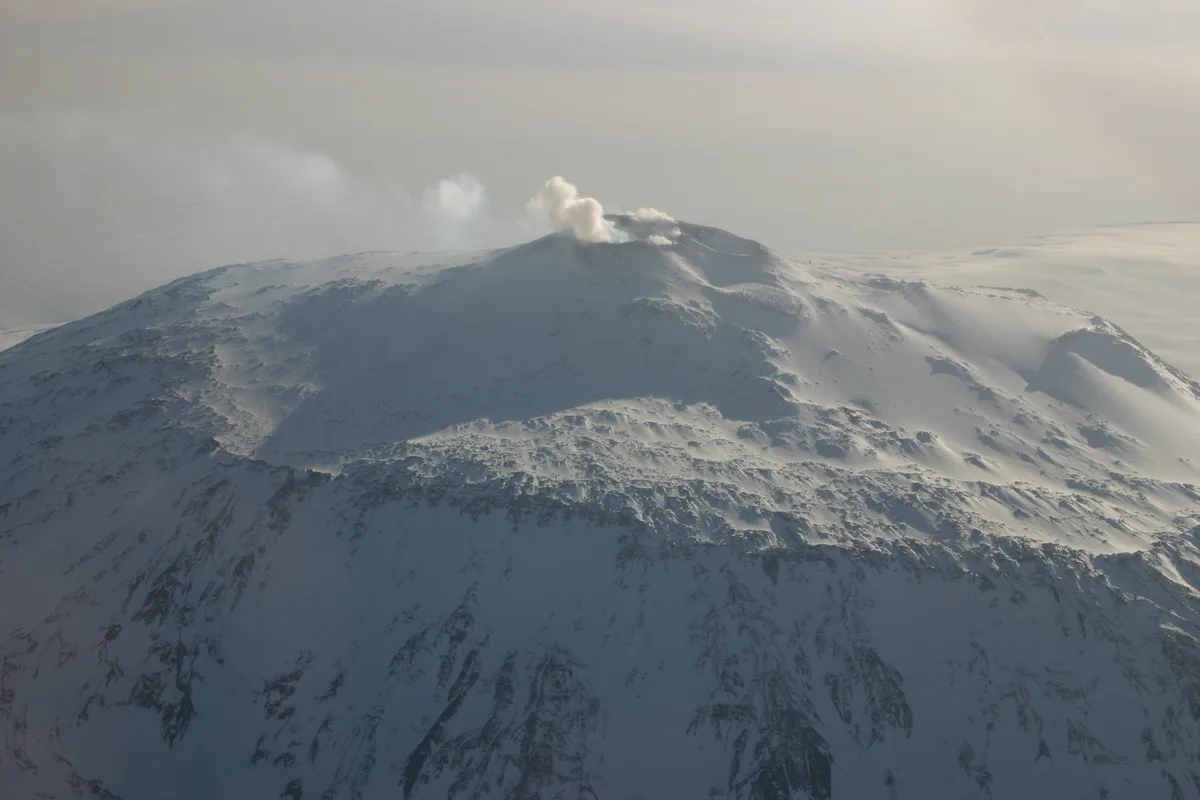
Ascent line, technical cruxes & camp topography profile for Caldera Rim & Fang Ridge Route of Mount Erebus
Mountain Safety & Conditions Disclaimer: High-altitude climbing, glacial travel, and technical ascents entail severe objective risks including avalanches, serac collapses, rapid weather collapse, and altitude illness. Historical route descriptions and summit claims on Mountanity reflect documented archival sources and must not be used as live operational safety assessments. Local regulations, permits, and physical glacial topography change continuously.
Peer Review: Senior Editorial Board & Historical Reviewers • Editorial Standards
Tactical & Camp Notes
Climbers must navigate toxic volcanic sulphur fumes near the crater rim. Temperatures can plummet to -45°C during blizzards, with zero shelter on the bare upper volcanic flanks.
Identified Objective Hazards
- •Toxic sulfur dioxide (SO2) and carbon dioxide volcanic gas plumes near the active crater rim
- •Blinding blizzard conditions with wind chills dropping below -60°C on exposed volcanic slopes
- •Fragile, deceptive ice caves and thermal vents masked by fragile snow crusts
- •Periodic strombolian volcanic explosions ejecting molten volcanic bombs and pumice
Historical Context
Pioneered on March 10, 1908, by Professor Edgeworth David, Douglas Mawson, Raymond Priestley, Alistair Mackay, Eric Marshall, and Philip Brocklehurst during Shackleton's Nimrod expedition.
Interactive Elevation Profile
Vertical profile, technical cruxes, and camp staging progression for Caldera Rim & Fang Ridge Route of Mount Erebus on Mount Erebus.
Coastal base near Shackleton's historic 1907 hut, situated beside Adélie penguin rookeries on the shore of McMurdo Sound.
Camp-by-Camp Topography
Key staging altitudes, technical cruxes, and terrain transitions for Caldera Rim & Fang Ridge Route of Mount Erebus.
Cape Royds Staging Area
Coastal base near Shackleton's historic 1907 hut, situated beside Adélie penguin rookeries on the shore of McMurdo Sound.
Lower Fang Bivouac
Sheltered snow camp pitched beneath the shattered cliffs of Fang Ridge, used by the 1908 party to wait out blizzards.
Old Crater Rim Plateau
A surreal polar volcanic plain dotted with towering hollow ice towers (ice fumaroles) exhaling warm geothermal steam.
Main Active Caldera Lip
The lip of the outer crater overlooking the glowing, churning lava lake in the inner pit, surrounded by deposits of volcanic anorthoclase crystals.
Topographic Location & Terrain Map
Cartographic datum, massif coordinates, and terrain context for Caldera Rim & Fang Ridge Route of Mount Erebus on Mount Erebus.
Interactive Topographic Terrain Map
Click below to load live cartographic contours, glacier approaches, and geographic markers for Mount Erebus (77°31′47″ S, 167°10′00″ E).
Key Statistics & Topographic Figures
- Route Type
- Polar Volcanic Ridge & Caldera Rim Expedition
Topography
- Technical Difficulty
- Exhausting Polar High-Latitude Trekking & Snow Slogging
Grade I-II polar snowfields, 30° glacier slopes, fumarole crevasse navigation
- Country / Region
- Antarctica (Ross Island / Transantarctic boundary)
Location
Archival Primary Source Quotations
“A mountain route is not merely a path of rock and ice; it is a test of human endurance, judgment, and humility.”
Defined Alpine Terminology & Concepts
- Crux
- The most difficult and technically demanding pitch or section of a climbing route.
- Normal Route (Voie Normale)
- The most frequently climbed, least technical, and historically standard path to a mountain summit.
Frequently Asked Questions: Caldera Rim & Fang Ridge Route of Mount Erebus
What is the climbing difficulty and grade of Caldera Rim & Fang Ridge Route of Mount Erebus?
Caldera Rim & Fang Ridge Route of Mount Erebus on mount-erebus is graded as Exhausting Polar High-Latitude Trekking & Snow Slogging, with technical climbing requirements including Grade I-II polar snowfields, 30° glacier slopes, fumarole crevasse navigation.
What are the primary hazards on the Caldera Rim & Fang Ridge Route of Mount Erebus?
Climbers on Caldera Rim & Fang Ridge Route of Mount Erebus must navigate severe objective hazards including Toxic sulfur dioxide (SO2) and carbon dioxide volcanic gas plumes near the active crater rim, Blinding blizzard conditions with wind chills dropping below -60°C on exposed volcanic slopes, Fragile, deceptive ice caves and thermal vents masked by fragile snow crusts, Periodic strombolian volcanic explosions ejecting molten volcanic bombs and pumice.
What camps are established on Caldera Rim & Fang Ridge Route of Mount Erebus?
Caldera Rim & Fang Ridge Route of Mount Erebus typically features 4 staging camps, progressing from Cape Royds Staging Area (10m) up toward the summit.
Mountain Ascended
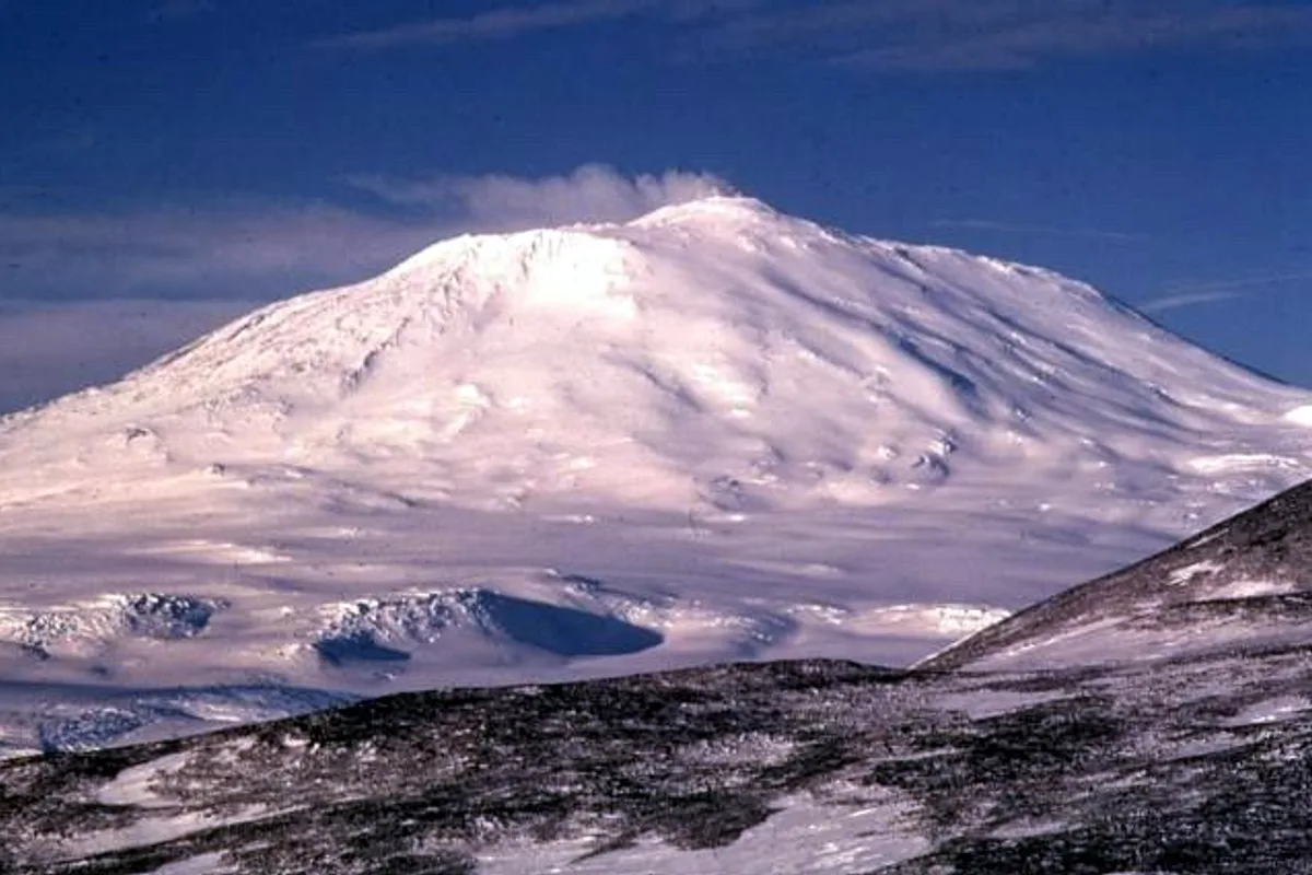

Mount Erebus
Mount Erebus is an active stratovolcano rising to 3,794 metres (12,448 ft) on Ross Island in Antarctica, making it the southernmost active volcano on Earth and the second-highest volcano in Antarctica. Famous for its persistent, bubbling phonolitic lava lake inside its inner crater and unique fumarolic ice towers (ice fumaroles), it was discovered in 1841 by Sir James Clark Ross. In March 1908, a six-man party led by Professor Edgeworth David and including Douglas Mawson and Raymond Priestley during Sir Ernest Shackleton's Nimrod Expedition achieved the heroic maiden first ascent, hauling sledges through ferocious polar blizzards to peer into the glowing volcanic abyss.
Documented Expeditions on this Route (1)
Verified historical summits, siege campaigns, and pioneer attempts recorded on Caldera Rim & Fang Ridge Route of Mount Erebus.
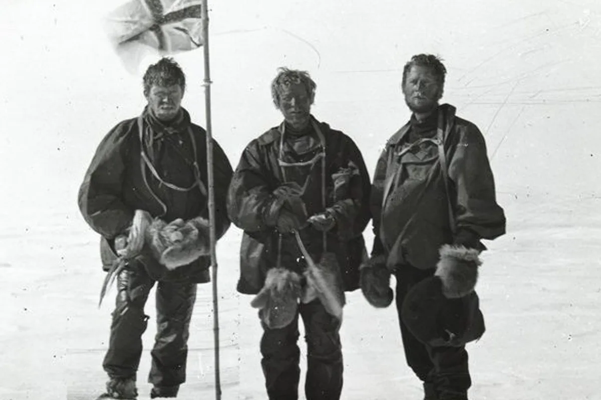
1908 Edgeworth David, Douglas Mawson and Raymond Priestley Historic First Ascent of Mount Erebus
On March 10, 1908, a six-man party from Sir Ernest Shackleton's British Antarctic (Nimrod) Expedition—led by 50-year-old Professor Edgeworth David and including Douglas Mawson and 21-year-old geologist Raymond Priestley—achieved the maiden first ascent of Mount Erebus (3,794 m). Hauling heavy sledges across icy volcanic slopes and enduring a multi-day blizzard at sub-zero temperatures, the climbers reached the active caldera lip to peer into the bubbling molten lava lake.
Archival Chronicles & Stories on this Route (1)
In-depth longform historical narratives, harrowing survival accounts, and firsthand alpine journals on Caldera Rim & Fang Ridge Route of Mount Erebus.
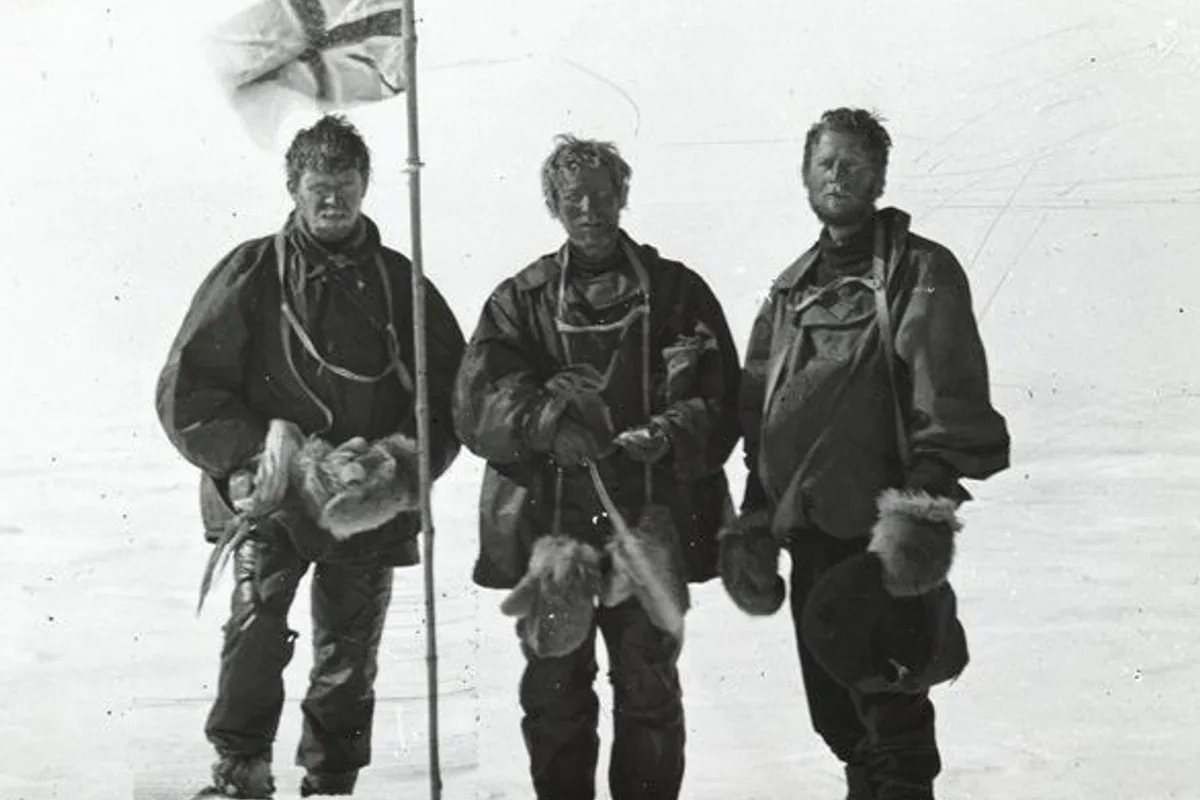
Into the Cauldron of Ice: The 1908 First Ascent of Mount Erebus
Through polar blizzards and geothermal ice towers to the glowing lava lake of Earth's southernmost active volcano.
Documented Sources & Archival Citations
- The Heart of the Antarctic(Sir Ernest Shackleton / William Heinemann)
Supporting claim: Official narrative of the 1908 ascent of Mount Erebus by the Nimrod party
Accessed/Documented: 1909 - Antarctic Volcanism(American Geophysical Union)
Supporting claim: Volcanological topography and route analysis of Mount Erebus
Accessed/Documented: 1990