1802 Alexander von Humboldt Chimborazo World Altitude Record Expedition
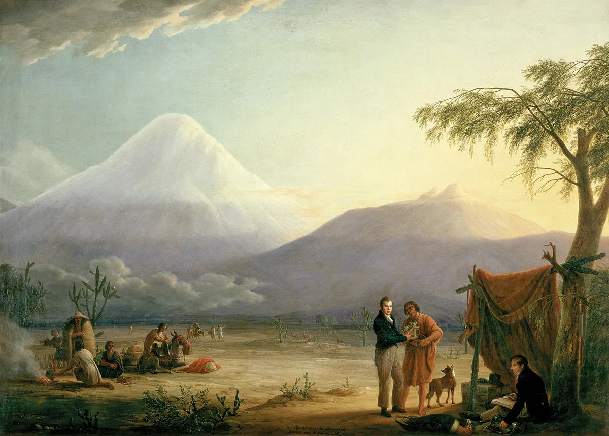
On June 23, 1802, Prussian naturalist Alexander von Humboldt, French botanist Aimé Bonpland, and Ecuadorian nobleman Carlos Montúfar reached 5,878 metres on Chimborazo. Overcoming altitude sickness, freezing gales, and sheer rock precipices without modern alpine gear, they set a world altitude record that stood for thirty years.
Mountain Safety & Conditions Disclaimer: High-altitude climbing, glacial travel, and technical ascents entail severe objective risks including avalanches, serac collapses, rapid weather collapse, and altitude illness. Historical route descriptions and summit claims on Mountanity reflect documented archival sources and must not be used as live operational safety assessments. Local regulations, permits, and physical glacial topography change continuously.
Peer Review: Senior Editorial Board & Historical Reviewers • Editorial Standards
Official Expedition Narrative & Archival Record
In June 1802, during their monumental exploration of the Spanish Americas, Prussian polymath Alexander von Humboldt, French botanist Aimé Bonpland, and Ecuadorian nobleman Carlos Montúfar arrived in Riobamba at the foot of Nevado Chimborazo (6,263 m). At the time, Chimborazo was universally regarded by European geographers as the highest mountain on Earth. On June 23, 1802, the party launched an audacious push up the volcano's southwestern slopes from a base camp on the high paramo. Dressed in simple woollen overcoats and leather shoes, without ropes, ice axes, or crampons, the climbers pressed upward along a knife-edge rock and ice rib flanking a steep ravine. As atmospheric pressure plummeted, the trio suffered severe nausea, dizziness, and hemorrhaging from their gums and lips. Despite bone-chilling mist, driving sleet, and terrifying exposure above yawning abysses, Humboldt continued to pause at regular intervals, carefully setting up delicate mercury barometers, thermometers, and cyanometers to record altitude and atmospheric properties. At approximately one o'clock in the afternoon, the climbers found their path blocked by an impassable transverse chasm—a bottomless rift in the volcanic rock and ice roughly four hundred feet wide. Barometric calculations placed their high point at 5,878 metres (19,286 feet). With freezing fog enveloping the ridge and frostbite threatening their extremities, Humboldt ordered a retreat. Although short of the summit, they had climbed higher than any human in recorded history, a world altitude record that stood until the 1830s. Humboldt synthesized the data into his revolutionary 'Tableau Physique des Andes', fundamentally establishing the sciences of biogeography and ecology.
Documented Team Composition
- Alexander von Humboldt (Expedition Leader & Polymath, Germany)
- Aimé Bonpland (Botanist & Naturalist, France)
- Carlos Montúfar (Explorer & Companion, Ecuador)
Key Statistics & Topographic Figures
- Altitude Attained
- 5,878 m (19,286 ft)
- Date of Ascent
- June 23, 1802
- Climbing Team
- Alexander von Humboldt, Aimé Bonpland, Carlos Montúfar
- Barometric Reading
- 14 inches, 2 lines (mercury column)
- Historical Significance
- World Altitude Record & Foundation of Biogeography
Archival Primary Source Quotations
“A mountain is not an isolated rock, but a great living organism where climate, vegetation, and geology form a single, harmonious cosmos.”
Defined Alpine Terminology & Concepts
- Tableau Physique des Andes
- Alexander von Humboldt's pioneering cross-sectional diagram illustrating the altitudinal zonation of plant life, temperature, and atmospheric pressure on Chimborazo.
- Altitudinal Zonation
- The distinct layering of ecosystems and vegetation communities at different vertical elevations due to declining temperatures and atmospheric density.
Frequently Asked Questions: 1802 Alexander von Humboldt Chimborazo World Altitude Record Expedition
What altitude record did Alexander von Humboldt set on Chimborazo in 1802?
Humboldt, Aimé Bonpland, and Carlos Montúfar reached 5,878 metres (19,286 feet) on Chimborazo on June 23, 1802, setting a world altitude record that stood for thirty years.
Why did Humboldt's party stop at 5,878 metres?
Their ascent was halted by an impassable transverse crevasse roughly 400 feet wide and 60 feet deep, combined with severe hypoxia, bleeding from their gums and lips, and frostbite.
What major scientific breakthrough resulted from Humboldt's Chimborazo expedition?
Humboldt created the 'Tableau Physique des Andes', synthesizing his barometric and botanical notes into the foundational principles of modern ecology, biogeography, and physical geography.
Did Humboldt believe Chimborazo was the highest mountain on Earth?
Yes, in 1802 Chimborazo was widely recognized by European geographers as the highest peak on Earth, before Himalayan summits were accurately surveyed.
Ascent Route & Topography
Chimborazo Normal Route (Whymper Route)
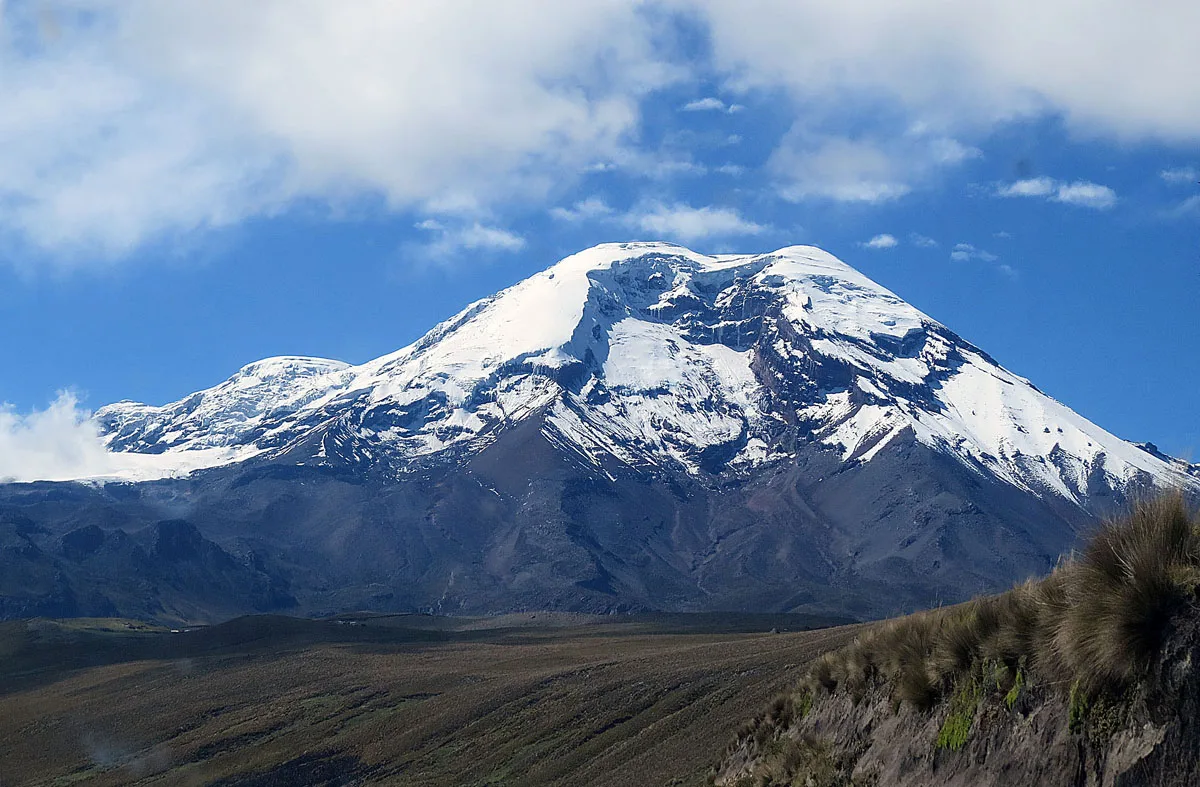
The Whymper Route follows the western ridges and glacier flanks of Chimborazo past the landmark rock buttress of El Castillo. Climbers ascend steep 40°-50° firn and penitentes before traversing expansive upper ice fields to reach Cumbre Veintimilla (6,230 m) and finally Cumbre Whymper at 6,263 metres.
Target Objective Peak
Chimborazo
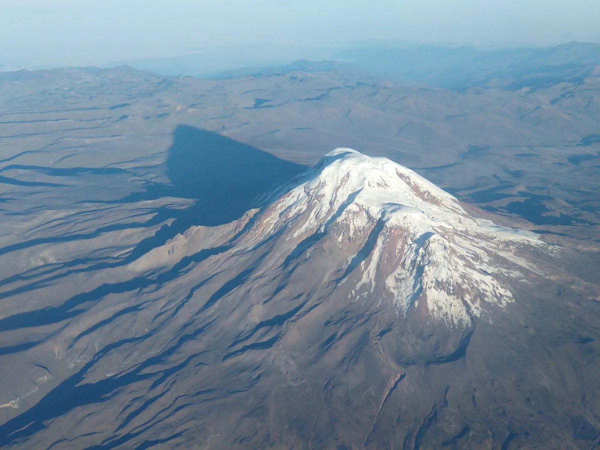
Nevado Chimborazo is a colossal 6,263-metre glaciated stratovolcano in the Cordillera Occidental of Ecuador. Because Earth is an oblate spheroid with an equatorial bulge, Chimborazo's summit is the furthest terrestrial point from the center of the Earth (6,384.4 km), making it the closest place on the planet's surface to the Sun. Renowned in exploration history, it was attempted by Alexander von Humboldt in 1802 and finally summited on January 4, 1880, by Edward Whymper alongside Val Tournanche alpine guides Louis Carrel and Jean-Antoine Carrel.
Featured Expedition Climber
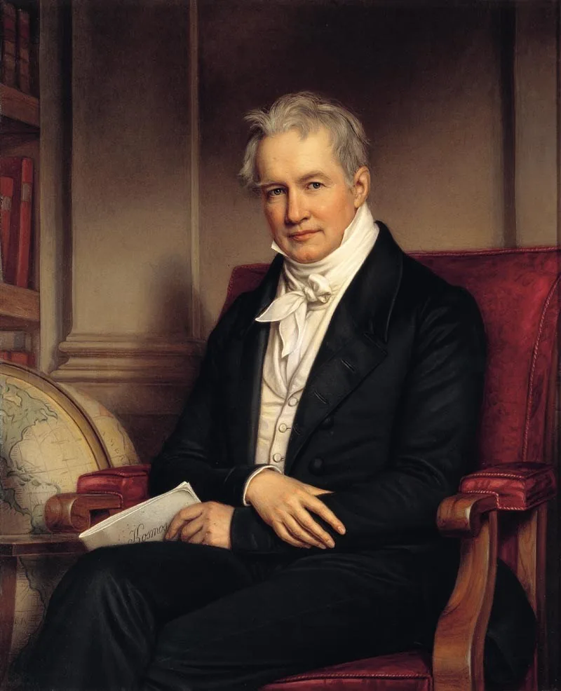
Alexander von Humboldt
Born on September 14, 1769, in Berlin, Prussia, Alexander von Humboldt grew into one of the most celebrated scientific minds in world history. Between 1799 and 1804, Humboldt undertook a monumental scientific expedition across the Americas accompanied by French botanist Aimé Bonpland and Ecuadorian nobleman Carlos Montúfar. Arriving in the Viceroyalty of New Granada (modern Ecuador) in 1802, Humboldt became mesmerized by the majestic volcanic massifs of the northern Andes, which he termed the 'Avenue of the Volcanoes'. On June 23, 1802, Humboldt, Bonpland, and Montúfar launched an audacious attempt to climb Chimborazo (6,263 m), which European geographers then believed to be the highest mountain on Earth. Equipped only with woollen coats, ordinary boots, and fragile mercury barometers, the party navigated sheer volcanic precipices, knife-edge rock ribs, and deep snowdrifts. Despite suffering from severe hypoxia, bleeding gums, freezing blizzards, and vertigo, they pressed on until halted by an impassable 400-foot chasm at an astonishing elevation of 5,878 metres (19,286 feet). Although they did not stand on the ultimate summit, Humboldt's achievement stood as the highest recorded altitude attained by humans in recorded history for more than three decades. More importantly, Humboldt used his observations to formulate his revolutionary concept of 'Naturgemälde' (painting of nature), showing how plant life, temperature, and atmospheric pressure vary systematically with altitude. This insight founded modern physical geography, climatology, and biogeography. Humboldt returned to Europe as an international icon, inspiring figures from Charles Darwin to Simón Bolívar, and lived in Berlin until his death on May 6, 1859.
Associated Historical Chronicles & Stories
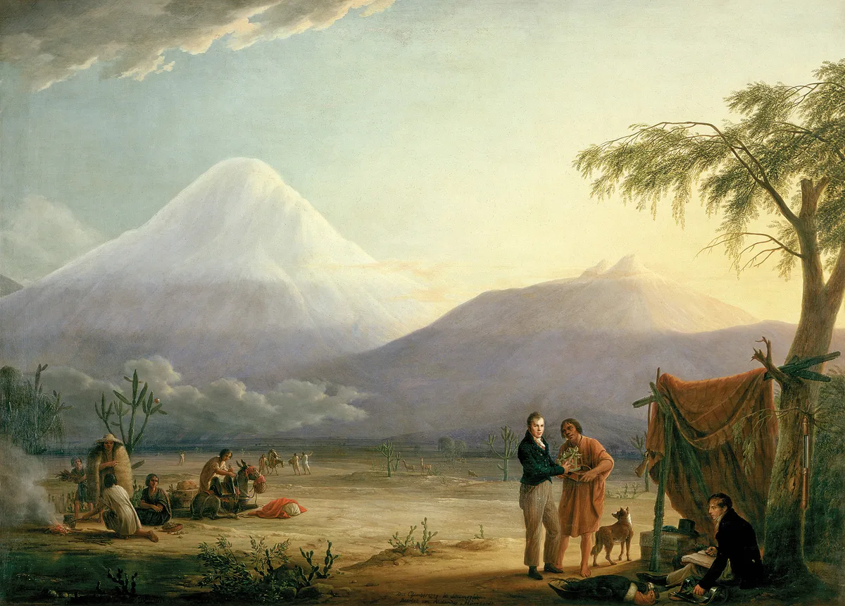
To the Edge of the Sky: Humboldt's 1802 Chimborazo Altitude Record
On June 23, 1802, Prussian polymath Alexander von Humboldt, botanist Aimé Bonpland, and Carlos Montúfar climbed to 5,878 metres on Chimborazo, setting a 30-year world altitude record and founding modern ecological science.
Documented Sources & Archival Citations
- Personal Narrative of Travels to the Equinoctial Regions of America(Alexander von Humboldt / Longman, Hurst, Rees, Orme & Brown)
Supporting claim: Firsthand expedition journal and barometric measurements of the 1802 Chimborazo attempt
Accessed/Documented: 1814 - The Invention of Nature: Alexander von Humboldt's New World(Andrea Wulf / Alfred A. Knopf)
Supporting claim: Historical analysis of Humboldt's world altitude record on Chimborazo and scientific findings
Accessed/Documented: 2015