1885 Wilhelm Sievers Sierra Nevada de Mérida Scientific Exploration
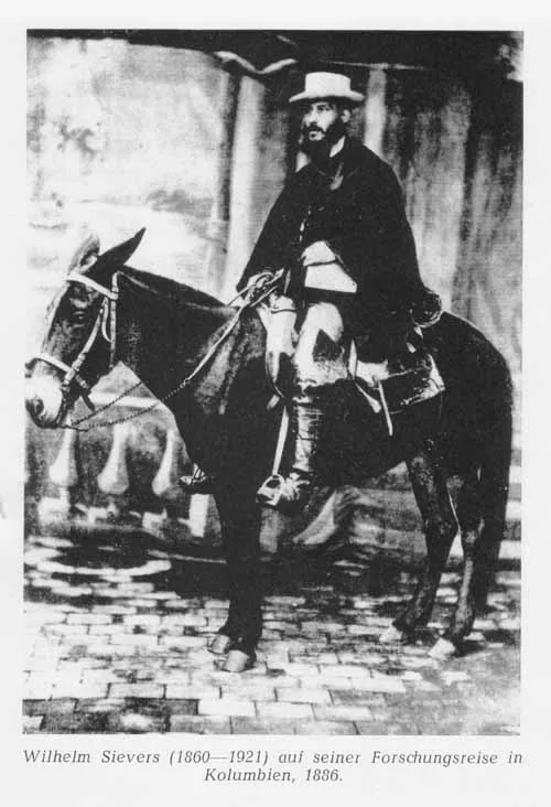
In early 1885, German geographer Wilhelm Sievers conducted the first scientific expedition into the high glaciated paramos of the Sierra Nevada de Mérida. Mapping high-altitude glacial cirques and calculating summit altitudes, Sievers laid the scientific foundation for Venezuelan Andean cartography.
Mountain Safety & Conditions Disclaimer: High-altitude climbing, glacial travel, and technical ascents entail severe objective risks including avalanches, serac collapses, rapid weather collapse, and altitude illness. Historical route descriptions and summit claims on Mountanity reflect documented archival sources and must not be used as live operational safety assessments. Local regulations, permits, and physical glacial topography change continuously.
Peer Review: Senior Editorial Board & Historical Reviewers • Editorial Standards
Official Expedition Narrative & Archival Record
In early 1885, German geomorphologist Wilhelm Sievers arrived in the Andean city of Mérida, dispatched by the Geographic Society of Hamburg to map the high cordillera of western Venezuela. Before Sievers' arrival, the glaciated spires of the Sierra Nevada were virtually unknown to global science, known only through indigenous folklore and vague colonial descriptions. Accompanied by local Andean muleteers, Sievers mounted an ambitious expedition into the high paramos. Ascending through cloud forests draped in bromeliads, the expedition established high camps above 4,000 metres near Laguna de Mucubají and the upper Chama river basin. Enduring freezing night winds and thick mountain fog, Sievers pushed his survey team across glaciated moraines and high cols below the jagged rock tooth then known as La Columna (now Pico Bolívar). Wielding mercurial barometers, boiling-point thermometers, and prismatic compasses, Sievers completed the first triangulated topographical map of the Venezuelan Andes. He documented the extensive glaciers mantling Pico Bolívar, Pico Humboldt, and Pico Bonpland, providing the first detailed measurements of tropical glaciation in northern South America. Published in Leipzig in 1888 as 'Die Cordillere von Mérida', Sievers' findings opened the Venezuelan Andes to the modern scientific and mountaineering world.
Documented Team Composition
- Wilhelm Sievers (Expedition Leader & Geographer, Germany)
- Local Venezuelan Field Guides and Muleteers (Venezuela)
Key Statistics & Topographic Figures
- Expedition Year
- 1885
- Expedition Leader
- Wilhelm Sievers (Geographer, Germany)
- Primary Focus
- Scientific Mapping & Glaciology
- Highest Massif Mapped
- Pico Bolívar / La Columna (4,978 m)
- Landmark Publication
- Die Cordillere von Mérida (1888)
Archival Primary Source Quotations
“To enter the high paramos of Mérida is to leave the tropics entirely behind and step into a primeval world of cold stone, whistling winds, and eternal ice.”
Defined Alpine Terminology & Concepts
- Frailejón
- A distinctive, woolly-leafed perennial giant plant of the genus Espeletia endemic to the high paramos of Venezuela and Colombia.
- Pleistocene Terminal Moraine
- A ridge of glacial debris and boulders deposited at the furthest extent of prehistoric ice sheet expansion.
Frequently Asked Questions: 1885 Wilhelm Sievers Sierra Nevada de Mérida Scientific Exploration
What did Wilhelm Sievers explore in Venezuela in 1885?
German geographer Wilhelm Sievers conducted the first scientific expedition into the glaciated paramos of the Sierra Nevada de Mérida, mapping the Pico Bolívar massif and surveying equatorial glaciers.
What major geographical book did Sievers publish on the Venezuelan Andes?
He published 'Die Cordillere von Mérida' in 1888, establishing the scientific foundation for Venezuelan Andean geology, glaciology, and cartography.
What evidence of past glaciation did Sievers discover in Mérida?
Sievers discovered moraines and U-shaped valleys proving that during the Pleistocene epoch, glaciers descended as low as 3,000 metres in the Venezuelan cordillera.
Which peak was known as La Columna during Sievers' 1885 expedition?
The peak then called La Columna is today known as Pico Bolívar, Venezuela's highest mountain at 4,978 metres.
Ascent Route & Topography
Pico Bolívar Normal Route (Weiss Route / La Garganta)
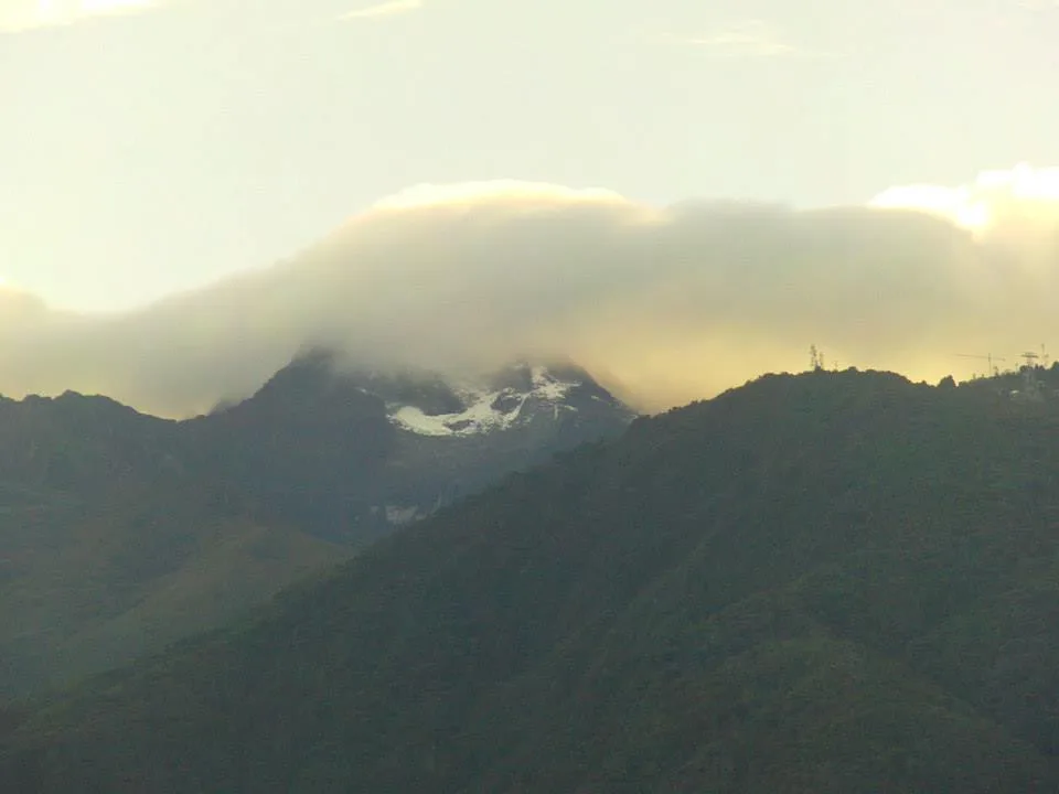
The historic Weiss Route ascends the southern flanks of Pico Bolívar through the high col of La Garganta ('The Throat') and the Timoncito couloir. The route combines high-altitude moraine hiking, 40°-45° firn gullies, and class 4 rock scrambling along exposed metamorphic ribs to reach the 4,978-metre summit bust of Simón Bolívar.
Target Objective Peak
Pico Bolívar
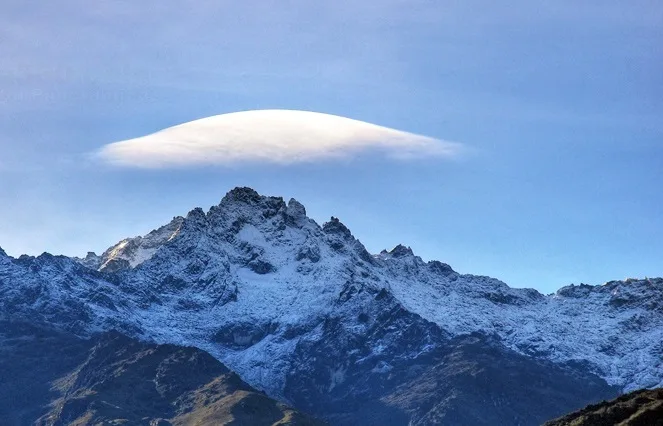
Pico Bolívar is the highest mountain in Venezuela, rising to 4,978 metres above the city of Mérida in the Venezuelan Andes. Historically crowned by northern equatorial glaciers, its jagged metamorphic horn stands as the geographical symbol of Venezuela's alpine heritage. First explored scientifically by German geographer Wilhelm Sievers in 1885, Pico Bolívar was first climbed on January 5, 1935, by Austrian alpinist Franz Josef Weiss alongside legendary Los Nevados guide Domingo Peña and Herlindo Molina.
Featured Expedition Climber
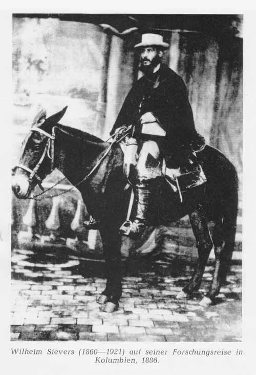
Wilhelm Sievers
Born on December 3, 1860, in Hamburg, Germany, Wilhelm Sievers studied geography and natural sciences at Jena, Göttingen, and Leipzig under renowned scholar Ferdinand von Richthofen. Specializing in high-mountain geomorphology, Sievers became fascinated by the northernmost extremities of the Andean cordillera, which had remained largely unmapped since the travels of Alexander von Humboldt. In 1884, sponsored by the Geographic Society of Hamburg, Sievers travelled to Venezuela. Over months of demanding fieldwork in 1885, he led the first systematic scientific exploration into the glaciated Sierra Nevada de Mérida. Sievers climbed into the high paramos, mapped the glacial cirques around the peak then known as La Columna (Pico Bolívar), and measured summit elevations with precision barometers. He followed this in 1886 with a comprehensive geological survey of the Sierra Nevada de Santa Marta in northern Colombia. Sievers authored seminal monographs including 'Die Cordillere von Mérida' (1888) and 'Zweite Reise in Venezuela' (1896), providing European science with its first detailed understanding of tropical glaciation and post-glacial moraines in South America. Appointed Professor of Geography at the University of Giessen in 1903, Sievers continued to publish global geographical treatises until his death on June 11, 1921.
Associated Historical Chronicles & Stories
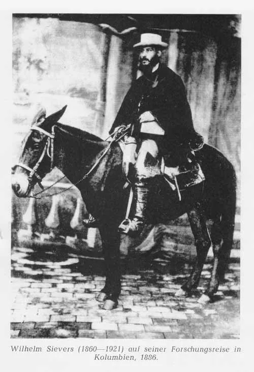
Into the Cloud Kingdom: Wilhelm Sievers in the Sierra Nevada de Mérida
In 1885, German geographer Wilhelm Sievers conducted the first scientific exploration of Venezuela's Sierra Nevada de Mérida, mapping glaciers and surveying the rocky towers of Pico Bolívar.
Documented Sources & Archival Citations
- Die Cordillere von Mérida nebst Bemerkungen über das Karibische Gebirge(Wilhelm Sievers / Geographische Abhandlungen)
Supporting claim: Firsthand scientific report and topographic map of the 1885 Mérida expedition
Accessed/Documented: 1888 - Zweite Reise in Venezuela(Wilhelm Sievers / Mittheilungen der Geographischen Gesellschaft in Hamburg)
Supporting claim: Extended geographical narrative of Venezuelan Andean exploratory expeditions
Accessed/Documented: 1896