Pico Bolívar
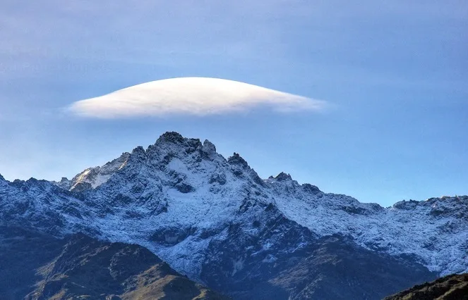
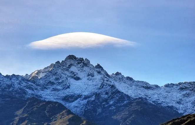
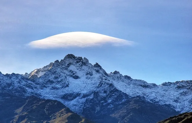
Pico Bolívar is the highest mountain in Venezuela, rising to 4,978 metres above the city of Mérida in the Venezuelan Andes. Historically crowned by northern equatorial glaciers, its jagged metamorphic horn stands as the geographical symbol of Venezuela's alpine heritage.
Mountain Safety & Conditions Disclaimer: High-altitude climbing, glacial travel, and technical ascents entail severe objective risks including avalanches, serac collapses, rapid weather collapse, and altitude illness. Historical route descriptions and summit claims on Mountanity reflect documented archival sources and must not be used as live operational safety assessments. Local regulations, permits, and physical glacial topography change continuously.
Peer Review: Senior Editorial Board & Historical Reviewers • Editorial Standards
Geographical Setting & Topography
Positioned in the central crest of the Sierra Nevada National Park in western Venezuela, Pico Bolívar towers nearly 3,500 metres above the Chama River valley. Connected by high jagged ridges to Pico Humboldt and Pico Bonpland, its steep metamorphic gneiss ramparts form the northernmost high-alpine bastion in South America.
Historic First Ascent
Date: 1935-01-05
Ascent Team: Franz Josef Weiss, Domingo Peña, and Herlindo Molina
Key Statistics & Topographic Figures
- Summit Elevation
- 4,978 m (16,332 ft)
- Topographic Prominence
- 3,957 m (Ultra-prominent peak)
- First Ascent Date
- January 5, 1935
- State / Location
- Mérida State, Venezuela
- Summit Monument
- Bronze bust of Simón Bolívar (installed 1951)
Archival Primary Source Quotations
“On Bolívar's summit, one stands upon the stony roof of Venezuela, bathed in the brilliant Andean light.”
Defined Alpine Terminology & Concepts
- Metamorphic Horn
- A sharply pointed mountain peak created by the headward erosion of multiple converging cirque glaciers around a hard gneiss core.
Pico Bolívar Mountain Weather Forecast
Detailed 14-Day Summit Window & Weather Timeline
Explore day-by-day summit push safety windows, wind shear analysis, and extended multi-day forecasts for Pico Bolívar.
Explore Pico Bolívar (4,978 m) in Interactive 3D
Inspect steep glacial walls, hanging seracs, ridge approaches, and elevation relief with 360° rotation and terrain tilt in WebGL.
Documented Climbing Routes (1)
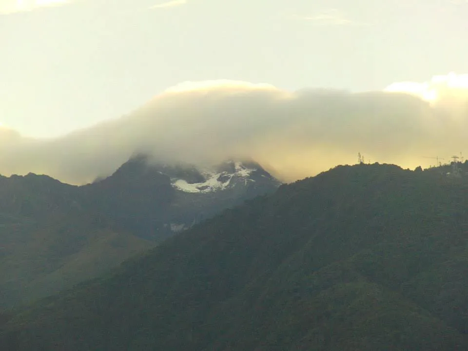
Pico Bolívar Normal Route (Weiss Route / La Garganta)
The historic Weiss Route ascends the southern flanks of Pico Bolívar through the high col of La Garganta ('The Throat') and the Timoncito couloir. The route combines high-altitude moraine hiking, 40°-45° firn gullies, and class 4 rock scrambling along exposed metamorphic ribs to reach the 4,978-metre summit bust of Simón Bolívar.
Historical Expeditions (2)
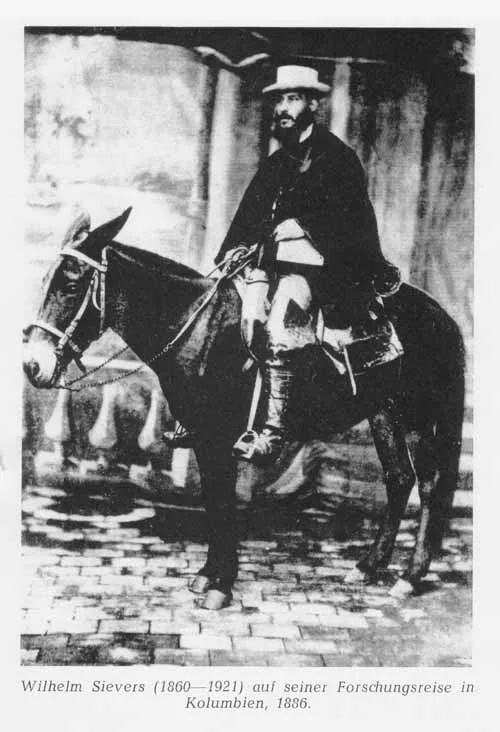
1885 Wilhelm Sievers Sierra Nevada de Mérida Scientific Exploration
In early 1885, German geographer Wilhelm Sievers conducted the first scientific expedition into the high glaciated paramos of the Sierra Nevada de Mérida. Mapping high-altitude glacial cirques and calculating summit altitudes, Sievers laid the scientific foundation for Venezuelan Andean cartography.
1935 Franz Josef Weiss and Domingo Peña Pico Bolívar Historic First Ascent Expedition
On January 5, 1935, Austrian mountaineer Franz Josef Weiss alongside Venezuelan guides Domingo Peña and Herlindo Molina achieved the historic first ascent of Pico Bolívar (4,978 m). Climbing through the steep couloir of La Garganta, they conquered Venezuela's highest alpine horn and deposited the first summit registry.
Summit Chronicles & Stories (2)
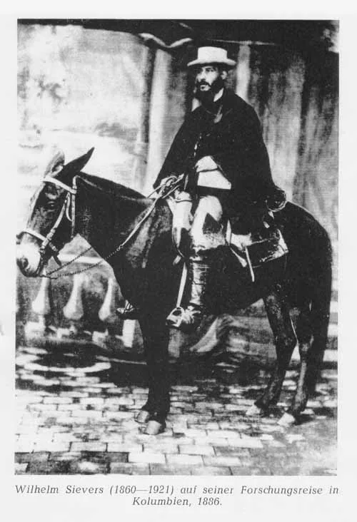
Into the Cloud Kingdom: Wilhelm Sievers in the Sierra Nevada de Mérida
In 1885, German geographer Wilhelm Sievers conducted the first scientific exploration of Venezuela's Sierra Nevada de Mérida, mapping glaciers and surveying the rocky towers of Pico Bolívar.
The Horn of the Liberator: Weiss and Peña Conquer Pico Bolívar in 1935
On January 5, 1935, Austrian climber Franz Josef Weiss and indigenous guide Domingo Peña conquered Pico Bolívar (4,978 m), completing the first ascent of Venezuela's highest mountain.
Frequently Asked Questions: Pico Bolívar
How high is Pico Bolívar in Venezuela?
Pico Bolívar stands at 4,978 metres (16,332 ft), the highest point in Venezuela.
Who first climbed Pico Bolívar?
Austrian engineer Franz Josef Weiss alongside Venezuelan guides Domingo Peña and Herlindo Molina summited on January 5, 1935.
What was Pico Bolívar called before 1925?
It was historically known as La Columna before being renamed in honour of the national liberator Simón Bolívar.
What is the difficulty of climbing Pico Bolívar?
The standard route through La Garganta is graded PD+/AD-, requiring steep 45° firn climbing and class 4 rock scrambling along exposed metamorphic gneiss.
Documented Sources & Archival Citations
- Die Cordillere von Mérida nebst Bemerkungen über das Karibische Gebirge(Wilhelm Sievers / Geographische Abhandlungen)
Supporting claim: First scientific geographical mapping and altitude measurements of the Mérida cordillera
Accessed/Documented: 1888 - La Conquista del Pico Bolívar(Franz Josef Weiss / Boletín del Centro Excursionista Caracas)
Supporting claim: Firsthand mountaineering account of the January 5, 1935 first ascent
Accessed/Documented: 1936