Pico Bolívar Normal Route (Weiss Route / La Garganta)
The historic Weiss Route ascends the southern flanks of Pico Bolívar through the high col of La Garganta ('The Throat') and the Timoncito couloir. The route combines high-altitude moraine hiking, 40°-45° firn gullies, and class 4 rock scrambling along exposed metamorphic ribs to reach the 4,978-metre summit bust of Simón Bolívar.
Ascent line, technical cruxes & camp topography profile for Pico Bolívar Normal Route (Weiss Route / La Garganta)
Mountain Safety & Conditions Disclaimer: High-altitude climbing, glacial travel, and technical ascents entail severe objective risks including avalanches, serac collapses, rapid weather collapse, and altitude illness. Historical route descriptions and summit claims on Mountanity reflect documented archival sources and must not be used as live operational safety assessments. Local regulations, permits, and physical glacial topography change continuously.
Peer Review: Senior Editorial Board & Historical Reviewers • Editorial Standards
Tactical & Camp Notes
Historically accessed from the Pico Espejo station of the Mérida Cable Car (4,150 m) or the mountain village of Los Nevados, climbers traverse around the base of Pico Espejo to reach the Laguna de Timoncito (4,600 m). The route enters the narrow couloir of La Garganta, climbing steep 40°–45° scree and firn. Reaching the ridge crest, climbers negotiate exposed class 3-4 rock slabs and chimneys along fractured gneiss buttresses. Fixed anchors and belays protect the final 50-metre rock wall leading directly to the summit platform at 4,978 metres, adorned with a famous bronze bust of Simón Bolívar.
Interactive Elevation Profile
Vertical profile, technical cruxes, and camp staging progression for Pico Bolívar Normal Route (Weiss Route / La Garganta) on Pico Bolívar.
High ridge staging point overlooking the dramatic glaciated cirques of Mérida.
Camp-by-Camp Topography
Key staging altitudes, technical cruxes, and terrain transitions for Pico Bolívar Normal Route (Weiss Route / La Garganta).
Pico Espejo Base
High ridge staging point overlooking the dramatic glaciated cirques of Mérida.
Laguna de Timoncito High Bivy
Glacial tarn perched directly beneath the sheer south face of Pico Bolívar.
Pico Bolívar Summit
The highest point in Venezuela, marked by a historic bronze bust of the Liberator.
Topographic Location & Terrain Map
Cartographic datum, massif coordinates, and terrain context for Pico Bolívar Normal Route (Weiss Route / La Garganta) on Pico Bolívar.
Interactive Topographic Terrain Map
Click below to load live cartographic contours, glacier approaches, and geographic markers for Pico Bolívar (8°32′28″ N, 71°02′52″ W).
Key Statistics & Topographic Figures
- Technical Grade
- PD+/AD- (Class 4 Rock Scramble, 45° Firn)
- Elevation Gain
- 828 m (from Pico Espejo base)
- Summit Altitude
- 4,978 m (16,332 ft)
- Rock Quality
- Precambrian Metamorphic Gneiss
Archival Primary Source Quotations
“To conquer La Garganta on Bolívar is to experience the true essence of classic Venezuelan alpinism.”
Defined Alpine Terminology & Concepts
- Gneiss Couloir
- A narrow, steep gully or gorge formed in banded metamorphic rock subject to severe freeze-thaw rockfall.
Frequently Asked Questions: Pico Bolívar Normal Route (Weiss Route / La Garganta)
What is the classic route on Pico Bolívar?
The Weiss Route through La Garganta (PD+/AD-), ascending the southern rock couloir and class 4 rock chimneys to the 4,978 m summit.
Where does the climb of Pico Bolívar begin?
From Pico Espejo (4,150 m) or the traditional paramo village of Los Nevados, staging at Laguna de Timoncito (4,600 m).
What technical gear is needed for Pico Bolívar?
A climbing helmet, rope, alpine harness, rock protection pitons/slings, and crampons during frosty or winter conditions.
Mountain Ascended
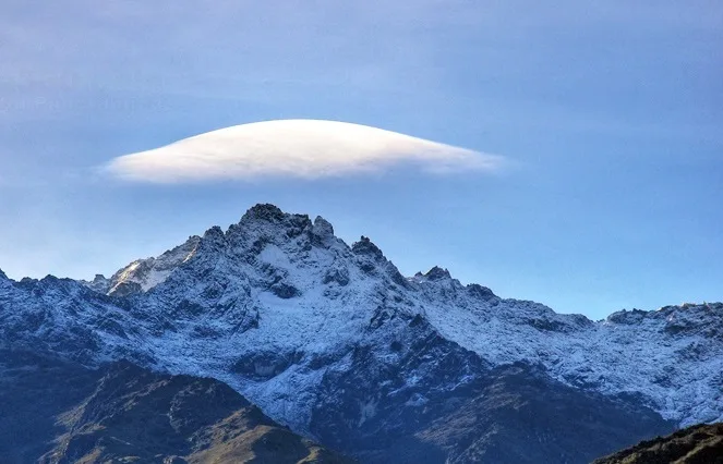
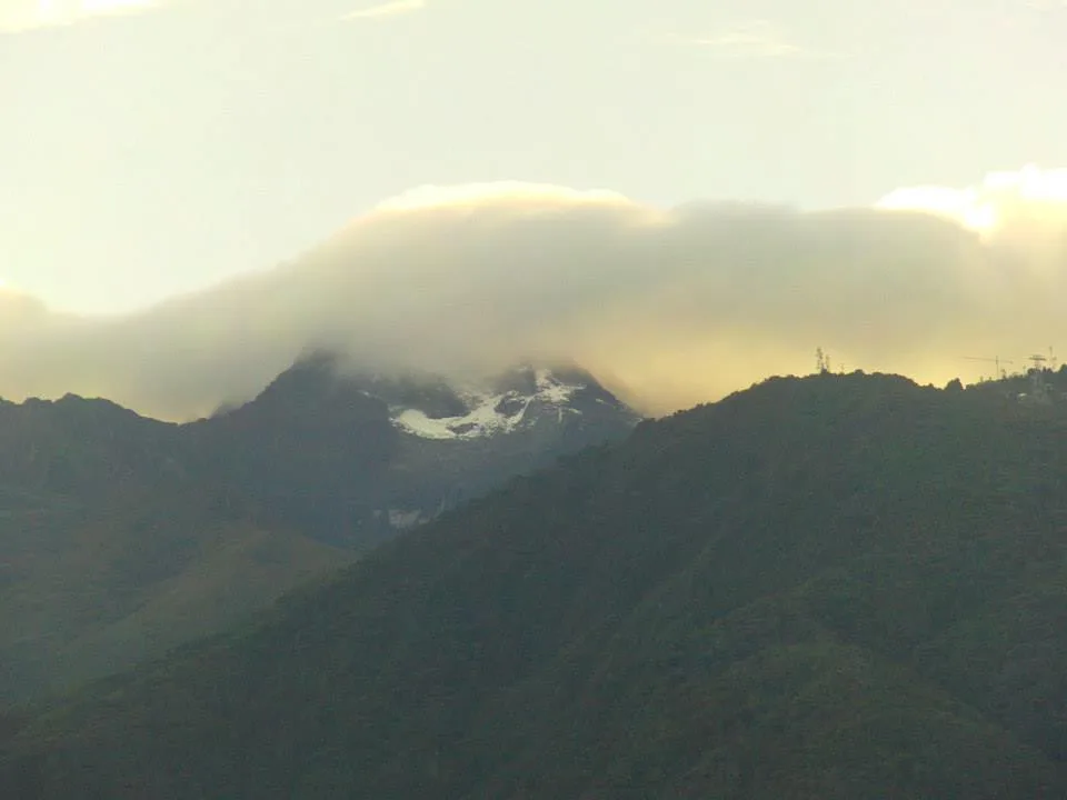
Pico Bolívar
Pico Bolívar is the highest mountain in Venezuela, rising to 4,978 metres above the city of Mérida in the Venezuelan Andes. Historically crowned by northern equatorial glaciers, its jagged metamorphic horn stands as the geographical symbol of Venezuela's alpine heritage. First explored scientifically by German geographer Wilhelm Sievers in 1885, Pico Bolívar was first climbed on January 5, 1935, by Austrian alpinist Franz Josef Weiss alongside legendary Los Nevados guide Domingo Peña and Herlindo Molina.
Documented Expeditions on this Route (2)
Verified historical summits, siege campaigns, and pioneer attempts recorded on Pico Bolívar Normal Route (Weiss Route / La Garganta).
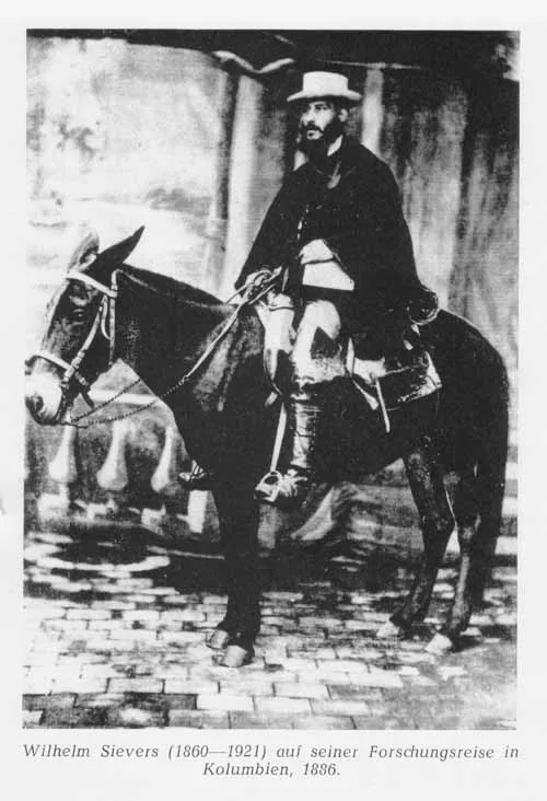
1885 Wilhelm Sievers Sierra Nevada de Mérida Scientific Exploration
In early 1885, German geographer Wilhelm Sievers conducted the first scientific expedition into the high glaciated paramos of the Sierra Nevada de Mérida. Mapping high-altitude glacial cirques and calculating summit altitudes, Sievers laid the scientific foundation for Venezuelan Andean cartography.
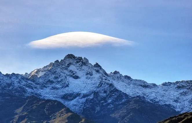
1935 Franz Josef Weiss and Domingo Peña Pico Bolívar Historic First Ascent Expedition
On January 5, 1935, Austrian mountaineer Franz Josef Weiss alongside Venezuelan guides Domingo Peña and Herlindo Molina achieved the historic first ascent of Pico Bolívar (4,978 m). Climbing through the steep couloir of La Garganta, they conquered Venezuela's highest alpine horn and deposited the first summit registry.
Archival Chronicles & Stories on this Route (2)
In-depth longform historical narratives, harrowing survival accounts, and firsthand alpine journals on Pico Bolívar Normal Route (Weiss Route / La Garganta).
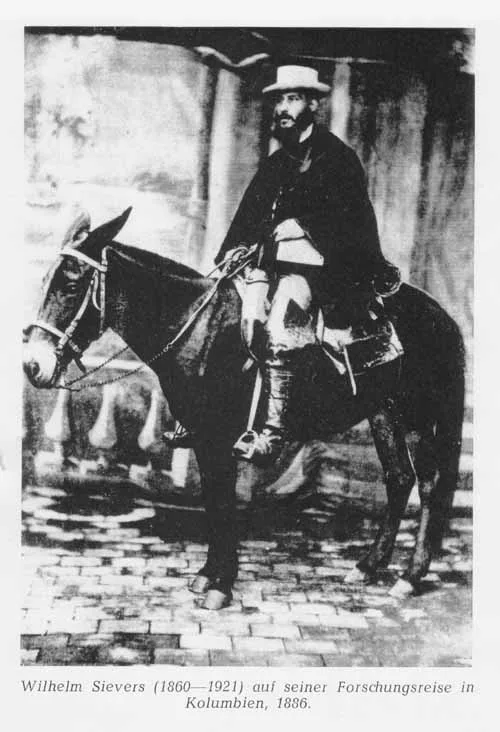
Into the Cloud Kingdom: Wilhelm Sievers in the Sierra Nevada de Mérida
In 1885, German geographer Wilhelm Sievers conducted the first scientific exploration of Venezuela's Sierra Nevada de Mérida, mapping glaciers and surveying the rocky towers of Pico Bolívar.
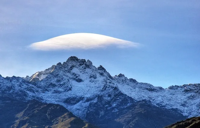
The Horn of the Liberator: Weiss and Peña Conquer Pico Bolívar in 1935
On January 5, 1935, Austrian climber Franz Josef Weiss and indigenous guide Domingo Peña conquered Pico Bolívar (4,978 m), completing the first ascent of Venezuela's highest mountain.
Documented Sources & Archival Citations
- La Conquista del Pico Bolívar(Franz Josef Weiss / Boletín del Centro Excursionista Caracas)
Supporting claim: Firsthand technical description of the 1935 pioneering route through La Garganta
Accessed/Documented: 1936 - Rutas de la Sierra Nevada de Mérida(Centro Excursionista Mérida)
Supporting claim: Comprehensive technical route specifications for Pico Bolívar
Accessed/Documented: 1998