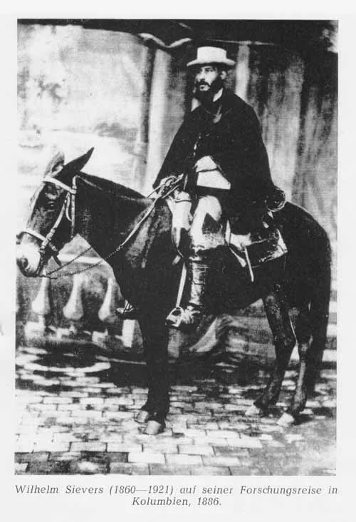
Wilhelm Sievers
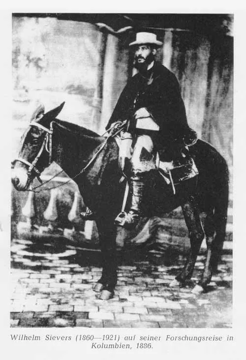
Wilhelm Sievers was an eminent German geographer, glaciologist, and Andean explorer who conducted the first scientific surveys of the Sierra Nevada de Mérida and Sierra Nevada de Santa Marta. In 1885, he led the pioneering expedition that mapped Venezuela's high cordillera and investigated tropical glaciation.
Mountain Safety & Conditions Disclaimer: High-altitude climbing, glacial travel, and technical ascents entail severe objective risks including avalanches, serac collapses, rapid weather collapse, and altitude illness. Historical route descriptions and summit claims on Mountanity reflect documented archival sources and must not be used as live operational safety assessments. Local regulations, permits, and physical glacial topography change continuously.
Peer Review: Senior Editorial Board & Historical Reviewers • Editorial Standards
Biographical Record & Archival Chronicle
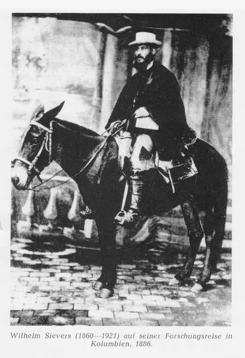
Born on December 3, 1860, in Hamburg, Germany, Wilhelm Sievers studied geography and natural sciences at Jena, Göttingen, and Leipzig under renowned scholar Ferdinand von Richthofen. Specializing in high-mountain geomorphology, Sievers became fascinated by the northernmost extremities of the Andean cordillera, which had remained largely unmapped since the travels of Alexander von Humboldt.
In 1884, sponsored by the Geographic Society of Hamburg, Sievers travelled to Venezuela. Over months of demanding fieldwork in 1885, he led the first systematic scientific exploration into the glaciated Sierra Nevada de Mérida. Sievers climbed into the high paramos, mapped the glacial cirques around the peak then known as La Columna (Pico Bolívar), and measured summit elevations with precision barometers. He followed this in 1886 with a comprehensive geological survey of the Sierra Nevada de Santa Marta in northern Colombia.
Sievers authored seminal monographs including 'Die Cordillere von Mérida' (1888) and 'Zweite Reise in Venezuela' (1896), providing European science with its first detailed understanding of tropical glaciation and post-glacial moraines in South America. Appointed Professor of Geography at the University of Giessen in 1903, Sievers continued to publish global geographical treatises until his death on June 11, 1921.
Notable Milestones & Ascents
- Conducted the first comprehensive scientific expedition into the Sierra Nevada de Mérida in 1885
- Mapped and measured the altitudes of Venezuela's highest peaks including the Pico Bolívar massif
- Carried out landmark geological and glaciological explorations of the Sierra Nevada de Santa Marta in 1886
- Published foundational geographical works including 'Die Cordillere von Mérida'
- Served as Professor of Geography at the University of Giessen (1903–1921)
Key Statistics & Topographic Figures
- Key Expedition
- Sierra Nevada de Mérida (1885)
- Lifespan
- 1860–1921 (Hamburg / Giessen, Germany)
- Academic Position
- Professor of Geography, University of Giessen
- Major Book
- Die Cordillere von Mérida (1888)
Archival Primary Source Quotations
“The cordilleras of South America reveal the immense kinetic history of our planet on a scale unmatched anywhere else on earth.”
Defined Alpine Terminology & Concepts
- Geomorphological Mapping
- The scientific recording of physical landforms, drainage patterns, and glacial deposits across a mountain range.
Frequently Asked Questions: Wilhelm Sievers
What were Wilhelm Sievers' key achievements in the Andes?
Sievers led the first scientific exploration of the Sierra Nevada de Mérida in 1885, mapped Pico Bolívar, and surveyed the Sierra Nevada de Santa Marta in 1886.
What did Sievers prove about prehistoric glaciation in Venezuela?
He proved that massive Pleistocene glaciers once descended down to 3,000 metres in the Venezuelan Andes, carving broad U-shaped valleys.
What academic post did Wilhelm Sievers hold?
He served as Professor of Geography at the University of Giessen from 1903 until his death in 1921.
Associated Summits (2)
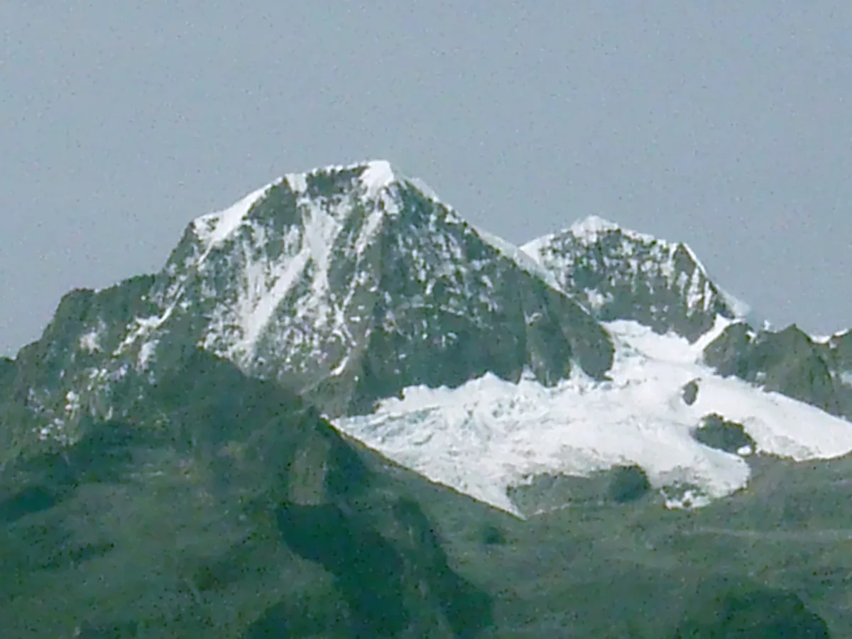
Pico Cristóbal Colón
Pico Cristóbal Colón is the highest mountain in Colombia and the fifth most topographically prominent peak on Earth, soaring to 5,730 metres in the isolated coastal massif of the Sierra Nevada de Santa Marta. Rising abruptly just 42 kilometres from the Caribbean Sea, this glaciated titan holds profound sacred significance for indigenous Kogui, Arhuaco, Wiwa, and Kankuamo peoples as the heart of the world. The peak was first climbed in 1939 by Walter Wood, Anderson Bakewell, and Colombian mountaineering pioneer Erwin Kraus.
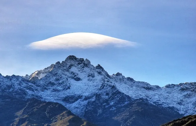
Pico Bolívar
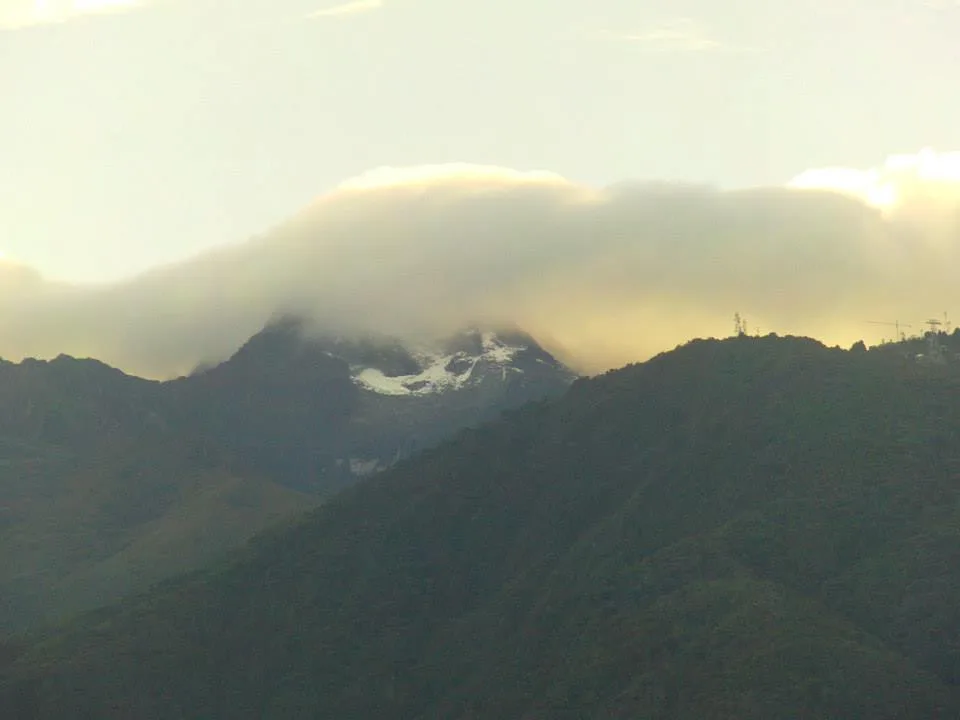
Pico Bolívar is the highest mountain in Venezuela, rising to 4,978 metres above the city of Mérida in the Venezuelan Andes. Historically crowned by northern equatorial glaciers, its jagged metamorphic horn stands as the geographical symbol of Venezuela's alpine heritage. First explored scientifically by German geographer Wilhelm Sievers in 1885, Pico Bolívar was first climbed on January 5, 1935, by Austrian alpinist Franz Josef Weiss alongside legendary Los Nevados guide Domingo Peña and Herlindo Molina.
Pioneered & Associated Routes (2)
Pico Cristóbal Colón Normal Route (North Glaciers & Arête)
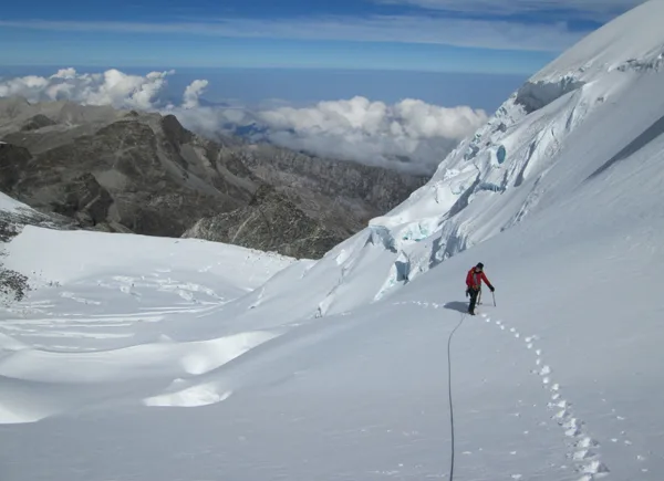
The classic ascent of Pico Cristóbal Colón navigates north-facing hanging glaciers and steep firn ramps before traversing an exposed granitic arête to the 5,730-metre summit. Requiring a multi-day jungle trek through indigenous ancestral territories, the route demands complete expedition self-sufficiency.
Pico Bolívar Normal Route (Weiss Route / La Garganta)
The historic Weiss Route ascends the southern flanks of Pico Bolívar through the high col of La Garganta ('The Throat') and the Timoncito couloir. The route combines high-altitude moraine hiking, 40°-45° firn gullies, and class 4 rock scrambling along exposed metamorphic ribs to reach the 4,978-metre summit bust of Simón Bolívar.
Documented Expeditions (1)
1885 Wilhelm Sievers Sierra Nevada de Mérida Scientific Exploration
In early 1885, German geographer Wilhelm Sievers conducted the first scientific expedition into the high glaciated paramos of the Sierra Nevada de Mérida. Mapping high-altitude glacial cirques and calculating summit altitudes, Sievers laid the scientific foundation for Venezuelan Andean cartography.
Associated Chronicles & Stories (1)
Into the Cloud Kingdom: Wilhelm Sievers in the Sierra Nevada de Mérida
In 1885, German geographer Wilhelm Sievers conducted the first scientific exploration of Venezuela's Sierra Nevada de Mérida, mapping glaciers and surveying the rocky towers of Pico Bolívar.
Documented Sources & Archival Citations
- Die Cordillere von Mérida nebst Bemerkungen über das Karibische Gebirge(Wilhelm Sievers / Geographische Abhandlungen)
Supporting claim: First scientific geographical mapping and altitude measurements of the Mérida cordillera
Accessed/Documented: 1888 - Reise in der Sierra Nevada de Santa Marta(Wilhelm Sievers / Zeitschrift der Gesellschaft für Erdkunde zu Berlin)
Supporting claim: Pioneering geological exploration of the Sierra Nevada de Santa Marta in Colombia
Accessed/Documented: 1887