1902 Gottfried Merzbacher Central Tien Shan Scientific Expedition
Between 1902 and 1903, German explorer Gottfried Merzbacher mounted a landmark scientific expedition into the Central Tien Shan, mapping the colossal Inylchek Glacier, discovering the famous ice-dammed Lake Merzbacher, and establishing the true geographical coordinates and alpine morphology of Khan Tengri (7,010 m).

Mountain Safety & Conditions Disclaimer: High-altitude climbing, glacial travel, and technical ascents entail severe objective risks including avalanches, serac collapses, rapid weather collapse, and altitude illness. Historical route descriptions and summit claims on Mountanity reflect documented archival sources and must not be used as live operational safety assessments. Local regulations, permits, and physical glacial topography change continuously.
Peer Review: Senior Editorial Board & Historical Reviewers • Editorial Standards
Official Expedition Narrative & Archival Record
In May 1902, Bavarian geographer and alpine pioneer Gottfried Merzbacher set out from Tashkent with an ambitious scientific caravan sponsored by the Imperial Russian Geographical Society. His objective was to unlock the mysterious core of the Central Tien Shan and reconnoiter an approach to Khan Tengri, which European geographers believed might be the highest mountain in northern Asia. Navigating through the upper Saryjaz valley and penetrating the unexplored Inylchek Glacier—a gargantuan river of ice stretching over 60 kilometres—Merzbacher encountered an astonishing geographical phenomenon. Trapped between the North and South Inylchek glaciers lay an immense alpine lake filled with thousands of floating icebergs. While camping along its shores, Merzbacher witnessed the lake suddenly drain beneath the ice in a cataclysmic glacial outburst flood (jökulhlaup), a discovery that made world headlines and permanently affixed the name Lake Merzbacher to modern maps. Pushing further up the southern glacier, Merzbacher reached the foot of Khan Tengri's sheer marble pyramid. Although his party was forced back by technical obstacles and severe weather at approximately 5,500 metres, Merzbacher produced the first accurate topographical maps and photographs of the range, laying the foundation for all subsequent twentieth-century ascents.
Documented Team Composition
- Gottfried Merzbacher (Expedition Leader & Geographer, Germany)
- Paul Keidel (Geologist, Germany)
- Hans Pfann (Alpinist & Surveyor, Germany)
- Franz Kostner (Tyrolean Alpine Guide, Austria)
- Local Kyrgyz and Kazakh Horsemen (Central Asia)
Key Statistics & Topographic Figures
- Expedition Span
- 1902–1903
- Glacier Explored
- Inylchek Glacier (approx. 60 km length)
- Lake Discovered
- Lake Merzbacher (3,300 m elevation)
- Expedition Leader
- Gottfried Merzbacher
- Mountain Range
- Central Tien Shan
Archival Primary Source Quotations
“The Tien Shan is not a realm for hasty conquests, but a labyrinth of ice and marble that yields its secrets only to unrelenting scientific patience.”
Defined Alpine Terminology & Concepts
- Lake Merzbacher
- A famous moraine-dammed and ice-dammed lake between the North and South Inylchek glaciers that empties abruptly every summer through subglacial channels.
- Inylchek Glacier
- One of the longest non-polar alpine valley glaciers on Earth, draining the high marble massifs of Khan Tengri and Peak Pobeda.
Frequently Asked Questions: 1902 Gottfried Merzbacher Central Tien Shan Scientific Expedition
What did Gottfried Merzbacher discover in the Central Tien Shan in 1902–1903?
Gottfried Merzbacher mapped the colossal Inylchek Glacier system and discovered Lake Merzbacher, a world-famous glacial lake that periodically discharges catastrophically via glacial lake outburst floods (GLOFs).
Why was Gottfried Merzbacher unable to summit Khan Tengri in 1902?
Merzbacher was exploring unmapped glaciated terrain without modern equipment, deciphering complex approaches across the 60-kilometer-long Inylchek Glacier rather than attempting a technical summit push.
What scientific contribution did Gottfried Merzbacher make to Central Asian geography?
Merzbacher published groundbreaking topographic surveys, geological profiles, and photographic records of the inner Tien Shan, establishing the true geography of the Khan Tengri massif.
Ascent Route & Topography
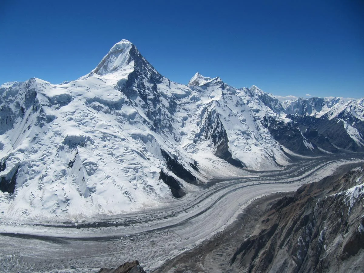
Khan Tengri West Ridge & Pogrebetsky Route
The West Ridge Pogrebetsky Route is the premier classic route on Khan Tengri (7,010 m), leading from the South Inylchek Glacier up the Semenovskiy Glacier to the West Col (Chakan-Tau, 5,900 m) and ascending the exposed western marble ridge. First climbed on September 11, 1931, by Mikhail Pogrebetsky, Boris Tyurin, and Franz-Josef Zauberer, the route involves sustained climbing on steep snow couloirs and technical marble rock bands above 6,700 metres. The route requires fixed-rope jumaring, rigorous acclimatization, and exceptional endurance against high-altitude hypothermia.
Target Objective Peak
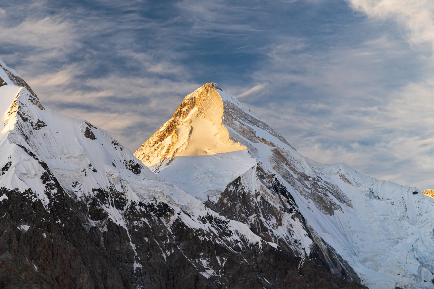



Khan Tengri / Lord of the Spirits
Khan Tengri is a breathtakingly symmetrical, marble-stratified pyramid rising to 7,010 metres (22,999 ft, including summit ice cap) in the Tengri-Tag range of the Central Tien Shan, straddling the borders of Kyrgyzstan, Kazakhstan, and China. Revered in ancient Tengrism as the sacred 'Lord of the Spirits' and famous for its fiery pink glow at sunset, the peak is one of the premier challenges of high-altitude mountaineering. First conquered on September 11, 1931, by a Ukrainian expedition led by Mikhail Pogrebetsky via the West Ridge, it was the scene of an epic survival climb in 1936 by the Abalakov brothers.
Featured Expedition Climber
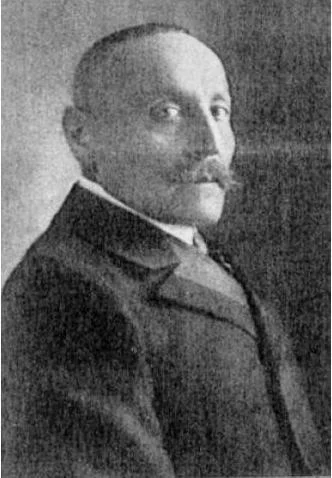
Gottfried Merzbacher
Gottfried Merzbacher was born on December 9, 1843, in Baiersdorf, Kingdom of Bavaria. Initially trained as a fur merchant, Merzbacher became passionate about mountaineering in the Bavarian and Tyrolean Alps before dedicating his independent wealth to geographical and glaciological exploration. In 1891 and 1892, Merzbacher mounted an ambitious expedition to the Caucasus, traversing remote passes and making pioneering ascents of Mount Kazbek (5,054 m) and Mount Elbrus (5,642 m), resulting in his monumental two-volume study Aus den Hochregionen des Kaukasus. Turning his focus eastward to the uncharted cordilleras of Central Asia, Merzbacher led the historic 1902–1903 expedition into the Central Tien Shan. His objective was the marble pyramid of Khan Tengri. Penetrating the vast Inylchek Glacier, Merzbacher discovered the enigmatic lake that now bears his name—Lake Merzbacher—a phenomenon of nature that fills each spring with glacial meltwater before cataclysmically draining beneath the ice sheet in a roaring outburst flood. He returned in 1907–1908 to map the northern tributaries of the Khan Tengri massif. Merzbacher received an honorary doctorate from the University of Munich and was awarded the Founder's Medal of the Royal Geographical Society. He passed away on April 14, 1926, remembered as the father of modern Tien Shan glaciology.
Associated Historical Chronicles & Stories

The Secret of the Vanishing Lake: Gottfried Merzbacher's 1902 Tien Shan Odyssey
German explorer Gottfried Merzbacher penetrates the colossal Inylchek Glacier in 1902, discovering Lake Merzbacher beneath the marble pyramid of Khan Tengri.
Documented Sources & Archival Citations
- The Central Tian-Shan Mountains: 1902–1903(John Murray, London / Gottfried Merzbacher)
Supporting claim: Primary official expedition report and cartographic narrative
Accessed/Documented: 1905