Khan Tengri West Ridge & Pogrebetsky Route
The West Ridge Pogrebetsky Route is the premier classic route on Khan Tengri (7,010 m), leading from the South Inylchek Glacier up the Semenovskiy Glacier to the West Col (Chakan-Tau, 5,900 m) and ascending the exposed western marble ridge. First climbed on September 11, 1931, by Mikhail Pogrebetsky, Boris Tyurin, and Franz-Josef Zauberer, the route involves sustained climbing on steep snow couloirs and technical marble rock bands above 6,700 metres.
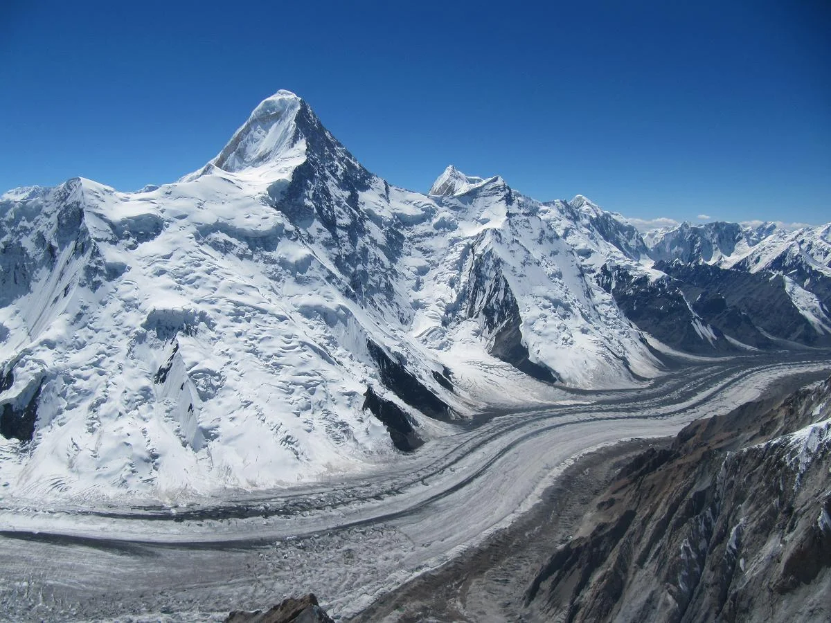
Ascent line, technical cruxes & camp topography profile for Khan Tengri West Ridge & Pogrebetsky Route
Mountain Safety & Conditions Disclaimer: High-altitude climbing, glacial travel, and technical ascents entail severe objective risks including avalanches, serac collapses, rapid weather collapse, and altitude illness. Historical route descriptions and summit claims on Mountanity reflect documented archival sources and must not be used as live operational safety assessments. Local regulations, permits, and physical glacial topography change continuously.
Peer Review: Senior Editorial Board & Historical Reviewers • Editorial Standards
Tactical & Camp Notes
Access is typically via helicopter transfer from Karkara base camp in Kazakhstan to South Inylchek Glacier Base Camp (4,000 m).
Identified Objective Hazards
- •Deadly ice avalanches sweeping the narrow 'bottleneck' couloir between Camp 1 and Camp 2 from Peak Chapaev
- •High-altitude cerebral or pulmonary edema (HACE/HAPE) above 6,000 metres
- •Severe windchill dropping temperatures below -30°C on the exposed marble ridge
- •Verglas ice covering smooth marble slabs on the final summit push
Interactive Elevation Profile
Vertical profile, technical cruxes, and camp staging progression for Khan Tengri West Ridge & Pogrebetsky Route on Khan Tengri / Lord of the Spirits.
Major expedition hub on the lateral moraine of South Inylchek Glacier with helipad and mess tents.
Camp-by-Camp Topography
Key staging altitudes, technical cruxes, and terrain transitions for Khan Tengri West Ridge & Pogrebetsky Route.
South Inylchek Base Camp
Major expedition hub on the lateral moraine of South Inylchek Glacier with helipad and mess tents.
Camp 1 (Semenovskiy Glacier)
Intermediate snow camp situated below the entrance to the Semenovskiy icefall.
Camp 2 (Semenovskiy Névé)
Glacier campsite tucked into the high ice basin beneath the towering west face of Khan Tengri.
Camp 3 (West Col / Chakan-Tau)
High mountain col camp pitched in snow caves or wind-battered tents on the ridge connecting Khan Tengri and Peak Chapaev.
Khan Tengri Summit
The razor-sharp marble pyramid summit crowned by a stainless-steel capsule and geodesic survey marker.
Topographic Location & Terrain Map
Cartographic datum, massif coordinates, and terrain context for Khan Tengri West Ridge & Pogrebetsky Route on Khan Tengri / Lord of the Spirits.
Interactive Topographic Terrain Map
Click below to load live cartographic contours, glacier approaches, and geographic markers for Khan Tengri / Lord of the Spirits (42°12′39″ N, 80°10′27″ E).
Key Statistics & Topographic Figures
- Route Type
- High-Altitude Marble Arête & Chakan-Tau Col Route
Topography
- Technical Difficulty
- Extremely Strenuous / Russian Grade 5A / Alpine Grade IV
Russian Grade 5A / Alpine Grade IV, fixed ropes on 45-50° ice and marble slabs above 6,700m
- Country / Region
- Kyrgyzstan / Kazakhstan (Tengri-Tag Range, Central Tien Shan)
Location
Archival Primary Source Quotations
“A mountain route is not merely a path of rock and ice; it is a test of human endurance, judgment, and humility.”
Defined Alpine Terminology & Concepts
- Crux
- The most difficult and technically demanding pitch or section of a climbing route.
- Normal Route (Voie Normale)
- The most frequently climbed, least technical, and historically standard path to a mountain summit.
Frequently Asked Questions: Khan Tengri West Ridge & Pogrebetsky Route
What is the climbing difficulty and grade of Khan Tengri West Ridge & Pogrebetsky Route?
Khan Tengri West Ridge & Pogrebetsky Route on khan-tengri is graded as Extremely Strenuous / Russian Grade 5A / Alpine Grade IV, with technical climbing requirements including Russian Grade 5A / Alpine Grade IV, fixed ropes on 45-50° ice and marble slabs above 6,700m.
What are the primary hazards on the Khan Tengri West Ridge & Pogrebetsky Route?
Climbers on Khan Tengri West Ridge & Pogrebetsky Route must navigate severe objective hazards including Deadly ice avalanches sweeping the narrow 'bottleneck' couloir between Camp 1 and Camp 2 from Peak Chapaev, High-altitude cerebral or pulmonary edema (HACE/HAPE) above 6,000 metres, Severe windchill dropping temperatures below -30°C on the exposed marble ridge, Verglas ice covering smooth marble slabs on the final summit push.
What camps are established on Khan Tengri West Ridge & Pogrebetsky Route?
Khan Tengri West Ridge & Pogrebetsky Route typically features 5 staging camps, progressing from South Inylchek Base Camp (4000m) up toward the summit.
Mountain Ascended
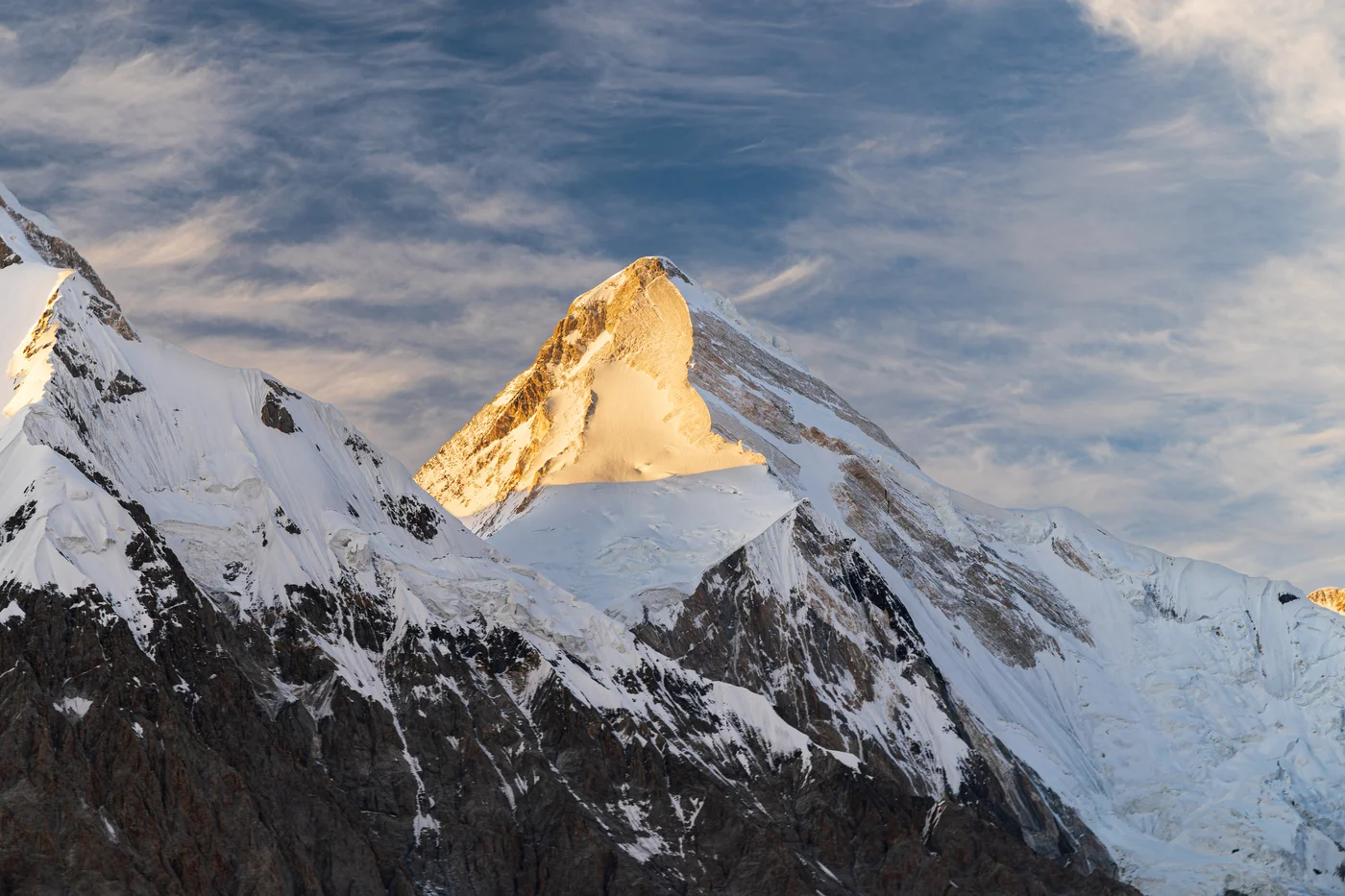


Khan Tengri / Lord of the Spirits
Khan Tengri is a breathtakingly symmetrical, marble-stratified pyramid rising to 7,010 metres (22,999 ft, including summit ice cap) in the Tengri-Tag range of the Central Tien Shan, straddling the borders of Kyrgyzstan, Kazakhstan, and China. Revered in ancient Tengrism as the sacred 'Lord of the Spirits' and famous for its fiery pink glow at sunset, the peak is one of the premier challenges of high-altitude mountaineering. First conquered on September 11, 1931, by a Ukrainian expedition led by Mikhail Pogrebetsky via the West Ridge, it was the scene of an epic survival climb in 1936 by the Abalakov brothers.
Documented Expeditions on this Route (3)
Verified historical summits, siege campaigns, and pioneer attempts recorded on Khan Tengri West Ridge & Pogrebetsky Route.

1902 Gottfried Merzbacher Central Tien Shan Scientific Expedition
Between 1902 and 1903, German explorer Gottfried Merzbacher mounted a landmark scientific expedition into the Central Tien Shan, mapping the colossal Inylchek Glacier, discovering the famous ice-dammed Lake Merzbacher, and establishing the true geographical coordinates and alpine morphology of Khan Tengri (7,010 m).
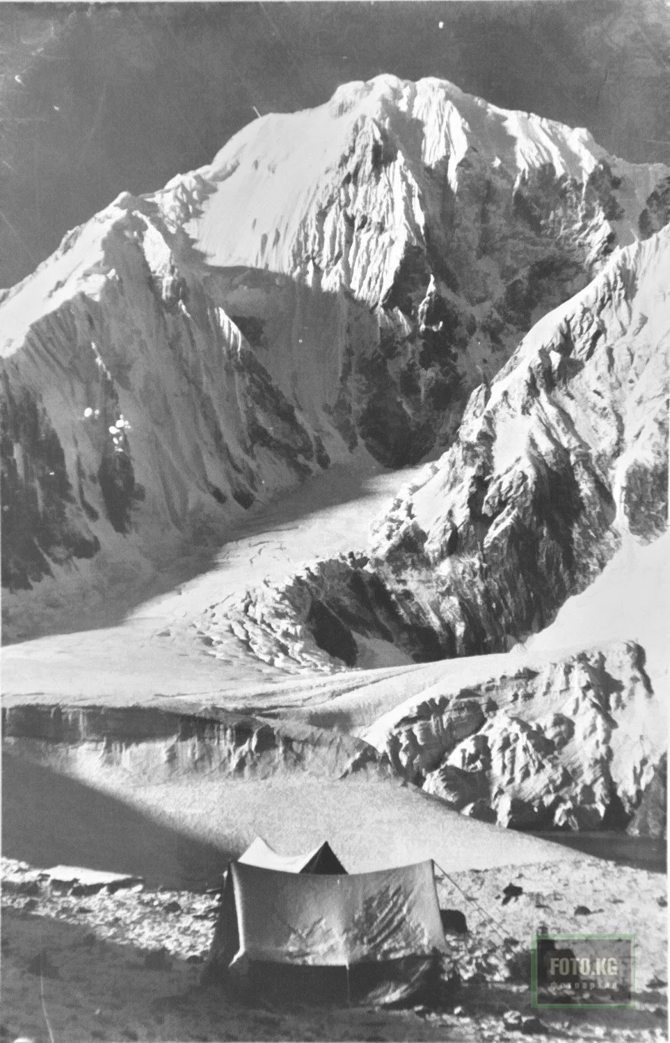
1931 Mikhail Pogrebetsky Ukrainian Expedition Historic First Ascent of Khan Tengri
On September 11, 1931, an intrepid Ukrainian expedition led by Mikhail Pogrebetsky alongside Boris Tyurin and Franz-Josef Zauberer achieved the historic maiden first ascent of Khan Tengri (7,010 m), conquering the dreaded marble pyramid via the West Ridge from the Inylchek Glacier.
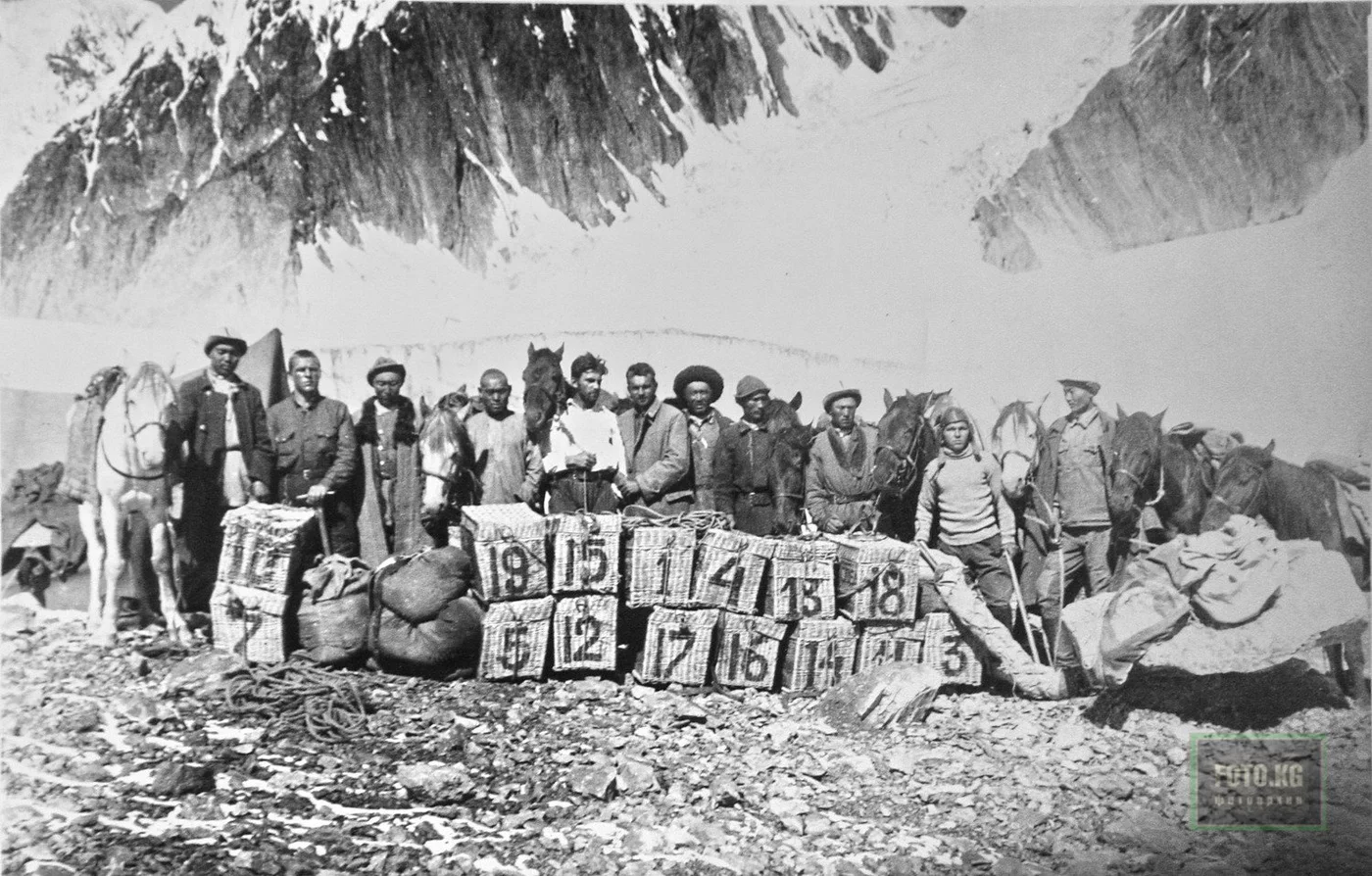
1936 Vitaly & Evgeny Abalakov Historic Khan Tengri Ascent & Survival Epic
In August 1936, legendary Siberian brothers Vitaly and Evgeny Abalakov led an assault up Khan Tengri (7,010 m), successfully summiting before battling through catastrophic sub-zero blizzards on a harrowing descent that became an epic of alpine courage.
Archival Chronicles & Stories on this Route (3)
In-depth longform historical narratives, harrowing survival accounts, and firsthand alpine journals on Khan Tengri West Ridge & Pogrebetsky Route.

The Secret of the Vanishing Lake: Gottfried Merzbacher's 1902 Tien Shan Odyssey
German explorer Gottfried Merzbacher penetrates the colossal Inylchek Glacier in 1902, discovering Lake Merzbacher beneath the marble pyramid of Khan Tengri.
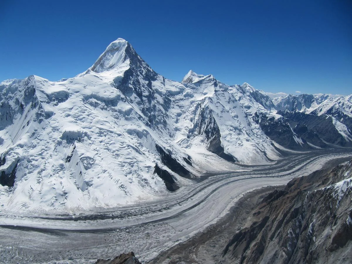
Conquering the Lord of Spirits: Mikhail Pogrebetsky's 1931 Khan Tengri Conquest
Ukrainian explorer Mikhail Pogrebetsky leads a three-year siege against the Central Tien Shan, achieving the historic 1931 maiden ascent of Khan Tengri (7,010 m).
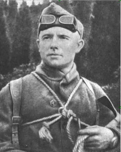
Brothers of Iron: Vitaly & Evgeny Abalakov's 1936 Khan Tengri Ordeal
Siberian brothers Vitaly and Evgeny Abalakov conquer Khan Tengri in 1936 and endure a legendary high-altitude blizzard survival epic on the Inylchek Glacier.
Documented Sources & Archival Citations
- Tian Shan High Altitude Route Directory(Kyrgyz Alpine Club)
Supporting claim: Technical specifications and safety advisories for Khan Tengri normal route
Accessed/Documented: 2026