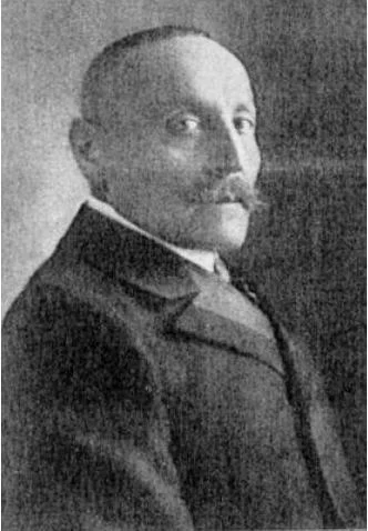
Gottfried Merzbacher
Gottfried Merzbacher was a pioneering German mountaineer, geographer, and explorer who led landmark scientific expeditions to the Caucasus and the Central Tien Shan between 1891 and 1908. His cartographic surveys of the Inylchek Glacier and discovery of the mysterious ice-dammed Lake Merzbacher opened the high Tien Shan to modern alpine exploration.
Mountain Safety & Conditions Disclaimer: High-altitude climbing, glacial travel, and technical ascents entail severe objective risks including avalanches, serac collapses, rapid weather collapse, and altitude illness. Historical route descriptions and summit claims on Mountanity reflect documented archival sources and must not be used as live operational safety assessments. Local regulations, permits, and physical glacial topography change continuously.
Peer Review: Senior Editorial Board & Historical Reviewers • Editorial Standards
Biographical Record & Archival Chronicle
Gottfried Merzbacher was born on December 9, 1843, in Baiersdorf, Kingdom of Bavaria. Initially trained as a fur merchant, Merzbacher became passionate about mountaineering in the Bavarian and Tyrolean Alps before dedicating his independent wealth to geographical and glaciological exploration.
In 1891 and 1892, Merzbacher mounted an ambitious expedition to the Caucasus, traversing remote passes and making pioneering ascents of Mount Kazbek (5,054 m) and Mount Elbrus (5,642 m), resulting in his monumental two-volume study Aus den Hochregionen des Kaukasus. Turning his focus eastward to the uncharted cordilleras of Central Asia, Merzbacher led the historic 1902–1903 expedition into the Central Tien Shan. His objective was the marble pyramid of Khan Tengri.
Penetrating the vast Inylchek Glacier, Merzbacher discovered the enigmatic lake that now bears his name—Lake Merzbacher—a phenomenon of nature that fills each spring with glacial meltwater before cataclysmically draining beneath the ice sheet in a roaring outburst flood. He returned in 1907–1908 to map the northern tributaries of the Khan Tengri massif. Merzbacher received an honorary doctorate from the University of Munich and was awarded the Founder's Medal of the Royal Geographical Society. He passed away on April 14, 1926, remembered as the father of modern Tien Shan glaciology.
Notable Milestones & Ascents
- Led landmark scientific expeditions to the Central Tien Shan in 1902–1903 and 1907–1908
- Discovered and mapped Lake Merzbacher, the famous glacier-dammed lake on the Inylchek Glacier
- Authored The Central Tian-Shan Mountains (1905) and Aus den Hochregionen des Kaukasus (1901)
- Conducted early sporting ascents in the Caucasus including Mount Kazbek (5,054 m) and Mount Elbrus
- Awarded the Founder's Gold Medal by the Royal Geographical Society (RGS) in 1907
Key Statistics & Topographic Figures
- Lifespan
- 1843 – 1926
- Nationality
- German
- Tien Shan Expeditions
- 1902–1903 and 1907–1908
- Geographical Discovery
- Lake Merzbacher and Inylchek Glacier mapping
Archival Primary Source Quotations
“Khan Tengri stood revealed before our gaze: a colossal marble crystal reigning over rivers of ice.”
Defined Alpine Terminology & Concepts
- GLOF
- Glacial Lake Outburst Flood; the periodic sudden draining of Lake Merzbacher through englacial tunnels into the Inylchek River.
Frequently Asked Questions: Gottfried Merzbacher
Who was Gottfried Merzbacher and what region did he explore?
Gottfried Merzbacher was a German explorer and mountaineer who conducted pioneering expeditions in the Caucasus and Central Tien Shan between 1891 and 1908.
What is Lake Merzbacher in the Tien Shan?
Lake Merzbacher is an ephemeral glacial lake dammed by the Inylchek Glacier that empties explosively every summer, discovered and described by Merzbacher in 1902.
Associated Summits (3)


Khan Tengri / Lord of the Spirits
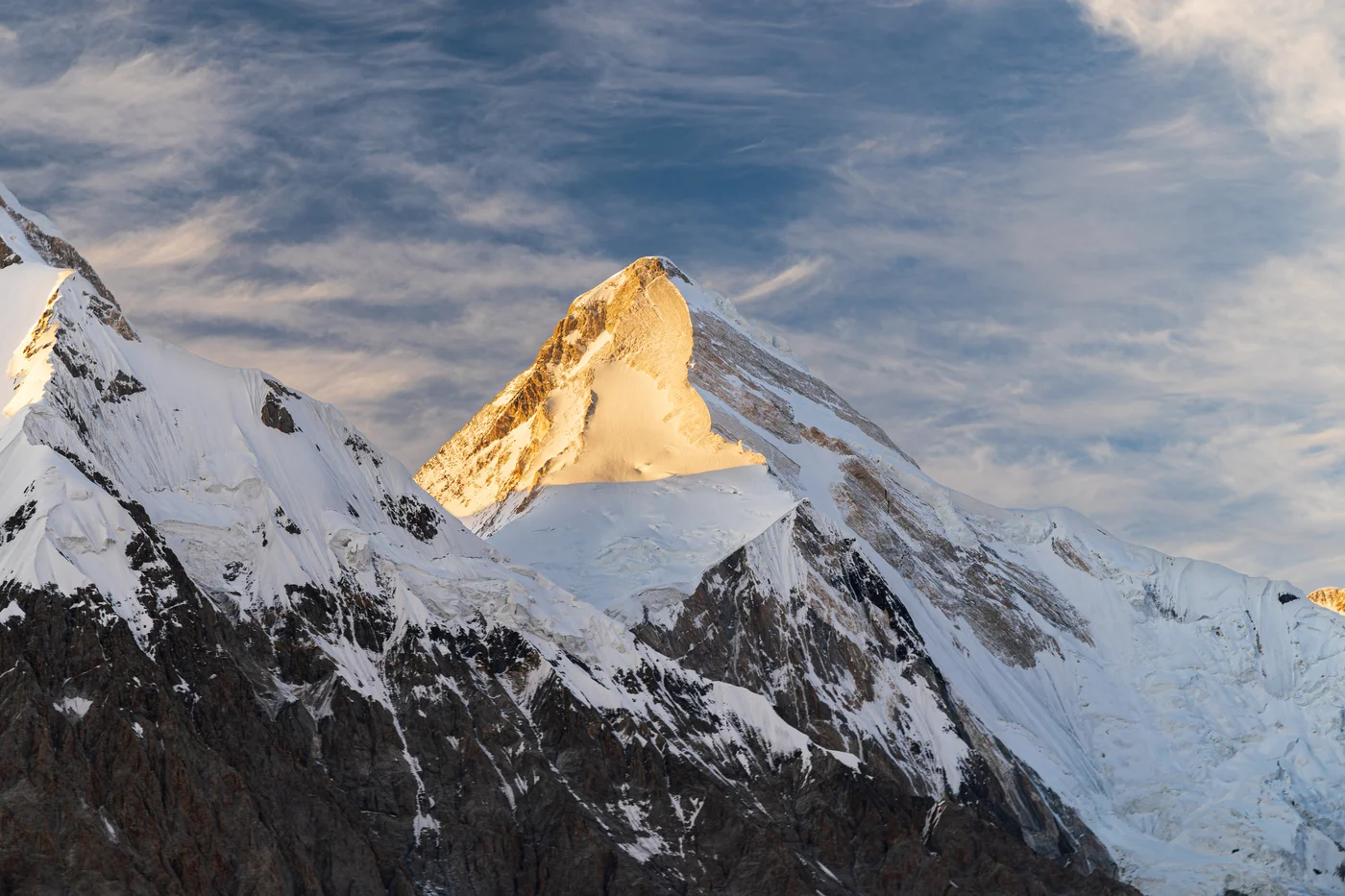
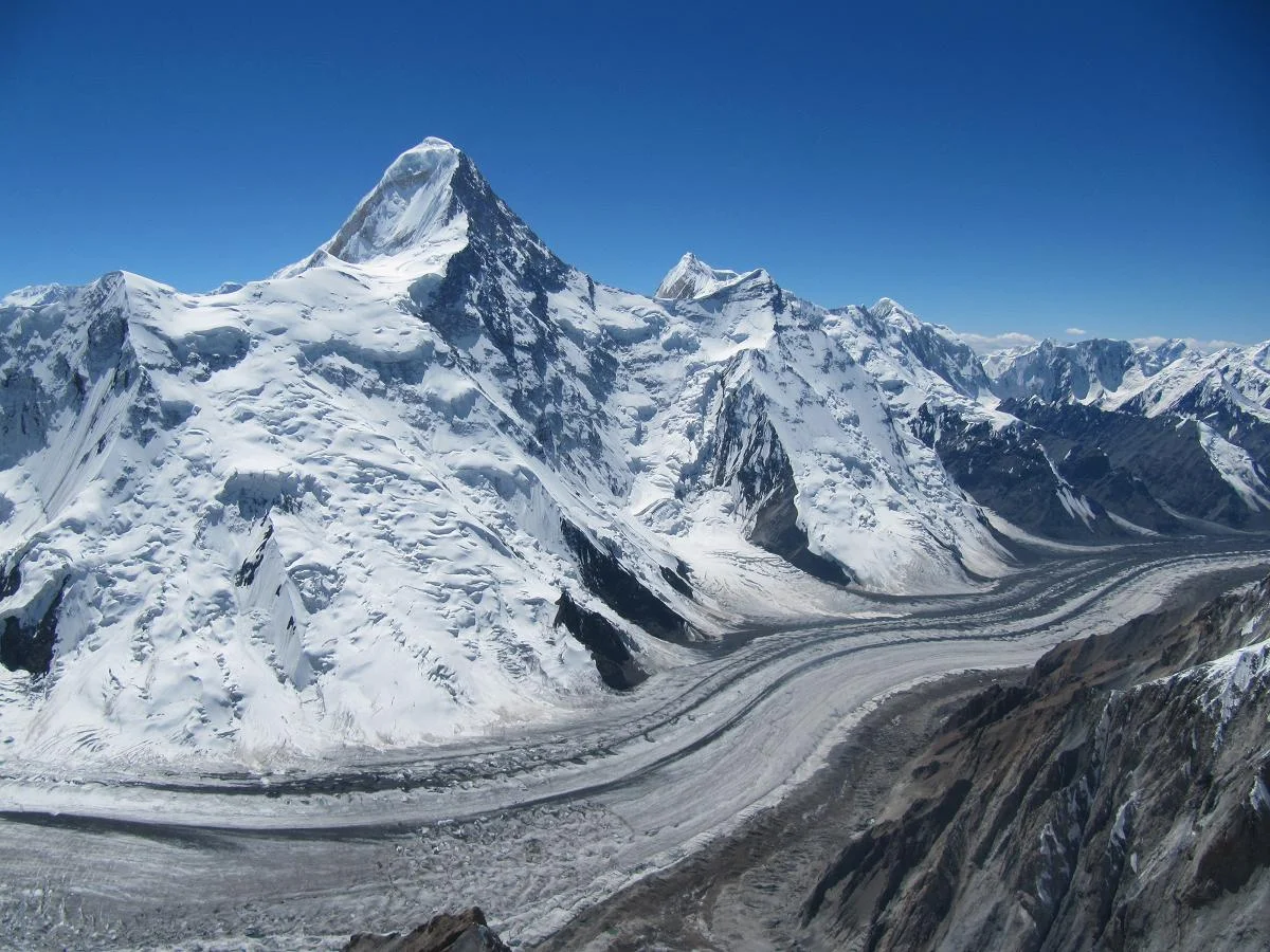
Khan Tengri is a breathtakingly symmetrical, marble-stratified pyramid rising to 7,010 metres (22,999 ft, including summit ice cap) in the Tengri-Tag range of the Central Tien Shan, straddling the borders of Kyrgyzstan, Kazakhstan, and China. Revered in ancient Tengrism as the sacred 'Lord of the Spirits' and famous for its fiery pink glow at sunset, the peak is one of the premier challenges of high-altitude mountaineering. First conquered on September 11, 1931, by a Ukrainian expedition led by Mikhail Pogrebetsky via the West Ridge, it was the scene of an epic survival climb in 1936 by the Abalakov brothers.
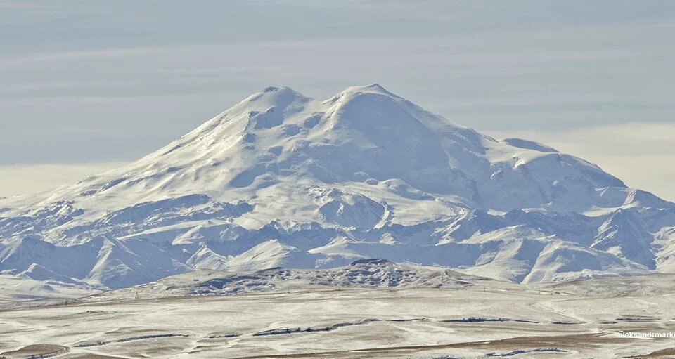
Mount Elbrus
Mount Elbrus is the highest mountain in Russia and Europe, soaring to 5,642 metres as the tenth-most topographically prominent peak on Earth and one of the Seven Summits. Situated in the Russian Caucasus near the Georgian border, this colossal dormant stratovolcano features two ice-capped volcanic domes separated by a high saddle at 5,416 metres. The eastern summit (5,621 m) was first climbed in 1829 by Circassian scout Killar Khashirov, while the true continental high point on the western summit (5,642 m) was conquered in 1874 by Florence Craufurd Grove, Frederick Gardiner, Horace Walker, Peter Knubel, and Balkar guide Ahiya Sottaev.
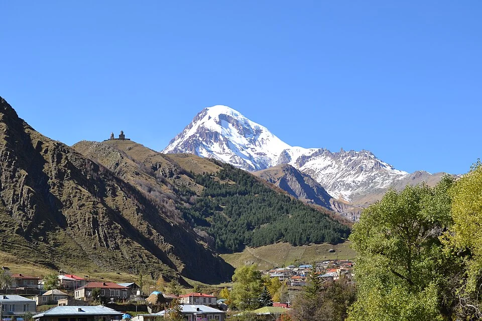

Mount Kazbek
Mount Kazbek (known in Georgian as Mqinvartsveri, meaning 'Glacier Peak') is a magnificent 5,054-metre dormant stratovolcano situated in northeastern Georgia just south of the Russian border. The third-highest summit in Georgia and the second-highest volcanic cone in the Caucasus after Elbrus, Kazbek towers majestically above the town of Stepantsminda and the historic Georgian Military Highway. Rich in mythology as the legendary peak where the Titan Amirani (the Georgian Prometheus) was chained for gifting fire to mortals, Kazbek was first climbed in 1868 by Douglas Freshfield, Adolphus Moore, Charles Tucker, and Chamonix guide François Devouassoud.
Pioneered & Associated Routes (3)
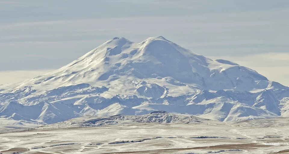
Elbrus South Normal Route via Garabashi & Pastukhov Rocks
The classic and most popular climbing route up Mount Elbrus, ascending the southern glaciated volcano flank from the Garabashi huts past Priyut 11 and the historic Pastukhov Rocks (4,700 m). Climbers ascend broad firn fields to the Col at 5,416 metres before climbing the final snow ramp to the 5,642-metre Western Summit.
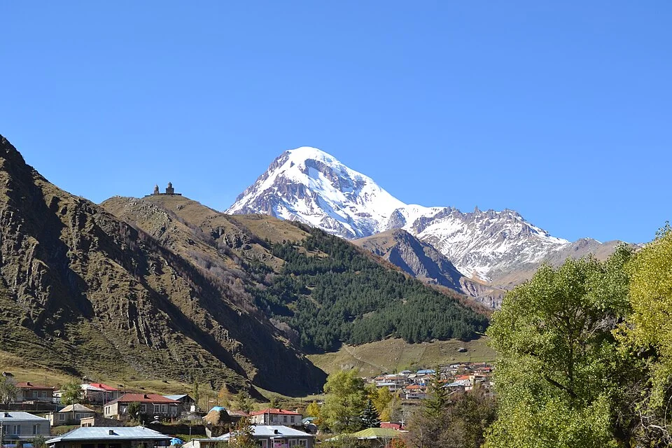
Mount Kazbek Normal Route via Gergeti Glacier & Betlemi Hut
The historic normal route up Mount Kazbek begins from the village of Stepantsminda, passing the iconic 14th-century Gergeti Trinity Church. Climbers cross the Gergeti Glacier to reach the historic Betlemi Hut (3,650 m). From the hut, the route traverses the upper glacier plateau before mounting a steep 40-degree firn slope to the 5,054-metre volcanic summit dome.
Khan Tengri West Ridge & Pogrebetsky Route
The West Ridge Pogrebetsky Route is the premier classic route on Khan Tengri (7,010 m), leading from the South Inylchek Glacier up the Semenovskiy Glacier to the West Col (Chakan-Tau, 5,900 m) and ascending the exposed western marble ridge. First climbed on September 11, 1931, by Mikhail Pogrebetsky, Boris Tyurin, and Franz-Josef Zauberer, the route involves sustained climbing on steep snow couloirs and technical marble rock bands above 6,700 metres. The route requires fixed-rope jumaring, rigorous acclimatization, and exceptional endurance against high-altitude hypothermia.
Documented Expeditions (1)

1902 Gottfried Merzbacher Central Tien Shan Scientific Expedition
Between 1902 and 1903, German explorer Gottfried Merzbacher mounted a landmark scientific expedition into the Central Tien Shan, mapping the colossal Inylchek Glacier, discovering the famous ice-dammed Lake Merzbacher, and establishing the true geographical coordinates and alpine morphology of Khan Tengri (7,010 m).
Associated Chronicles & Stories (1)

The Secret of the Vanishing Lake: Gottfried Merzbacher's 1902 Tien Shan Odyssey
German explorer Gottfried Merzbacher penetrates the colossal Inylchek Glacier in 1902, discovering Lake Merzbacher beneath the marble pyramid of Khan Tengri.
Documented Sources & Archival Citations
- The Central Tian-Shan Mountains: 1902–1903(John Murray, London / Gottfried Merzbacher)
Supporting claim: Primary geographic journal and maps of the Tien Shan exploration
Accessed/Documented: 1905 - Gottfried Merzbacher: An Explorer in the Mountains of Central Asia(Royal Geographical Society / Geographical Journal)
Supporting claim: Memorial obituary and scientific evaluation of Merzbacher's expeditions
Accessed/Documented: 1926