Mount Belukha Delone Couloir & Saddle Route
The Delone Couloir and Saddle Route is the classic technical line ascending Mount Belukha East Peak (4,506 m) from the Mensu Glacier basin. Pioneered in 1926 by eminent mathematician and alpinist Boris Delone, the route ascends a narrow, 300-metre ice chute angled at 40 to 45 degrees to gain the elevated Delone Pass at 3,400 metres.
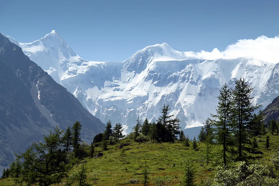
Ascent line, technical cruxes & camp topography profile for Mount Belukha Delone Couloir & Saddle Route
Mountain Safety & Conditions Disclaimer: High-altitude climbing, glacial travel, and technical ascents entail severe objective risks including avalanches, serac collapses, rapid weather collapse, and altitude illness. Historical route descriptions and summit claims on Mountanity reflect documented archival sources and must not be used as live operational safety assessments. Local regulations, permits, and physical glacial topography change continuously.
Peer Review: Senior Editorial Board & Historical Reviewers • Editorial Standards
Tactical & Camp Notes
Trailhead approach begins from Tyungur village along the Akkem or Kucherla river valleys, with base camp at Lake Akkem (2,050 m).
Identified Objective Hazards
- •Severe stonefall and icefall in the Delone Couloir, especially under direct sunlight
- •Deep hidden crevasses on the Berelskoye Glacier névé requiring roped travel at all times
- •Sudden sub-zero Siberian blizzards and fierce winds with zero visibility
- •Extreme remote isolation requiring complete self-rescue capability
Interactive Elevation Profile
Vertical profile, technical cruxes, and camp staging progression for Mount Belukha Delone Couloir & Saddle Route on Mount Belukha / Belukha East Peak.
Picturesque glacial lake camp with meteorological station, rescue post, and sweeping views of Belukha North Face.
Camp-by-Camp Topography
Key staging altitudes, technical cruxes, and terrain transitions for Mount Belukha Delone Couloir & Saddle Route.
Lake Akkem Base Camp
Picturesque glacial lake camp with meteorological station, rescue post, and sweeping views of Belukha North Face.
Tomsk Bivouac
High moraine campsite nestled beneath the foot of the steep Delone Couloir.
Berelskoye Plateau Camp
Glacial plateau snow camp positioned between the East and West peaks of Belukha.
Belukha East Peak Summit
The wind-scoured ice dome apex marking the highest geographical summit in the Altai and Siberia.
Topographic Location & Terrain Map
Cartographic datum, massif coordinates, and terrain context for Mount Belukha Delone Couloir & Saddle Route on Mount Belukha / Belukha East Peak.
Interactive Topographic Terrain Map
Click below to load live cartographic contours, glacier approaches, and geographic markers for Mount Belukha / Belukha East Peak (49°48′16″ N, 86°35′17″ E).
Key Statistics & Topographic Figures
- Route Type
- Glaciated Couloir & Steep Snow-Ice Ridge
Topography
- Technical Difficulty
- Demanding Technical Glacial Ascent / Russian Grade 3B
Russian Grade 3B / Alpine Grade III, 40-45° hard water ice, crevasse navigation, fixed ropes
- Country / Region
- Russia / Kazakhstan (Katun Range, Altai Mountains)
Location
Archival Primary Source Quotations
“A mountain route is not merely a path of rock and ice; it is a test of human endurance, judgment, and humility.”
Defined Alpine Terminology & Concepts
- Crux
- The most difficult and technically demanding pitch or section of a climbing route.
- Normal Route (Voie Normale)
- The most frequently climbed, least technical, and historically standard path to a mountain summit.
Frequently Asked Questions: Mount Belukha Delone Couloir & Saddle Route
What is the climbing difficulty and grade of Mount Belukha Delone Couloir & Saddle Route?
Mount Belukha Delone Couloir & Saddle Route on mount-belukha is graded as Demanding Technical Glacial Ascent / Russian Grade 3B, with technical climbing requirements including Russian Grade 3B / Alpine Grade III, 40-45° hard water ice, crevasse navigation, fixed ropes.
What are the primary hazards on the Mount Belukha Delone Couloir & Saddle Route?
Climbers on Mount Belukha Delone Couloir & Saddle Route must navigate severe objective hazards including Severe stonefall and icefall in the Delone Couloir, especially under direct sunlight, Deep hidden crevasses on the Berelskoye Glacier névé requiring roped travel at all times, Sudden sub-zero Siberian blizzards and fierce winds with zero visibility, Extreme remote isolation requiring complete self-rescue capability.
What camps are established on Mount Belukha Delone Couloir & Saddle Route?
Mount Belukha Delone Couloir & Saddle Route typically features 4 staging camps, progressing from Lake Akkem Base Camp (2050m) up toward the summit.
Mountain Ascended
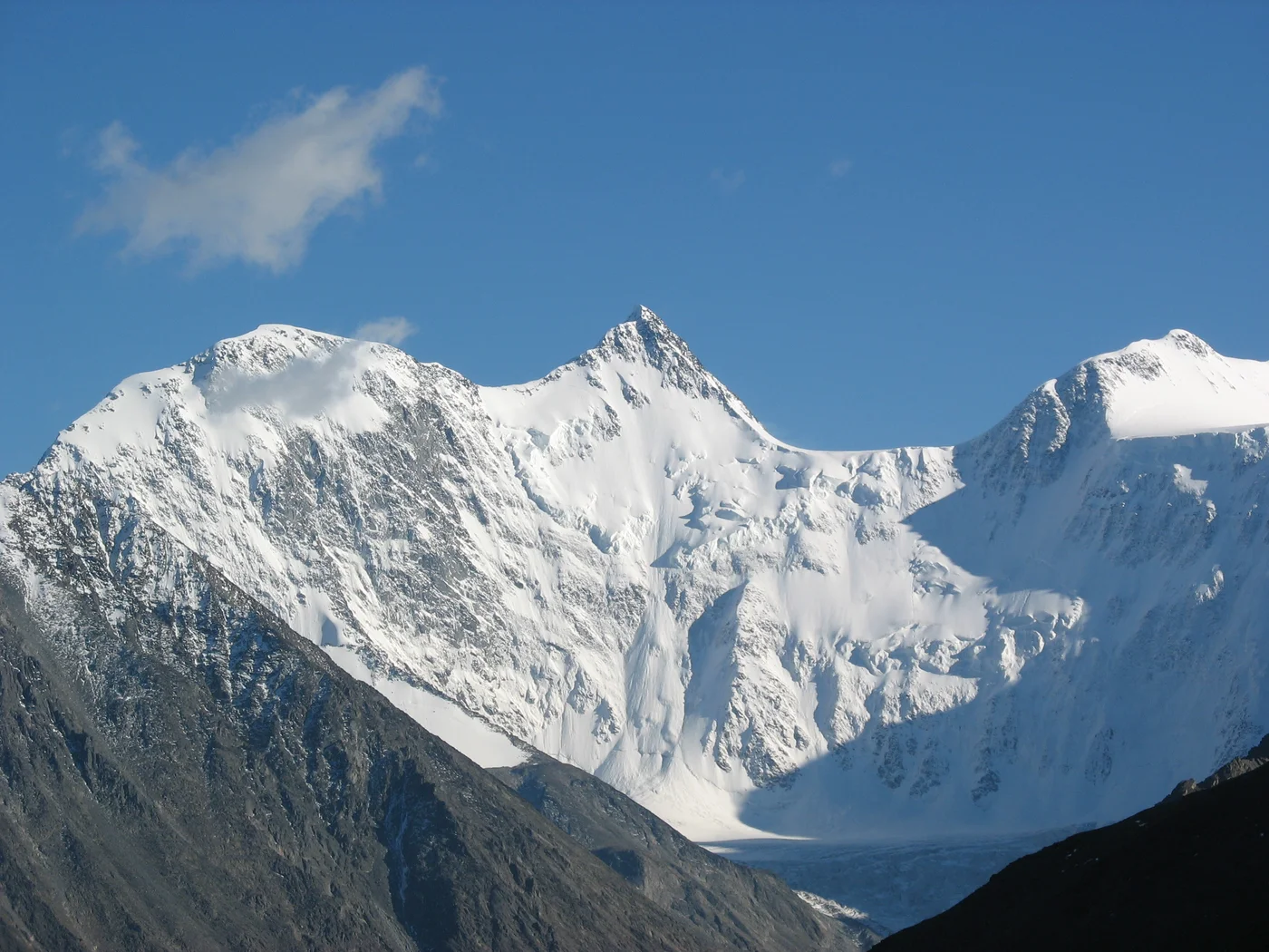
Mount Belukha / Belukha East Peak
Mount Belukha is a majestic double-headed glaciated massif rising to 4,506 metres (14,783 ft) on the border between Russia and Kazakhstan, reigning as the highest peak in the Altai Mountains and the crown of Siberia. Revered in indigenous Altai mythology as Uch-Sumer and linked by mystics to the legendary spiritual realm of Shambhala, Belukha feeds massive valley glaciers including the Mensu and Katun. First reached on July 26, 1914, by brothers Boris and Mikhail Tronov, the mountain was transformed into a proving ground for technical Soviet alpinism in 1926 when mathematician Boris Delone pioneered the classic route via the Delone Couloir and Saddle.
Documented Expeditions on this Route (1)
Verified historical summits, siege campaigns, and pioneer attempts recorded on Mount Belukha Delone Couloir & Saddle Route.
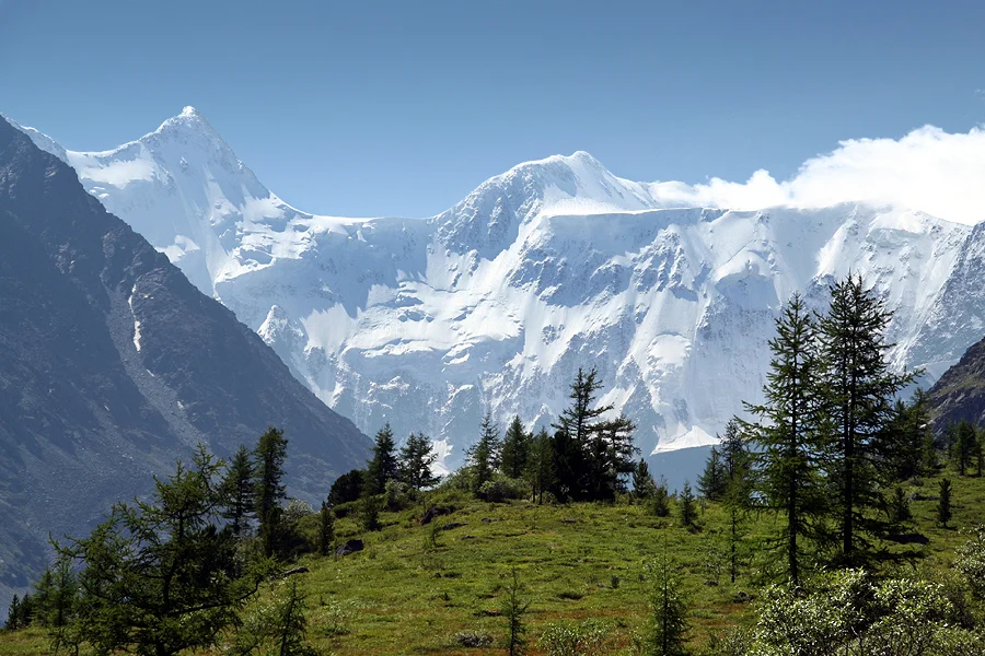
1926 Boris Delone Historic First Ascent of Belukha via Delone Couloir
In August 1926, eminent Soviet mathematician and alpinist Boris Delone pioneered the historic technical route up Mount Belukha East Peak (4,506 m) in the Altai Mountains, scaling the steep 300-metre ice couloir to Delone Pass and proving that modern alpine techniques could conquer Siberian peaks.
Archival Chronicles & Stories on this Route (1)
In-depth longform historical narratives, harrowing survival accounts, and firsthand alpine journals on Mount Belukha Delone Couloir & Saddle Route.
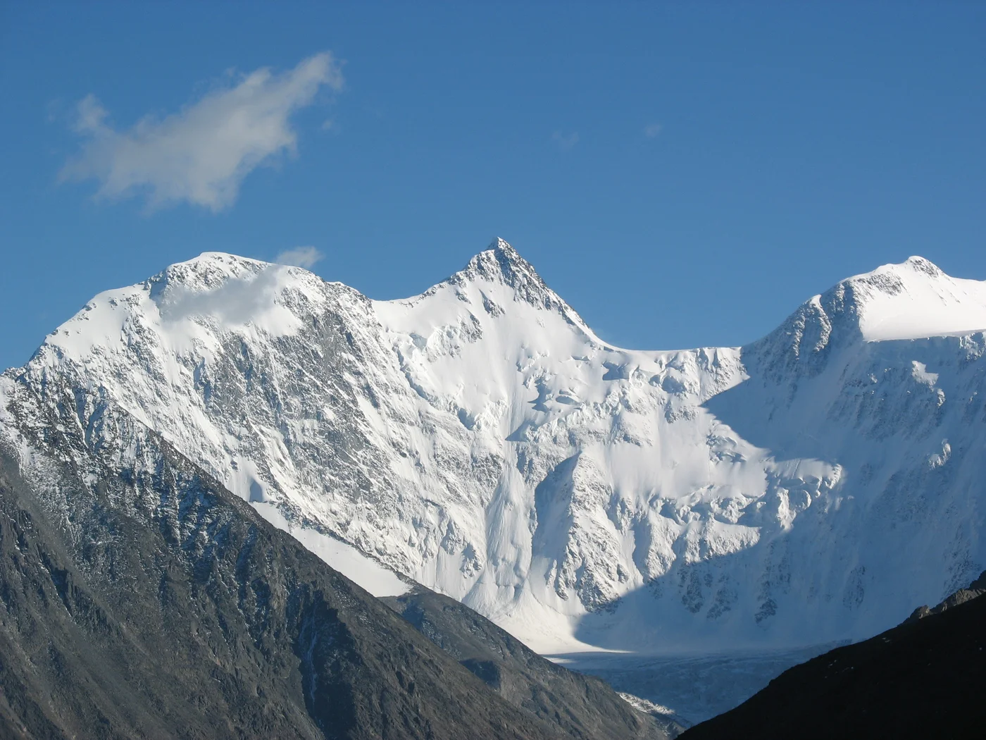
The Mathematician and the Mountain: Boris Delone's 1926 Belukha Triumph
Eminent mathematician Boris Delone leads a daring 1926 expedition into the Altai Mountains, scaling the sheer ice couloir to conquer Mount Belukha East Peak.
Documented Sources & Archival Citations
- Altai Alpine Guidebook(Russian Mountaineering Federation)
Supporting claim: Technical route grading and approach specifics for Mount Belukha
Accessed/Documented: 2026