Ismoil Somoni Borodkin Pillar & Pamir Plateau Route
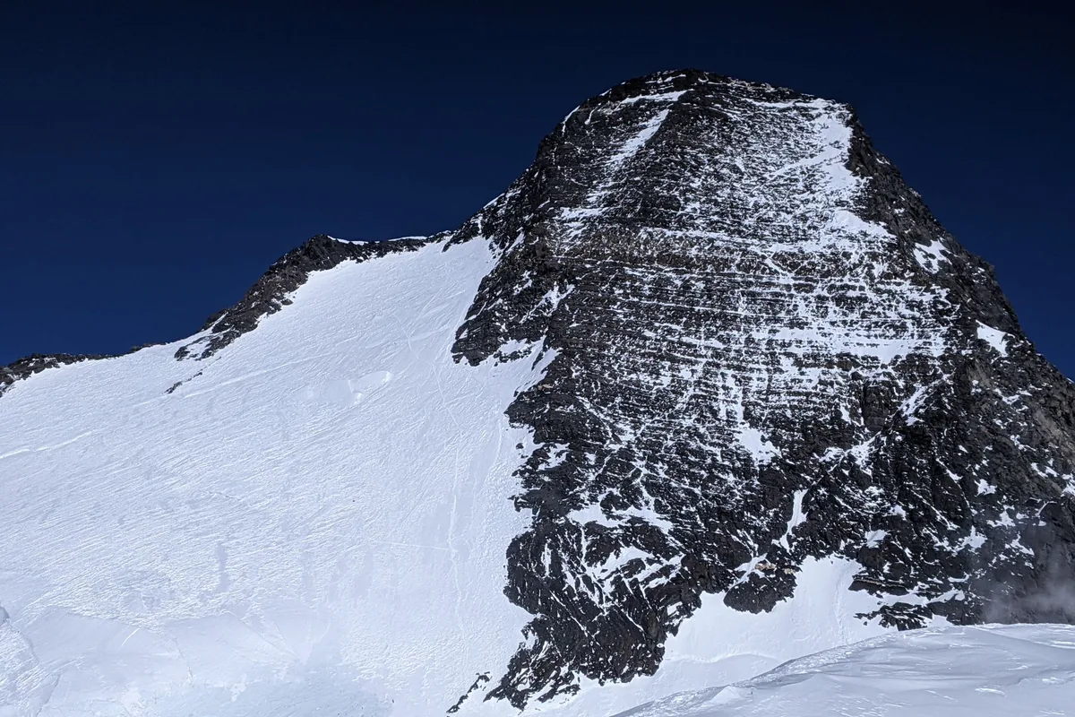
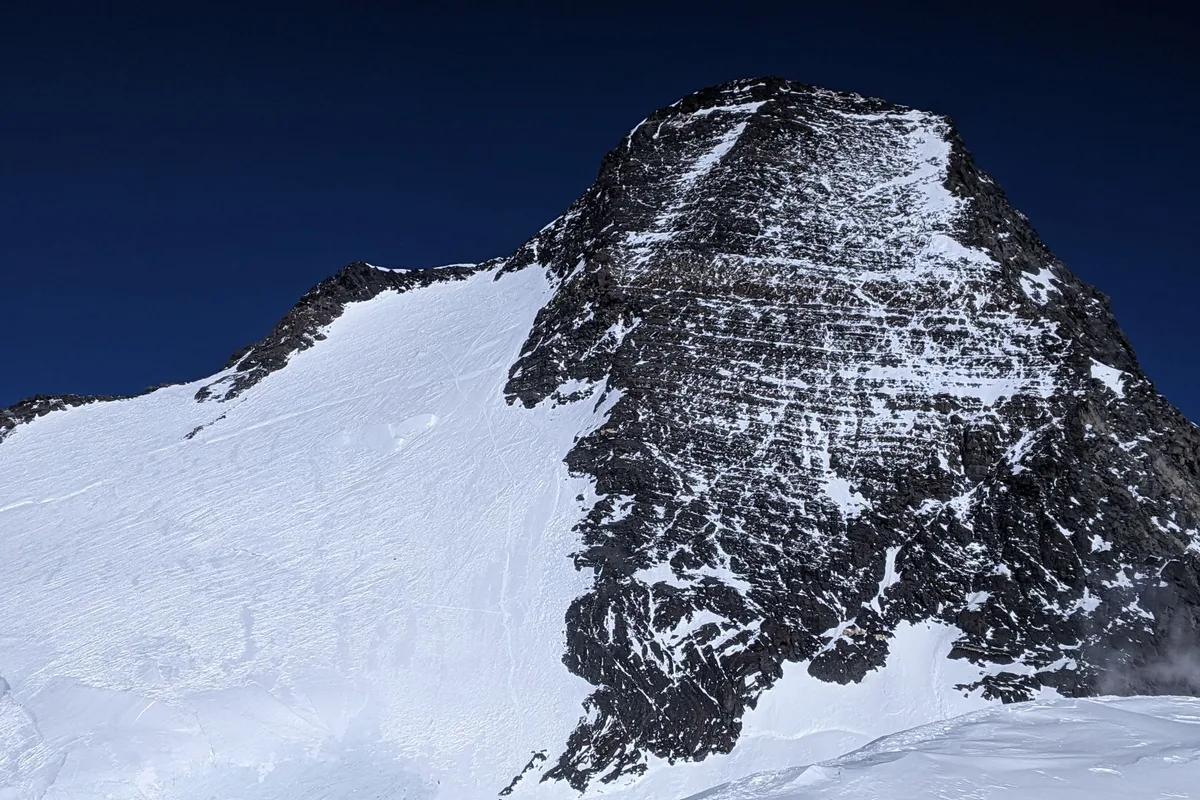
The Borodkin Pillar is the classic and most aesthetically renowned route up Ismoil Somoni Peak (7,495 m). Initiated from Moskvina Base Camp across the Walter Glacier, the route scales the steep rocky and mixed Borodkin Pillar to gain the immense Pamir Plateau of Pravda at 6,000 metres, traverses under Peak Dushanbe (6,950 m), and pushes up the final exposed summit crest to 7,495 metres.
Ascent line, technical cruxes & camp topography profile for Ismoil Somoni Borodkin Pillar & Pamir Plateau Route
Mountain Safety & Conditions Disclaimer: High-altitude climbing, glacial travel, and technical ascents entail severe objective risks including avalanches, serac collapses, rapid weather collapse, and altitude illness. Historical route descriptions and summit claims on Mountanity reflect documented archival sources and must not be used as live operational safety assessments. Local regulations, permits, and physical glacial topography change continuously.
Peer Review: Senior Editorial Board & Historical Reviewers • Editorial Standards
Tactical & Camp Notes
Helicopter access from Dushanbe to Moskvina Glade Base Camp (4,200 m). Full high-altitude acclimatization required before tackling the plateau.
Identified Objective Hazards
- •Catastrophic sub-zero storms with jet-stream winds exceeding 100 km/h across the Pamir Plateau
- •Severe acute mountain sickness (AMS) and high-altitude pulmonary edema (HAPE) above 6,000 m
- •Technical rockfall on the lower pitches of the Borodkin Pillar during afternoon thawing
- •Deep crevasse fields and navigation loss in whiteout conditions on the high plateau
Interactive Elevation Profile
Vertical profile, technical cruxes, and camp staging progression for Ismoil Somoni Borodkin Pillar & Pamir Plateau Route on Ismoil Somoni Peak / Peak Communism.
The historic alpine base camp situated at the confluence of the Walter and Moskvina glaciers with medical and dining huts.
Camp-by-Camp Topography
Key staging altitudes, technical cruxes, and terrain transitions for Ismoil Somoni Borodkin Pillar & Pamir Plateau Route.
Moskvina Glade Base Camp
The historic alpine base camp situated at the confluence of the Walter and Moskvina glaciers with medical and dining huts.
Camp 1 (Borodkin Foot)
Moraine campsite placed directly below the initial steep rock buttress of the Borodkin Pillar.
Camp 2 (Plateau Edge)
High camp positioned on the snowy shoulder where the Borodkin Pillar tops out onto the Pamir Plateau.
Camp 3 (Pamir Plateau)
Camp pitched in the vast, wind-scoured snow plain of the Pamir Plateau of Pravda.
Camp 4 (Peak Dushanbe Col)
Final assault camp excavated into snow beneath the summit pyramid ridge.
Ismoil Somoni Summit
The highest geographic point in the Pamirs and the former Soviet Union.
Topographic Location & Terrain Map
Cartographic datum, massif coordinates, and terrain context for Ismoil Somoni Borodkin Pillar & Pamir Plateau Route on Ismoil Somoni Peak / Peak Communism.
Interactive Topographic Terrain Map
Click below to load live cartographic contours, glacier approaches, and geographic markers for Ismoil Somoni Peak / Peak Communism (38°56′59″ N, 72°00′55″ E).
Key Statistics & Topographic Figures
- Route Type
- Glaciated Rock Buttress & Ultra-High Plateau Traverse
Topography
- Technical Difficulty
- Formidable High-Altitude Mixed Ascent / Russian Grade 5A
Russian Grade 5A / Alpine Grade IV, mixed rock pitches (UIAA IV-V), fixed ropes, sub-polar wind exposure
- Country / Region
- Tajikistan (Academy of Sciences Range, Pamir Mountains)
Location
Archival Primary Source Quotations
“A mountain route is not merely a path of rock and ice; it is a test of human endurance, judgment, and humility.”
Defined Alpine Terminology & Concepts
- Crux
- The most difficult and technically demanding pitch or section of a climbing route.
- Normal Route (Voie Normale)
- The most frequently climbed, least technical, and historically standard path to a mountain summit.
Frequently Asked Questions: Ismoil Somoni Borodkin Pillar & Pamir Plateau Route
What is the climbing difficulty and grade of Ismoil Somoni Borodkin Pillar & Pamir Plateau Route?
Ismoil Somoni Borodkin Pillar & Pamir Plateau Route on ismoil-somoni-peak is graded as Formidable High-Altitude Mixed Ascent / Russian Grade 5A, with technical climbing requirements including Russian Grade 5A / Alpine Grade IV, mixed rock pitches (UIAA IV-V), fixed ropes, sub-polar wind exposure.
What are the primary hazards on the Ismoil Somoni Borodkin Pillar & Pamir Plateau Route?
Climbers on Ismoil Somoni Borodkin Pillar & Pamir Plateau Route must navigate severe objective hazards including Catastrophic sub-zero storms with jet-stream winds exceeding 100 km/h across the Pamir Plateau, Severe acute mountain sickness (AMS) and high-altitude pulmonary edema (HAPE) above 6,000 m, Technical rockfall on the lower pitches of the Borodkin Pillar during afternoon thawing, Deep crevasse fields and navigation loss in whiteout conditions on the high plateau.
What camps are established on Ismoil Somoni Borodkin Pillar & Pamir Plateau Route?
Ismoil Somoni Borodkin Pillar & Pamir Plateau Route typically features 6 staging camps, progressing from Moskvina Glade Base Camp (4200m) up toward the summit.
Mountain Ascended
Ismoil Somoni Peak / Peak Communism
Ismoil Somoni Peak (formerly Peak Communism and Peak Stalin) is the highest mountain in Tajikistan, the supreme apex of the Pamir Mountains, and was the highest summit in the entire Soviet Union at 7,495 metres (24,590 ft). Rising dramatically above the Fortambek and Walter glaciers in the Academy of Sciences Range, the mountain features colossal vertical relief, massive avalanche chutes, and the sprawling Pamir Plateau of Pravda perched at over 6,000 metres. Conquered in a legendary solo ascent in 1933 by Evgeny Abalakov, it remains the crowning challenge of the Snow Leopard award.
Documented Expeditions on this Route (2)
Verified historical summits, siege campaigns, and pioneer attempts recorded on Ismoil Somoni Borodkin Pillar & Pamir Plateau Route.
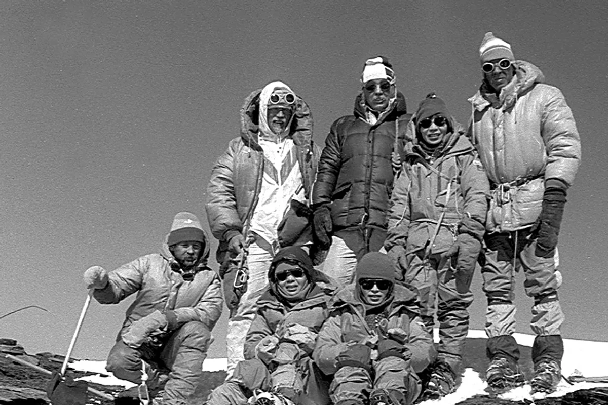
1933 Soviet Tajik-Pamir Expedition: Evgeny Abalakov Solo Summit of Peak Communism
On September 3, 1933, master Soviet climber and sculptor Evgeny Abalakov achieved the legendary solo first ascent of Peak Communism (7,495 m, now Ismoil Somoni Peak), establishing the national climbing record of the Soviet Union in a ferocious sub-zero blizzard.
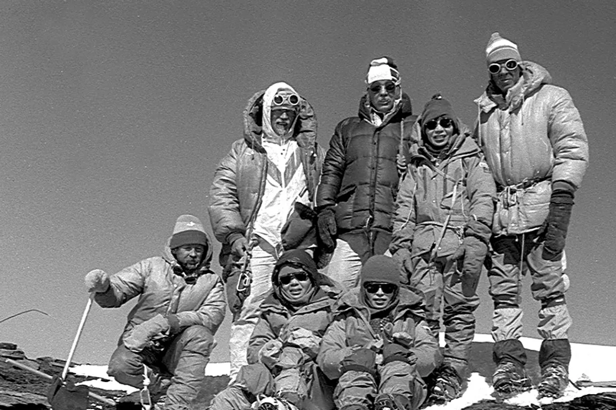
1968 Valentin Borodkin Expedition: Opening the Borodkin Pillar on Peak Communism
In August 1968, Soviet climber Valentin Borodkin pioneered the legendary Borodkin Pillar route up the North Face of Ismoil Somoni Peak (7,495 m), unlocking direct access to the Pamir Plateau of Pravda and establishing the modern standard route.
Archival Chronicles & Stories on this Route (2)
In-depth longform historical narratives, harrowing survival accounts, and firsthand alpine journals on Ismoil Somoni Borodkin Pillar & Pamir Plateau Route.
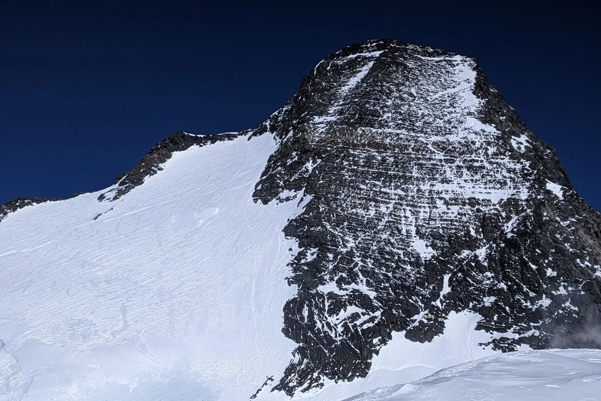
The Solitary Hero on the USSR's Summit: Evgeny Abalakov on Peak Communism, 1933
In the early 1930s, Soviet geographers were gripped by a profound mystery: what was the true supreme peak of the USSR? Initial surveys had misidentified Mount G...
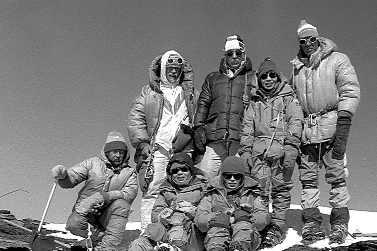
Scaling the Borodkin Pillar: The Route that Unlocked the Pamir Plateau, 1968
The colossal North Face of Ismoil Somoni Peak rises over 3,000 vertical metres above the Walter Glacier, guarded by the immense, sub-polar snow plateau known as...
Documented Sources & Archival Citations
- Routes of the Pamirs and Tien Shan(Soviet Mountaineering Federation)
Supporting claim: Technical grade and topography of the Borodkin Pillar Route
Accessed/Documented: 2026