Lenin Peak Razdelnaya Route & West Ridge
The Razdelnaya Route via the North Face and West Ridge is the classic standard route on Lenin Peak (7,134 m). Starting from the Achik-Tash Base Camp (3,600 m), the route navigates the crevassed Lenin Glacier to Camp 2 (5,300 m), scales the steep snow slopes to Razdelnaya Peak (6,148 m) for Camp 3, and makes a sustained 1,000-metre summit push along the exposed West Ridge to 7,134 metres.
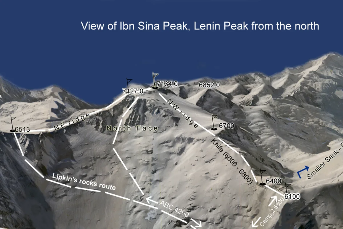
Ascent line, technical cruxes & camp topography profile for Lenin Peak Razdelnaya Route & West Ridge
Mountain Safety & Conditions Disclaimer: High-altitude climbing, glacial travel, and technical ascents entail severe objective risks including avalanches, serac collapses, rapid weather collapse, and altitude illness. Historical route descriptions and summit claims on Mountanity reflect documented archival sources and must not be used as live operational safety assessments. Local regulations, permits, and physical glacial topography change continuously.
Peer Review: Senior Editorial Board & Historical Reviewers • Editorial Standards
Tactical & Camp Notes
Vehicle accessible to Achik-Tash Base Camp from Osh, Kyrgyzstan. The premier entry-level 7,000m expedition in the world.
Identified Objective Hazards
- •Hidden crevasse falls on the glacier traverse between Camp 1 and Camp 2
- •Severe altitude sickness (AMS) caused by rapid ascent schedules on non-technical terrain
- •Extreme solar radiation and dehydration in 'The Frying Pan' snow bowl
- •Sudden whiteout blizzards along the 4-kilometre summit ridge above 6,400 m
Interactive Elevation Profile
Vertical profile, technical cruxes, and camp staging progression for Lenin Peak Razdelnaya Route & West Ridge on Lenin Peak / Ibn Sina Peak.
Lush alpine meadow camp with yurts, dining halls, electricity, and vehicle road access from Osh.
Camp-by-Camp Topography
Key staging altitudes, technical cruxes, and terrain transitions for Lenin Peak Razdelnaya Route & West Ridge.
Achik-Tash Base Camp
Lush alpine meadow camp with yurts, dining halls, electricity, and vehicle road access from Osh.
Camp 1 (Advanced Base Camp)
Located on the lateral moraine of the Lenin Glacier beneath the formidable North Face.
Camp 2
High camp situated in the glacier basin above 'The Frying Pan' beneath the slopes of Razdelnaya.
Camp 3 (Razdelnaya Shoulder)
The critical high assault camp perched on the snow dome summit of Razdelnaya Peak.
Lenin Peak Summit
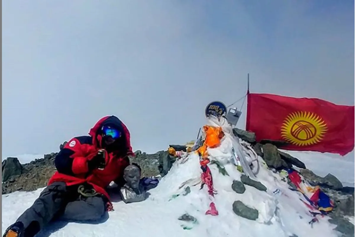
Broad, boulder-strewn summit plateau featuring the bronze monument bust of Vladimir Lenin.
Topographic Location & Terrain Map
Cartographic datum, massif coordinates, and terrain context for Lenin Peak Razdelnaya Route & West Ridge on Lenin Peak / Ibn Sina Peak.
Interactive Topographic Terrain Map
Click below to load live cartographic contours, glacier approaches, and geographic markers for Lenin Peak / Ibn Sina Peak (39°20′48″ N, 72°52′47″ E).
Key Statistics & Topographic Figures
- Route Type
- Glaciated Névé Face & High Alpine Ridge
Topography
- Technical Difficulty
- Non-Technical High-Endurance 7,000m Climb / Russian Grade 5A
Russian Grade 5A / Alpine Grade IV (primarily due to extreme altitude and blizzard hazards, technical pitches 35-40° snow/ice)
- Country / Region
- Kyrgyzstan / Tajikistan (Trans-Alay Range, Northern Pamir)
Location
Archival Primary Source Quotations
“A mountain route is not merely a path of rock and ice; it is a test of human endurance, judgment, and humility.”
Defined Alpine Terminology & Concepts
- Crux
- The most difficult and technically demanding pitch or section of a climbing route.
- Normal Route (Voie Normale)
- The most frequently climbed, least technical, and historically standard path to a mountain summit.
Frequently Asked Questions: Lenin Peak Razdelnaya Route & West Ridge
What is the climbing difficulty and grade of Lenin Peak Razdelnaya Route & West Ridge?
Lenin Peak Razdelnaya Route & West Ridge on lenin-peak is graded as Non-Technical High-Endurance 7,000m Climb / Russian Grade 5A, with technical climbing requirements including Russian Grade 5A / Alpine Grade IV (primarily due to extreme altitude and blizzard hazards, technical pitches 35-40° snow/ice).
What are the primary hazards on the Lenin Peak Razdelnaya Route & West Ridge?
Climbers on Lenin Peak Razdelnaya Route & West Ridge must navigate severe objective hazards including Hidden crevasse falls on the glacier traverse between Camp 1 and Camp 2, Severe altitude sickness (AMS) caused by rapid ascent schedules on non-technical terrain, Extreme solar radiation and dehydration in 'The Frying Pan' snow bowl, Sudden whiteout blizzards along the 4-kilometre summit ridge above 6,400 m.
What camps are established on Lenin Peak Razdelnaya Route & West Ridge?
Lenin Peak Razdelnaya Route & West Ridge typically features 5 staging camps, progressing from Achik-Tash Base Camp (3600m) up toward the summit.
Mountain Ascended
Lenin Peak / Ibn Sina Peak
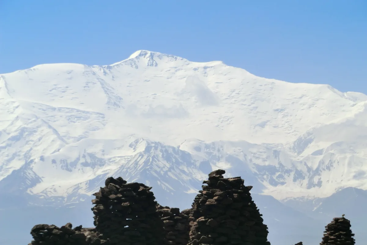
Lenin Peak (officially Ibn Sina Peak in Tajikistan) is a colossal glaciated mountain rising to 7,134 metres (23,406 ft) on the border of Kyrgyzstan and Tajikistan in the Trans-Alay Range of the northern Pamirs. Famous for its massive non-technical snow slopes and broad summit plateau, it was first conquered during the 1928 German-Soviet Alay-Pamir Expedition by Karl Wien, Eugen Allwein, and Erwin Schneider, setting an international altitude record for that era. Today, it is revered as the world's most climbed and accessible 7,000-metre peak.
Documented Expeditions on this Route (1)
Verified historical summits, siege campaigns, and pioneer attempts recorded on Lenin Peak Razdelnaya Route & West Ridge.
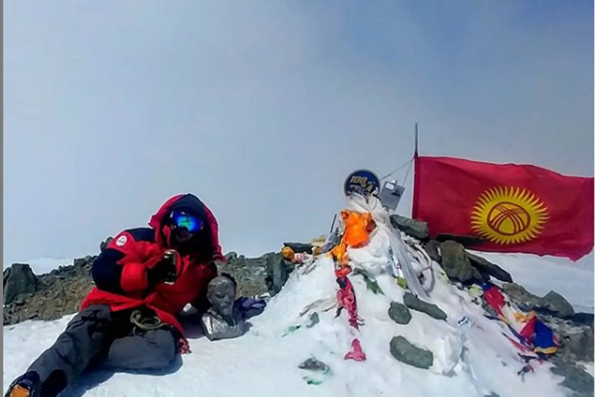
1928 German-Soviet Alay-Pamir Expedition: Maiden Ascent of Lenin Peak
On September 25, 1928, German and Austrian mountaineers Karl Wien, Eugen Allwein, and Erwin Schneider achieved the first ascent of Lenin Peak (7,134 m) in the Pamirs, setting a world climbing altitude record during the historic German-Soviet Alay-Pamir Expedition.
Archival Chronicles & Stories on this Route (1)
In-depth longform historical narratives, harrowing survival accounts, and firsthand alpine journals on Lenin Peak Razdelnaya Route & West Ridge.
At the Roof of the World: The 1928 Conquest of Lenin Peak
In 1928, the governments of the Weimar Republic and the Soviet Union launched the most ambitious joint scientific expedition ever assembled in Central Asia: the...
Documented Sources & Archival Citations
- Pamir and Tien Shan Mountaineering Guide(Alpindustria & Kyrgyz Alpine Club)
Supporting claim: Standard high camp distribution and GPS trail markers for the Razdelnaya Route
Accessed/Documented: 2026