Yerupajá West Face and South Ridge
The historic first ascent route of Yerupajá ascends the glaciated western cirque and tackles the ferocious, cornice-hung South Ridge to reach Peru's second-highest summit at 6,635 metres. Pioneered on July 31, 1950, by Harvard mountaineers Jim Maxwell and Dave Harrah, the route demands mastery of steep 60-degree firn, rotten limestone crags, and nerve-testing overhanging double snow cornices suspended over two-mile drops.
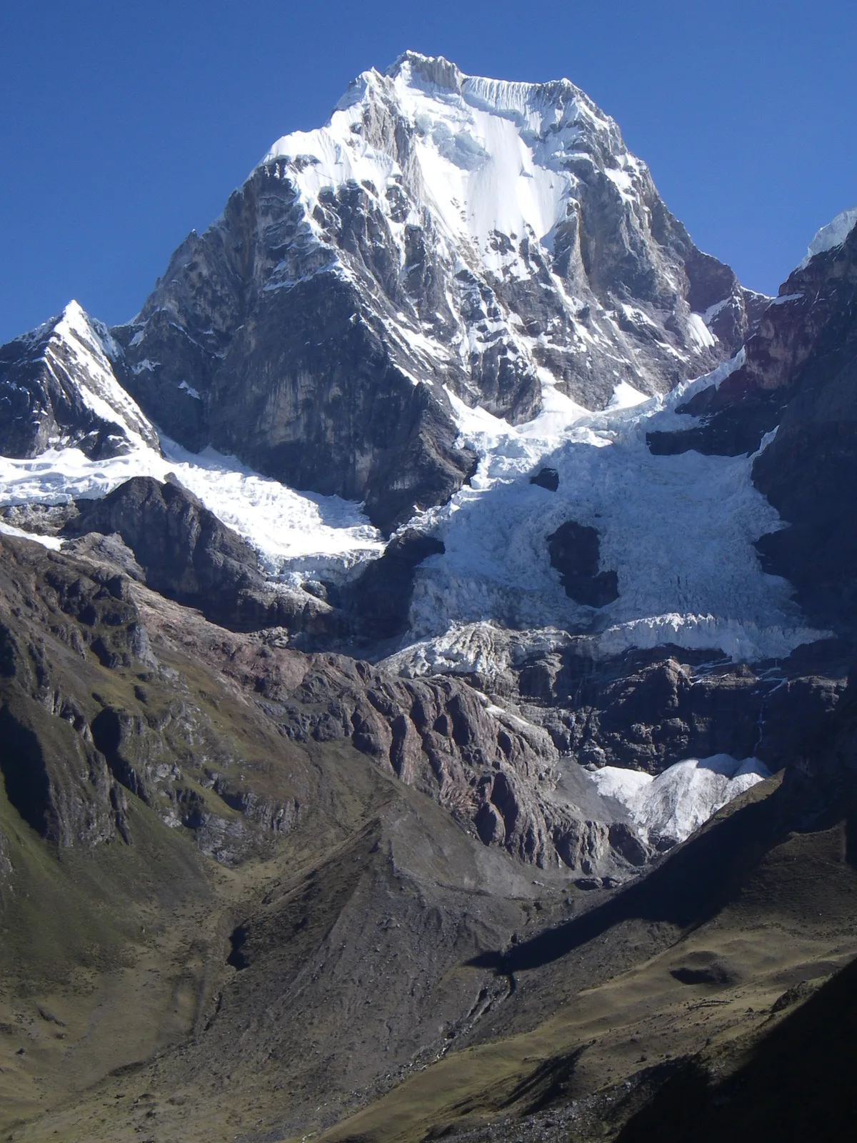
Ascent line, technical cruxes & camp topography profile for Yerupajá West Face and South Ridge
Mountain Safety & Conditions Disclaimer: High-altitude climbing, glacial travel, and technical ascents entail severe objective risks including avalanches, serac collapses, rapid weather collapse, and altitude illness. Historical route descriptions and summit claims on Mountanity reflect documented archival sources and must not be used as live operational safety assessments. Local regulations, permits, and physical glacial topography change continuously.
Peer Review: Senior Editorial Board & Historical Reviewers • Editorial Standards
Tactical & Camp Notes
From Laguna Jahuacocha, the route gains the glaciated basin beneath the southwest face. Climbers surmount the complex lower icefall and bergschrund to establish high camps on perched snow shelves. Above 6,000 metres, the line traverses steep 55-60 degree ice couloirs to gain the razor-like South Ridge. Here climbers must straddle fragile double-sided snow cornices with sheer 4,000-foot precipices falling to both sides, requiring pitch-by-pitch belays through snow flutings to attain the summit pinnacle.
Interactive Elevation Profile
Vertical profile, technical cruxes, and camp staging progression for Yerupajá West Face and South Ridge on Yerupajá.
Idyllic grassy plateau camp beside Laguna Jahuacocha beneath the western precipice.
Camp-by-Camp Topography
Key staging altitudes, technical cruxes, and terrain transitions for Yerupajá West Face and South Ridge.
Laguna Jahuacocha Base Camp
Idyllic grassy plateau camp beside Laguna Jahuacocha beneath the western precipice.
Glacier Camp (Camp 1)
Snow terrace nestled on the upper glacier above the moraine wall.
Col Bivouac (Camp 2)
Narrow ice shelf scooped into the windswept ridge col beneath the summit crest.
Yerupajá Summit
Highest point in the Cordillera Huayhuash, offering dizzying views across Central Peru.
Topographic Location & Terrain Map
Cartographic datum, massif coordinates, and terrain context for Yerupajá West Face and South Ridge on Yerupajá.
Interactive Topographic Terrain Map
Click below to load live cartographic contours, glacier approaches, and geographic markers for Yerupajá (10°16′04″ S, 76°54′23″ W).
Key Statistics & Topographic Figures
- Route Elevation Gain
- 1,400 metres from upper glacier camp
- Summit Altitude
- 6,635 m (21,768 ft)
- First Ascent Date
- July 31, 1950 (Maxwell & Harrah)
- Key Crux
- Straddling double-sided overhanging snow cornices at 6,500 m
Archival Primary Source Quotations
“On the ridge of Yerupajá, you are suspended between heaven and Earth on a cornice of wind-blown snow.”
Defined Alpine Terminology & Concepts
- Knife-Edge Arête
- A razor-thin mountain ridge formed between two glaciated valleys where snow and rock meet at an acute angle.
Frequently Asked Questions: Yerupajá West Face and South Ridge
What is the Yerupajá West Face and South Ridge route?
It is the historic 1950 first ascent line of Yerupajá pioneered by Jim Maxwell and Dave Harrah, ascending 1,400 metres to 6,635 metres.
What makes the South Ridge of Yerupajá so treacherous?
The ridge features gigantic, unstable double-sided snow cornices suspended over 4,000-foot precipices that climbers must straddle.
What is the technical grade of the Yerupajá first ascent route?
The route is graded ED- with 60-degree firn slopes, complex crevasse navigation, and high-altitude exposure.
Mountain Ascended
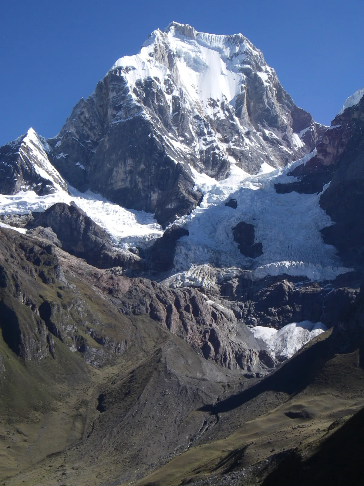

Yerupajá
Yerupajá is the second-highest peak in Peru and the undisputed monarch of the Cordillera Huayhuash, soaring to 6,635 metres. Celebrated for its razor-sharp summit cornices, vertical ice walls, and ominous local moniker El Carnicero (The Butcher), it was first climbed in July 1950 by Jim Maxwell and Dave Harrah of the Harvard Andean Mountaineering Club. In 1968, Chris Jones and Paul Dix completed the first ascent of its fearsome 1,200-metre West Face.
Documented Expeditions on this Route (2)
Verified historical summits, siege campaigns, and pioneer attempts recorded on Yerupajá West Face and South Ridge.
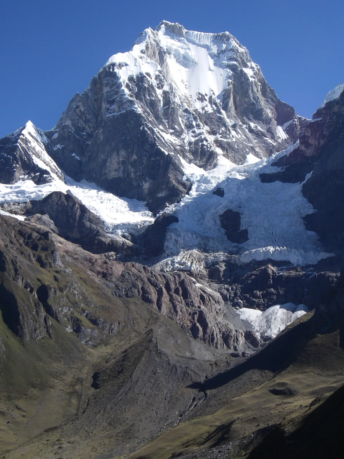
1950 Harvard Andean Yerupajá Historic First Ascent Expedition
On July 31, 1950, American climbers Jim Maxwell and Dave Harrah of the Harvard Andean Mountaineering Club achieved the historic first ascent of Yerupajá (6,635 m), the second-highest peak in Peru. Enduring extreme cornice balancing and an unplanned open bivouac at 6,500 metres that caused severe frostbite, their ascent was hailed as a milestone of post-war North American alpinism.
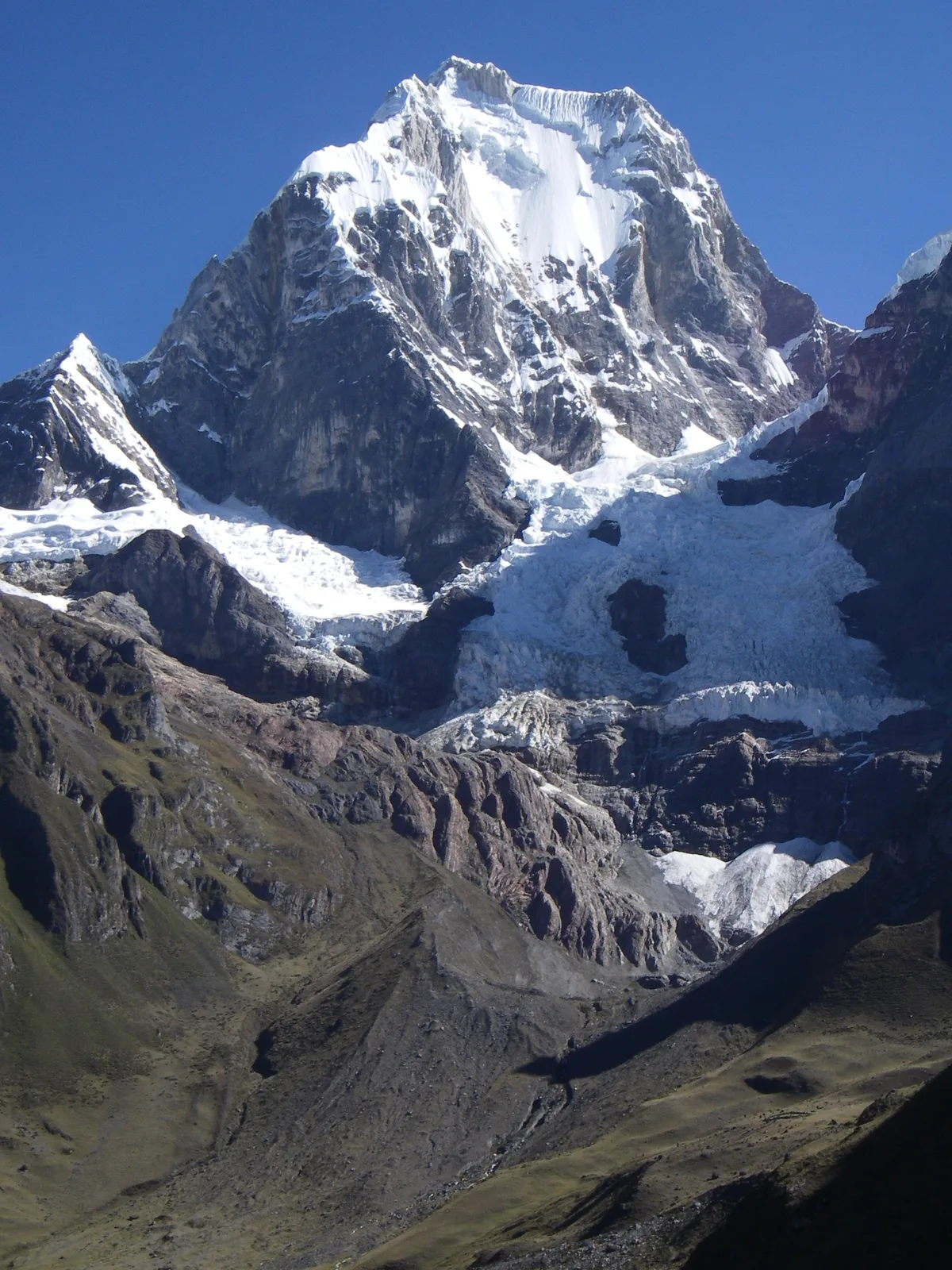
1968 Jones-Dix Yerupajá West Face Historic Direct Ascent
On July 27, 1968, British climber Chris Jones and American alpinist Paul Dix, supported by Dean Caldwell and Leif Patterson, completed the historic first ascent of the terrifying 1,200-metre West Face of Yerupajá (6,635 m). Braving relentless spindrift avalanches, vertical ice flutings, and hanging bivouacs, they unlocked the premier big-wall ice face of the Andes.
Archival Chronicles & Stories on this Route (2)
In-depth longform historical narratives, harrowing survival accounts, and firsthand alpine journals on Yerupajá West Face and South Ridge.
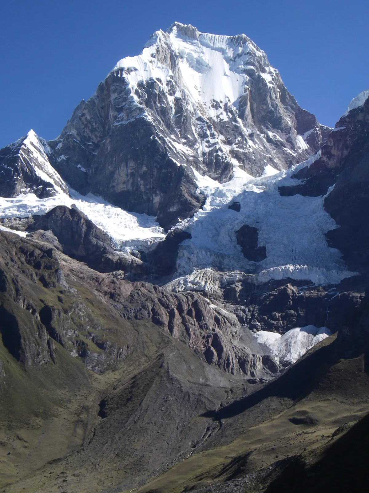
Conquering The Butcher: The 1950 Harvard First Ascent of Yerupajá
On July 31, 1950, Harvard mountaineers Jim Maxwell and Dave Harrah conquered Yerupajá (6,635 m), surviving knife-edge double cornices and an emergency sub-zero bivouac.
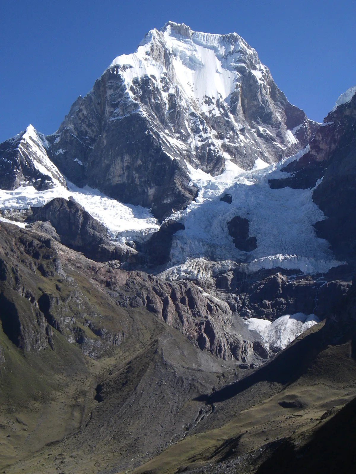
Direct on El Carnicero: The 1968 West Face of Yerupajá
On July 27, 1968, Chris Jones and Paul Dix unlocked the 1,200-metre direct West Face of Yerupajá (6,635 m), achieving one of the greatest big-wall ice ascents of the era.
Documented Sources & Archival Citations
- The Butcher: The Ascent of Yerupajá(John Sack / Rinehart & Company)
Supporting claim: Comprehensive chronicle of the route engineering and summit push by Maxwell and Harrah
Accessed/Documented: 1952 - American Alpine Journal: Harvard Andean Expedition 1950(Dave Harrah / American Alpine Club)
Supporting claim: Detailed route notes, ridge hazards, and bivouac analysis on Yerupajá
Accessed/Documented: 1951