Project Possible 14/7: The 189-Day Himalayan Odyssey
How Nirmal 'Nimsdai' Purja and his Nepali team climbed all fourteen 8,000-meter peaks in 189 days, redefining the boundaries of human endurance.
Mountain Safety & Conditions Disclaimer: High-altitude climbing, glacial travel, and technical ascents entail severe objective risks including avalanches, serac collapses, rapid weather collapse, and altitude illness. Historical route descriptions and summit claims on Mountanity reflect documented archival sources and must not be used as live operational safety assessments. Local regulations, permits, and physical glacial topography change continuously.
Peer Review: Senior Editorial Board & Historical Reviewers • Editorial Standards
The Audacity of Project Possible
In late 2018, when former British Special Forces operator Nirmal “Nimsdai” Purja MBE announced his ambition to summit all fourteen of the world’s 8,000-meter peaks in a single season—targeting just seven months—the global mountaineering establishment dismissed it as impossible. The previous world record stood at seven years, ten months, and six days, set by South Korean climber Kim Chang-ho, while the pioneering milestone set by Jerzy Kukuczka took nearly eight years.
Purja, born in the lowlands of Myagdi and forged through sixteen years of service in the British Brigade of Gurkhas and the elite Special Boat Service (SBS), possessed a rare fusion of military operational logistics, physiological resilience, and an unwavering team ethos. Re-branding the venture as Project Possible 14/7, he set out not only to shatter speed records, but to place Nepali and Sherpa mountaineers at the center of the global alpine stage.
Phase 1: The Nepal Crucible (Spring 2019)
The campaign commenced on April 23, 2019, on the lethal north face of Annapurna I (8,091m). After securing the summit, Purja received word that a stranded Malaysian climber, Dr. Chin Kin Wah, was dying in the open near 7,500m. In a demonstration of alpine brotherhood, Purja led a daring high-altitude helicopter extraction team back up into the avalanche-swept slopes to guide the climber to safety.
Without pause, Purja and his core team—Mingma David Sherpa, Geljen Sherpa, and Lakpa Dendi Sherpa—transferred directly to Dhaulagiri I (8,167m), summiting amidst severe gales on May 12. Three days later, on May 15, they stood atop Kangchenjunga (8,586m) after another grueling push, during which they again gave up their personal oxygen supplies to assist stricken descending climbers.
On May 22, Purja summited Mount Everest (8,849m) at 5:30 AM—capturing the viral photograph of the summit ridge traffic jam that focused worldwide attention on Himalayan commercialization—before descending to the South Col and climbing Lhotse (8,516m) just 10 hours and 15 minutes later. Transferring across the valley, he completed Makalu (8,485m) on May 24, setting a record of three 8,000-meter summits in just 48 hours. Phase 1 concluded with six giants in 31 days.
Phase 2: The Karakoram Sprint (Summer 2019)
Arriving in Pakistan in late June, the team entered the savage relief of the Karakoram. On July 3, Purja summited Nanga Parbat (8,126m) via the steep Kinshofer Route. Moving swiftly to the Baltoro Glacier, they summited Gasherbrum I (8,080m) on July 15 and Gasherbrum II (8,035m) on July 18.
At K2 Base Camp, dozens of commercial expeditions had abandoned their summit bids due to high avalanche risk, severe wind, and heavy snow clogging the Bottleneck. Taking command of route-fixing operations, Purja and his team forged through the deep drifts and led the international push, reaching the summit of K2 (8,611m) on July 24. Two days later, on July 26, they summited Broad Peak (8,051m). Five Karakoram giants had fallen in 23 days.
Phase 3: The Tibetan Finish & Global Triumph
The final phase presented severe bureaucratic hurdles. Cho Oyu (8,188m) was summited from Tibet on September 23, followed by Manaslu (8,163m) in Nepal on September 27. However, Shishapangma (8,027m) in Tibet remained officially closed to foreign mountaineers by Chinese authorities due to safety concerns.
Following coordinated diplomatic appeals from the Nepali government, international climbing federations, and high-level authorities, China granted an exceptional special permit. On October 29, 2019, at 8:58 AM local time, Nirmal Purja and his team stood upon the summit of Shishapangma.
The entire 14-peak campaign had taken 6 months and 6 days (189 days). In one singular, relentless season, Nirmal Purja and his Nepali brethren did not just rewrite the record books—they permanently redefined what is humanly possible in the high mountains of Earth.
Key Statistics & Topographic Figures
- Category
- Record Expeditions
Archival Subject
- Reading Time
- 10 min read
Narrative Length
- Key Mountain
- annapurna-1, dhaulagiri, kangchenjunga, mount-everest, lhotse, makalu, nanga-parbat, gasherbrum-1, gasherbrum-2, k2, broad-peak, cho-oyu, manaslu, shishapangma
Objective
- Ascent Route
- annapurna-north-face, dhaulagiri-northeast-ridge, kangchenjunga-southwest-face, south-col-route, lhotse-normal-route, makalu-normal-route, kinshofer-route, gasherbrum-1-normal, gasherbrum-2-southwest-ridge, abruzzi-spur, broad-peak-normal, cho-oyu-normal-route, manaslu-northeast-face, shishapangma-normal-route
Topography
- Verification
- Editorially Verified
Archival Standard
Archival Primary Source Quotations
“In the mountains, truth is etched in ice and granite; every step requires unwavering respect for the heights.”
Defined Alpine Terminology & Concepts
- Summit Push
- The final continuous climbing effort from the highest established camp to the mountain apex and back.
- Death Zone Chronicle
- A verified, research-backed historical narrative documenting the human, technical, and environmental realities of an alpine expedition.
Frequently Asked Questions: Project Possible 14/7: The 189-Day Himalayan Odyssey
What is the core chronicle and subject of "Project Possible 14/7: The 189-Day Himalayan Odyssey"?
How Nirmal 'Nimsdai' Purja and his Nepali team climbed all fourteen 8,000-meter peaks in 189 days, redefining the boundaries of human endurance.
Which mountain peaks and routes are featured in "Project Possible 14/7: The 189-Day Himalayan Odyssey"?
This narrative documents climbs on annapurna-1, dhaulagiri, kangchenjunga, mount-everest, lhotse, makalu, nanga-parbat, gasherbrum-1, gasherbrum-2, k2, broad-peak, cho-oyu, manaslu, shishapangma along the annapurna-north-face, dhaulagiri-northeast-ridge, kangchenjunga-southwest-face, south-col-route, lhotse-normal-route, makalu-normal-route, kinshofer-route, gasherbrum-1-normal, gasherbrum-2-southwest-ridge, abruzzi-spur, broad-peak-normal, cho-oyu-normal-route, manaslu-northeast-face, shishapangma-normal-route in Nepal.
Which documented expedition is chronicled in this story?
This historical chronicle captures the events of the 2019-project-possible, verified through contemporary journals and archival records.
Who authored and researched this archival chronicle?
Authored and researched by Mountanity Research Desk, drawing on primary eyewitness testimonies, alpine club registries, and verified summit logs.
What makes this high-altitude chronicle historically significant?
Categorized under "Record Expeditions", this chronicle preserves critical lessons in alpine leadership, survival, tactical speed, and human endurance in the death zone.
Related Mountains


Mount Everest
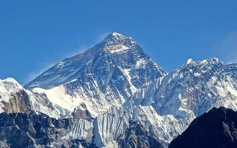
Mount Everest is the highest mountain above sea level on Earth, standing at an official elevation of 8,848.86 meters (29,031.7 ft). Straddling the international frontier between Nepal and China, it is known locally as Sagarmatha in Nepali ('Goddess of the Sky') and Chomolungma in Tibetan ('Mother Goddess of the World'). The peak rises into the extreme upper troposphere, where oxygen levels drop to barely one-third of sea-level pressure. Climbers face hurricane-force jet stream winds, severe frostbite conditions, shifting ice crevasses in the Khumbu Icefall, and the dangerous Death Zone above 8,000 meters.

K2
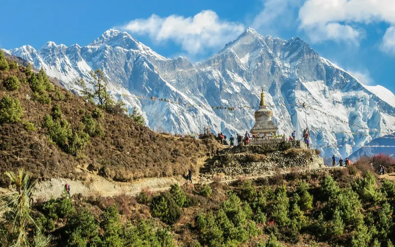
K2, at 8,611 meters (28,251 ft), is the second-highest mountain on Earth and widely regarded as the most technically demanding and lethal 8,000-meter peak. Located in the heart of the Karakoram on the border between Pakistan and China, K2 is characterized by sheer relief, severe weather anomalies, and persistent objective hazards including the notorious Bottleneck couloir.

Kangchenjunga
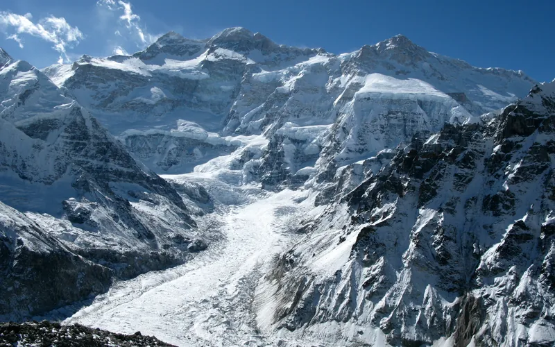
Kangchenjunga, at 8,586 meters (28,169 ft), is the third-highest mountain on Earth, rising on the border between Nepal and Sikkim, India. Honored as sacred by locals, early ascent teams respected local beliefs by stopping short of the actual highest crest. It features immense vertical relief and notorious storm cycles.
Lhotse
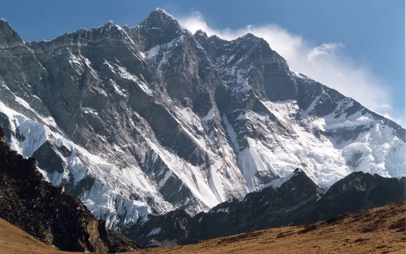
Lhotse, at 8,516 meters (27,940 ft), is the fourth-highest mountain on Earth, connected directly to Mount Everest via the South Col. Renowned for its sheer 3,200-meter South Face, one of the most imposing rock and ice walls in alpinism, the standard route tackles the grueling Lhotse Couloir from the Western Cwm.
Makalu
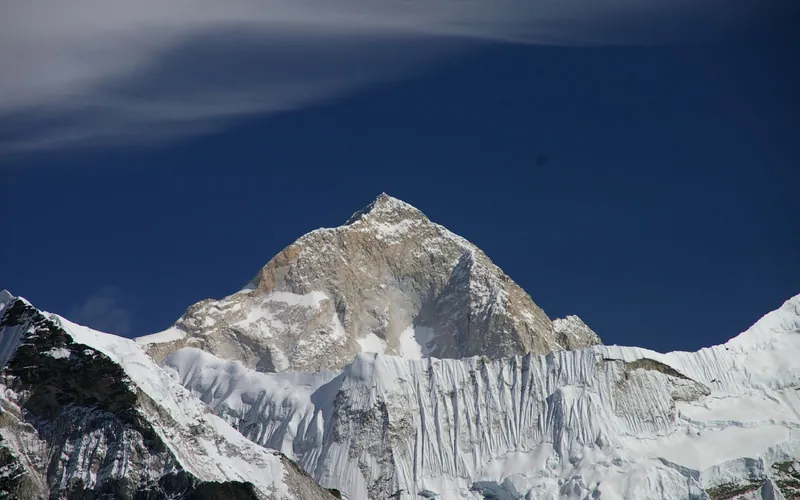
Makalu, at 8,485 meters (27,838 ft), is the fifth-highest mountain on Earth, located 19 km southeast of Mount Everest. An isolated four-sided granite pyramid, it is known for technical knife-edge ridges, severe exposure, and punishing weather, making it one of the most challenging eight-thousanders.
Cho Oyu
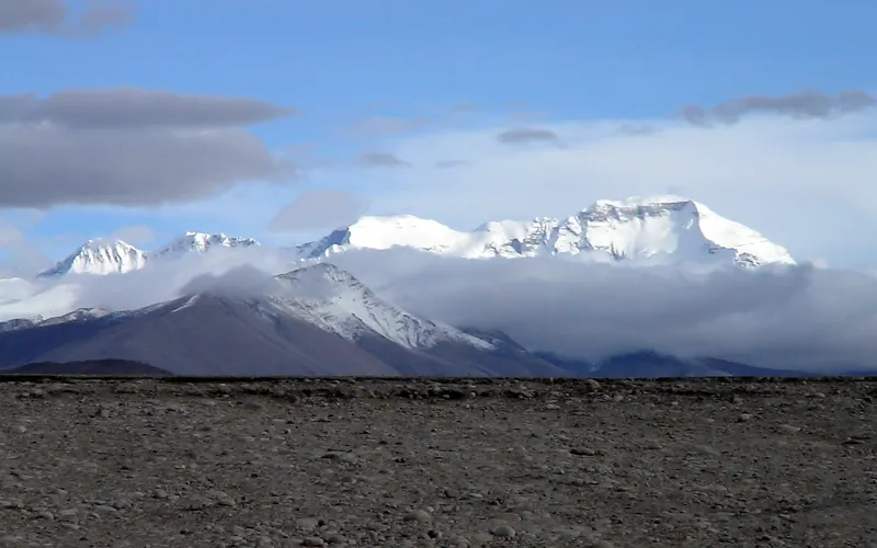
Cho Oyu, at 8,188 meters (26,864 ft), is the sixth-highest mountain in the world, situated 20 km west of Mount Everest. Meaning 'Turquoise Goddess' in Tibetan, it stands on the glaciated Nangpa La trade route between Nepal and Tibet. Its moderate northwest slopes make it the most accessible 8,000-meter peak.
Dhaulagiri I
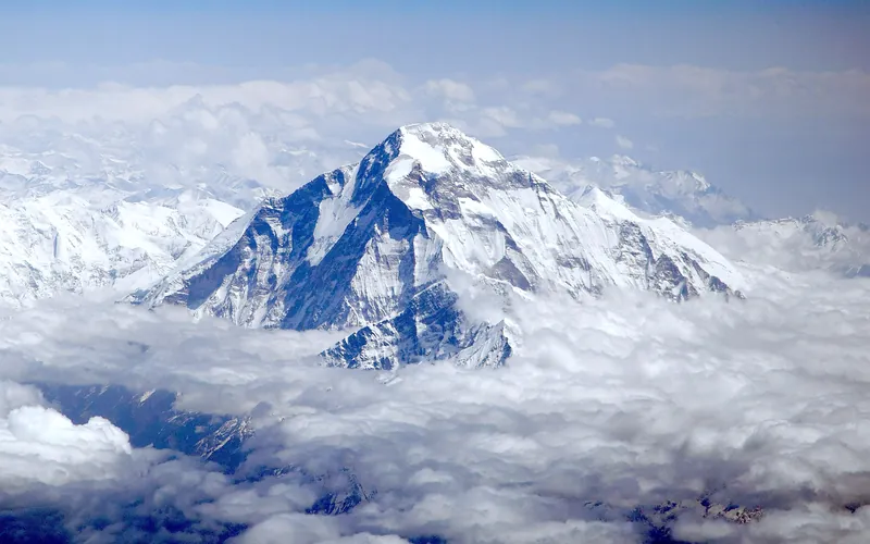
Dhaulagiri I, at 8,167 meters (26,795 ft), is the seventh-highest mountain on Earth and the highest peak situated entirely within Nepal. Rising steeply above the Kali Gandaki Gorge—the deepest gorge on Earth—opposite Annapurna, Dhaulagiri forms a staggering 7,000-meter vertical rise from the river valley.
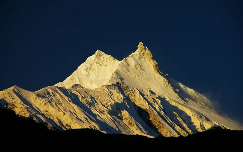
Manaslu
Manaslu, at 8,163 meters (26,781 ft), is the eighth-highest mountain in the world, situated in the Mansiri Himal of west-central Nepal. Known as the 'Mountain of the Spirit', its long ridges and valley glaciers offer dramatic topography culminating in a delicate, exposed knife-edge summit crest.
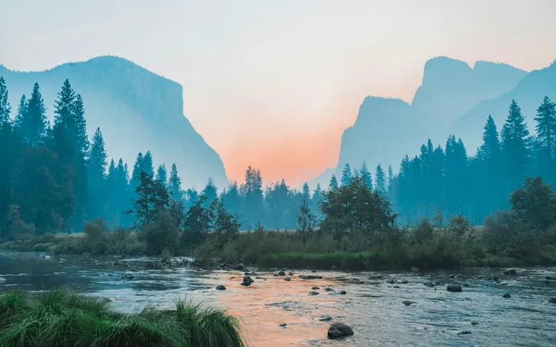
Nanga Parbat
Nanga Parbat, at 8,126 meters (26,660 ft), is the ninth-highest mountain on Earth and the western anchor of the Himalayas in Pakistan. It boasts the Rupal Face, the highest vertical precipice in the world at 4,600 meters from valley floor to summit. Known for profound climbing history, highlighted by Hermann Buhl's legendary solo summit without supplemental oxygen in 1953.
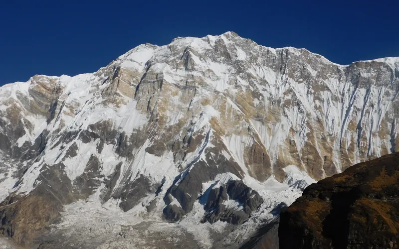
Annapurna I
Annapurna I, at 8,091 meters (26,545 ft), is the tenth-highest mountain in the world and historically the first 8,000-meter peak ever summited (June 3, 1950 by Maurice Herzog and Louis Lachenal). Rising above the Annapurna Sanctuary, its north and south walls present extreme avalanche and serac fall hazards.
Gasherbrum I
Gasherbrum I, at 8,068 meters (26,470 ft), is the eleventh-highest mountain in the world. Named 'Hidden Peak' by explorer William Martin Conway due to its concealment behind surrounding Karakoram giants, it stands on the border between Pakistan and China. The peak was first climbed in 1958 by an American team led by Nick Clinch, and in 1992 Nazir Sabir summited it with Rajab Shah and Mehrban Shah, marking his fourth Pakistani eight-thousander.
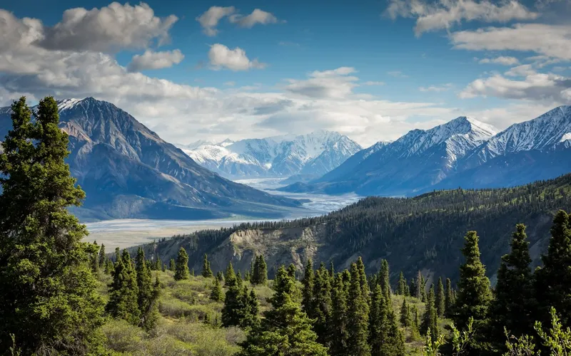
Broad Peak
Broad Peak, at 8,051 meters (26,414 ft), is the twelfth-highest mountain in the world. Located in the Karakoram directly across the Godwin-Austen Glacier from K2, it is famous for its 1.5-kilometre-long summit crest. First climbed in lightweight alpine style without supplemental oxygen or high-altitude porters in 1957 by an Austrian team.
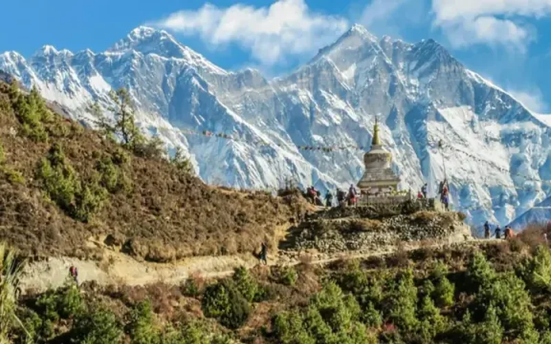
Gasherbrum II
Gasherbrum II, standing at 8,035 meters (26,362 ft), is the thirteenth-highest mountain on Earth and the third-highest peak of the Gasherbrum massif in the Karakoram. Located at the head of the Baltoro Glacier on the Pakistan-China frontier, it features a classic pyramidal profile with challenging ice couloirs. First summited in 1956 by an Austrian team, it was famously climbed in pure alpine style in 1982 by Reinhold Messner, Nazir Sabir, and Sher Khan.
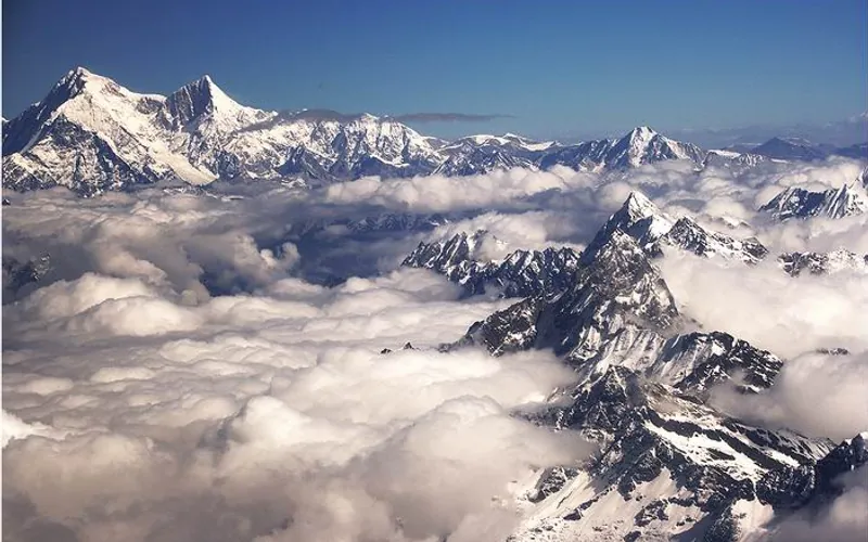
Shishapangma
Shishapangma, at 8,027 meters (26,335 ft), is the fourteenth-highest mountain on Earth and the only 8,000-meter peak situated entirely within Tibetan/Chinese territory. Due to geopolitical restrictions, it was the final eight-thousander to be climbed, summited by a Chinese expedition on May 2, 1964.