1930–1931 British Arctic Air Route Expedition (BAARE) Discovery of the Watkins Range
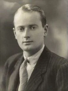
Led by 23-year-old Gino Watkins, the 1930–1931 British Arctic Air Route Expedition conducted the definitive scientific exploration of East Greenland. Using de Havilland Gipsy Moth aircraft and dog sleds, Watkins discovered the Watkins Range, discovered Gunnbjørn Fjeld (3,694 m), mapped the Schweizerland Alps, and surveyed potential transatlantic air corridors.
Mountain Safety & Conditions Disclaimer: High-altitude climbing, glacial travel, and technical ascents entail severe objective risks including avalanches, serac collapses, rapid weather collapse, and altitude illness. Historical route descriptions and summit claims on Mountanity reflect documented archival sources and must not be used as live operational safety assessments. Local regulations, permits, and physical glacial topography change continuously.
Peer Review: Senior Editorial Board & Historical Reviewers • Editorial Standards
Official Expedition Narrative & Archival Record
In July 1930, the sealer Quest sailed from London carrying fourteen young British scientists led by Henry George 'Gino' Watkins. The expedition's mission was to survey the meteorological and topographical feasibility of a Great Circle air route connecting Great Britain and Canada via the Greenland ice cap. Establishing Base Camp at Sermilik Fjord near Ammassalik, Watkins combined traditional Inuit dogsledging and hunting techniques with modern aviation, operating two Gipsy Moth floatplanes equipped with skis. During reconnaissance flights deep into the interior of King Christian IX Land, Watkins sighted an unknown, colossal cordillera of dark nunataks breaching the ice sheet—the Watkins Range—crowned by Gunnbjørn Fjeld, which superseded Petermann Peak as the highest mountain in the Arctic. Simultaneously, the expedition constructed Ice Cap Station, an isolated weather outpost at 2,620 metres on the Inland Ice, and carried out pioneering geological mapping led by Lawrence Wager, who discovered the famous Skaergaard intrusion. The expedition stands as one of the most brilliant and scientifically productive Arctic endeavours in history.
Documented Team Composition
- Henry George 'Gino' Watkins (Expedition Leader, UK)
- Augustine Courtauld (Surveyor & Meteorologist, UK)
- Lawrence Rickard Wager (Chief Geologist, UK)
- Alfred Stephenson (Chief Surveyor, UK)
- F. Spencer Chapman (Ornithologist & Photographer, UK)
- John Rymill (Surveyor, Australia)
- Quintin Riley (Meteorologist, UK)
Key Statistics & Topographic Figures
- Expedition Leader
- Henry George 'Gino' Watkins (age 23)
- Discovery
- Watkins Range & Gunnbjørn Fjeld
- Base Camp
- Sermilik Fjord, East Greenland
- Aircraft Deployed
- 2 de Havilland Gipsy Moth biplanes
- High Station
- Ice Cap Station (2,620 metres)
Archival Primary Source Quotations
“Watkins had the gift of leadership in supreme degree. He led without appearing to command, inspiring devotion and daring among all who followed him.”
Defined Alpine Terminology & Concepts
- Piteraq
- A ferocious cold katabatic wind that originates on the Greenland inland ice sheet and sweeps down coastal fjords with hurricane force.
- Inland Ice
- The vast continental ice sheet covering over 80 percent of Greenland, reaching thicknesses over three kilometres.
Frequently Asked Questions: 1930–1931 British Arctic Air Route Expedition (BAARE) Discovery of the Watkins Range
What was the primary goal of the British Arctic Air Route Expedition?
The expedition aimed to survey the meteorological and topographical viability of a transatlantic commercial air route connecting Britain and Canada via the Greenland ice cap.
What major geographical discovery was made during BAARE?
Expedition leader Gino Watkins discovered the Watkins Range, identifying Gunnbjørn Fjeld as the highest mountain north of the Arctic Circle.
How did Gino Watkins innovate Arctic exploration methodology?
Watkins combined indigenous Inuit hunting, seal-skin kayaking, and dog-sledging skills with modern aviation using two ski-equipped Gipsy Moth biplanes.
Ascent Route & Topography
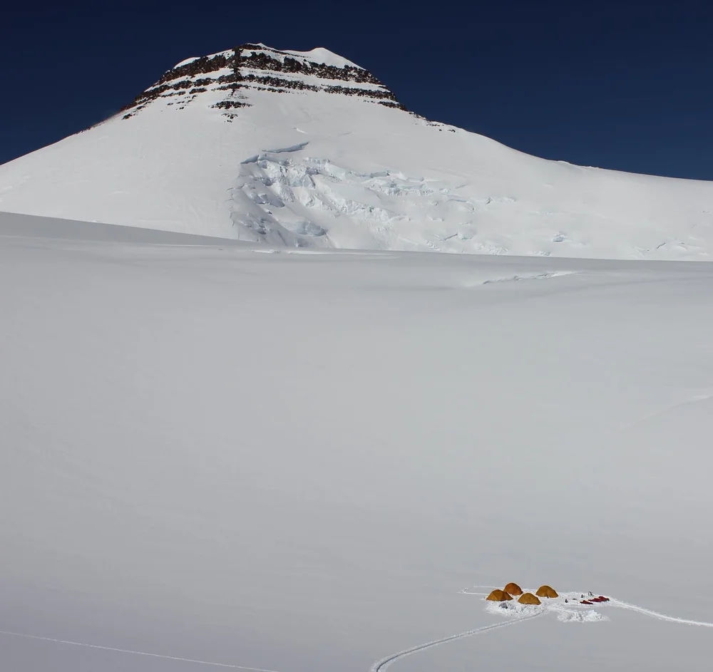
South Ridge Normal Route of Gunnbjørn Fjeld
The South Ridge Normal Route on Gunnbjørn Fjeld ascends from the upper glaciated basin of the Watkins Range to follow a broad, windswept snow and ice ramp onto the narrow summit ridge. First climbed on August 16, 1935, by Lawrence Wager, Ebbe Munck, Jack Longland, and Patrick Courtauld, it is the classic line to the highest summit in the Arctic. Although technical difficulties are modest (Grade II alpine snow up to 35 degrees), climbers must manage severe Arctic cold, hidden crevasses, and utter remote wilderness where rescue by ski-equipped aircraft is weather-dependent.
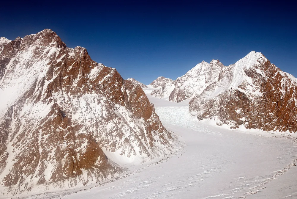
Northeast Ridge & Summit Ice Dome of Mount Forel
The Northeast Ridge of Mount Forel ascends glaciated slopes from the Schweizerland plateau before tackling the steep, crevassed approach to the mountain's prominent summit ice dome. First reconnoitred by Gino Watkins and Alfred Stephenson in 1931 and climbed to the apex by André Roch's Swiss expedition in 1938, this route combines alpine glacier route-finding with 45-degree ice climbing over the final rim to reach the top. Climbers face ferocious coastal Greenland storms and complex crevasse fields.
Target Objective Peaks
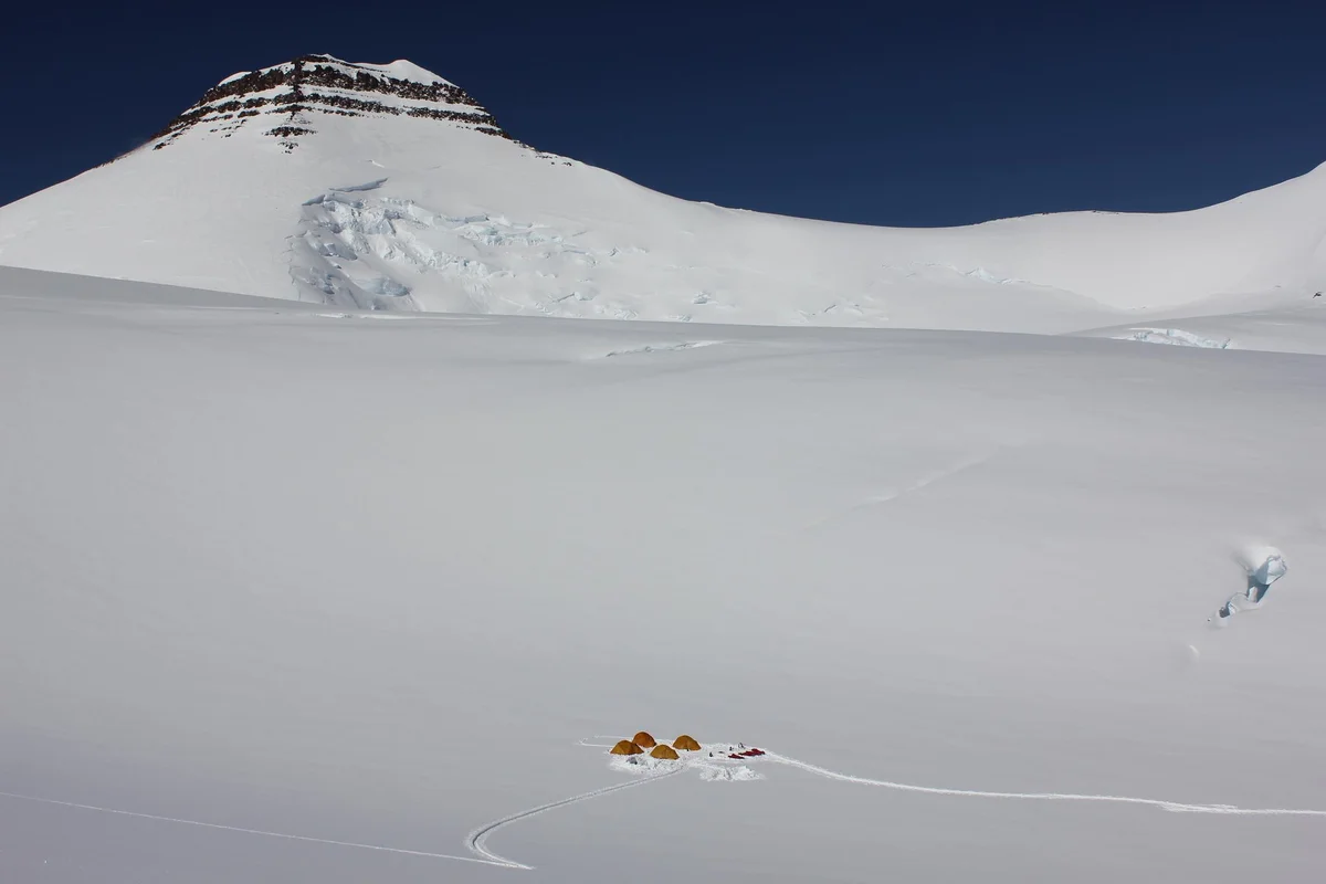

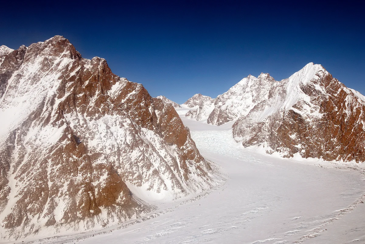
Gunnbjørn Fjeld
Gunnbjørn Fjeld is the highest mountain in Greenland and the highest peak north of the Arctic Circle at 3,694 metres (12,119 ft). Rising as an enormous basaltic nunatak above the glaciated plateau of the Watkins Range in East Greenland, it was first sighted from the air in 1930 by Gino Watkins and named after the 9th-century Norse explorer Gunnbjørn Ulfsson. The maiden first ascent was achieved on August 16, 1935, by Lawrence Wager, Ebbe Munck, Jack Longland, and Patrick Courtauld during an Anglo-Danish expedition. Climbing Gunnbjørn Fjeld involves moderate alpine glacier ascents, but requires complete self-reliance against extreme polar gales, severe windchill, and isolated Arctic conditions.
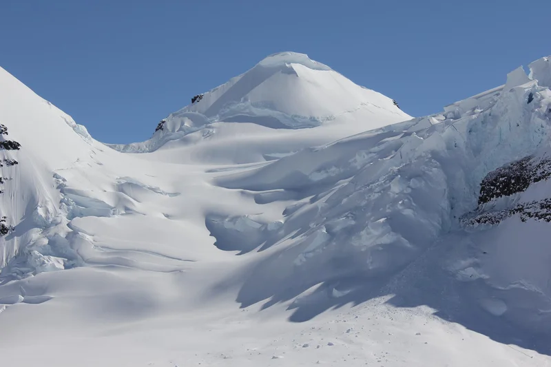
Mount Forel
Mount Forel is a magnificent glaciated dome summit standing at 3,383 metres (11,099 ft) in the Schweizerland Alps of East Greenland, just north of the Arctic Circle. It is the highest mountain in Greenland outside the Watkins Range. Named in 1912 by Swiss explorer Alfred de Quervain in honor of limnologist François-Alphonse Forel, the mountain was famously explored by Gino Watkins and Alfred Stephenson in 1931, before being conquered on its first ascent by André Roch's Swiss expedition in 1938. The peak is renowned for its perpetual summit ice dome and sweeping views across the Sermilik fjord and coastal glacier systems.
Featured Expedition Climbers
Augustine Courtauld
Augustine Courtauld was born on August 26, 1904, in Braintree, Essex, England, into the prominent Courtauld industrial and textile family. Educated at Charterhouse and Trinity College, Cambridge, Courtauld developed formidable seamanship as a competitive deep-sea yachtsman and joined James Wordie's 1926 expedition to East Greenland and 1929 expedition to Jan Mayen, mastering Arctic maritime navigation and survival. In 1930, Courtauld joined Gino Watkins' British Arctic Air Route Expedition as surveyor and meteorologist. To obtain vital year-round meteorological data for proposed North Atlantic commercial air routes, the expedition constructed an isolated weather station—Ice Cap Station—perched at 2,620 metres elevation on the crest of the Greenland Inland Ice. When winter reliefs were threatened by savage blizzards, Courtauld volunteered on December 6, 1930, to man the station entirely alone for the winter. Over the ensuing five months, brutal polar blizzards completely buried the small dome tent beneath snow and rime. Courtauld's ventilation pipe froze, his kerosene supplies dwindled, and on March 22, 1931, the entrance tunnel collapsed, entombing him in utter darkness beneath the ice sheet. For six weeks in total silence, rationing food in sub-zero cold, Courtauld maintained his calm resolve until May 5, 1931, when Watkins, Chapman, and Rymill located the buried station's protruding vent pipe and dug him out alive and in high spirits. Courtauld received the Polar Medal with Arctic Clasp in 1932. In 1935, he helped finance and plan the Anglo-Danish Expedition led by Lawrence Wager that conquered Gunnbjørn Fjeld. He served in the Royal Navy during World War II and authored 'Man the Mountain: An Anthology of Mount Exploration'. Courtauld died on March 3, 1959, at age 54, commemorated by Mount Augustine in East Greenland.
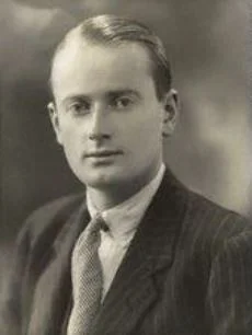
Gino Watkins
Henry George 'Gino' Watkins was born on January 29, 1907, in London, England. Educated at Lancing College and Trinity College, Cambridge, Watkins developed an early passion for mountaineering and polar survival under the mentorship of polar veteran James Wordie. Possessing extraordinary leadership qualities, personal charm, and an instinctive mastery of indigenous Inuit hunting techniques, Watkins organized and led his first Arctic expedition to Edgeøya, Svalbard, in 1927 at just twenty years of age. In 1930, Watkins conceived and directed the ambitious British Arctic Air Route Expedition (BAARE) to East Greenland. Supported by the Royal Geographical Society, the expedition aimed to survey the feasibility of a transatlantic air route linking Britain to Canada via the Arctic ice sheet. Operating from a coastal base near Ammassalik, Watkins utilized two de Havilland Gipsy Moth biplanes, dog-sled teams, and Inuit kayaks. Flying reconnaissance missions deep over King Christian IX Land, Watkins discovered an immense, uncharted mountain range protruding through the inland ice—later officially designated the Watkins Range, containing the highest summits in the entire Arctic. In 1931, Watkins, alongside surveyor Alfred Stephenson, mounted a bold attempt to climb Mount Forel (3,383 m) in the Schweizerland Alps, reaching the high ice dome before being turned back by crevasses. In August 1932, while leading the East Greenland Expedition at Lake Fjord to continue meteorological surveys for Pan American Airways, Watkins went hunting alone in his seal-skin kayak. His empty kayak and clothing were found floating among sea ice; his body was never recovered. Watkins died on August 20, 1932, at age 25, mourned worldwide as one of Britain's most gifted and inspiring polar leaders.
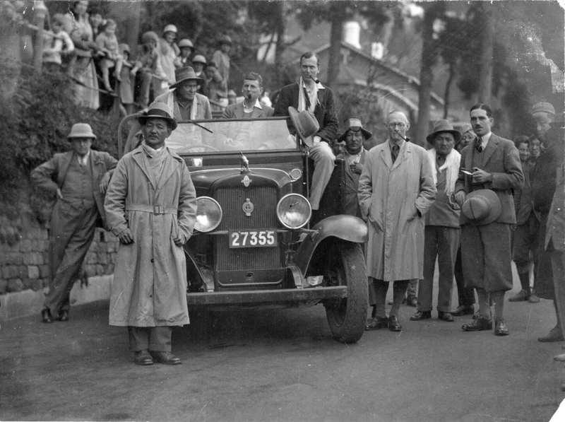
Lawrence Wager
Lawrence Rickard Wager was born on February 5, 1904, in Batley, Yorkshire, England. An exceptionally gifted student of natural sciences, Wager earned first-class honours in geology from Pembroke College, Cambridge. He quickly established himself as one of Britain's most formidable alpine climbers, honing his rock and ice skills in the Lake District, Wales, and the Alps. In 1930, Wager was appointed chief geologist on Gino Watkins' British Arctic Air Route Expedition to East Greenland. Over fourteen months of rigorous fieldwork, Wager carried out landmark geological surveys of the coastal layered igneous formations, discovering the world-renowned Skaergaard intrusion in Kangerlussuaq Fjord—a geological marvel that remains one of the world's most studied magma chamber sequences. In 1933, Wager was selected for Hugh Ruttledge's fourth British Mount Everest Expedition. On May 30, 1933, Wager and Percy Wyn-Harris made a legendary summit bid on the North Face of Everest, climbing above 8,500 metres without supplementary oxygen. Near the First Step, Wager discovered Andrew Irvine's ice axe from the fateful 1924 expedition. Wager and Wyn-Harris pushed to an altitude of approximately 8,570 metres—matching Edward Norton's 1924 world altitude record—before being turned back by treacherous sloping snow slabs in the Great Couloir. In 1935, Wager returned to Greenland to co-lead the Anglo-Danish Expedition alongside Ebbe Munck. Navigating through sea ice in the sealer 'Quest', the expedition ventured into the unexplored Watkins Range. On August 16, 1935, Wager, Munck, Jack Longland, and Patrick Courtauld achieved the maiden first ascent of Gunnbjørn Fjeld (3,694 m), conquering the roof of the Arctic. Wager was later elected a Fellow of the Royal Society and served as Professor of Geology at Oxford University until his death on November 20, 1965.
Associated Historical Chronicles & Stories
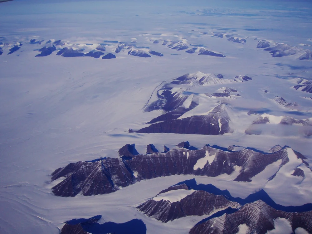
Wings Over the Ice Cap: The 1930 Watkins BAARE Expedition
Gino Watkins and his band of young British explorers take Gipsy Moth biplanes and dog sleds into East Greenland, discovering the Arctic's highest summits.
Documented Sources & Archival Citations
- The British Arctic Air Route Expedition(H. G. Watkins / The Geographical Journal)
Supporting claim: Comprehensive scientific expedition report
Accessed/Documented: 1932