Chopicalqui
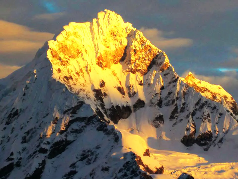
Chopicalqui is a magnificent 6,354-metre glaciated peak rising in the heart of Peru's Cordillera Blanca between Huascarán and Yanapaccha. First summited on August 3, 1932, by Erwin Schneider, Philipp Borchers, and Hermann Hoerlin, it is celebrated for its elegant Southwest Ridge route.

Mountain Safety & Conditions Disclaimer: High-altitude climbing, glacial travel, and technical ascents entail severe objective risks including avalanches, serac collapses, rapid weather collapse, and altitude illness. Historical route descriptions and summit claims on Mountanity reflect documented archival sources and must not be used as live operational safety assessments. Local regulations, permits, and physical glacial topography change continuously.
Peer Review: Senior Editorial Board & Historical Reviewers • Editorial Standards
Geographical Setting & Topography
Forming an eastern rampart of the Huascarán massif within Huascarán National Park, Chopicalqui stands above the spectacular Llanganuco valley and the Portachuelo de Llanganuco pass. It is separated from Huascarán Sur by a high glaciated col and feeds the Ancush and Llanganuco glacier systems.
Historic First Ascent
Date: 1932-08-03
Ascent Team: Erwin Schneider, Philipp Borchers, and Hermann Hoerlin
Key Statistics & Topographic Figures
- Elevation
- 6,354 m (20,846 ft)
- Prominence
- 584 m
- First Ascent Date
- August 3, 1932 (Schneider, Borchers, Hoerlin)
- Classic Route
- Southwest Ridge (AD, 50° snow)
- High Camp Elevation
- 5,600 m (Southwest Col)
Archival Primary Source Quotations
“Chopicalqui is a mountain sculpted by winds and glaciers into an alpine masterpiece of crystalline purity.”
Defined Alpine Terminology & Concepts
- Knife-Edge Arête
- A sharp, narrow mountain ridge of rock or hard snow formed by the intersecting headwalls of parallel glaciers.
- Portachuelo de Llanganuco
- A high vehicular pass at 4,767 metres providing access between the Callejón de Huaylas and the eastern valleys of the Cordillera Blanca.
Chopicalqui Mountain Weather Forecast
Detailed 14-Day Summit Window & Weather Timeline
Explore day-by-day summit push safety windows, wind shear analysis, and extended multi-day forecasts for Chopicalqui.
Explore Chopicalqui (6,354 m) in Interactive 3D
Inspect steep glacial walls, hanging seracs, ridge approaches, and elevation relief with 360° rotation and terrain tilt in WebGL.
Documented Climbing Routes (1)
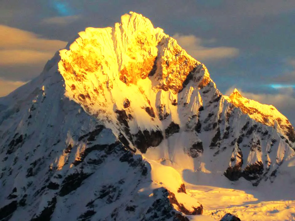
Chopicalqui Southwest Ridge
The Southwest Ridge of Chopicalqui is one of the most aesthetic and popular high-altitude ridge climbs in the Cordillera Blanca. First scaled in August 1932 by Erwin Schneider, Philipp Borchers, and Hermann Hoerlin, the line rises along a soaring glaciated crest from the col above Quebrada Llanganuco. Climbers must overcome exposed knife-edge snow arêtes, bergschrund crossings, and a dramatic final summit mushroom at 6,354 metres.
Historical Expeditions (1)
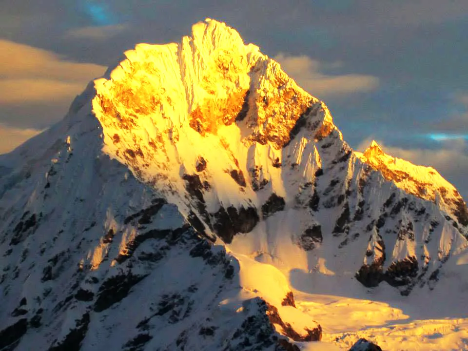
1932 Schneider Chopicalqui Historic First Ascent Expedition
On August 3, 1932, Austrian mountaineer Erwin Schneider, Philipp Borchers, and Hermann Hoerlin made the historic first ascent of Nevado Chopicalqui (6,354 m) in Peru's Cordillera Blanca. Pioneering the elegant Southwest Ridge line from Quebrada Llanganuco, the climbers negotiated razor-sharp snow arêtes and fragile summit cornices to unlock one of the Andes' most aesthetic summits.
Summit Chronicles & Stories (1)
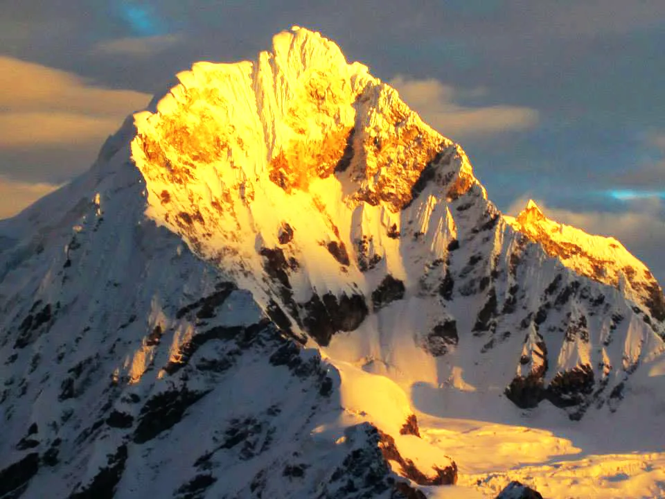
The Knife-Edge of Llanganuco: Erwin Schneider's 1932 Triumph on Chopicalqui
Just two weeks after conquering Huascarán Sur, Erwin Schneider, Philipp Borchers, and Hermann Hoerlin pioneered the razor-sharp Southwest Ridge of Chopicalqui (6,354 m).
Frequently Asked Questions: Chopicalqui
What is the elevation of Nevado Chopicalqui?
Nevado Chopicalqui rises to 6,354 metres (20,846 ft) in the central Cordillera Blanca of Peru.
Who made the first ascent of Chopicalqui?
Austrian topographer Erwin Schneider, German expedition leader Philipp Borchers, and physicist Hermann Hoerlin made the first ascent on August 3, 1932.
What is the standard climbing route on Chopicalqui?
The standard route is the classic Southwest Ridge (graded AD), celebrated for sharp snow arêtes, bergschrund crossings, and aesthetic ridge walking.
Where do climbers establish camps on Chopicalqui?
Climbers typically use Base Camp in Quebrada Llanganuco (4,200 m), Moraine Camp (4,900 m), and High Camp on the Southwest Col (5,600 m).
Why is Chopicalqui considered one of the classic 6,000-metre peaks in Peru?
It offers moderate technical difficulty, relatively straightforward glacier access from Yungay, and extraordinary panoramic views of Huascarán and Chacraraju.
Documented Sources & Archival Citations
- Die Weiße Kordillere(Philipp Borchers / Verlag F. Bruckmann)
Supporting claim: Official expedition chronicle of the 1932 DÖAV first ascent of Chopicalqui
Accessed/Documented: 2026 - Classic Climbs of the Cordillera Blanca(Brad Johnson / The Mountaineers Books)
Supporting claim: Technical route description and topographical survey of the Southwest Ridge
Accessed/Documented: 2026