North Col & Northeast Ridge Route
The historic northern route on Mount Everest (8,848. 86m), ascending from the Rongbuk and East Rongbuk glaciers to breach the icy wall of the North Col (7,020m).
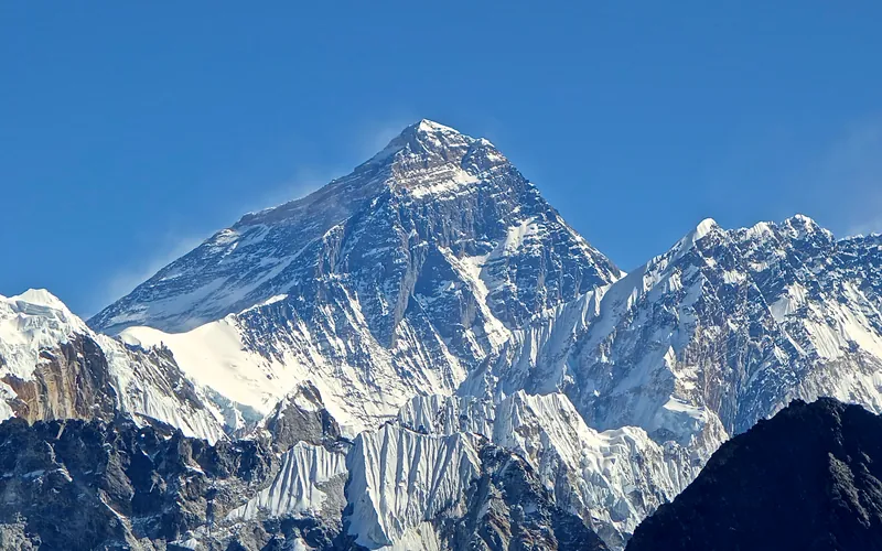
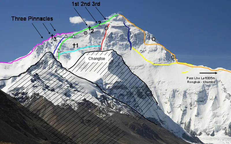
Ascent line, technical cruxes & camp topography profile for North Col & Northeast Ridge Route
Mountain Safety & Conditions Disclaimer: High-altitude climbing, glacial travel, and technical ascents entail severe objective risks including avalanches, serac collapses, rapid weather collapse, and altitude illness. Historical route descriptions and summit claims on Mountanity reflect documented archival sources and must not be used as live operational safety assessments. Local regulations, permits, and physical glacial topography change continuously.
Peer Review: Senior Editorial Board & Historical Reviewers • Editorial Standards
Tactical & Camp Notes
Unlike the snow-draped Southeast Ridge in Nepal, the North Route is severely dry and rocky, exposed directly to Siberian jet stream gales exceeding 100 mph. The infamous Second Step represents the premier technical climbing crux of Everest.
Identified Objective Hazards
- •Severe exposure to arctic jet stream winds exceeding 120 km/h on the open North Ridge
- •Extreme technical rock climbing at extreme altitude above 8,600 meters in the Death Zone
- •Shattered, down-sloping limestone rock ledges ('the tiles') prone to fatal slips
- •Acute hypoxia and rapid cerebral and pulmonary edema without supplemental oxygen
Historical Context
The route of the early British reconnaissance expeditions (1921, 1922, 1924) and the setting of the greatest mystery in mountaineering: whether Mallory and Irvine reached the summit before dying in 1924.
Interactive Elevation Profile
Vertical profile, technical cruxes, and camp staging progression for North Col & Northeast Ridge Route on Mount Everest.
Located on open gravel plains near the historic Rongbuk Monastery, with direct panoramic vistas of Everest's immense North Face.
Camp-by-Camp Topography
Key staging altitudes, technical cruxes, and terrain transitions for North Col & Northeast Ridge Route.
North Base Camp (Rongbuk)
Located on open gravel plains near the historic Rongbuk Monastery, with direct panoramic vistas of Everest's immense North Face.
Advanced Base Camp (ABC)
Pitched at the head of the East Rongbuk Glacier directly beneath the towering serac wall of the North Col.
Camp I (North Col)
A wind-scoured snow saddle linking Mount Everest to Changtse (North Peak), reached via steep 50-degree ice gullies.
Camp II
Established on wind-scoured rock ledges on the lower Northwest Ridge, entering the transition toward the Death Zone.
Camp III (Assault Camp)
Perched on precarious sloping gravel ledges beneath the Yellow Band, the staging point for midnight summit assaults.
First Step
A prominent outcrop of jagged limestone boulders along the Northeast Ridge requiring awkward rock moves.
Second Step
A terrifying 30-meter vertical limestone cliff. Its final 5-meter overhanging headwall was scaled by Qu Yinhua barefoot in 1960 and is now climbed via an aluminum ladder fixed by Chinese mountaineers in 1975.
Third Step
The final steep rock buttress along the ridge leading out onto the upper summit snow pyramid.
Summit
The highest geographic point on Earth, a corniced snow ridge overlooking Tibet and Nepal.
Topographic Location & Terrain Map
Cartographic datum, massif coordinates, and terrain context for North Col & Northeast Ridge Route on Mount Everest.
Interactive Topographic Terrain Map
Click below to load live cartographic contours, glacier approaches, and geographic markers for Mount Everest (27°59′17″ N, 86°55′30″ E).
Key Statistics & Topographic Figures
- Route Type
- Historic Ridge & High-Altitude Mixed Traverse
Topography
- Technical Difficulty
- Extremely Demanding / Grade V, Severe High-Altitude Technical Crux
UIAA IV rock slabs, 45°–55° ice, Yellow Band traverses, Second Step crux
- Country / Region
- China (Tibet / Tingri County)
Location
Archival Primary Source Quotations
“A mountain route is not merely a path of rock and ice; it is a test of human endurance, judgment, and humility.”
Defined Alpine Terminology & Concepts
- Crux
- The most difficult and technically demanding pitch or section of a climbing route.
- Normal Route (Voie Normale)
- The most frequently climbed, least technical, and historically standard path to a mountain summit.
Frequently Asked Questions: North Col & Northeast Ridge Route
What is the climbing difficulty and grade of North Col & Northeast Ridge Route?
North Col & Northeast Ridge Route on mount-everest is graded as Extremely Demanding / Grade V, Severe High-Altitude Technical Crux, with technical climbing requirements including UIAA IV rock slabs, 45°–55° ice, Yellow Band traverses, Second Step crux.
What are the primary hazards on the North Col & Northeast Ridge Route?
Climbers on North Col & Northeast Ridge Route must navigate severe objective hazards including Severe exposure to arctic jet stream winds exceeding 120 km/h on the open North Ridge, Extreme technical rock climbing at extreme altitude above 8,600 meters in the Death Zone, Shattered, down-sloping limestone rock ledges ('the tiles') prone to fatal slips, Acute hypoxia and rapid cerebral and pulmonary edema without supplemental oxygen.
What camps are established on North Col & Northeast Ridge Route?
North Col & Northeast Ridge Route typically features 9 staging camps, progressing from North Base Camp (Rongbuk) (5200m) up toward the summit.
Mountain Ascended
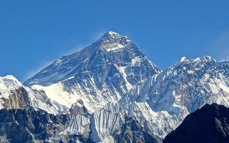


Mount Everest
Mount Everest is the highest mountain above sea level on Earth, standing at an official elevation of 8,848.86 meters (29,031.7 ft). Straddling the international frontier between Nepal and China, it is known locally as Sagarmatha in Nepali ('Goddess of the Sky') and Chomolungma in Tibetan ('Mother Goddess of the World'). The peak rises into the extreme upper troposphere, where oxygen levels drop to barely one-third of sea-level pressure. Climbers face hurricane-force jet stream winds, severe frostbite conditions, shifting ice crevasses in the Khumbu Icefall, and the dangerous Death Zone above 8,000 meters.
Documented Expeditions on this Route (2)
Verified historical summits, siege campaigns, and pioneer attempts recorded on North Col & Northeast Ridge Route.
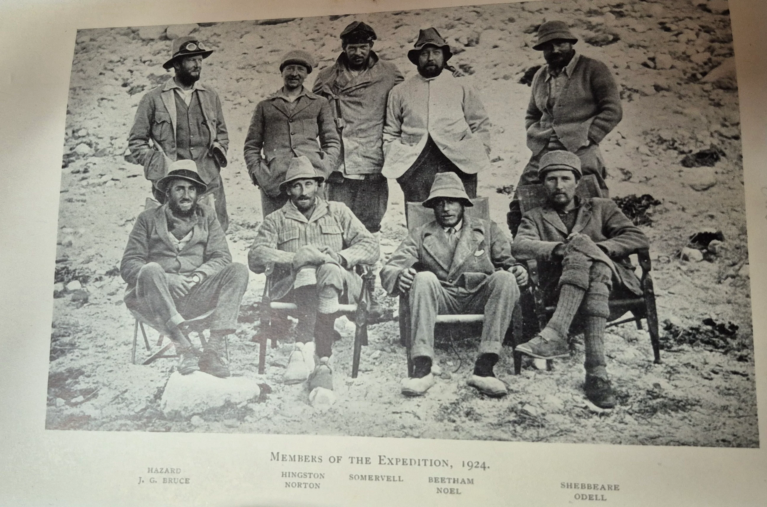
1924 British Mount Everest Expedition
The third British expedition to Mount Everest, marked by Edward Norton reaching 8,570m without supplemental oxygen and the tragic disappearance of George Mallory and Andrew Irvine high on the Northeast Ridge on June 8, 1924.
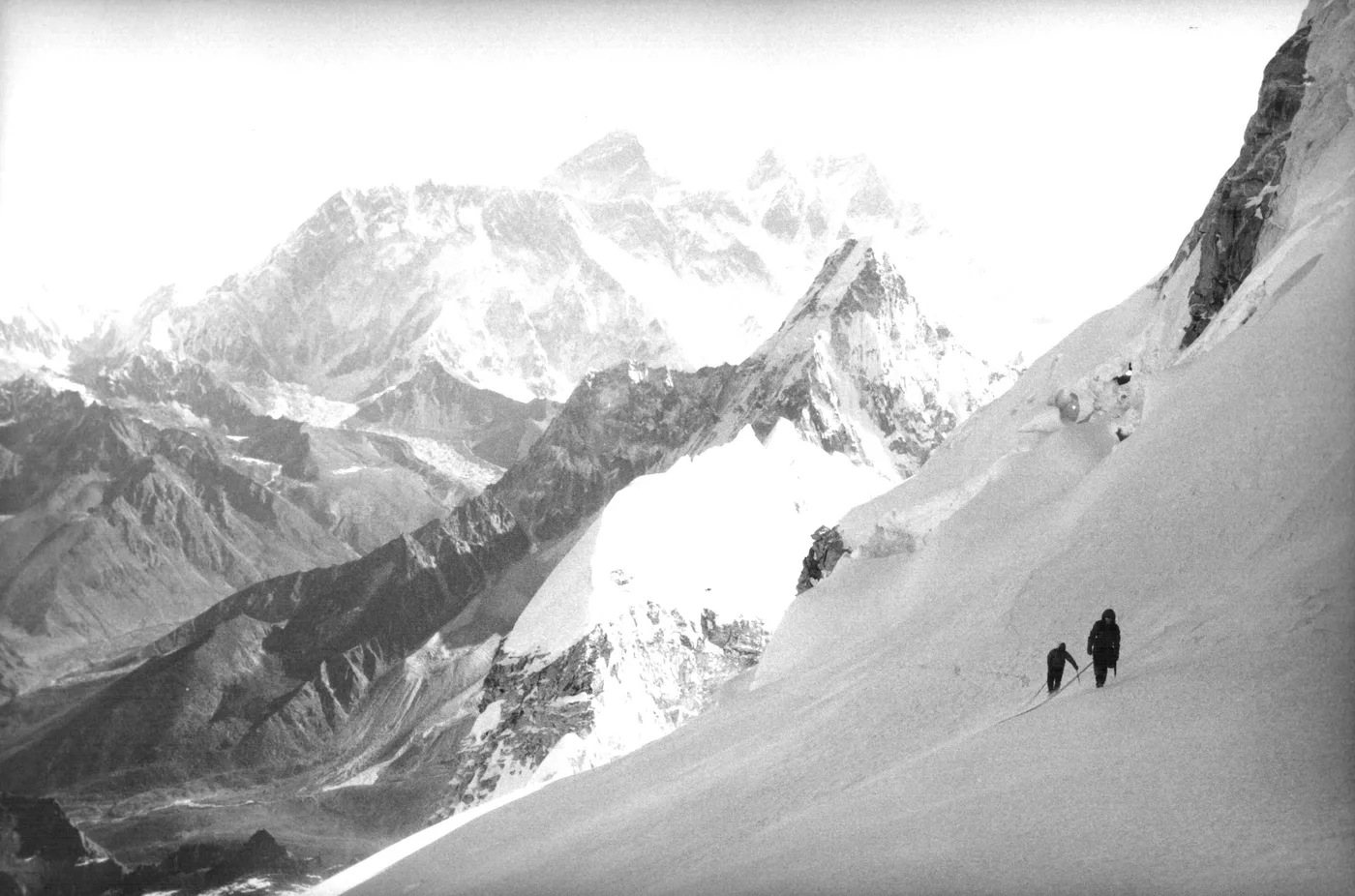
1995 Alison Hargreaves Mount Everest Solo Expedition
The groundbreaking spring 1995 solo expedition in which British mountaineer Alison Hargreaves became the first woman in history to summit Mount Everest alone, unsupported, and without supplemental oxygen or Sherpa assistance via the North Col and Northeast Ridge.
Archival Chronicles & Stories on this Route (3)
In-depth longform historical narratives, harrowing survival accounts, and firsthand alpine journals on North Col & Northeast Ridge Route.
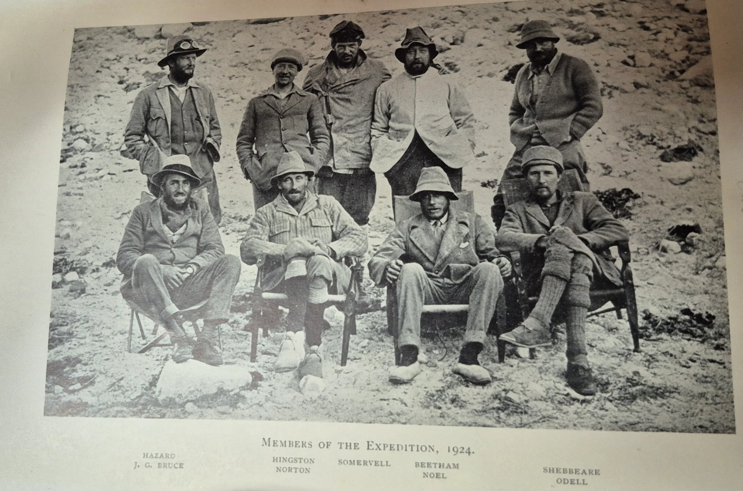
Everest 1924: Mallory, Irvine, and the Enduring Riddle of the Second Step
On June 8, 1924, George Leigh Mallory and Andrew 'Sandy' Irvine were seen 'going strong for the top' before vanishing into swirling clouds near the Second Step of Mount Everest, igniting a century-long quest for truth.
Alone at 8,570 Meters: Edward Norton's 1924 Everest Record That Stood for 54 Years
On June 4, 1924, British officer Edward Norton traversed solo into the Great Couloir of Everest to reach 8,570 meters without supplemental oxygen, setting a world record that stood unbroken until 1978.
Everest 1995: Alison Hargreaves' Pure Solo Ascent Without Oxygen
On May 13, 1995, British mountaineer Alison Hargreaves made history as the first woman to summit Mount Everest solo, unsupported, and without supplemental oxygen via the North Ridge.
Documented Sources & Archival Citations
- The Fight for Everest: 1924(E.F. Norton / Edward Arnold & Co.)
Supporting claim: Official expedition record detailing the establishment of camps on the North Col and high ridge
Accessed/Documented: 1925 - The Ghosts of Everest: The Search for Mallory & Irvine(Jochen Hemmleb, Larry A. Johnson, Eric R. Simonson / Mountaineers Books)
Supporting claim: Modern forensic reconstruction of the North Ridge route and discovery of Mallory's body
Accessed/Documented: 1999