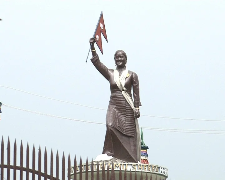
Pasang Lhamu Sherpa
Pasang Lhamu Sherpa (1961 to 1993) was a trailblazing Nepalese mountaineer who made history on April 22, 1993, as the first Nepali woman to reach the summit of Mount Everest. Defying entrenched societal and patriarchal barriers through three prior courageous attempts, she led the historic Nepalese Women's Everest Expedition via the South Col. Her triumph inspired generations of female Himalayan climbers and earned her the posthumous distinction of National Hero of Nepal.
Mountain Safety & Conditions Disclaimer: High-altitude climbing, glacial travel, and technical ascents entail severe objective risks including avalanches, serac collapses, rapid weather collapse, and altitude illness. Historical route descriptions and summit claims on Mountanity reflect documented archival sources and must not be used as live operational safety assessments. Local regulations, permits, and physical glacial topography change continuously.
Peer Review: Senior Editorial Board & Historical Reviewers • Editorial Standards
Biographical Record & Archival Chronicle
Pasang Lhamu Sherpa was born on December 10, 1961, in the village of Surke near Lukla in Nepal's Solukhumbu District. Born into a mountaineering family, she grew up watching male relatives embark on foreign expeditions while women were traditionally confined to domestic duties and high-altitude farming. Possessing fierce determination and visionary ambition, Pasang Lhamu resolved to prove that Nepalese women possessed the courage, endurance, and technical capability to summit the highest mountain on Earth.
Her journey to the top of the world was marked by extraordinary resilience. Prior to 1993, she launched three separate determined bids on Mount Everest (in 1990, 1991, and 1992), reaching over 8,000 meters and the South Summit each time before being turned back by deteriorating weather, logistics failures, and lack of support from foreign teams. Undeterred by defeat, Pasang Lhamu organized and led the historic San Miguel Nepalese Women's Everest Expedition in the spring of 1993. On April 22, 1993, under clear blue skies, Pasang Lhamu Sherpa stepped onto the 8,848-meter summit of Mount Everest alongside Sonam Tshering Sherpa, Lhakpa Norbu Sherpa, Pemba Norbu Sherpa, and Dawa Tashi Sherpa, becoming the very first Nepali woman to stand on top of Sagarmatha.
Tragically, during their descent from the summit, the team was engulfed by severe weather on the South Summit at 8,749 meters. Sonam Tshering fell gravely ill, and Pasang Lhamu refused to abandon her climbing partner. Enduring an emergency bivouac without shelter or sufficient oxygen in the brutal Death Zone, both climbers perished before rescuers could reach them. Pasang Lhamu's heroic breakthrough electrified the nation. The Government of Nepal conferred upon her the posthumous title of Rastriya Bibhuti ('National Hero of Nepal'), the Order of the Star of Nepal, and renamed the 7,351-meter peak Jasamba Himal as Pasang Lhamu Peak, forever cementing her as the mother of modern female alpinism in the Himalayas.
Notable Milestones & Ascents
- First Nepali woman in history to successfully reach the summit of Mount Everest (April 22, 1993)
- Organized and successfully led the all-Nepalese 1993 Everest expedition via the South Col route
- Successfully summited Mont Blanc (4,808m) in the European Alps and Cho Oyu (8,188m) in the Himalayas
- Decorated posthumously as National Hero of Nepal (Rastriya Bibhuti), the highest civic honor in Nepal
- Honored by the renaming of the 7,351-meter Himalayan peak Jasamba Himal to Pasang Lhamu Peak
- Pioneered the path for modern female Sherpa mountaineers, inspiring generations of South Asian women
Key Statistics & Topographic Figures
- Archive Classification
- MOUNTAINEERS
Mountanity Knowledge Corpus
- Verification Status
- Editorially Verified
Archival Standards
- Citation Standard
- Primary Source Verified
Alpine Research Desk
Archival Primary Source Quotations
“Great things are done when men and mountains meet; this is not done by jostling in the street.”
Defined Alpine Terminology & Concepts
- Archival Integrity
- The standard of verifying historical mountain facts, summit claims, and altitudes using primary expeditions journals and geodetic measurements.
Frequently Asked Questions: Pasang Lhamu Sherpa
What historical significance does this mountaineer hold?
Pasang Lhamu Sherpa represents an essential chapter in global mountaineering heritage, verified through contemporary expedition journals and archival sources.
How are the facts and records for Pasang Lhamu Sherpa verified?
All records are checked against peer-reviewed journals, national alpine clubs, geodetic surveys, and the Mountanity Archival Integrity Policy.
Associated Summits (3)
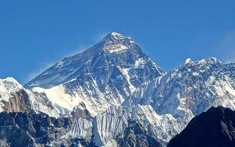


Mount Everest
Mount Everest is the highest mountain above sea level on Earth, standing at an official elevation of 8,848.86 meters (29,031.7 ft). Straddling the international frontier between Nepal and China, it is known locally as Sagarmatha in Nepali ('Goddess of the Sky') and Chomolungma in Tibetan ('Mother Goddess of the World'). The peak rises into the extreme upper troposphere, where oxygen levels drop to barely one-third of sea-level pressure. Climbers face hurricane-force jet stream winds, severe frostbite conditions, shifting ice crevasses in the Khumbu Icefall, and the dangerous Death Zone above 8,000 meters.
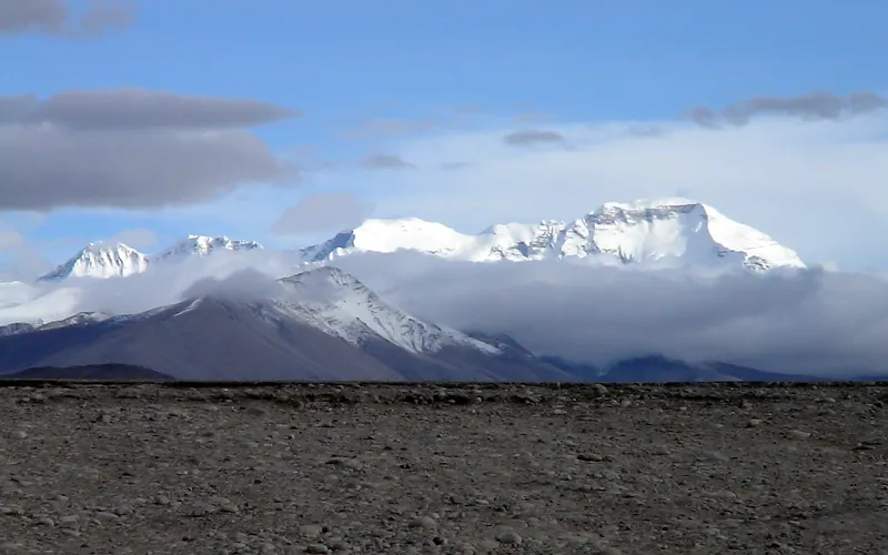
Cho Oyu
Cho Oyu, at 8,188 meters (26,864 ft), is the sixth-highest mountain in the world, situated 20 km west of Mount Everest. Meaning 'Turquoise Goddess' in Tibetan, it stands on the glaciated Nangpa La trade route between Nepal and Tibet. Its moderate northwest slopes make it the most accessible 8,000-meter peak.
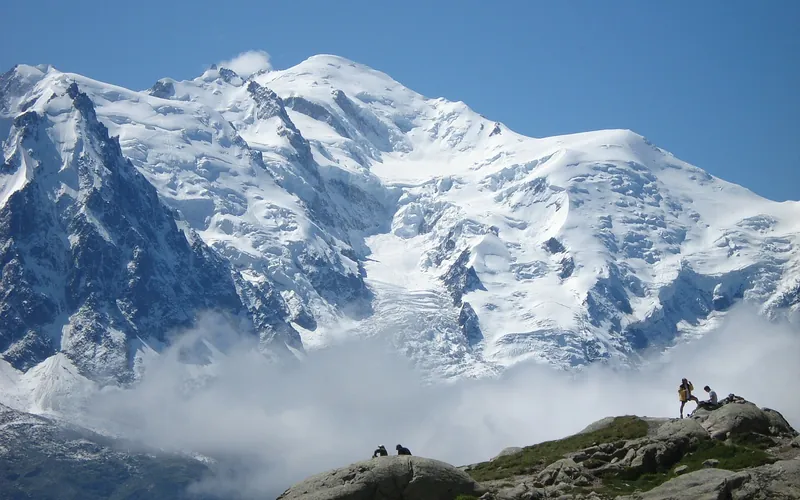


Mont Blanc
Mont Blanc (Monte Bianco), at 4,808 meters (15,774 ft), is the highest mountain in the Alps and Western Europe. Rising on the Franco-Italian watershed, this iconic glacier-draped granite massif is revered as the historic cradle of modern mountaineering following its celebrated first ascent in 1786. Featuring towering seracs, complex crevasse systems, and classic ridges like the Goûter and Bosses, it attracts climbers from around the globe.
Pioneered & Associated Routes (7)
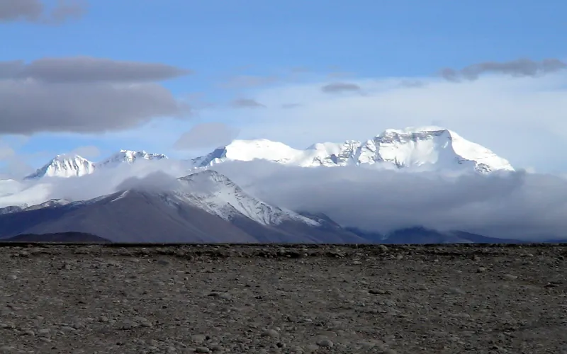
Cho Oyu Northwest Face & Ridge (Normal Route)
The Northwest Ridge is the standard and most climbed route on Cho Oyu, approached from the Tibetan plateau via the Gyabrag Glacier. First climbed in 1954 by an Austrian expedition, the route features relatively moderate snow slopes of 30 to 40 degrees, punctuated by a single prominent technical crux known as the Ice Cliff at 6,700m. Above Camp 3, climbers cross the Yellow Band and emerge onto a vast, gently rising summit plateau.
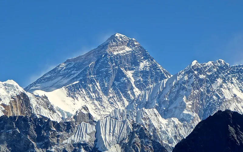
Mount Everest North Face (Hornbein Couloir Direct)
The North Face of Mount Everest via the Japanese Couloir and the sheer Hornbein Couloir is one of the most direct and formidable ice lines in the Himalayas. Rising 3,000 vertical meters from the Rongbuk Glacier to the summit, it funnels through a narrow 60-degree snow-and-ice cleft slicing straight through the Yellow Band and upper limestone cliffs of the North Face. In August 1986, Swiss alpinists Erhard Loretan and Jean Troillet executed one of the most audacious speed climbs in mountain history: climbing the entire face in a single 31-hour push at night without supplemental oxygen, tents, or fixed ropes. After summiting on August 30, they glissaded down the 3,000-meter face on their backs and buttocks in just 3.5 hours, completing the entire round trip in an astonishing 43 hours.
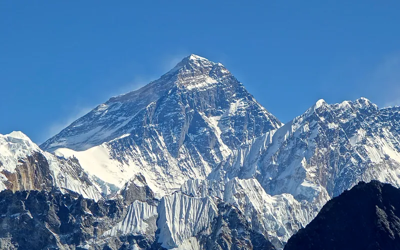
North Col & Northeast Ridge Route
The historic northern route on Mount Everest (8,848.86m), ascending from the Rongbuk and East Rongbuk glaciers to breach the icy wall of the North Col (7,020m). From the col, the route traverses the wind-blasted Northwest Ridge onto the North Face before joining the razor-like Northeast Ridge, navigating the notorious First, Second, and Third Steps in the Death Zone. This was the stage of George Mallory and Andrew Irvine's fateful 1924 climb and was first definitively surmounted on May 25, 1960, by Chinese climbers Wang Fuzhou, Qu Yinhua, and Gongbu.
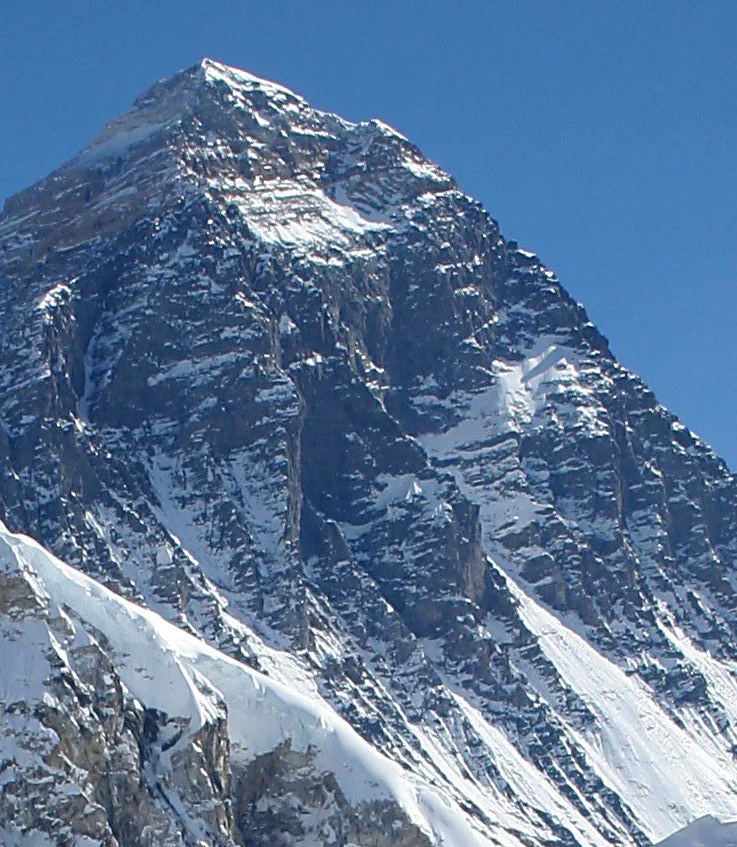
Mount Everest Southwest Face (Bonington Route)
The Southwest Face of Mount Everest (8,848.86m) rises 2,300 vertical meters from the Western Cwm to the summit, presenting one of the largest and most forbidding rock and ice faces in the world. Dominated by the vertical 300-meter 'Rock Band' at 8,200–8,500 meters, the face repelled six international attempts between 1969 and 1974. In autumn 1975, a legendary British expedition led by Chris Bonington breached the face when Paul Braithwaite and Nick Estcourt unlocked the key ramp through the Rock Band. On September 24, 1975, Doug Scott and Dougal Haston climbed to the South Summit and pushed on to the main summit, becoming the first Britons to conquer Everest. Trapped by nightfall during their descent, they survived an epic open bivouac at 8,760 meters without oxygen, sleeping bags, or frostbite.
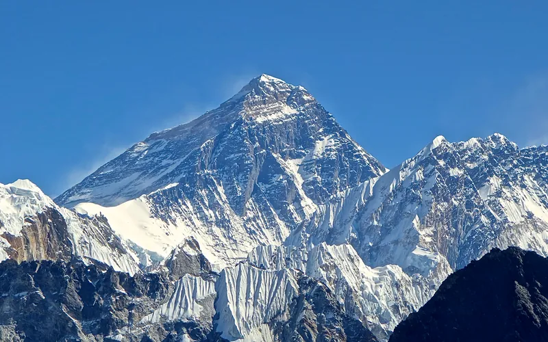
Mount Everest Complete West Ridge (Yugoslav Direct)
The Complete West Ridge of Mount Everest is one of the most formidable and sustained technical routes on the mountain. Pioneered in spring 1979 by an elite Yugoslav expedition led by Tone Škarja, the route tackles the integral knife-edge crest directly from the Lho La col (6,026m) all the way to the 8,848.86m summit. Unlike the 1963 American West Ridge route which diverted into the Hornbein Couloir from the North Face, the Yugoslav line stayed strictly along the razor-edge crest of the West Ridge, surmounting technical rock buttresses up to Grade V+ at extreme altitude before traversing around the Yellow Band. On May 13, 1979, Andrej Štremfelj and Nejc Zaplotnik achieved the first ascent of the complete ridge, followed two days later by Stane Belak, Marjan Manfreda, and Ang Phu Sherpa in one of the greatest feats in Himalayan history.
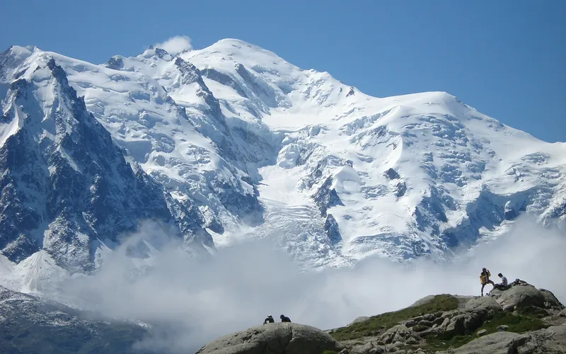
Goûter Route (Voie Royale / Normal Route)
The Goûter Route, often called the Voie Royale, is the most frequented and classic line to the summit of Mont Blanc (4,808 m). Starting from the Tramway du Mont-Blanc terminus at Nid d'Aigle (2,372 m), climbers ascend past the Tête Rousse Glacier, traverse the notorious Grand Couloir, scramble up the steep Aiguille du Goûter to the Goûter Refuge (3,835 m), and complete the dawn push across the Dôme du Goûter and the exposed knife-edge Arête des Bosses to the summit dome.
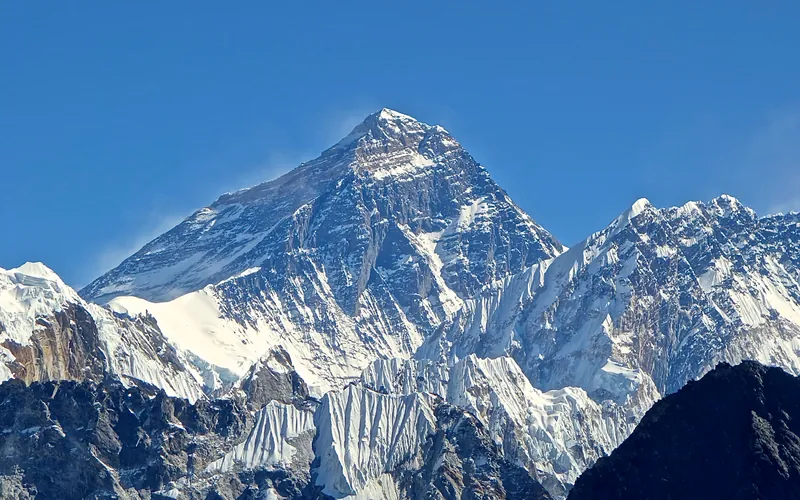
South Col & Southeast Ridge (Normal Route)
The South Col Route along the Southeast Ridge is the historic path of the 1953 first ascent and the most popular route on Mount Everest. Starting from Base Camp on the Khumbu Glacier in Nepal, climbers navigate the shifting seracs of the Khumbu Icefall into the Western Cwm. The route then scales the icy 45-degree slope of the Lhotse Face to the South Col at 7,925 meters, launching the final summit bid through the Balcony, South Summit, and Hillary Step to the summit of Earth at 8,848.86 meters.
Documented Expeditions (1)
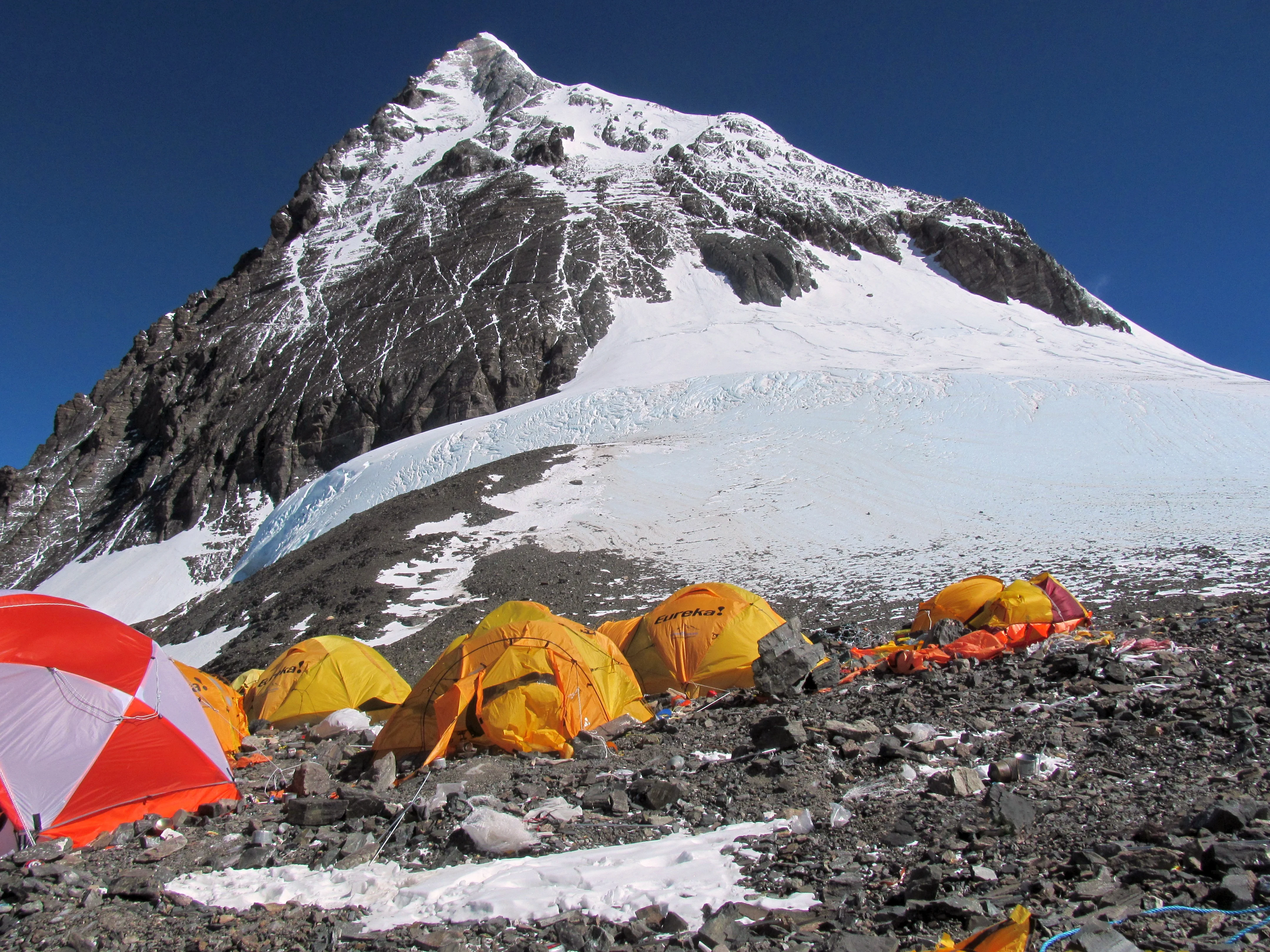
1993 Nepalese Women's Mount Everest Expedition
On April 22, 1993, Pasang Lhamu Sherpa made history by reaching the summit of Mount Everest (8,848m) as the first Nepali woman, breaking historic gender barriers and leading an all-Nepalese team via the South Col route.
Associated Chronicles & Stories (1)
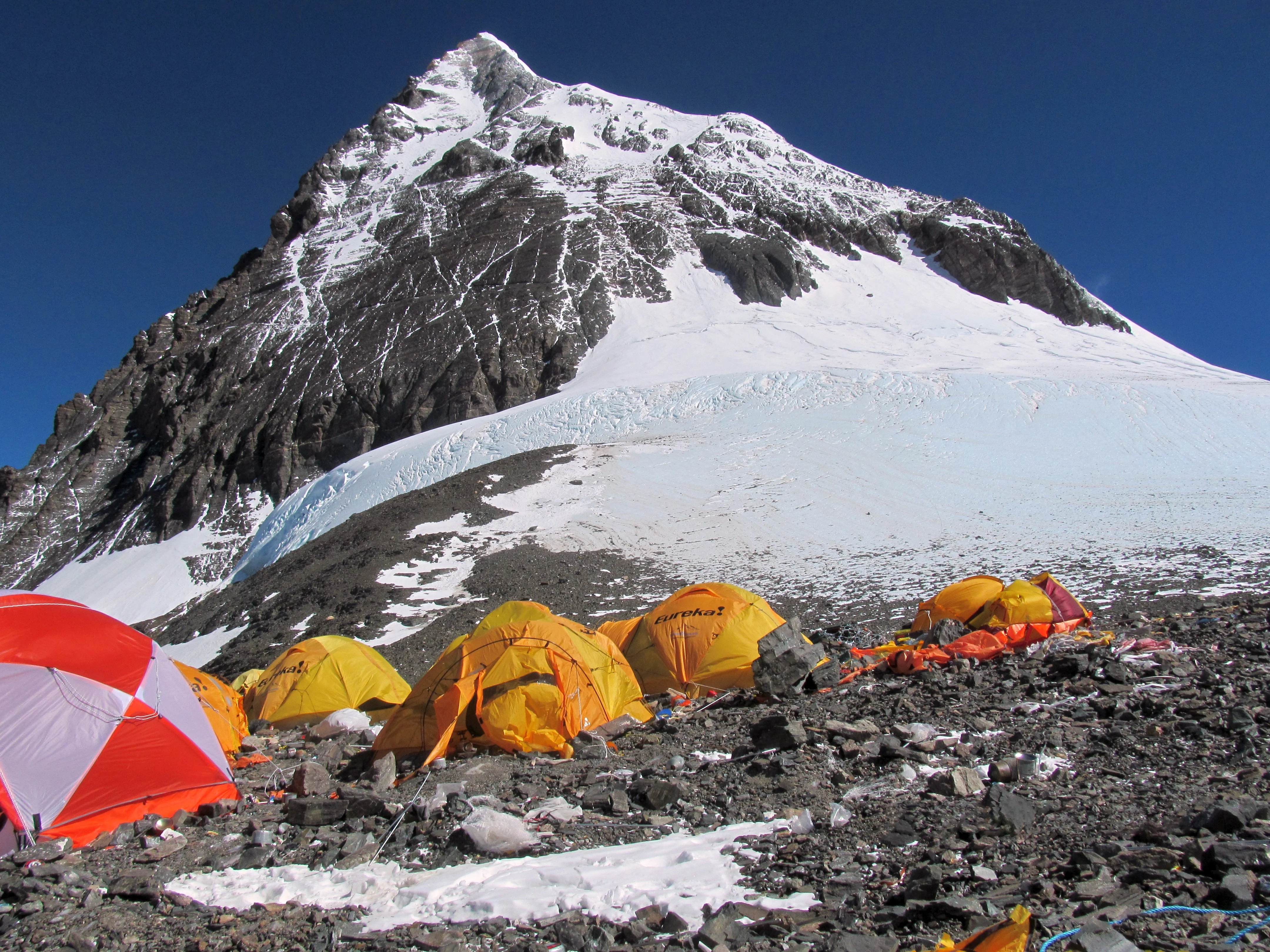
Sagarmatha's Daughter: Pasang Lhamu Sherpa's Historic Everest Breakthrough
On April 22, 1993, Pasang Lhamu Sherpa shattered patriarchal boundaries to become the first Nepali woman to stand on the summit of Mount Everest.
Documented Sources & Archival Citations
- Himalayan Database: Pasang Lhamu Sherpa 1993 Ascent(Elizabeth Hawley / Himalayan Database)
Supporting claim: Official verification of the April 22, 1993 summit of Mount Everest by Pasang Lhamu Sherpa
Accessed/Documented: 2024 - Pasang: In the Shadow of Everest(Sharon Wood / Mountainfilm Archive)
Supporting claim: Comprehensive historical documentary and biographical tribute to Pasang Lhamu's life and legacy
Accessed/Documented: 2022