Chogolisa
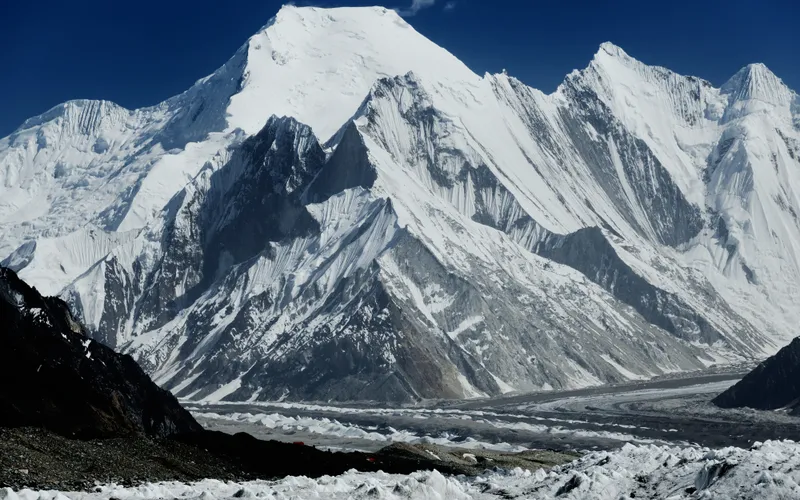
Chogolisa, standing at 7,665 meters (25,148 ft) in the Karakoram range of Pakistan, is renowned as Bride Peak for its broad, graceful snow-draped profile. Located south of Concordia and the Baltoro Glacier, it features two prominent summits connected by a sweeping knife-edge snow ridge.

Mountain Safety & Conditions Disclaimer: High-altitude climbing, glacial travel, and technical ascents entail severe objective risks including avalanches, serac collapses, rapid weather collapse, and altitude illness. Historical route descriptions and summit claims on Mountanity reflect documented archival sources and must not be used as live operational safety assessments. Local regulations, permits, and physical glacial topography change continuously.
Peer Review: Senior Editorial Board & Historical Reviewers • Editorial Standards
Geographical Setting & Topography
Situated in the Masherbrum Mountains southwest of Concordia in Gilgit-Baltistan, flanking the upper reaches of the Chogolisa and Vigne glaciers.
Historic First Ascent
Date: August 4, 1958
Ascent Team: Fred Pressl and Adolf Bräunlich (Austrian Expedition led by Eduard Koblmüller)
Key Statistics & Topographic Figures
- Official Elevation
- 7,665 m (25,148 ft)
Chogolisa I (Southwest Peak)
- Topographic Prominence
- 1,624 m
Karakoram Masherbrum Group
- 1909 World Record
- 7,498 m (24,600 ft)
Duke of the Abruzzi Record
- First Ascent Date
- August 4, 1958
Fred Pressl & Adolf Bräunlich
- Geographic Coordinates
- 35°36′42″ N, 76°34′26″ E
Gilgit-Baltistan, Pakistan
- Normal Route
- Southeast Ridge
Alpine AD+/D, 50° Snow
Archival Primary Source Quotations
“Chogolisa was lost in a sea of gray vapor, the wind tearing across the ridge with blinding force. One step too close to the edge, and the silent white ledge vanished into the abyss.”
Defined Alpine Terminology & Concepts
- Bride Peak
- The historical name given to Chogolisa by Martin Conway in 1892, honoring its sweeping snow mantle resembling a bridal gown flowing from the summit crest.
- Cornice Fracture
- A sudden structural collapse where wind-compacted snow shelves overhanging mountain precipices break under pressure, posing an extreme objective hazard on knife-edge alpine ridges.
Chogolisa Mountain Weather Forecast
Detailed 14-Day Summit Window & Weather Timeline
Explore day-by-day summit push safety windows, wind shear analysis, and extended multi-day forecasts for Chogolisa.
Explore Chogolisa (7,665 m) in Interactive 3D
Inspect steep glacial walls, hanging seracs, ridge approaches, and elevation relief with 360° rotation and terrain tilt in WebGL.
Documented Climbing Routes (1)
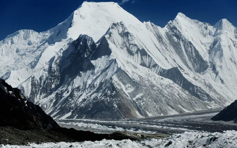
Southeast Ridge (Standard Route)
The Southeast Ridge of Chogolisa (7,665m) ascends from the upper Chogolisa Glacier, scaling steep ice couloirs to gain the elegant, wind-sculpted snow arête leading toward the summit. First explored in 1909 by the Duke of the Abruzzi to 7,498 meters, attempted in alpine style in 1957 by Hermann Buhl and Kurt Diemberger, and first summited on August 4, 1958, by Fred Pressl and Adolf Bräunlich.
Historical Expeditions (2)
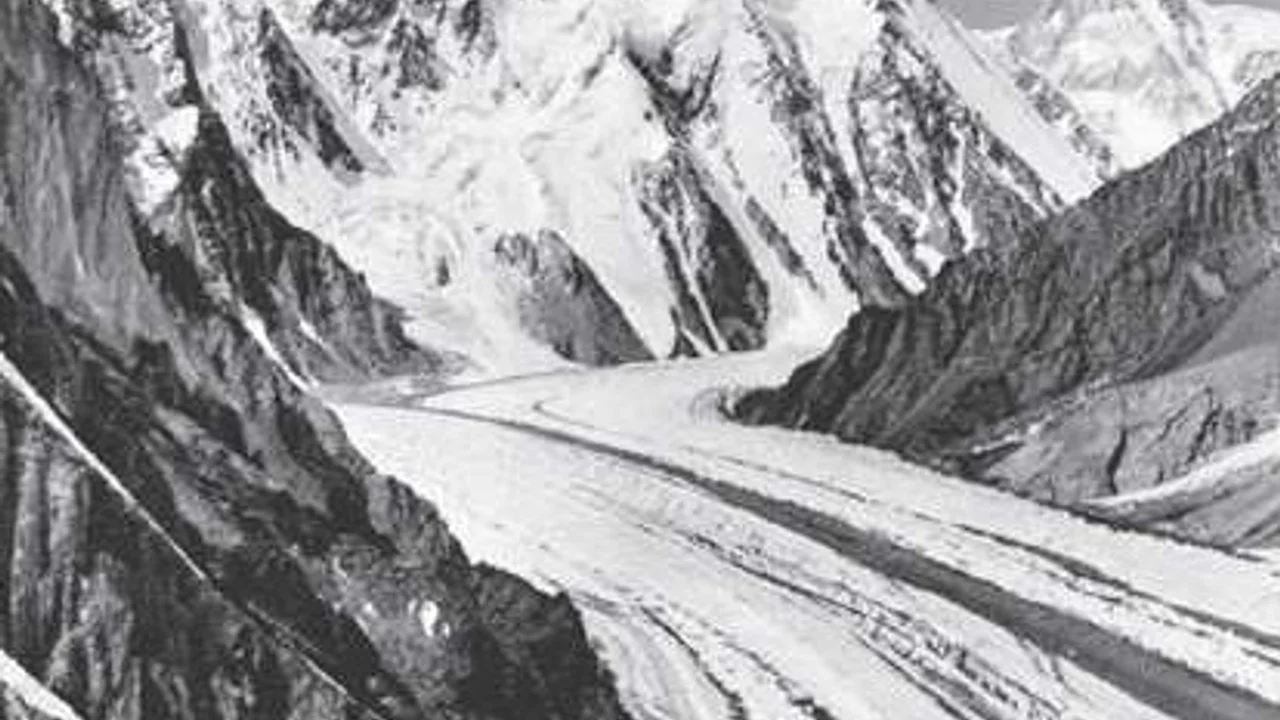
1909 Duke of the Abruzzi Karakoram Expedition
The monumental 1909 Italian expedition led by Prince Luigi Amedeo, Duke of the Abruzzi, accompanied by master photographer Vittorio Sella, that surveyed K2, discovered and pioneered the Abruzzi Spur, and established a world altitude record of 7,498 meters on Chogolisa.
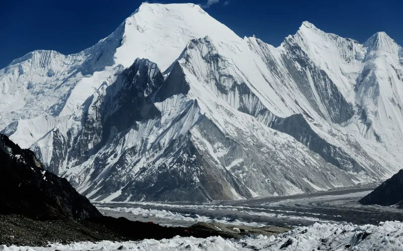
1957 Austrian Chogolisa Alpine Expedition
The lightweight two-man alpine-style push on Chogolisa (7,665m) by Hermann Buhl and Kurt Diemberger, ending in a severe blizzard retreat and Buhl's fatal cornice fall.
Summit Chronicles & Stories (2)
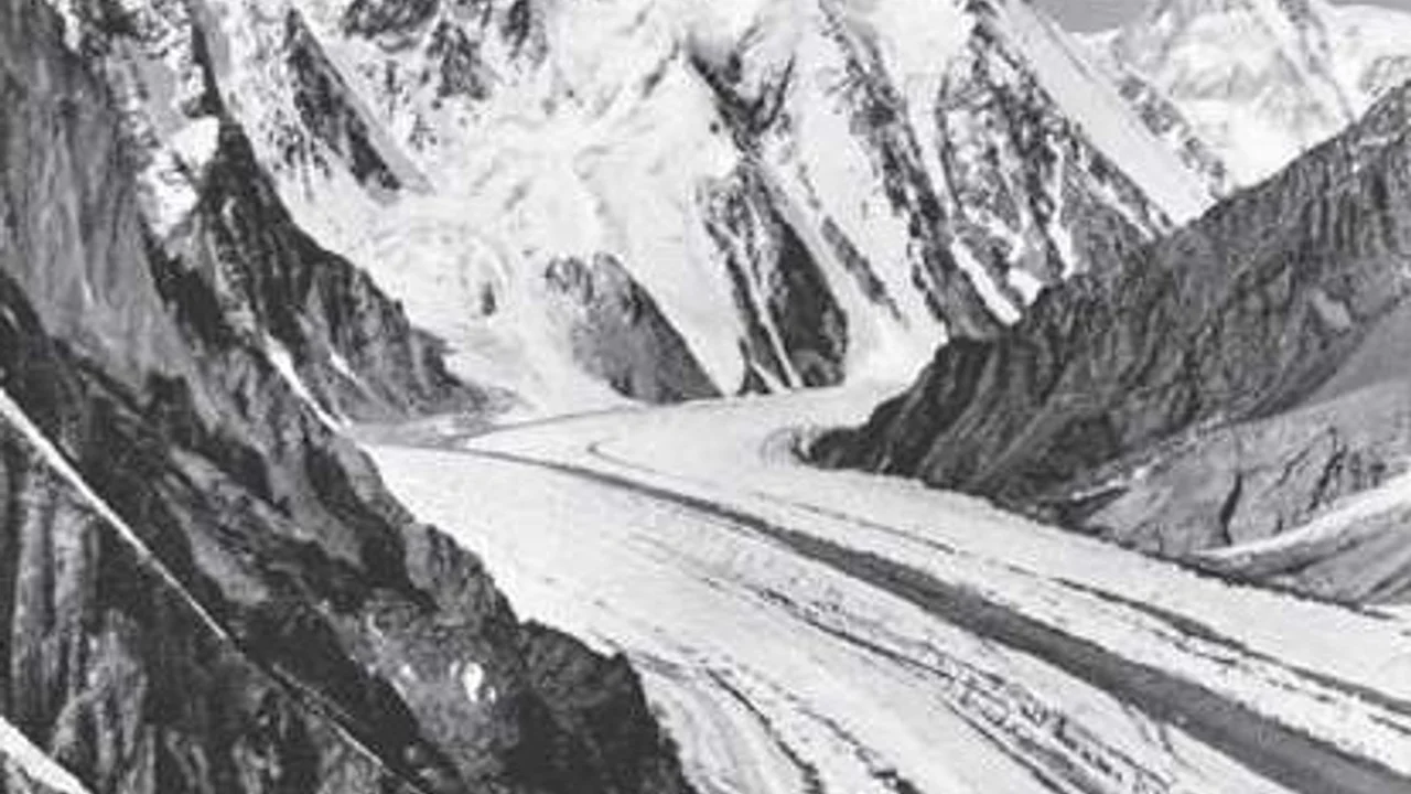
K2 1909: The Duke of the Abruzzi, Vittorio Sella, and the Genesis of the Abruzzi Spur
In 1909, Prince Luigi Amedeo, Duke of the Abruzzi, and master photographer Vittorio Sella mounted a monumental expedition into the Karakoram, unlocking the secrets of K2, naming the Abruzzi Spur, and setting a world altitude record of 7,498m on Chogolisa.
1957 Chogolisa: Hermann Buhl's Final Alpine Frontier
The poignant chronicle of Hermann Buhl and Kurt Diemberger's lightweight alpine attempt on Chogolisa and the tragic summit cornice fall.
Frequently Asked Questions: Chogolisa
What is Chogolisa and why is it called Bride Peak?
Chogolisa (7,665m) is a prominent glaciated mountain located in the Karakoram range of Gilgit-Baltistan, Pakistan. Explorer Sir William Martin Conway named it Bride Peak in 1892 because its broad, elegant, snow-draped profile resembles a bridal veil cascading across the sky.
What historic altitude record was set on Chogolisa in 1909?
In 1909, Prince Luigi Amedeo, Duke of the Abruzzi, reached an elevation of 7,498 meters (24,600 feet) on Chogolisa’s Southeast Ridge without supplemental oxygen, establishing a world altitude record that stood unbroken for 13 years until 1922 on Mount Everest.
What happened to Hermann Buhl on Chogolisa in 1957?
On June 27, 1957, Austrian climbing pioneer Hermann Buhl and Kurt Diemberger made an alpine-style push reaching ~7,300 meters on Chogolisa. Forced to retreat by a sudden blinding blizzard, a massive snow cornice collapsed beneath Buhl’s feet, plunging him 900 meters down the North Face. His body was never recovered.
Who completed the first ascent of Chogolisa?
Fred Pressl and Adolf Bräunlich completed the first confirmed ascent of Chogolisa on August 4, 1958, via the Southeast Ridge as members of an Austrian expedition led by Eduard Koblmüller.
Documented Sources & Archival Citations
- Summits and Secrets(Kurt Diemberger / Hodder & Stoughton)
Supporting claim: Account of the 1957 alpine style attempt with Hermann Buhl
Accessed/Documented: 1971 - Karakoram and Western Himalaya 1909: An Account of the Expedition of H.R.H. Prince Luigi Amedeo of Savoy(Filippo de Filippi / Edward Arnold)
Supporting claim: Documentation of the 1909 Abruzzi altitude record reaching 7,498 meters
Accessed/Documented: 1912 - American Alpine Journal: Asia, Pakistan, Chogolisa First Ascent(American Alpine Club)
Supporting claim: Official verification of the 1958 Austrian first ascent by Pressl and Bräunlich
Accessed/Documented: 1959