Grand Traverse of Aoraki / Mount Cook
The Grand Traverse of Aoraki / Mount Cook is widely considered the supreme classic high alpine expedition in the Southern Alps. Spanning the entire triple-crowned crest of New Zealand's highest mountain—crossing the Low Peak (3,593 m), Middle Peak (3,717 m), and High Peak (3,724 m)—the route features kilometres of exposed corniced ice ridges, shattered greywacke pinnacles, and dizzying exposure above the Caroline Face and Linda Glacier.
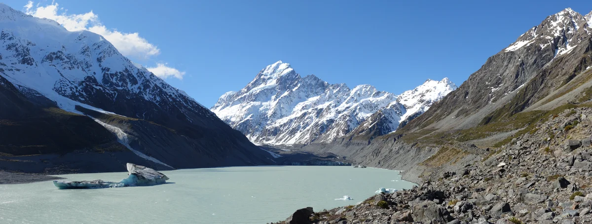
Ascent line, technical cruxes & camp topography profile for Grand Traverse of Aoraki / Mount Cook
Mountain Safety & Conditions Disclaimer: High-altitude climbing, glacial travel, and technical ascents entail severe objective risks including avalanches, serac collapses, rapid weather collapse, and altitude illness. Historical route descriptions and summit claims on Mountanity reflect documented archival sources and must not be used as live operational safety assessments. Local regulations, permits, and physical glacial topography change continuously.
Peer Review: Senior Editorial Board & Historical Reviewers • Editorial Standards
Tactical & Camp Notes
Requires sustained balance along knife-edge snow cornices with vertical drops of over 1,500 metres on either flank. A sudden westerly gale from the Tasman Sea can make retreat from the ridge crest almost impossible.
Identified Objective Hazards
- •Severe and rapid storm cycles from the Tasman Sea producing instantaneous zero-visibility whiteouts and gale-force winds
- •Fragile, massive snow cornices overhanging the East and West faces that can collapse under foot
- •Extreme exposure along knife-edge arêtes requiring hours of uninterrupted concentration without solid anchors
- •Loose, frost-shattered greywacke rock prone to dislodgement on climbing pitches
Historical Context
Pioneered on January 3, 1913, by pioneering Australian mountaineer Freda Du Faur together with Peter Graham and David Thomson. Du Faur's traverse in a single day stunned the global climbing establishment and shattered contemporary gender prejudices.
Interactive Elevation Profile
Vertical profile, technical cruxes, and camp staging progression for Grand Traverse of Aoraki / Mount Cook on Aoraki / Mount Cook.
Modern high alpine hut perched above the Grand Plateau, serving as the launch base for the Linda Glacier and East Ridge approaches.
Camp-by-Camp Topography
Key staging altitudes, technical cruxes, and terrain transitions for Grand Traverse of Aoraki / Mount Cook.
Plateau Hut Staging
Modern high alpine hut perched above the Grand Plateau, serving as the launch base for the Linda Glacier and East Ridge approaches.
Empress Hut / Upper Hooker Shelf
Remote bivouac staging area at the foot of the western faces, used for traversing approaches via Sheila Glacier.
Low Peak Summit Notch
The first summit tower reached when traversing from south to north, demanding immediate step-cutting along wind-packed ice flutings.
Middle Peak Crest
The narrow central horn connecting the southern and northern crests, exposed to violent updrafts from the Tasman Sea.
High Peak Apex
The highest geographic point in New Zealand, reached via a narrow, heavily corniced snow crest that must be respected without standing directly on the fragile wind lip.
Topographic Location & Terrain Map
Cartographic datum, massif coordinates, and terrain context for Grand Traverse of Aoraki / Mount Cook on Aoraki / Mount Cook.
Interactive Topographic Terrain Map
Click below to load live cartographic contours, glacier approaches, and geographic markers for Aoraki / Mount Cook (43°35′42″ S, 170°08′30″ E).
Key Statistics & Topographic Figures
- Route Type
- Classic High Alpine Ridge Traverse
Topography
- Technical Difficulty
- Extremely Severe Alpine Endurance / NZ Alpine Grade 3+, UIAA IV
NZ Grade 3+, 50° ice and snow arêtes, loose UIAA III-IV rock
- Country / Region
- New Zealand (Southern Alps / Canterbury)
Location
Archival Primary Source Quotations
“A mountain route is not merely a path of rock and ice; it is a test of human endurance, judgment, and humility.”
Defined Alpine Terminology & Concepts
- Crux
- The most difficult and technically demanding pitch or section of a climbing route.
- Normal Route (Voie Normale)
- The most frequently climbed, least technical, and historically standard path to a mountain summit.
Frequently Asked Questions: Grand Traverse of Aoraki / Mount Cook
What is the climbing difficulty and grade of Grand Traverse of Aoraki / Mount Cook?
Grand Traverse of Aoraki / Mount Cook on aoraki-mount-cook is graded as Extremely Severe Alpine Endurance / NZ Alpine Grade 3+, UIAA IV, with technical climbing requirements including NZ Grade 3+, 50° ice and snow arêtes, loose UIAA III-IV rock.
What are the primary hazards on the Grand Traverse of Aoraki / Mount Cook?
Climbers on Grand Traverse of Aoraki / Mount Cook must navigate severe objective hazards including Severe and rapid storm cycles from the Tasman Sea producing instantaneous zero-visibility whiteouts and gale-force winds, Fragile, massive snow cornices overhanging the East and West faces that can collapse under foot, Extreme exposure along knife-edge arêtes requiring hours of uninterrupted concentration without solid anchors, Loose, frost-shattered greywacke rock prone to dislodgement on climbing pitches.
What camps are established on Grand Traverse of Aoraki / Mount Cook?
Grand Traverse of Aoraki / Mount Cook typically features 5 staging camps, progressing from Plateau Hut Staging (2210m) up toward the summit.
Mountain Ascended
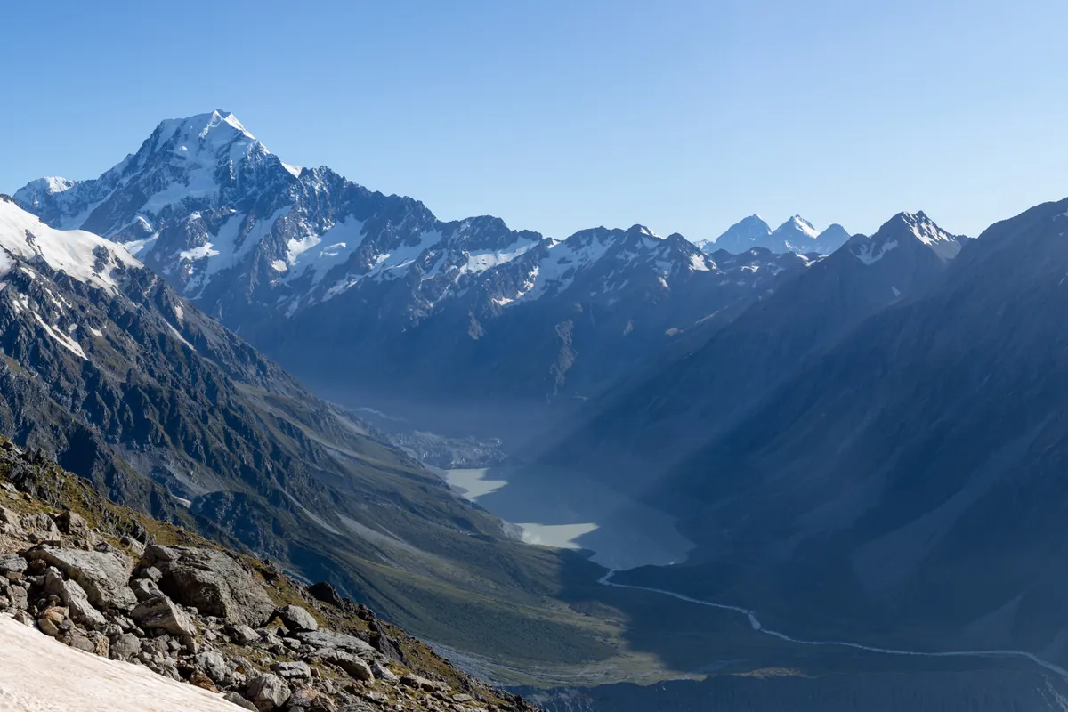
Aoraki / Mount Cook
Aoraki / Mount Cook is the highest mountain in New Zealand at 3,724 meters (12,218 ft). Located in the Southern Alps, it is an ultra-prominent glaciated peak rising dramatically above the Tasman Glacier. It is sacred in Māori mythology as the ancestor Aoraki. The mountain is renowned as the formative training ground where Sir Edmund Hillary developed his high-altitude icecraft. On January 30, 1948, Hillary completed the historic first ascent of the technical South Ridge alongside Harry Ayres. Climbing Aoraki requires expert crampon technique, glacier navigation, and vigilance against severe maritime storms.
Documented Expeditions on this Route (3)
Verified historical summits, siege campaigns, and pioneer attempts recorded on Grand Traverse of Aoraki / Mount Cook.
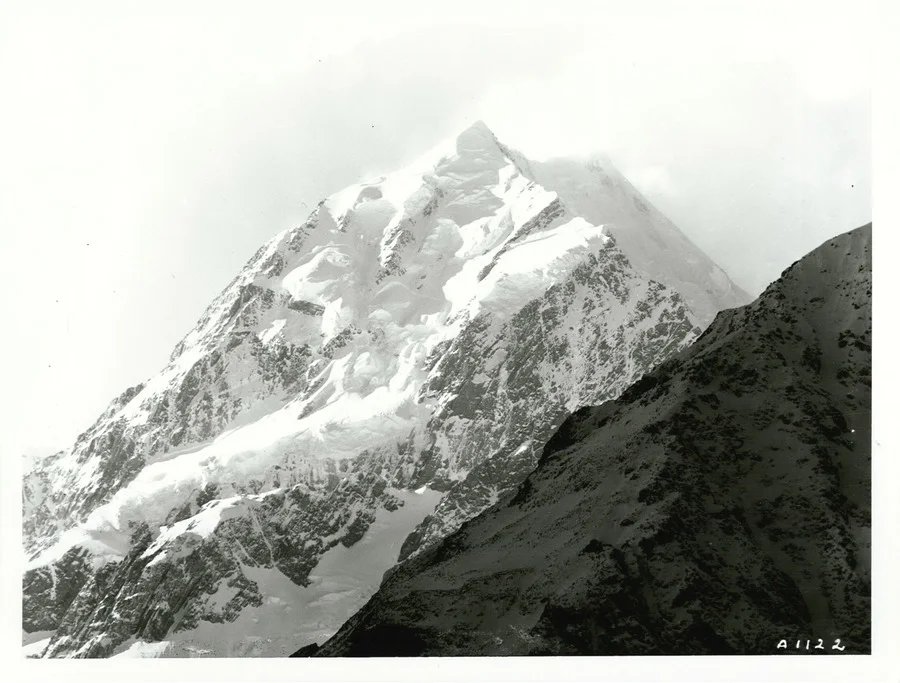
1894 Tom Fyfe, George Graham and Jack Clarke Historic First Ascent of Aoraki / Mount Cook
On Christmas Day, December 25, 1894, three amateur New Zealand climbers—Tom Fyfe, George Graham, and 19-year-old Jack Clarke—achieved the historic maiden first ascent of Aoraki / Mount Cook (3,724 m). Spurred by news that an English party with European guides was en route to claim the peak, the trio climbed without crampons up the unscaled North Ridge, cutting steps for hours to reach the summit and establish New Zealand's independent alpine tradition.
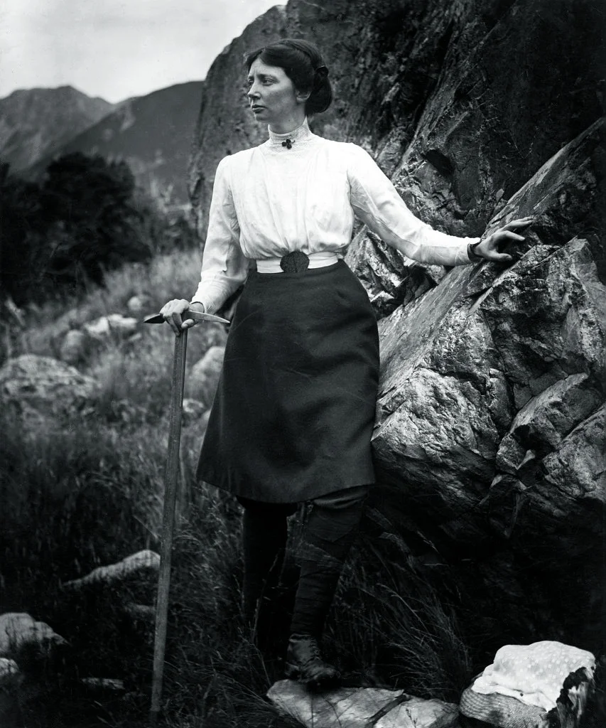
1910 Freda Du Faur Historic First Female Ascent of Aoraki / Mount Cook
On December 3, 1910, 28-year-old Australian climber Emmeline Freda Du Faur made history by becoming the first woman to reach the summit of Aoraki / Mount Cook (3,724 m). Guided by Peter and Alec Graham, Du Faur completed the round-trip climb from the Hermitage in a record-breaking fourteen hours, demonstrating peerless endurance and dismantling Victorian misconceptions about female athletic potential.
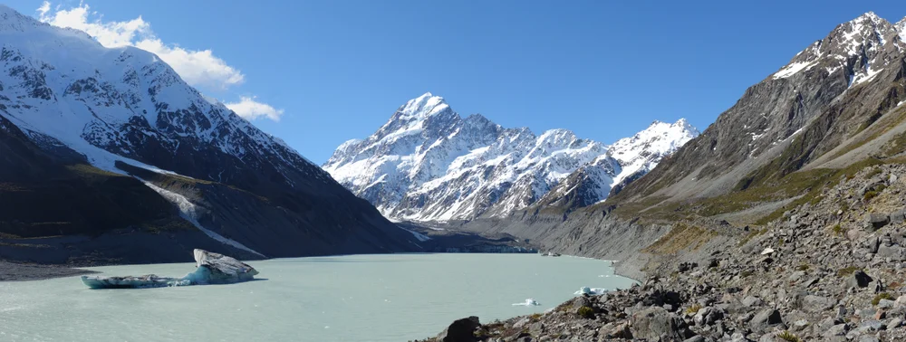
1913 Freda Du Faur and Peter Graham Historic Maiden Grand Traverse of Aoraki / Mount Cook
On January 3, 1913, Australian mountaineer Freda Du Faur and guides Peter Graham and David Thomson achieved the first complete Grand Traverse of Aoraki / Mount Cook (3,724 m). Traversed south to north across Low Peak, Middle Peak, and High Peak along razor-edge corniced ridges and vertical greywacke gendarmes, the 20-hour expedition stands as the greatest triumph of New Zealand's golden age of mountaineering.
Archival Chronicles & Stories on this Route (3)
In-depth longform historical narratives, harrowing survival accounts, and firsthand alpine journals on Grand Traverse of Aoraki / Mount Cook.
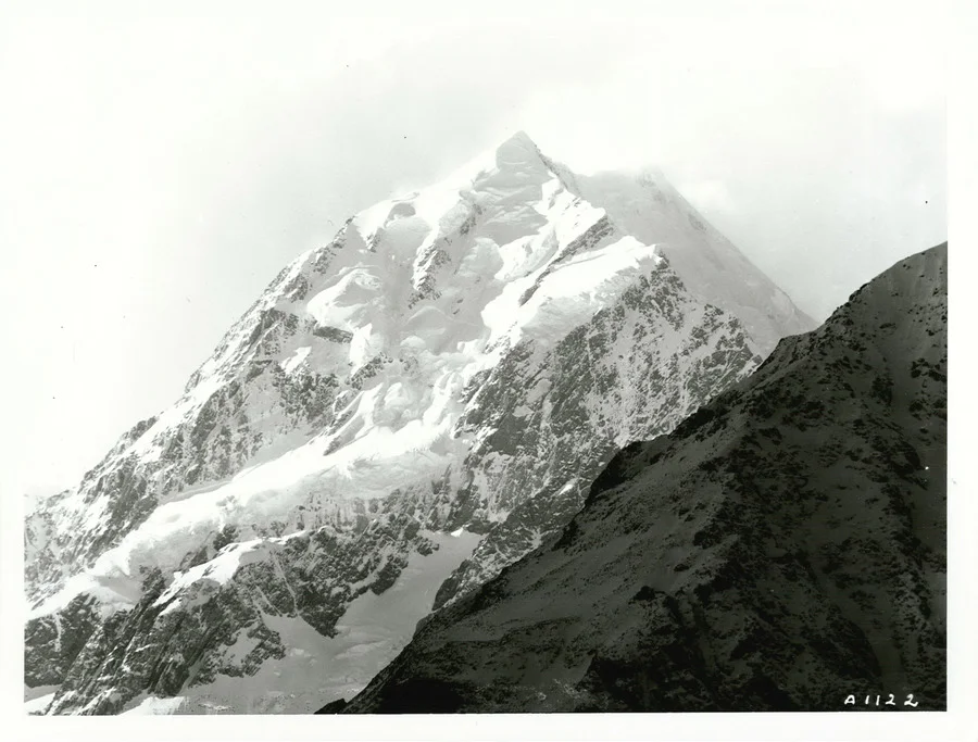
Christmas on the Cloud Piercer: The 1894 First Ascent of Mount Cook
The race against European aristocrats to claim New Zealand's greatest glaciated crown on Christmas Day 1894.
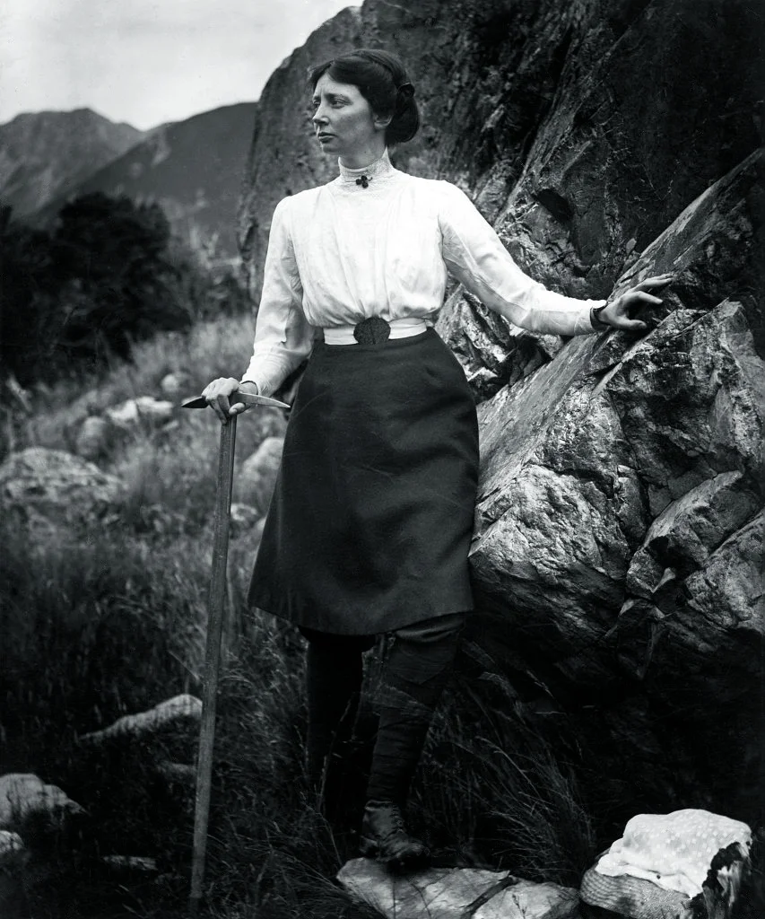
Skirts on the Summit: Freda Du Faur's 1910 Mount Cook Triumph
How an Australian woman broke Edwardian society's rules and conquered New Zealand's highest peak in record time.
Across the Razor's Edge: The 1913 Mount Cook Grand Traverse
Twenty continuous hours on the knife-edge crest of New Zealand: Freda Du Faur and Peter Graham conquer the triple peaks of Aoraki.
Documented Sources & Archival Citations
- The Conquest of Mount Cook and Other Climbs(Freda Du Faur / George Allen & Unwin)
Supporting claim: Firsthand autobiographical account of the first complete Grand Traverse
Accessed/Documented: 1915 - Peter Graham, Mountain Guide: An Autobiography(Peter Graham / A.H. & A.W. Reed)
Supporting claim: Historical guide memoirs of the 1913 Grand Traverse expedition
Accessed/Documented: 1965