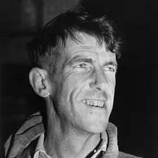
Sir Edmund Hillary
Sir Edmund Hillary was a pioneering New Zealand mountaineer, polar explorer, and author. On May 29, 1953, he and Tenzing Norgay completed the first verified summit of Mount Everest. He later reached the South Pole overland in 1958 and founded the humanitarian Himalayan Trust.
Mountain Safety & Conditions Disclaimer: High-altitude climbing, glacial travel, and technical ascents entail severe objective risks including avalanches, serac collapses, rapid weather collapse, and altitude illness. Historical route descriptions and summit claims on Mountanity reflect documented archival sources and must not be used as live operational safety assessments. Local regulations, permits, and physical glacial topography change continuously.
Peer Review: Senior Editorial Board & Historical Reviewers • Editorial Standards
Biographical Record & Archival Chronicle
Edmund Percival Hillary was born in Auckland, New Zealand, on July 20, 1919. A school trip to Mount Ruapehu sparked his lifelong passion for alpine climbing. He completed his first major ascent on Mount Ollivier (1,933m) in 1939. During World War II, Hillary served as a navigator in the Royal New Zealand Air Force. Afterward, he trained under master alpine guide Harry Ayres in the Southern Alps. On January 30, 1948, Hillary and Ayres achieved the first ascent of Mount Cook's South Ridge. This demanding technical climb established Hillary as New Zealand's foremost ice climber.
In 1951, Eric Shipton recruited Hillary for the British Everest Reconnaissance Expedition. Hillary and George Lowe pioneered a viable route through the chaotic Khumbu Icefall. Their breakthrough unlocked the southern approach into the Western Cwm. Hillary returned to the Himalayas for the 1952 British Cho Oyu Expedition. There, he tested experimental open-circuit oxygen equipment above 6,800 meters. Colonel John Hunt subsequently selected Hillary for the 1953 British Mount Everest Expedition.
On May 29, 1953, Hillary and Tenzing Norgay launched their summit push from 8,500 meters. High on the Southeast Ridge, they encountered a formidable 12-meter rock barrier. This vertical cliff between rock and snow is now called the Hillary Step. Hillary jammed his body into a narrow crack and levered upward with crampons. He breached the crux and safely belayed Tenzing up the pitch. At 11:30 AM, both men reached the 8,848.86-meter summit of Mount Everest. They achieved the first confirmed human summit in history.
Between 1956 and 1958, Hillary led the New Zealand Trans-Antarctic expedition party. He drove three modified Ferguson farm tractors across treacherous crevassed icefields. On January 4, 1958, Hillary's team successfully reached the South Pole. It was the first overland journey to the pole since Captain Scott in 1912. In 1960, Hillary organized the high-altitude Silver Hut Expedition. His team conducted physiological research and made the first ascent of Ama Dablam.
Hillary dedicated decades of his life to helping the Sherpa communities of Nepal. In 1960, he established the Himalayan Trust to fund essential local infrastructure. The foundation built 27 schools, two hospitals, and twelve medical clinics in Solukhumbu. It also constructed the mountain airstrip at Lukla to connect remote villages. Grateful Sherpas honored Hillary with the affectionate title of Burra Sahib. In 2003, Nepal granted Hillary honorary citizenship, making him the first foreign national so recognized. Queen Elizabeth II invested him as a Knight Companion of the Garter in 1995. Hillary passed away in 2008, remembered worldwide as a compassionate explorer.
Notable Milestones & Ascents
- First confirmed human ascent of Mount Everest (8,848.86m) on May 29, 1953, with Tenzing Norgay
- First ascent of the 12-meter Hillary Step (8,790m) on Everest's exposed Southeast Ridge
- First ascent of the South Ridge of Aoraki / Mount Cook (3,724m) on January 30, 1948, with Harry Ayres
- Organized and led the 1960–1961 Silver Hut Expedition, yielding the first ascent of Ama Dablam (6,812m)
- First overland motorized vehicle expedition to reach the South Pole (January 4, 1958) since Captain Scott in 1912
- Founded the Himalayan Trust, building 27 schools, 2 hospitals, 12 medical clinics, and Lukla Airport in Solukhumbu, Nepal
- First foreign national granted honorary Nepalese citizenship (2003) and appointed Knight Companion of the Garter (1995)
- Served as New Zealand High Commissioner to India, Nepal, and Bangladesh (1985–1988)
Key Statistics & Topographic Figures
- First Human Summit
- May 29, 1953
11:30 AM with Tenzing Norgay
- Hillary Step Crux
- 8,790 Meters
12m vertical rock chimney
- South Pole Overland
- January 4, 1958
First overland since Scott 1912
- Himalayan Trust Schools
- 27 Schools Built
Solukhumbu District, Nepal
- Hospitals & Clinics
- 2 Hospitals, 12 Clinics
Kundé, Phaplu & Sherpa villages
- Highest Royal Honor
- Knight of the Garter (KG)
Invested by Queen Elizabeth II (1995)
Archival Primary Source Quotations
“It is not the mountain we conquer, but ourselves.”
“Well, George, we knocked the bastard off.”
“I think the most worthwhile thing I have done has not been on the mountains, but helping the Sherpa people build their schools and hospitals.”
Defined Alpine Terminology & Concepts
- Hillary Step
- A formidable 12-meter (40 ft) vertical rock and snow prow at 8,790 meters on Mount Everest Southeast Ridge, representing the classic technical barrier before the true summit.
- Himalayan Trust
- A non-profit humanitarian foundation established in 1960 by Sir Edmund Hillary dedicated to providing education, healthcare, reforestation, and infrastructure for the Sherpa people of Solukhumbu.
- Burra Sahib
- An honorific Hindi/Nepali term meaning "Big Leader" or "Respected Elder", lovingly bestowed upon Sir Edmund Hillary by the Sherpas of Nepal for his lifelong dedication to their welfare.
- Southern Alps Icecraft
- The rugged, heavily crevassed alpine climbing school of New Zealand’s South Island, where climbers like Hillary mastered manual step-cutting and glacier navigation on peaks like Aoraki / Mount Cook.
Frequently Asked Questions: Sir Edmund Hillary
When did Sir Edmund Hillary first summit Mount Everest?
Sir Edmund Hillary and Nepali-Tibetan sardar Tenzing Norgay reached the summit of Mount Everest on May 29, 1953, at 11:30 AM via the South Col and Southeast Ridge route as part of the ninth British Everest expedition led by Colonel John Hunt.
What is the Hillary Step on Mount Everest and why is it famous?
The Hillary Step was a 12-meter (40-foot) near-vertical rock face situated along the Southeast Ridge at 8,790 meters. On May 29, 1953, Edmund Hillary pioneered its ascent by wedging his cramponed body into a narrow crack between the rock and an overhanging snow cornice, unlocking the final path to the summit.
How did Sir Edmund Hillary reach the South Pole in 1958?
As leader of the New Zealand section of the Commonwealth Trans-Antarctic Expedition, Hillary drove three modified Ferguson TE-20 farm tractors across 2,000 kilometers of crevassed Antarctic ice, reaching the South Pole on January 4, 1958. This marked the first overland expedition to reach the South Pole since Captain Scott in 1912, and the first ever using motor vehicles.
What was the Himalayan Trust and what did it build in Nepal?
Founded by Sir Edmund Hillary in 1960 at the request of local Sherpa elders, the Himalayan Trust constructed 27 schools (including Khumjung School), two hospitals (Kundé and Phaplu), 12 medical clinics, suspension bridges across the Dudh Kosi, and the Tenzing-Hillary Airport in Lukla, transforming Solukhumbu health and education.
What mountains did Edmund Hillary climb before Mount Everest?
Hillary developed his high-altitude icecraft in the Southern Alps of New Zealand, making the historic first ascent of the South Ridge of Aoraki / Mount Cook (3,724m) on January 30, 1948, with guide Harry Ayres, followed by the 1951 British Everest Reconnaissance and 1952 Cho Oyu Expedition with Eric Shipton.
What honors and titles did Sir Edmund Hillary receive during his lifetime?
Hillary was created a Knight Commander of the Order of the British Empire (KBE) in 1953, appointed to the Order of New Zealand (ONZ) in 1987, invested as a Knight Companion of the Most Noble Order of the Garter (KG) in 1995, granted honorary citizenship of Nepal in 2003, and featured on the New Zealand $5 banknote starting in 1992.
Associated Summits (3)
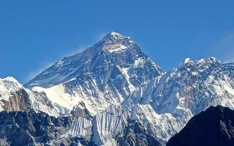


Mount Everest
Mount Everest is the highest mountain above sea level on Earth, standing at an official elevation of 8,848.86 meters (29,031.7 ft). Straddling the international frontier between Nepal and China, it is known locally as Sagarmatha in Nepali ('Goddess of the Sky') and Chomolungma in Tibetan ('Mother Goddess of the World'). The peak rises into the extreme upper troposphere, where oxygen levels drop to barely one-third of sea-level pressure. Climbers face hurricane-force jet stream winds, severe frostbite conditions, shifting ice crevasses in the Khumbu Icefall, and the dangerous Death Zone above 8,000 meters.
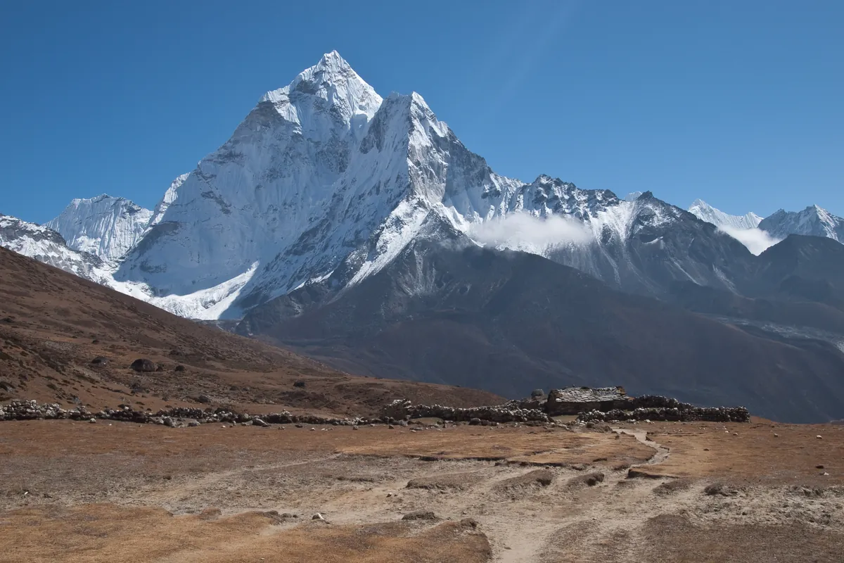
Ama Dablam
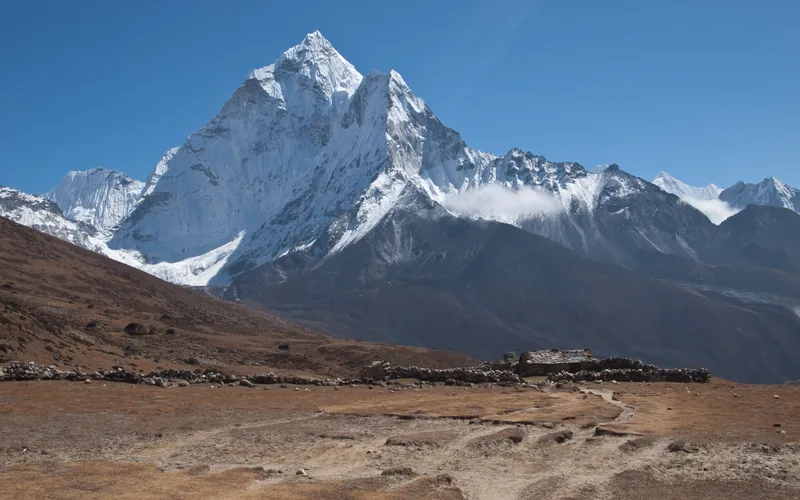
Ama Dablam is an iconic 6,812-meter (22,349 ft) mountain in the eastern Himalayan region of Nepal. Renowned worldwide for its soaring granite ridges and hanging glaciers, it is often called the Matterhorn of the Himalayas. Its name translates as 'Mother's Necklace', referring to the hanging serac resembling a traditional Sherpa pendant. Sir Edmund Hillary conceived and led the 1960–1961 Silver Hut Expedition that unlocked the mountain. On January 15, 1961, Hillary's assault team achieved the historic first ascent via the Southwest Ridge. It remains one of the most aesthetic and technically demanding alpine ascents in the world.
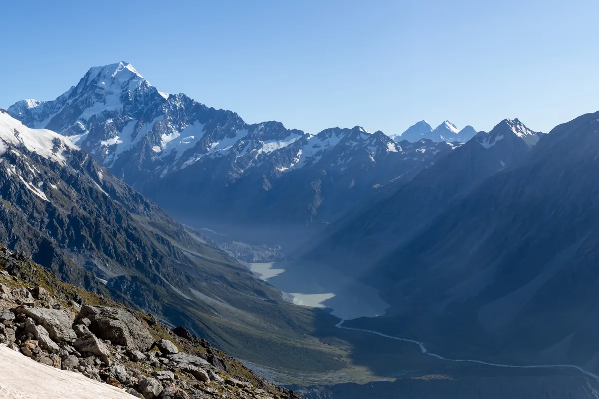
Aoraki / Mount Cook
Aoraki / Mount Cook is the highest mountain in New Zealand at 3,724 meters (12,218 ft). Located in the Southern Alps, it is an ultra-prominent glaciated peak rising dramatically above the Tasman Glacier. It is sacred in Māori mythology as the ancestor Aoraki. The mountain is renowned as the formative training ground where Sir Edmund Hillary developed his high-altitude icecraft. On January 30, 1948, Hillary completed the historic first ascent of the technical South Ridge alongside Harry Ayres. Climbing Aoraki requires expert crampon technique, glacier navigation, and vigilance against severe maritime storms.
Pioneered & Associated Routes (8)
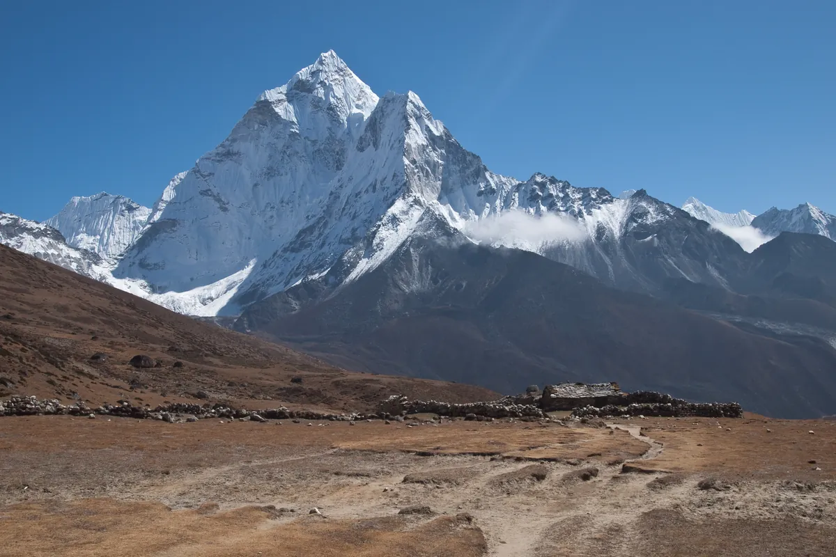
Southwest Ridge of Ama Dablam (Normal Route)
The Southwest Ridge is the iconic classic route on Ama Dablam and one of the finest technical ridge ascents in the Himalayas. First climbed on January 15, 1961, by Sir Edmund Hillary's Silver Hut Expedition team, the route climbs soaring granite towers, knife-edge snow flutings, and steep ice beneath the hanging Dablam glacier. The route features famous technical cruxes including the vertical granite Yellow Tower (UIAA 5.7), the breathtaking exposed Mushroom Ridge, and a steep final ice pitch to the 6,812-meter apex.
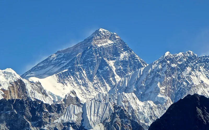
Mount Everest North Face (Hornbein Couloir Direct)
The North Face of Mount Everest via the Japanese Couloir and the sheer Hornbein Couloir is one of the most direct and formidable ice lines in the Himalayas. Rising 3,000 vertical meters from the Rongbuk Glacier to the summit, it funnels through a narrow 60-degree snow-and-ice cleft slicing straight through the Yellow Band and upper limestone cliffs of the North Face. In August 1986, Swiss alpinists Erhard Loretan and Jean Troillet executed one of the most audacious speed climbs in mountain history: climbing the entire face in a single 31-hour push at night without supplemental oxygen, tents, or fixed ropes. After summiting on August 30, they glissaded down the 3,000-meter face on their backs and buttocks in just 3.5 hours, completing the entire round trip in an astonishing 43 hours.
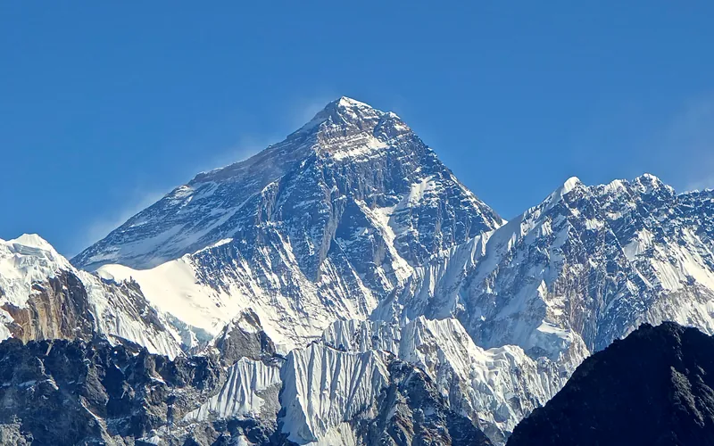
North Col & Northeast Ridge Route
The historic northern route on Mount Everest (8,848.86m), ascending from the Rongbuk and East Rongbuk glaciers to breach the icy wall of the North Col (7,020m). From the col, the route traverses the wind-blasted Northwest Ridge onto the North Face before joining the razor-like Northeast Ridge, navigating the notorious First, Second, and Third Steps in the Death Zone. This was the stage of George Mallory and Andrew Irvine's fateful 1924 climb and was first definitively surmounted on May 25, 1960, by Chinese climbers Wang Fuzhou, Qu Yinhua, and Gongbu.
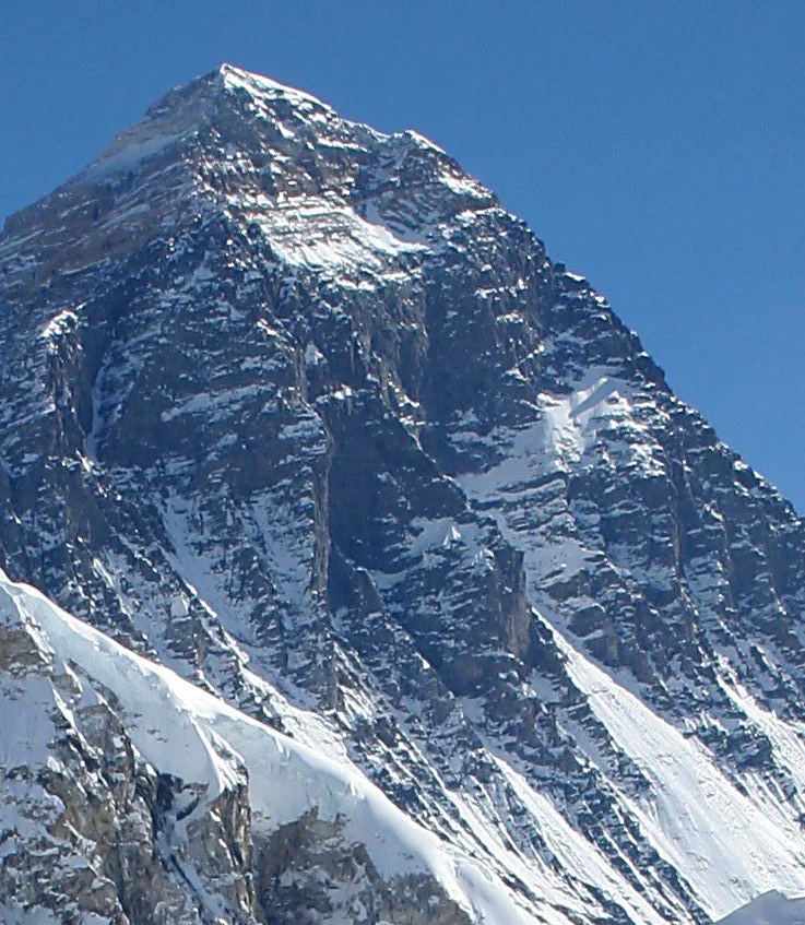
Mount Everest Southwest Face (Bonington Route)
The Southwest Face of Mount Everest (8,848.86m) rises 2,300 vertical meters from the Western Cwm to the summit, presenting one of the largest and most forbidding rock and ice faces in the world. Dominated by the vertical 300-meter 'Rock Band' at 8,200–8,500 meters, the face repelled six international attempts between 1969 and 1974. In autumn 1975, a legendary British expedition led by Chris Bonington breached the face when Paul Braithwaite and Nick Estcourt unlocked the key ramp through the Rock Band. On September 24, 1975, Doug Scott and Dougal Haston climbed to the South Summit and pushed on to the main summit, becoming the first Britons to conquer Everest. Trapped by nightfall during their descent, they survived an epic open bivouac at 8,760 meters without oxygen, sleeping bags, or frostbite.
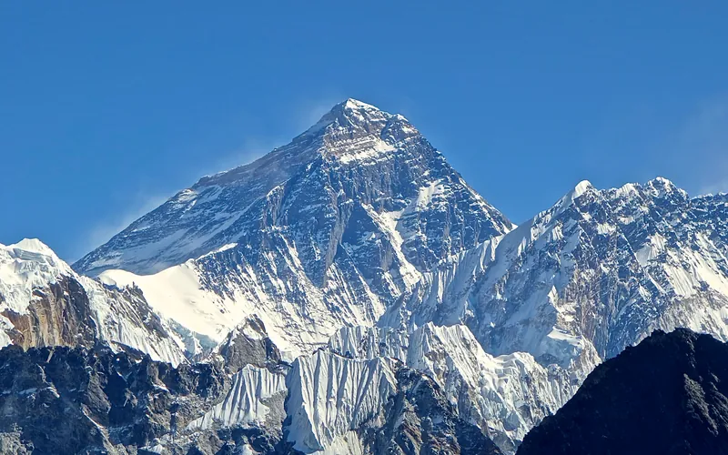
Mount Everest Complete West Ridge (Yugoslav Direct)
The Complete West Ridge of Mount Everest is one of the most formidable and sustained technical routes on the mountain. Pioneered in spring 1979 by an elite Yugoslav expedition led by Tone Škarja, the route tackles the integral knife-edge crest directly from the Lho La col (6,026m) all the way to the 8,848.86m summit. Unlike the 1963 American West Ridge route which diverted into the Hornbein Couloir from the North Face, the Yugoslav line stayed strictly along the razor-edge crest of the West Ridge, surmounting technical rock buttresses up to Grade V+ at extreme altitude before traversing around the Yellow Band. On May 13, 1979, Andrej Štremfelj and Nejc Zaplotnik achieved the first ascent of the complete ridge, followed two days later by Stane Belak, Marjan Manfreda, and Ang Phu Sherpa in one of the greatest feats in Himalayan history.
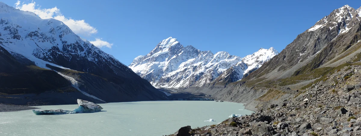
Grand Traverse of Aoraki / Mount Cook
The Grand Traverse of Aoraki / Mount Cook is widely considered the supreme classic high alpine expedition in the Southern Alps. Spanning the entire triple-crowned crest of New Zealand's highest mountain—crossing the Low Peak (3,593 m), Middle Peak (3,717 m), and High Peak (3,724 m)—the route features kilometres of exposed corniced ice ridges, shattered greywacke pinnacles, and dizzying exposure above the Caroline Face and Linda Glacier. First completed on January 3, 1913, by Australian mountaineer Freda Du Faur with guides Peter Graham and David Thomson, it remains a benchmark test of high-altitude speed, crampon confidence, and ridge-walking balance.
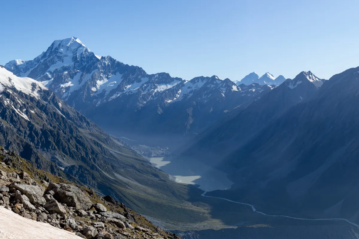
South Ridge of Aoraki / Mount Cook
The South Ridge of Aoraki / Mount Cook is a celebrated technical alpine route on New Zealand's highest peak. First climbed on January 30, 1948, by Sir Edmund Hillary, Harry Ayres, and Mick Sullivan, the route established Hillary's reputation as a world-class ice climber. Starting from Gardiner Hut, climbers traverse the Noeline Glacier to access the knife-edge rock and ice crest. The route demands steep mixed rock climbing, delicate step-cutting on exposed ice slopes, and navigation across corniced arêtes to reach the Low Peak and High Peak (3,724m).
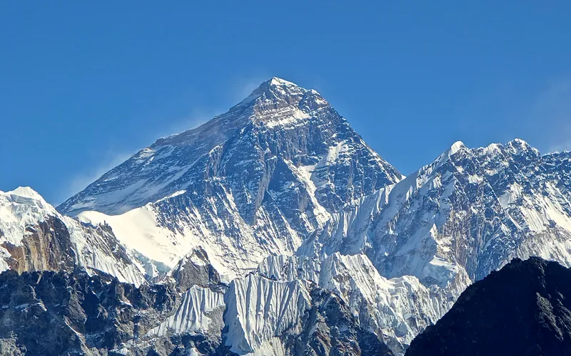
South Col & Southeast Ridge (Normal Route)
The South Col Route along the Southeast Ridge is the historic path of the 1953 first ascent and the most popular route on Mount Everest. Starting from Base Camp on the Khumbu Glacier in Nepal, climbers navigate the shifting seracs of the Khumbu Icefall into the Western Cwm. The route then scales the icy 45-degree slope of the Lhotse Face to the South Col at 7,925 meters, launching the final summit bid through the Balcony, South Summit, and Hillary Step to the summit of Earth at 8,848.86 meters.
Documented Expeditions (4)
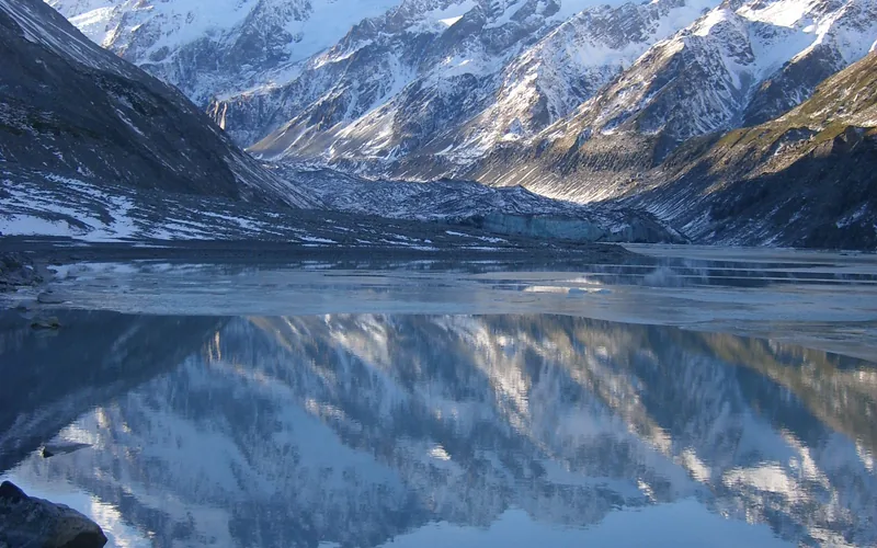
1948 Aoraki Mount Cook South Ridge Expedition
Sir Edmund Hillary and Harry Ayres achieved the first ascent of the demanding South Ridge of Aoraki / Mount Cook (3,724m) on January 30, 1948, establishing a landmark in New Zealand alpine climbing.
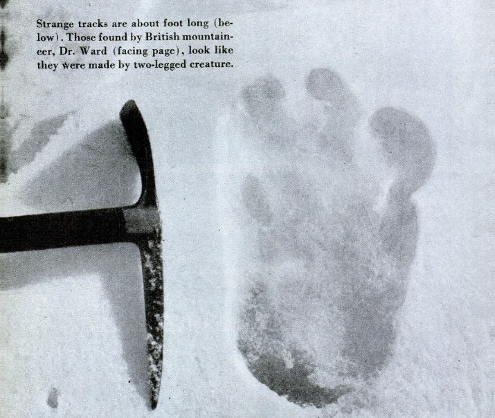
1951 British Mount Everest Reconnaissance Expedition
The pivotal 1951 reconnaissance expedition led by Eric Shipton and featuring Edmund Hillary that entered the newly opened Solukhumbu region of Nepal, conquered the chaotic Khumbu Icefall, and discovered the viable southern highway to Mount Everest's summit.
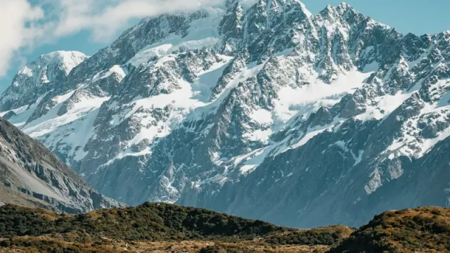
1953 British Mount Everest Expedition
Led by Colonel John Hunt, the ninth British expedition achieved the monumental first confirmed human ascent of Mount Everest on May 29, 1953.
1961 Hillary Silver Hut Ama Dablam Expedition
Organized under Sir Edmund Hillary's legendary 1960-61 Silver Hut Scientific Expedition, team members forged the historic first ascent of Ama Dablam (6,812m) via the Southwest Ridge on March 13, 1961.
Associated Chronicles & Stories (2)
1948 Mount Cook South Ridge: Hillary's Alpine Baptism
How Edmund Hillary and Harry Ayres conquered the unclimbed South Ridge of Aoraki / Mount Cook in 1948.
1961 Ama Dablam: The Silver Hut Himalayan First Ascent
How Sir Edmund Hillary's Silver Hut team made the historic first ascent of Ama Dablam's Southwest Ridge in March 1961.
Documented Sources & Archival Citations
- High Adventure: The True Story of the First Ascent of Mount Everest(Edmund Hillary / Hodder & Stoughton)
Supporting claim: Firsthand memoir of the 1953 Everest climb, equipment, and scaling the Hillary Step
Accessed/Documented: 1955 - The Ascent of Everest(John Hunt / Hodder & Stoughton)
Supporting claim: Official expedition dispatch, camp elevations, logistics, and summit pairing
Accessed/Documented: 1953 - Nothing Venture, Nothing Win(Edmund Hillary / Hodder & Stoughton)
Supporting claim: Autobiography detailing Southern Alps apprenticeship, South Pole expedition, and Sherpa aid
Accessed/Documented: 1975 - View from the Summit: The Remarkable Memoir of the First Person on Everest(Edmund Hillary / Pocket Books)
Supporting claim: Reflective life chronicle, Antarctic traverse, and Himalayan Trust operations
Accessed/Documented: 2000 - Alexander Turnbull Library Archival Photographic Collection (Ref: 1/2-020196-F)(National Library of New Zealand / John Dobree Pascoe Collection)
Supporting claim: Archival photographic negative and portrait documentation of Edmund Hillary
Accessed/Documented: 1953 - Dictionary of New Zealand Biography: Sir Edmund Percival Hillary(Ministry for Culture and Heritage / Te Ara Encyclopedia of New Zealand)
Supporting claim: Official state biographical chronicle and diplomatic/humanitarian service records
Accessed/Documented: 2010