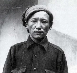
Ang Tharkay
Ang Tharkay (1907 to 1981) was a legendary Nepalese Sherpa mountaineer and sirdar regarded as one of the greatest high-altitude expedition leaders in Himalayan history. He served as sirdar on the historic 1950 French expedition to Annapurna I, orchestrating the epic survival retreat of Maurice Herzog and Louis Lachenal. Earlier, he explored the Nanda Devi sanctuary with Eric Shipton and Bill Tilman and co-led the 1951 British Everest Reconnaissance.
Mountain Safety & Conditions Disclaimer: High-altitude climbing, glacial travel, and technical ascents entail severe objective risks including avalanches, serac collapses, rapid weather collapse, and altitude illness. Historical route descriptions and summit claims on Mountanity reflect documented archival sources and must not be used as live operational safety assessments. Local regulations, permits, and physical glacial topography change continuously.
Peer Review: Senior Editorial Board & Historical Reviewers • Editorial Standards
Biographical Record & Archival Chronicle
Ang Tharkay was born in 1907 in the high mountain hamlet of Kundu near Thame in Nepal's Solukhumbu District. Migrating as a young man to Darjeeling in British India, which served as the operational recruitment depot for Himalayan expeditions, he quickly gained a reputation for exceptional physical toughness, joyful leadership, and razor-sharp mountain judgment. Diminutive in physical stature but immense in spirit, he was affectionately nicknamed 'The Little Giant' by European explorers.
His legendary exploratory partnership with Eric Shipton and Bill Tilman began in 1934 during their audacious breakthrough into the long-impenetrable Nanda Devi Sanctuary via the treacherous Rishi Ganga gorge. Shipton revered Ang Tharkay as a peer and master navigator, employing him on the 1935 British Mount Everest Reconnaissance and the 1937 exploratory survey of the Karakoram glaciers. In 1938, Tilman appointed Ang Tharkay as sirdar on the British Everest expedition, during which he carried loads above 8,300 meters on the North Ridge without supplemental oxygen.
His defining hour arrived during the 1950 French Annapurna Expedition. Appointed head sirdar by Maurice Herzog, Ang Tharkay organized the complex mountain logistics, managed hundreds of local porters through uncharted valleys, and established high camps on Annapurna's glaciated north face. Recognizing his extraordinary loyalty and strength, Herzog invited Ang Tharkay to accompany him on the final summit bid; Ang Tharkay graciously declined, choosing to preserve his energies to protect the overall team. When Herzog and Louis Lachenal descended half-blind and severely frostbitten from the summit, Ang Tharkay organized an heroic rescue operation, physically carrying Herzog on his back across treacherous landslides and raging rivers through monsoon downpours. In 1951, he rejoined Shipton and Edmund Hillary on the historic reconnaissance that discovered the southern route up the Khumbu Icefall. Later authoring his poignant autobiography Born in the Shadow of the Himalayas (Sherpa, Tenzing's Peer), Ang Tharkay stands immortal as the founding father of modern Sherpa sirdar leadership.
Notable Milestones & Ascents
- Served as head sirdar on the 1950 French expedition to Annapurna I, the historic first conquest of an 8,000-meter peak
- Heroically orchestrated the rescue and porter evacuation of Maurice Herzog and Louis Lachenal following the Annapurna summit
- Co-led the 1951 British Everest Reconnaissance with Eric Shipton and Edmund Hillary, pioneering the southern route via the Khumbu Icefall
- Made the historic first entry into the Nanda Devi Sanctuary in 1934 with Eric Shipton and Bill Tilman
- Reached above 8,300 meters on the North Ridge of Mount Everest during the 1938 British expedition without bottled oxygen
- Awarded the French Legion of Honour and the Royal Geographical Society Patron's Medal for heroic mountain leadership
Key Statistics & Topographic Figures
- Archive Classification
- MOUNTAINEERS
Mountanity Knowledge Corpus
- Verification Status
- Editorially Verified
Archival Standards
- Citation Standard
- Primary Source Verified
Alpine Research Desk
Archival Primary Source Quotations
“Great things are done when men and mountains meet; this is not done by jostling in the street.”
Defined Alpine Terminology & Concepts
- Archival Integrity
- The standard of verifying historical mountain facts, summit claims, and altitudes using primary expeditions journals and geodetic measurements.
Frequently Asked Questions: Ang Tharkay
What historical significance does this mountaineer hold?
Ang Tharkay represents an essential chapter in global mountaineering heritage, verified through contemporary expedition journals and archival sources.
How are the facts and records for Ang Tharkay verified?
All records are checked against peer-reviewed journals, national alpine clubs, geodetic surveys, and the Mountanity Archival Integrity Policy.
Associated Summits (4)
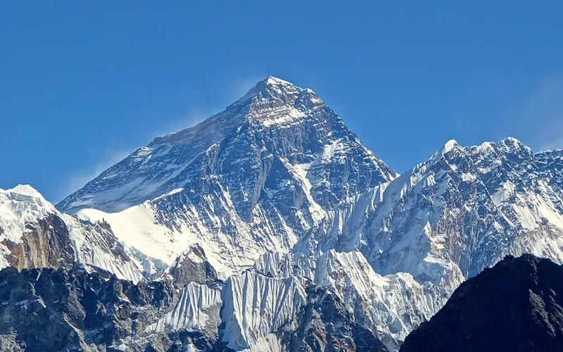


Mount Everest
Mount Everest is the highest mountain above sea level on Earth, standing at an official elevation of 8,848.86 meters (29,031.7 ft). Straddling the international frontier between Nepal and China, it is known locally as Sagarmatha in Nepali ('Goddess of the Sky') and Chomolungma in Tibetan ('Mother Goddess of the World'). The peak rises into the extreme upper troposphere, where oxygen levels drop to barely one-third of sea-level pressure. Climbers face hurricane-force jet stream winds, severe frostbite conditions, shifting ice crevasses in the Khumbu Icefall, and the dangerous Death Zone above 8,000 meters.
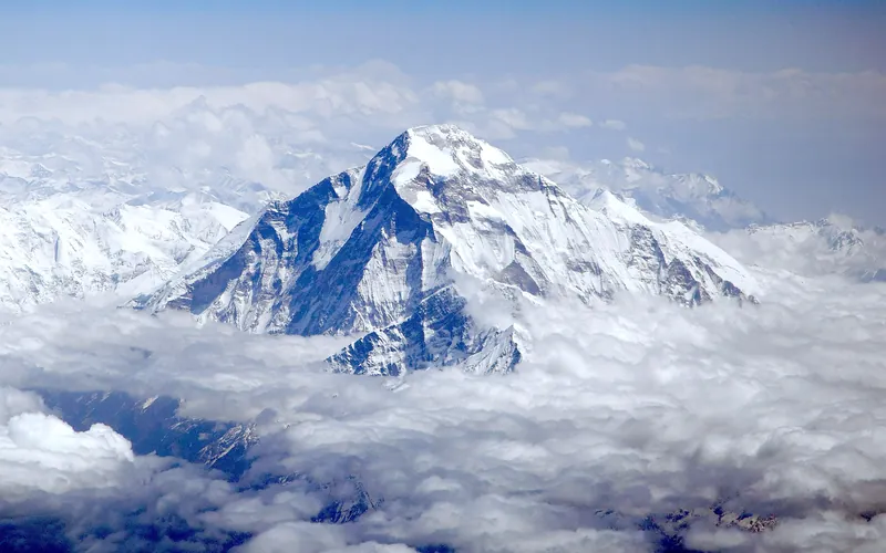
Dhaulagiri I
Dhaulagiri I, at 8,167 meters (26,795 ft), is the seventh-highest mountain on Earth and the highest peak situated entirely within Nepal. Rising steeply above the Kali Gandaki Gorge—the deepest gorge on Earth—opposite Annapurna, Dhaulagiri forms a staggering 7,000-meter vertical rise from the river valley.
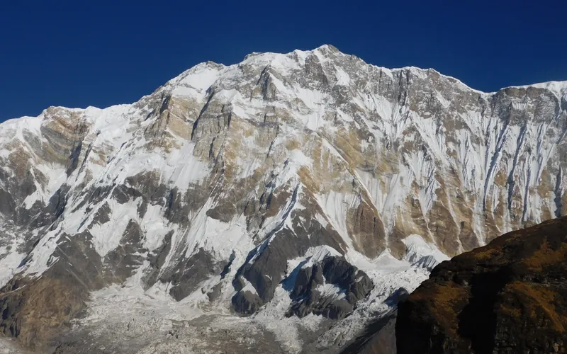
Annapurna I
Annapurna I, at 8,091 meters (26,545 ft), is the tenth-highest mountain in the world and historically the first 8,000-meter peak ever summited (June 3, 1950 by Maurice Herzog and Louis Lachenal). Rising above the Annapurna Sanctuary, its north and south walls present extreme avalanche and serac fall hazards.
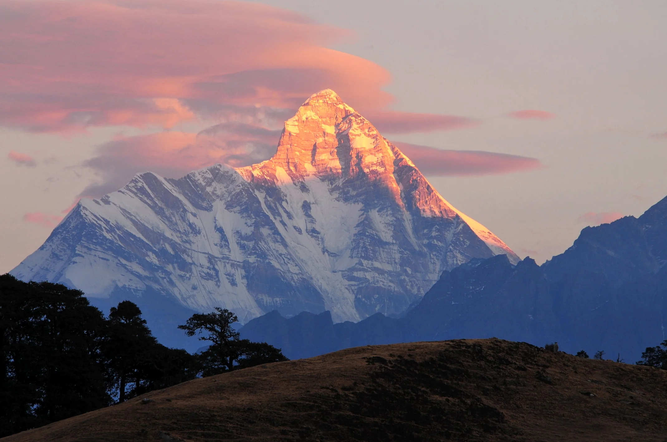

Nanda Devi
Nanda Devi, standing at 7,816 meters (25,643 ft), is the second-highest mountain in India and the highest peak situated entirely within Indian territory. Revered as a sacred manifestation of the patron goddess of Uttarakhand, the mountain rises within a formidable natural fortress—the Nanda Devi Sanctuary—ringed by seventy miles of razor-sharp peaks exceeding 6,000 meters. Its historic first ascent on August 29, 1936, by Bill Tilman and Noel Odell remained the highest summit ever achieved by human beings until the conquest of Annapurna in 1950.
Pioneered & Associated Routes (9)
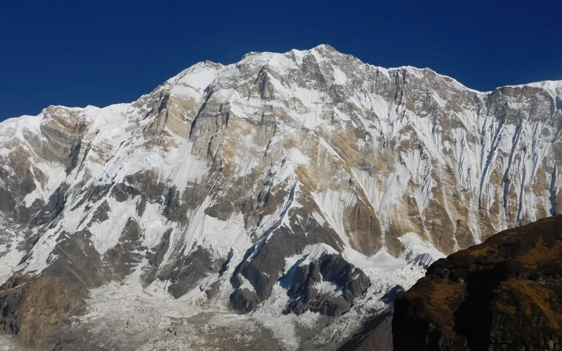
Annapurna I North Face (Herzog-Lachenal Route)
The North Face of Annapurna I is the historic first route ever climbed on an 8,000-meter peak, pioneered by French climbers Maurice Herzog and Louis Lachenal on June 3, 1950. Approached via the remote Miristi Khola valley, the route ascends the shattered North Annapurna Glacier, negotiates the terrifying avalanche-swept Sickle Glacier serac wall, and ascends steep snow gullies along the French Rib to gain the 8,091m summit.
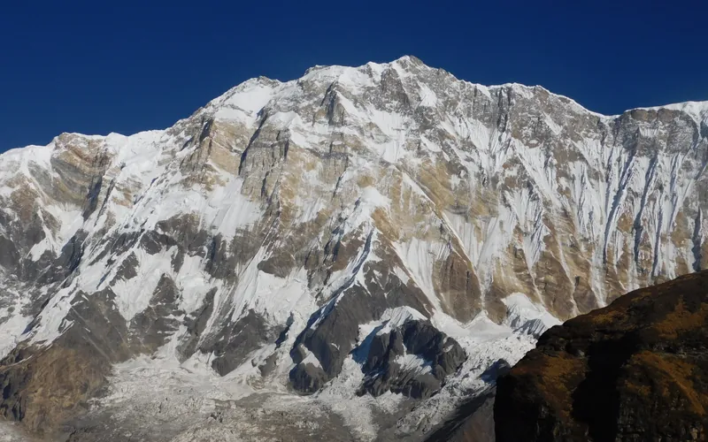
Annapurna I South Face (Bonington-Haston-Whillans Route)
The South Face of Annapurna I is one of the most formidable big-wall arenas in world mountaineering, rising 3,000 vertical metres of sheer rock, ice flutings, and overhanging bands directly from the Annapurna Sanctuary. First ascended via siege tactics by Dougal Haston and Don Whillans in 1970, it was later climbed in a revolutionary, lightweight solo push by Swiss alpinist Ueli Steck in October 2013 in just 28 hours round-trip.
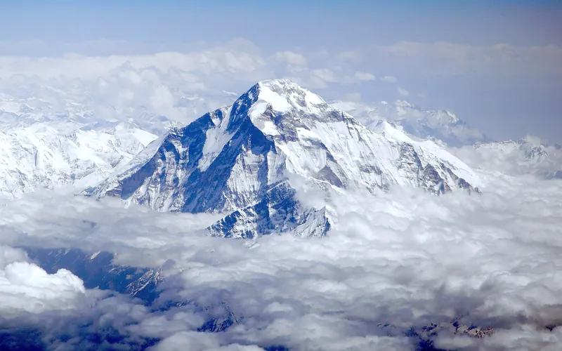
Dhaulagiri I Northeast Ridge (Normal Route)
The Northeast Ridge is the standard climbing route on Dhaulagiri I, first ascended in 1960 by a Swiss-Austrian team. The route begins on the glaciated Mayangdi Khola valley, climbs to the Northeast Col (5,700m), and works its way up the mountain's north-northeast face. The upper section traverses steep, wind-scoured blue ice shelves below the summit rocks and negotiates a final, exposed couloir leading directly to the 8,167m summit.
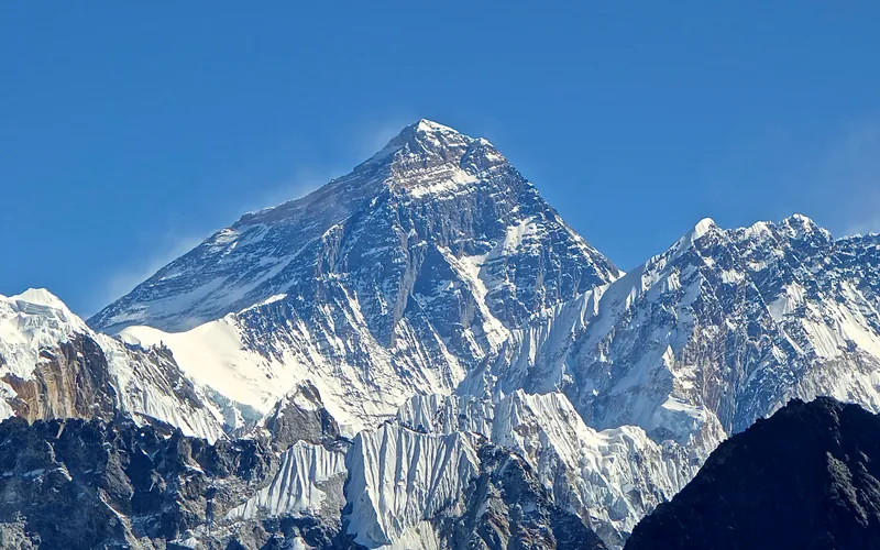
Mount Everest North Face (Hornbein Couloir Direct)
The North Face of Mount Everest via the Japanese Couloir and the sheer Hornbein Couloir is one of the most direct and formidable ice lines in the Himalayas. Rising 3,000 vertical meters from the Rongbuk Glacier to the summit, it funnels through a narrow 60-degree snow-and-ice cleft slicing straight through the Yellow Band and upper limestone cliffs of the North Face. In August 1986, Swiss alpinists Erhard Loretan and Jean Troillet executed one of the most audacious speed climbs in mountain history: climbing the entire face in a single 31-hour push at night without supplemental oxygen, tents, or fixed ropes. After summiting on August 30, they glissaded down the 3,000-meter face on their backs and buttocks in just 3.5 hours, completing the entire round trip in an astonishing 43 hours.
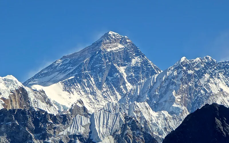
North Col & Northeast Ridge Route
The historic northern route on Mount Everest (8,848.86m), ascending from the Rongbuk and East Rongbuk glaciers to breach the icy wall of the North Col (7,020m). From the col, the route traverses the wind-blasted Northwest Ridge onto the North Face before joining the razor-like Northeast Ridge, navigating the notorious First, Second, and Third Steps in the Death Zone. This was the stage of George Mallory and Andrew Irvine's fateful 1924 climb and was first definitively surmounted on May 25, 1960, by Chinese climbers Wang Fuzhou, Qu Yinhua, and Gongbu.
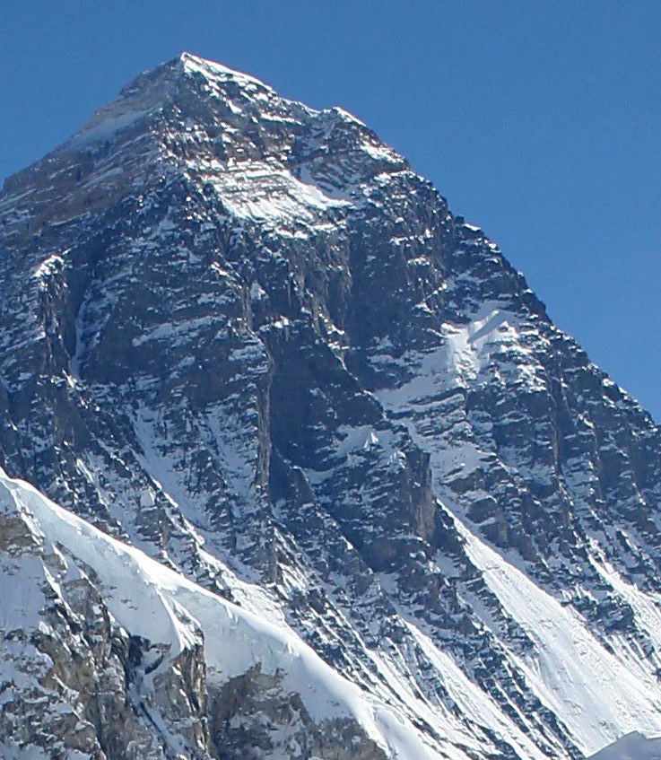
Mount Everest Southwest Face (Bonington Route)
The Southwest Face of Mount Everest (8,848.86m) rises 2,300 vertical meters from the Western Cwm to the summit, presenting one of the largest and most forbidding rock and ice faces in the world. Dominated by the vertical 300-meter 'Rock Band' at 8,200–8,500 meters, the face repelled six international attempts between 1969 and 1974. In autumn 1975, a legendary British expedition led by Chris Bonington breached the face when Paul Braithwaite and Nick Estcourt unlocked the key ramp through the Rock Band. On September 24, 1975, Doug Scott and Dougal Haston climbed to the South Summit and pushed on to the main summit, becoming the first Britons to conquer Everest. Trapped by nightfall during their descent, they survived an epic open bivouac at 8,760 meters without oxygen, sleeping bags, or frostbite.
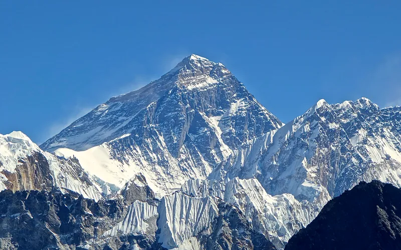
Mount Everest Complete West Ridge (Yugoslav Direct)
The Complete West Ridge of Mount Everest is one of the most formidable and sustained technical routes on the mountain. Pioneered in spring 1979 by an elite Yugoslav expedition led by Tone Škarja, the route tackles the integral knife-edge crest directly from the Lho La col (6,026m) all the way to the 8,848.86m summit. Unlike the 1963 American West Ridge route which diverted into the Hornbein Couloir from the North Face, the Yugoslav line stayed strictly along the razor-edge crest of the West Ridge, surmounting technical rock buttresses up to Grade V+ at extreme altitude before traversing around the Yellow Band. On May 13, 1979, Andrej Štremfelj and Nejc Zaplotnik achieved the first ascent of the complete ridge, followed two days later by Stane Belak, Marjan Manfreda, and Ang Phu Sherpa in one of the greatest feats in Himalayan history.
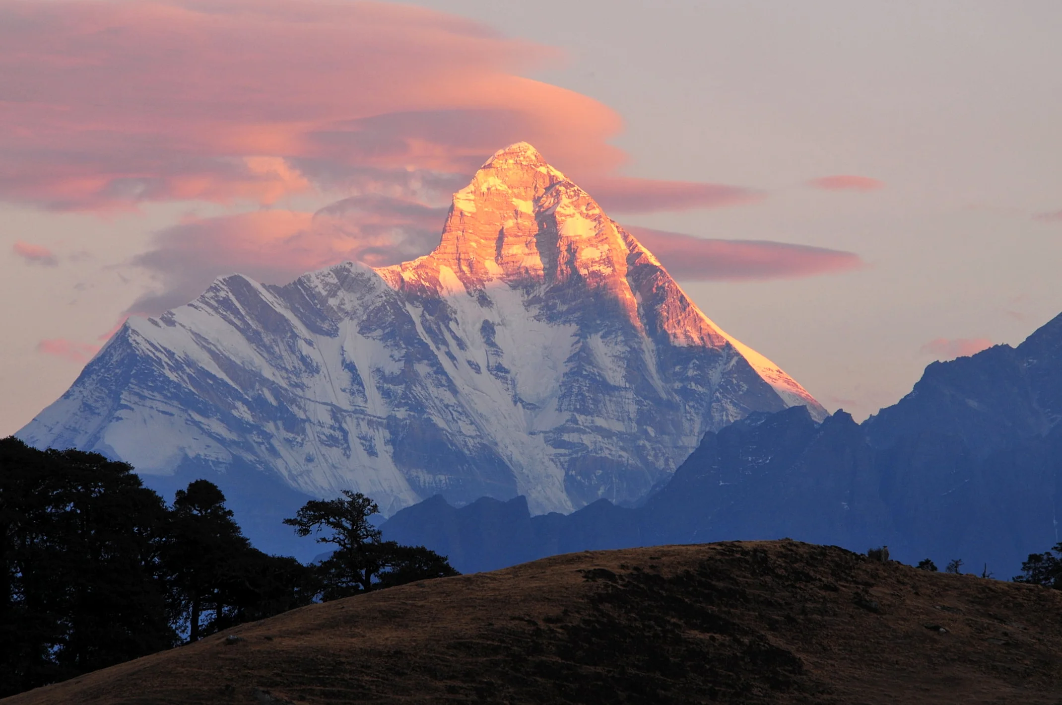
South Ridge & Coxcomb (Original 1936 Route)
The historic maiden first ascent route on Nanda Devi (7,816m), pioneered during the landmark 1936 British-American expedition by Bill Tilman and Noel Odell. Approached through the terrifyingly narrow, sheer chasms of the Rishi Ganga gorge into the virgin meadows of the Nanda Devi Sanctuary, the climb traverses the southern glaciated basin to ascend a razor-sharp rock spine known as the Coxcomb. Overcoming steep mixed rock towers and narrow snow ridges without supplemental oxygen, Tilman and Odell achieved the summit on August 29, 1936, establishing the highest mountain climbed by humans until 1950.
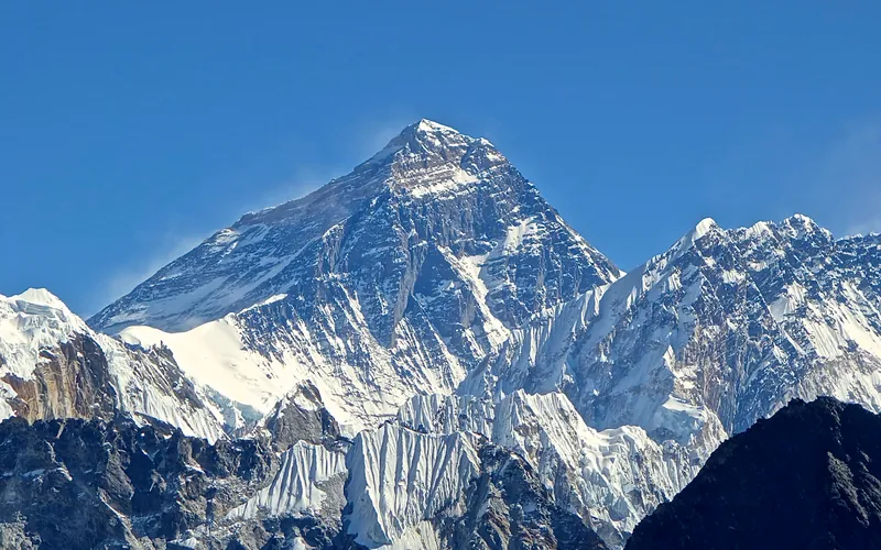
South Col & Southeast Ridge (Normal Route)
The South Col Route along the Southeast Ridge is the historic path of the 1953 first ascent and the most popular route on Mount Everest. Starting from Base Camp on the Khumbu Glacier in Nepal, climbers navigate the shifting seracs of the Khumbu Icefall into the Western Cwm. The route then scales the icy 45-degree slope of the Lhotse Face to the South Col at 7,925 meters, launching the final summit bid through the Balcony, South Summit, and Hillary Step to the summit of Earth at 8,848.86 meters.
Documented Expeditions (2)
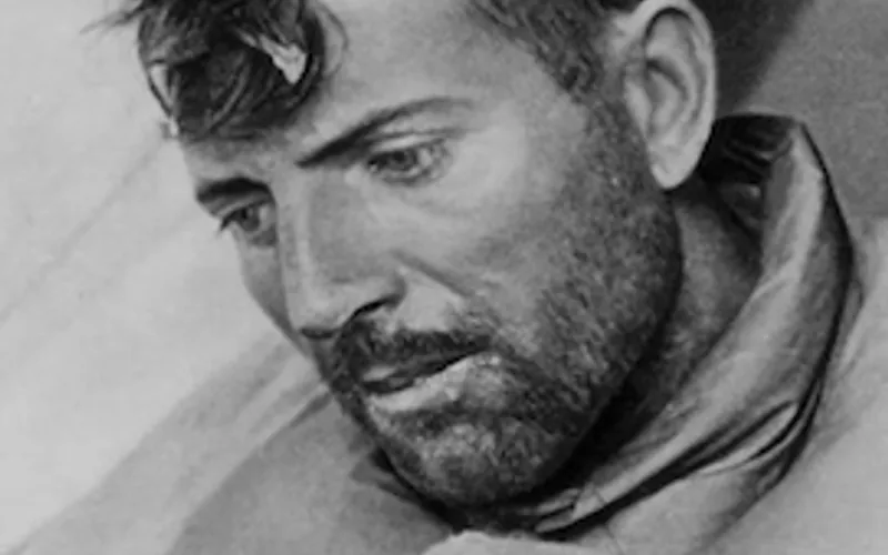
1950 French Annapurna Expedition
Led by Maurice Herzog, the 1950 French expedition made history by achieving the first summit of an 8,000-meter peak when Herzog and Louis Lachenal reached the top of Annapurna I (8,091m) on June 3, 1950, without supplemental oxygen.
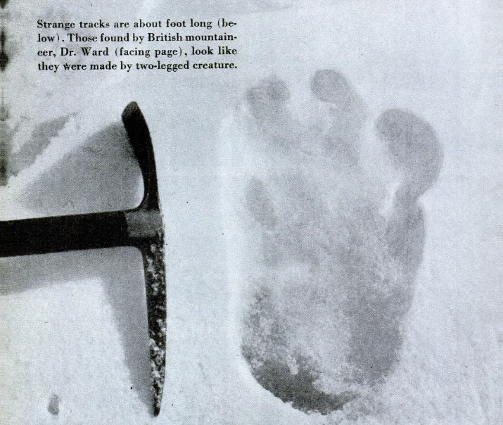
1951 British Mount Everest Reconnaissance Expedition
The pivotal 1951 reconnaissance expedition led by Eric Shipton and featuring Edmund Hillary that entered the newly opened Solukhumbu region of Nepal, conquered the chaotic Khumbu Icefall, and discovered the viable southern highway to Mount Everest's summit.
Documented Sources & Archival Citations
- Born in the Shadow of the Himalayas (Memoires d'un Sherpa)(Ang Tharkay / Amiot-Dumont)
Supporting claim: Autobiographical account of his expeditions with Shipton, Tilman, and the 1950 Annapurna first ascent
Accessed/Documented: 1954 - Annapurna: First Conquest of an 8,000-Meter Peak(Maurice Herzog / Jonathan Cape)
Supporting claim: Official expedition record honoring Ang Tharkay's pivotal sirdar leadership and lifesaving rescue
Accessed/Documented: 1951