
Nirmal Purja
Nirmal 'Nimsdai' Purja MBE is a Nepali-British high-altitude mountaineer and former Special Boat Service (SBS) operator who redefined modern alpinism. In 2019, he summited all fourteen of the world's 8,000-meter peaks in a record 189 days during Project Possible 14/7. In January 2021, he co-led the historic first winter ascent of K2, reaching the summit without supplemental oxygen.
Mountain Safety & Conditions Disclaimer: High-altitude climbing, glacial travel, and technical ascents entail severe objective risks including avalanches, serac collapses, rapid weather collapse, and altitude illness. Historical route descriptions and summit claims on Mountanity reflect documented archival sources and must not be used as live operational safety assessments. Local regulations, permits, and physical glacial topography change continuously.
Peer Review: Senior Editorial Board & Historical Reviewers • Editorial Standards
Biographical Record & Archival Chronicle
Nirmal 'Nimsdai' Purja was born on July 25, 1983, in Dana, a small village in the Myagdi District of western Nepal. Raised in Chitwan in the southern lowlands, he dreamed from childhood of military service. In 2003, at age nineteen, he joined the legendary British Brigade of Gurkhas, serving with distinction before becoming, in 2009, the first Gurkha to pass the grueling selection for the UK Special Forces' elite Special Boat Service (SBS). Across nearly a decade of classified combat operations as a cold-weather warfare specialist, Purja honed the extreme mental grit, physiological stamina, and high-stakes operational planning that would subsequently transform high-altitude mountaineering.
Purja's climbing journey began during military leave in 2012 when, with zero prior mountaineering experience, he trekked to Everest Base Camp and summited Lobuche East (6,119m). In 2014, he achieved his first 8,000-meter summit on Dhaulagiri I after just fifteen days of acclimatization. In 2016 and 2017, he led Gurkha expeditions to Mount Everest, summiting twice and pioneering fast-rotation tactics. Recognising his extraordinary high-altitude physiology, Queen Elizabeth II appointed Purja a Member of the Most Excellent Order of the British Empire (MBE) in 2018 for outstanding achievements in extreme high-altitude mountaineering. Months later, he resigned from the Special Forces just years short of a guaranteed lifetime military pension to pursue a lifelong dream that seasoned alpine authorities deemed impossible.
In 2019, Purja launched 'Project Possible 14/7'—a mission to summit all fourteen of the world's 8,000-meter 'death zone' peaks in just seven months, shattering the previous world record of seven years, ten months, and six days set by Kim Chang-ho. Starting on April 23 on the avalanche-prone north face of Annapurna I, Purja conquered Nepal's giants in rapid succession: Dhaulagiri, Kangchenjunga, Mount Everest, Lhotse, and Makalu. On Everest, Lhotse, and Makalu, he established a staggering record by summiting all three peaks in only 48 hours. Beyond speed, Purja gained global admiration for stopping his own climbs to lead life-saving high-altitude rescues, including the helicopter rescue of Dr. Chin Kin Wah on Annapurna and assisting stranded climbers on Kangchenjunga.
Phase 2 of Project Possible swept through Pakistan's Karakoram in July 2019. In just twenty-three days, Purja summited Nanga Parbat, Gasherbrum I, Gasherbrum II, K2, and Broad Peak. On K2, when dozens of international teams were paralyzed by deep snow and severe avalanche danger in the Bottleneck, Purja and his team of Nepali climbers took charge of route-fixing, broke trail through the drifts, and spearheaded the successful team summit push. Moving to Tibet for Phase 3, he claimed Cho Oyu on September 23 and Manaslu on September 27. When China initially withheld permits for Shishapangma, international diplomatic appeals facilitated by the Nepali government led to special clearance. On October 29, 2019, Purja stood on Shishapangma's summit, completing all fourteen 8,000ers in just 189 days (6 months and 6 days).
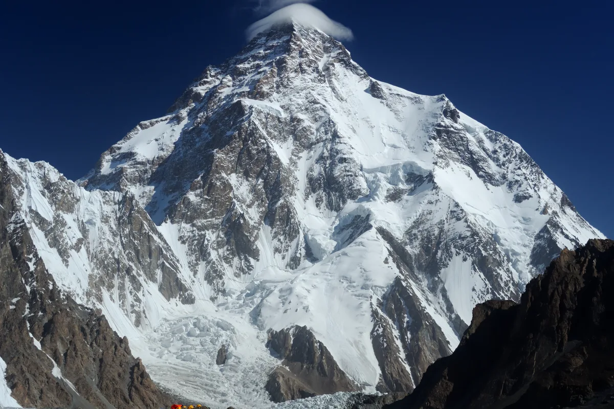
Fifteen months later, on January 16, 2021, Purja achieved high-altitude immortality by co-leading the historic first winter ascent of K2 (8,611m)—the last remaining 8,000-meter peak unclimbed in winter. In arctic temperatures of −65 °C, two Nepali teams unified their efforts. Purja chose to push for the summit entirely without supplemental oxygen, a feat of immense physiological defiance given his lack of high-camp acclimatization. Halting ten meters below the summit, all ten Nepali climbers linked arms, sang Nepal's national anthem, and stepped onto the summit together at 4:58 PM. Purja's career has redefined high-altitude mountaineering, shattered Western-centric historical paradigms, and brought rightful global recognition to Nepali and Sherpa climbers as supreme high-altitude masters.
Notable Milestones & Ascents
- Summited all fourteen 8,000-meter peaks in 189 days (6 months and 6 days) during Project Possible 14/7 (2019)
- First winter ascent of K2 (8,611m) on January 16, 2021, climbing without supplemental oxygen
- Fastest triple summit of Mount Everest, Lhotse, and Makalu in 48 hours (May 2019)
- Fastest continuous ascent of the five 8,000m peaks of Pakistan (K2, Nanga Parbat, Broad Peak, Gasherbrum I, Gasherbrum II) in 23 days
- Appointed Member of the Order of the British Empire (MBE) by Queen Elizabeth II (2018)
- Led daring high-altitude rescues on Annapurna I (Dr. Chin Kin Wah) and Kangchenjunga
- First Gurkha soldier to qualify and serve in the British Special Boat Service (SBS)
- Author of bestselling autobiographical chronicle 'Beyond Possible: One Soldier, Fourteen Peaks'
Key Statistics & Topographic Figures
- 14 Peaks Record
- 189 Days
Previous record: 7 years, 10 months
- 8,000m Summits
- 14 Giants
All death-zone peaks on Earth
- Fastest Triple Summit
- 48 Hours
Everest, Lhotse & Makalu in May 2019
- Karakoram Sprint
- 23 Days
All 5 Pakistan 8,000ers in July 2019
- K2 Winter First Ascent
- January 16, 2021
Summited without supplemental O2
- Military Service
- 16 Years
British Gurkhas & UK Special Forces (SBS)
Archival Primary Source Quotations
“When you are in the death zone, you don’t have time to doubt. You have to believe in your training, your brotherhood, and the impossible.”
“I wanted to show the world what the human spirit can achieve when you refuse to accept limits. Giving up is not in the blood.”
“We stepped onto the summit of K2 in winter together as one team, singing our national anthem, to prove that Nepali climbers belong at the very summit of mountaineering history.”
Defined Alpine Terminology & Concepts
- Project Possible 14/7
- The historic 2019 high-altitude expedition conceived and led by Nirmal Purja to summit all fourteen of the world’s 8,000-meter peaks in seven months, completed in 189 days.
- Winter K2
- The last remaining 8,000-meter peak unclimbed during the winter season until January 16, 2021, characterized by extreme jet-stream winds, −65 °C cold, and technical mixed climbing.
- Death Zone Window
- The critical 48-to-72-hour meteorological calm window during which human climbers can navigate elevations above 8,000 meters before physical deterioration becomes fatal.
- Trailbreaking
- The physically grueling effort of kicking steps and breaking a route through waist-deep unconsolidated snow at extreme altitude, traditionally executed by lead Sherpa climbers.
Frequently Asked Questions: Nirmal Purja
What is Nirmal Purja famous for in mountaineering history?
Nirmal "Nimsdai" Purja MBE is world-famous for summiting all fourteen of the world’s 8,000-meter peaks in a record-shattering 6 months and 6 days (189 days) in 2019 during "Project Possible 14/7", and for co-leading the historic first winter ascent of K2 on January 16, 2021, which he summited without supplemental oxygen.
How fast did Nirmal Purja climb all 14 eight-thousanders?
Nirmal Purja completed all fourteen 8,000-meter peaks between April 23, 2019 and October 29, 2019—a total span of 189 days. This pulverized the previous speed record of 7 years, 10 months, and 6 days set by South Korean climber Kim Chang-ho.
Did Nirmal Purja use supplemental oxygen on the first winter ascent of K2?
No. On January 16, 2021, when a unified team of ten Nepali mountaineers made the historic first winter ascent of K2 (8,611m), Nirmal Purja climbed and summited entirely without supplemental oxygen, despite having only acclimatized up to Camp 2 prior to the summit push.
What was Nirmal Purja’s background before professional mountaineering?
Purja served for sixteen years in the British military: six years in the renowned Brigade of Gurkhas (2003–2009) followed by nearly a decade in the Special Boat Service (SBS), the elite maritime counter-terrorism unit of the UK Special Forces, where he was a cold-weather warfare specialist.
What high-altitude rescues did Nirmal Purja conduct during Project Possible?
During his 2019 speed record, Purja stopped multiple summit bids to lead rescues. On Annapurna I, he led a high-altitude helicopter rescue operation that saved stranded Malaysian climber Dr. Chin Kin Wah at 7,500m. On Kangchenjunga, he and his team surrendered their own oxygen canisters to assist descending climbers who had run out of oxygen.
Who took the famous 2019 Mount Everest summit ridge traffic jam photo?
Nirmal Purja captured the viral photograph on May 22, 2019, while descending from the summit of Mount Everest toward the South Col. The photo showed hundreds of climbers queued along the Hillary Step and focused worldwide attention on overcrowding in commercial Himalayan guiding.
How many individual expeditions did Nirmal Purja complete during Project Possible?
Nirmal Purja completed 14 separate individual 8,000-meter peak expeditions across Nepal, Pakistan, and China between April 23 and October 29, 2019, conquering Annapurna I, Dhaulagiri, Kangchenjunga, Everest, Lhotse, Makalu, Nanga Parbat, Gasherbrum I, Gasherbrum II, K2, Broad Peak, Cho Oyu, Manaslu, and Shishapangma.
What world records does Nirmal Purja hold in mountaineering?
Nirmal Purja holds multiple world records certified by Guinness World Records and international alpine federations, including the fastest ascent of all 14 eight-thousanders (189 days), fastest triple summit of Everest, Lhotse, and Makalu (48 hours 30 minutes), fastest double summit of Everest and Lhotse (10 hours 15 minutes), and fastest continuous climb of all 5 Pakistani 8,000m peaks (23 days).
Associated Summits (15)
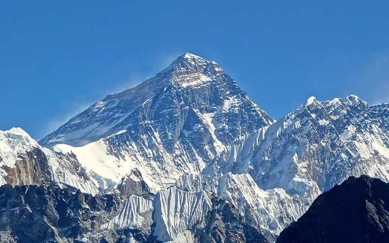


Mount Everest
Mount Everest is the highest mountain above sea level on Earth, standing at an official elevation of 8,848.86 meters (29,031.7 ft). Straddling the international frontier between Nepal and China, it is known locally as Sagarmatha in Nepali ('Goddess of the Sky') and Chomolungma in Tibetan ('Mother Goddess of the World'). The peak rises into the extreme upper troposphere, where oxygen levels drop to barely one-third of sea-level pressure. Climbers face hurricane-force jet stream winds, severe frostbite conditions, shifting ice crevasses in the Khumbu Icefall, and the dangerous Death Zone above 8,000 meters.
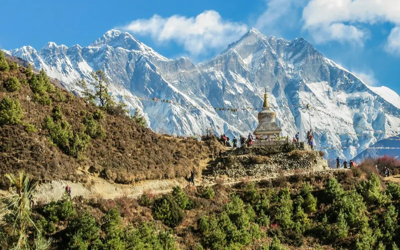

K2
K2, at 8,611 meters (28,251 ft), is the second-highest mountain on Earth and widely regarded as the most technically demanding and lethal 8,000-meter peak. Located in the heart of the Karakoram on the border between Pakistan and China, K2 is characterized by sheer relief, severe weather anomalies, and persistent objective hazards including the notorious Bottleneck couloir.
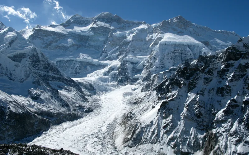

Kangchenjunga
Kangchenjunga, at 8,586 meters (28,169 ft), is the third-highest mountain on Earth, rising on the border between Nepal and Sikkim, India. Honored as sacred by locals, early ascent teams respected local beliefs by stopping short of the actual highest crest. It features immense vertical relief and notorious storm cycles.
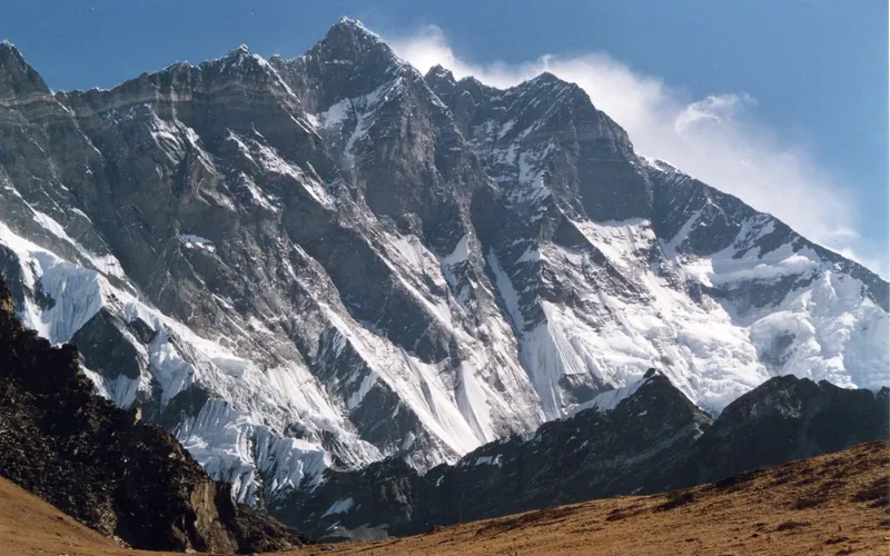
Lhotse
Lhotse, at 8,516 meters (27,940 ft), is the fourth-highest mountain on Earth, connected directly to Mount Everest via the South Col. Renowned for its sheer 3,200-meter South Face, one of the most imposing rock and ice walls in alpinism, the standard route tackles the grueling Lhotse Couloir from the Western Cwm.
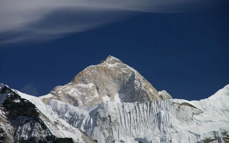
Makalu
Makalu, at 8,485 meters (27,838 ft), is the fifth-highest mountain on Earth, located 19 km southeast of Mount Everest. An isolated four-sided granite pyramid, it is known for technical knife-edge ridges, severe exposure, and punishing weather, making it one of the most challenging eight-thousanders.
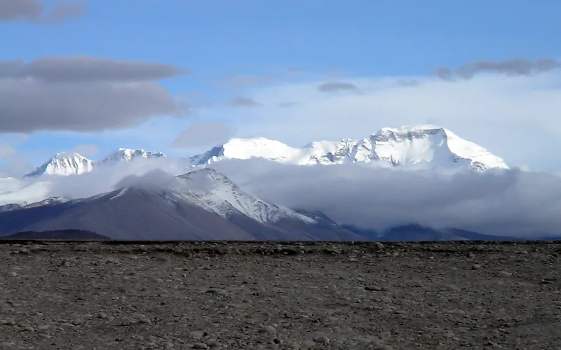
Cho Oyu
Cho Oyu, at 8,188 meters (26,864 ft), is the sixth-highest mountain in the world, situated 20 km west of Mount Everest. Meaning 'Turquoise Goddess' in Tibetan, it stands on the glaciated Nangpa La trade route between Nepal and Tibet. Its moderate northwest slopes make it the most accessible 8,000-meter peak.
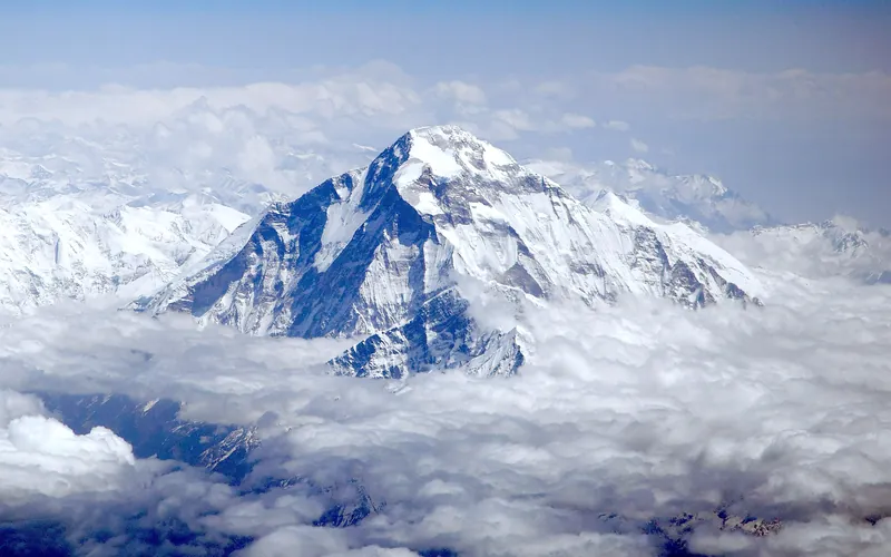
Dhaulagiri I
Dhaulagiri I, at 8,167 meters (26,795 ft), is the seventh-highest mountain on Earth and the highest peak situated entirely within Nepal. Rising steeply above the Kali Gandaki Gorge—the deepest gorge on Earth—opposite Annapurna, Dhaulagiri forms a staggering 7,000-meter vertical rise from the river valley.
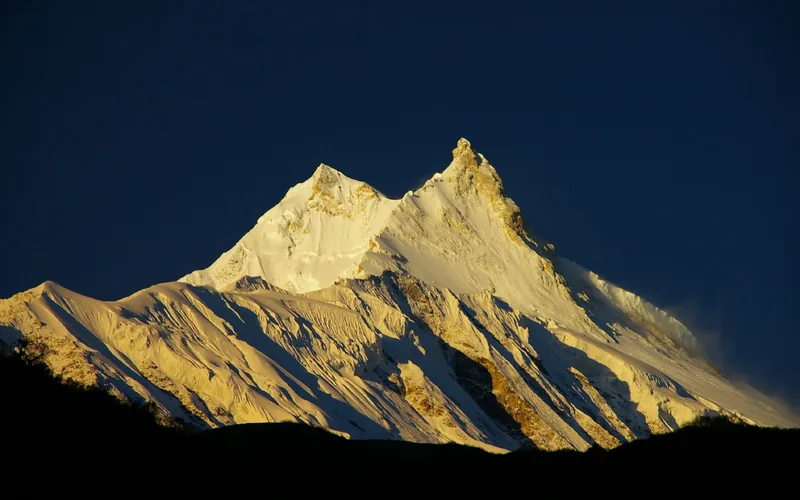
Manaslu
Manaslu, at 8,163 meters (26,781 ft), is the eighth-highest mountain in the world, situated in the Mansiri Himal of west-central Nepal. Known as the 'Mountain of the Spirit', its long ridges and valley glaciers offer dramatic topography culminating in a delicate, exposed knife-edge summit crest.
Nanga Parbat
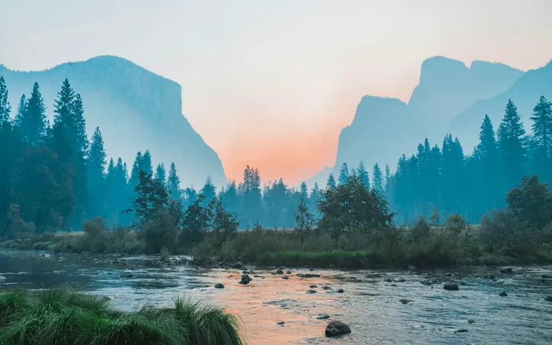
Nanga Parbat, at 8,126 meters (26,660 ft), is the ninth-highest mountain on Earth and the western anchor of the Himalayas in Pakistan. It boasts the Rupal Face, the highest vertical precipice in the world at 4,600 meters from valley floor to summit. Known for profound climbing history, highlighted by Hermann Buhl's legendary solo summit without supplemental oxygen in 1953.
Annapurna I
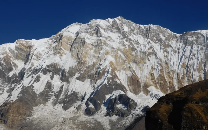
Annapurna I, at 8,091 meters (26,545 ft), is the tenth-highest mountain in the world and historically the first 8,000-meter peak ever summited (June 3, 1950 by Maurice Herzog and Louis Lachenal). Rising above the Annapurna Sanctuary, its north and south walls present extreme avalanche and serac fall hazards.
Gasherbrum I
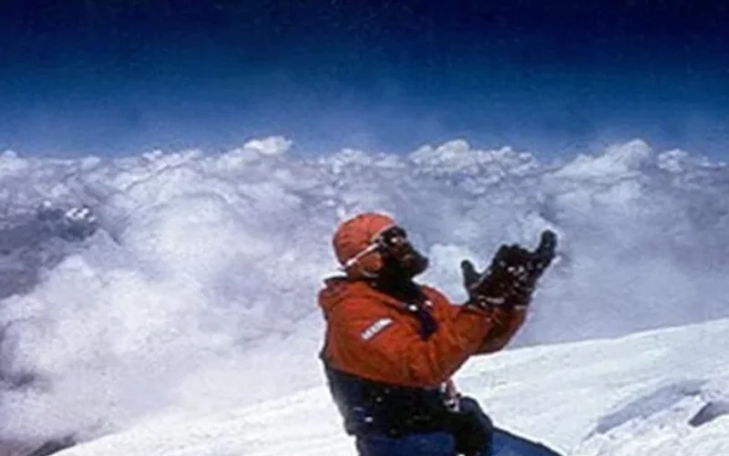
Gasherbrum I, at 8,068 meters (26,470 ft), is the eleventh-highest mountain in the world. Named 'Hidden Peak' by explorer William Martin Conway due to its concealment behind surrounding Karakoram giants, it stands on the border between Pakistan and China. The peak was first climbed in 1958 by an American team led by Nick Clinch, and in 1992 Nazir Sabir summited it with Rajab Shah and Mehrban Shah, marking his fourth Pakistani eight-thousander.
Broad Peak
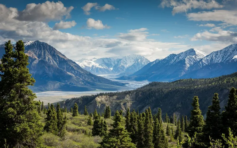
Broad Peak, at 8,051 meters (26,414 ft), is the twelfth-highest mountain in the world. Located in the Karakoram directly across the Godwin-Austen Glacier from K2, it is famous for its 1.5-kilometre-long summit crest. First climbed in lightweight alpine style without supplemental oxygen or high-altitude porters in 1957 by an Austrian team.
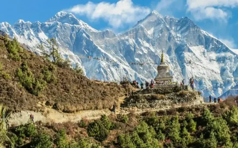
Gasherbrum II
Gasherbrum II, standing at 8,035 meters (26,362 ft), is the thirteenth-highest mountain on Earth and the third-highest peak of the Gasherbrum massif in the Karakoram. Located at the head of the Baltoro Glacier on the Pakistan-China frontier, it features a classic pyramidal profile with challenging ice couloirs. First summited in 1956 by an Austrian team, it was famously climbed in pure alpine style in 1982 by Reinhold Messner, Nazir Sabir, and Sher Khan.
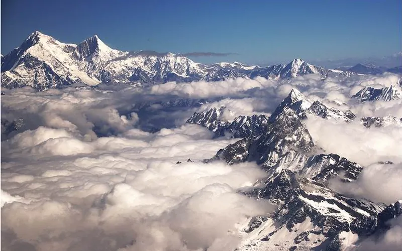
Shishapangma
Shishapangma, at 8,027 meters (26,335 ft), is the fourteenth-highest mountain on Earth and the only 8,000-meter peak situated entirely within Tibetan/Chinese territory. Due to geopolitical restrictions, it was the final eight-thousander to be climbed, summited by a Chinese expedition on May 2, 1964.
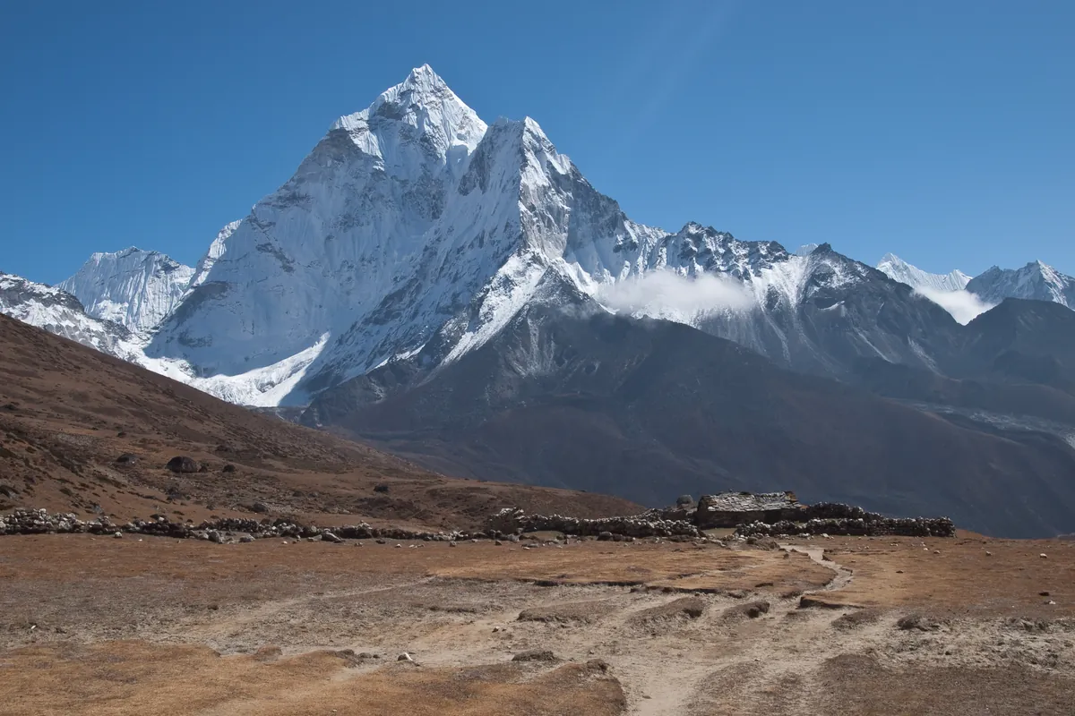
Ama Dablam
Ama Dablam is an iconic 6,812-meter (22,349 ft) mountain in the eastern Himalayan region of Nepal. Renowned worldwide for its soaring granite ridges and hanging glaciers, it is often called the Matterhorn of the Himalayas. Its name translates as 'Mother's Necklace', referring to the hanging serac resembling a traditional Sherpa pendant. Sir Edmund Hillary conceived and led the 1960–1961 Silver Hut Expedition that unlocked the mountain. On January 15, 1961, Hillary's assault team achieved the historic first ascent via the Southwest Ridge. It remains one of the most aesthetic and technically demanding alpine ascents in the world.
Pioneered & Associated Routes (25)
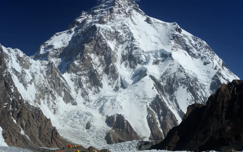
Abruzzi Spur (Southeast Ridge)
The Abruzzi Spur is the most famous and frequently climbed route on K2, tracing the mountain's steep southeast ridge from the Godwin-Austen Glacier to the summit. First explored in 1909 by Prince Luigi Amedeo, Duke of the Abruzzi, it was successfully climbed to the summit in 1954 by an Italian team. The route requires extreme physical endurance and high-grade technical climbing on rock, ice, and mixed terrain through legendary cruxes like House's Chimney, the Black Pyramid, and the Bottleneck couloir.
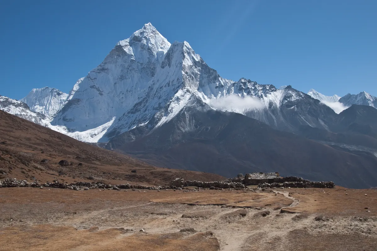
Southwest Ridge of Ama Dablam (Normal Route)
The Southwest Ridge is the iconic classic route on Ama Dablam and one of the finest technical ridge ascents in the Himalayas. First climbed on January 15, 1961, by Sir Edmund Hillary's Silver Hut Expedition team, the route climbs soaring granite towers, knife-edge snow flutings, and steep ice beneath the hanging Dablam glacier. The route features famous technical cruxes including the vertical granite Yellow Tower (UIAA 5.7), the breathtaking exposed Mushroom Ridge, and a steep final ice pitch to the 6,812-meter apex.
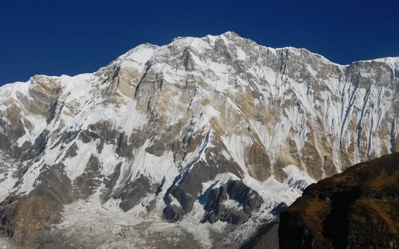
Annapurna I North Face (Herzog-Lachenal Route)
The North Face of Annapurna I is the historic first route ever climbed on an 8,000-meter peak, pioneered by French climbers Maurice Herzog and Louis Lachenal on June 3, 1950. Approached via the remote Miristi Khola valley, the route ascends the shattered North Annapurna Glacier, negotiates the terrifying avalanche-swept Sickle Glacier serac wall, and ascends steep snow gullies along the French Rib to gain the 8,091m summit.
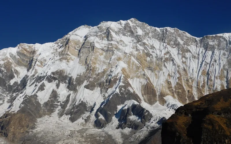
Annapurna I South Face (Bonington-Haston-Whillans Route)
The South Face of Annapurna I is one of the most formidable big-wall arenas in world mountaineering, rising 3,000 vertical metres of sheer rock, ice flutings, and overhanging bands directly from the Annapurna Sanctuary. First ascended via siege tactics by Dougal Haston and Don Whillans in 1970, it was later climbed in a revolutionary, lightweight solo push by Swiss alpinist Ueli Steck in October 2013 in just 28 hours round-trip.
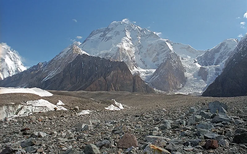
Normal Route (West Ridge & Northwest Face)
The Normal Route on Broad Peak ascends the rugged western spur from the Godwin-Austen Glacier, navigating steep mixed rock ribs before entering the upper glacial basin beneath the high saddle (the Col). From the Col at 7,800 meters, climbers enter the Death Zone to tackle the long, corniced summit ridge leading across the Foresummit to the true summit at 8,051 meters. First conquered in 1957 by an Austrian team in lightweight alpine style without bottled oxygen, and climbed in 1982 by Reinhold Messner, Nazir Sabir, and Sher Khan in a groundbreaking rapid alpine push.
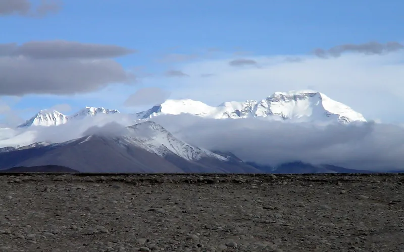
Cho Oyu Northwest Face & Ridge (Normal Route)
The Northwest Ridge is the standard and most climbed route on Cho Oyu, approached from the Tibetan plateau via the Gyabrag Glacier. First climbed in 1954 by an Austrian expedition, the route features relatively moderate snow slopes of 30 to 40 degrees, punctuated by a single prominent technical crux known as the Ice Cliff at 6,700m. Above Camp 3, climbers cross the Yellow Band and emerge onto a vast, gently rising summit plateau.
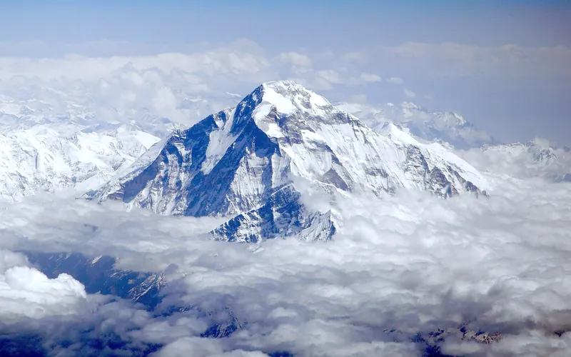
Dhaulagiri I Northeast Ridge (Normal Route)
The Northeast Ridge is the standard climbing route on Dhaulagiri I, first ascended in 1960 by a Swiss-Austrian team. The route begins on the glaciated Mayangdi Khola valley, climbs to the Northeast Col (5,700m), and works its way up the mountain's north-northeast face. The upper section traverses steep, wind-scoured blue ice shelves below the summit rocks and negotiates a final, exposed couloir leading directly to the 8,167m summit.
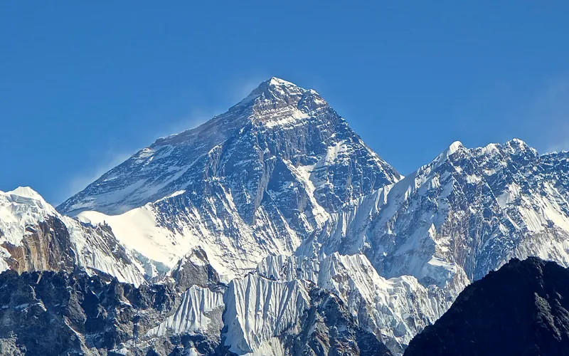
Mount Everest North Face (Hornbein Couloir Direct)
The North Face of Mount Everest via the Japanese Couloir and the sheer Hornbein Couloir is one of the most direct and formidable ice lines in the Himalayas. Rising 3,000 vertical meters from the Rongbuk Glacier to the summit, it funnels through a narrow 60-degree snow-and-ice cleft slicing straight through the Yellow Band and upper limestone cliffs of the North Face. In August 1986, Swiss alpinists Erhard Loretan and Jean Troillet executed one of the most audacious speed climbs in mountain history: climbing the entire face in a single 31-hour push at night without supplemental oxygen, tents, or fixed ropes. After summiting on August 30, they glissaded down the 3,000-meter face on their backs and buttocks in just 3.5 hours, completing the entire round trip in an astonishing 43 hours.
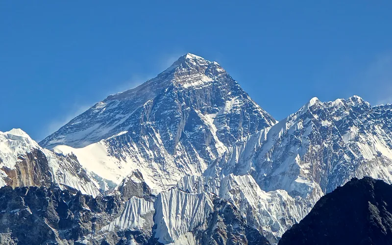
North Col & Northeast Ridge Route
The historic northern route on Mount Everest (8,848.86m), ascending from the Rongbuk and East Rongbuk glaciers to breach the icy wall of the North Col (7,020m). From the col, the route traverses the wind-blasted Northwest Ridge onto the North Face before joining the razor-like Northeast Ridge, navigating the notorious First, Second, and Third Steps in the Death Zone. This was the stage of George Mallory and Andrew Irvine's fateful 1924 climb and was first definitively surmounted on May 25, 1960, by Chinese climbers Wang Fuzhou, Qu Yinhua, and Gongbu.
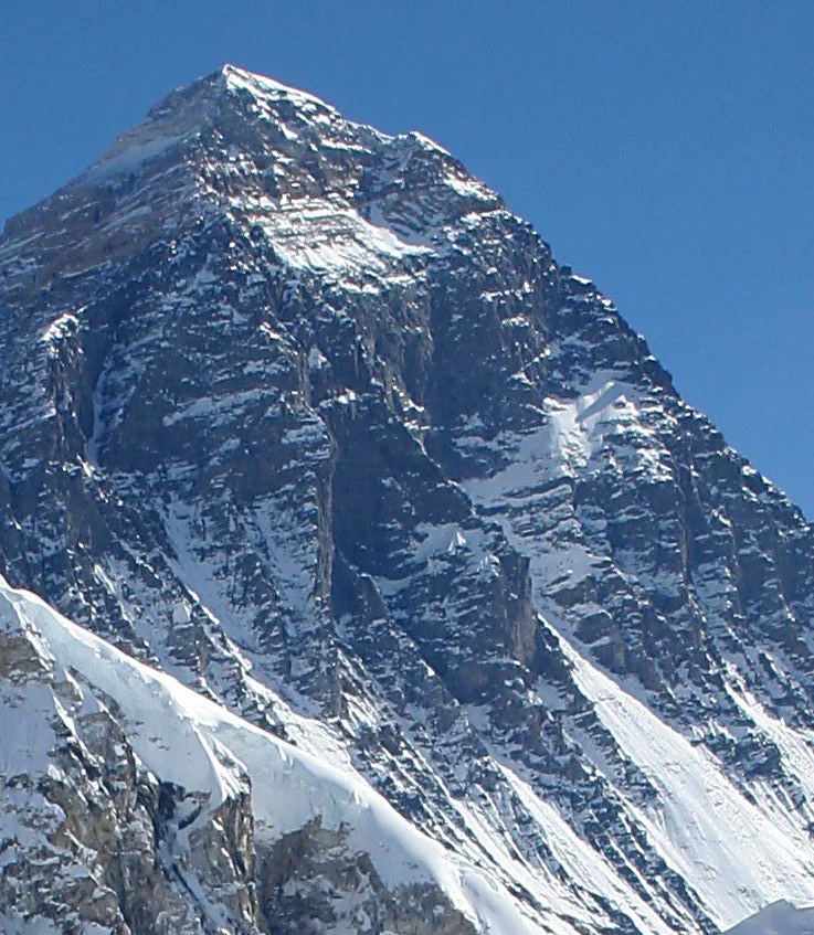
Mount Everest Southwest Face (Bonington Route)
The Southwest Face of Mount Everest (8,848.86m) rises 2,300 vertical meters from the Western Cwm to the summit, presenting one of the largest and most forbidding rock and ice faces in the world. Dominated by the vertical 300-meter 'Rock Band' at 8,200–8,500 meters, the face repelled six international attempts between 1969 and 1974. In autumn 1975, a legendary British expedition led by Chris Bonington breached the face when Paul Braithwaite and Nick Estcourt unlocked the key ramp through the Rock Band. On September 24, 1975, Doug Scott and Dougal Haston climbed to the South Summit and pushed on to the main summit, becoming the first Britons to conquer Everest. Trapped by nightfall during their descent, they survived an epic open bivouac at 8,760 meters without oxygen, sleeping bags, or frostbite.
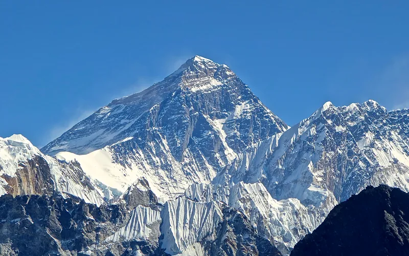
Mount Everest Complete West Ridge (Yugoslav Direct)
The Complete West Ridge of Mount Everest is one of the most formidable and sustained technical routes on the mountain. Pioneered in spring 1979 by an elite Yugoslav expedition led by Tone Škarja, the route tackles the integral knife-edge crest directly from the Lho La col (6,026m) all the way to the 8,848.86m summit. Unlike the 1963 American West Ridge route which diverted into the Hornbein Couloir from the North Face, the Yugoslav line stayed strictly along the razor-edge crest of the West Ridge, surmounting technical rock buttresses up to Grade V+ at extreme altitude before traversing around the Yellow Band. On May 13, 1979, Andrej Štremfelj and Nejc Zaplotnik achieved the first ascent of the complete ridge, followed two days later by Stane Belak, Marjan Manfreda, and Ang Phu Sherpa in one of the greatest feats in Himalayan history.
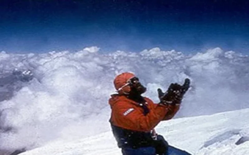
Northwest Face & Japanese Couloir (Normal Route)
The Northwest Face via the Japanese Couloir is the standard and most frequently climbed line on Gasherbrum I (8,068m / Hidden Peak). Starting from the South Gasherbrum Glacier, climbers traverse the shared lower icefall into the Gasherbrum Cwm, then branch southward toward the forbidding northwest wall. The technical centerpiece is the Japanese Couloir—a sustained 50 to 60-degree gully of hard blue ice and shattered rock leading to the high col and summit slopes. First ascended in 1958 by Americans Pete Schoening and Andy Kauffman via the South Ridge, the Japanese Couloir line became the modern benchmark, climbed rapidly in 1992 by Nazir Sabir, Rajab Shah, and Mehrban Shah.
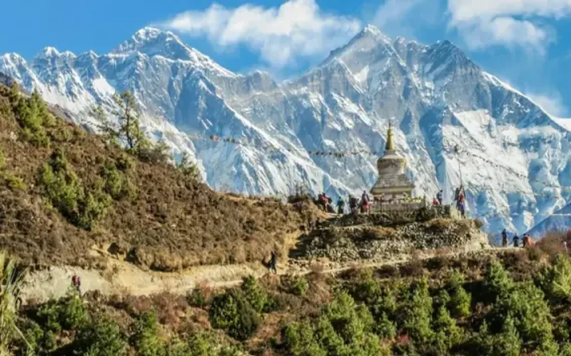
Southwest Ridge (Normal Route)
The Southwest Ridge is the standard and historically celebrated route on Gasherbrum II (8,035m). Starting from the South Gasherbrum Glacier, climbers navigate the heavily crevassed lower icefall into the Gasherbrum Cwm before tackling the technical crux of the route: the steep mixed snow and ice crest known as the Banana Ridge. Above Camp III, the route traverses expansive snow basins into the Death Zone, making a final push up a delicate diagonal couloir to the summit. First climbed in 1956 by an Austrian team, and completed in rapid alpine style in 1982 by Reinhold Messner, Nazir Sabir, and Sher Khan.
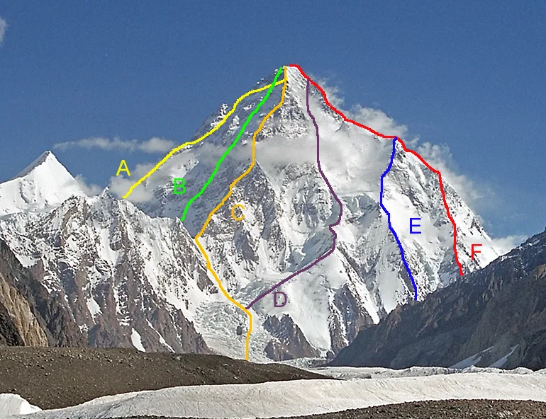
K2 South Face (The Polish Line)
The Polish Line on the South Face of K2 (8,611m) is widely regarded as one of the most perilous and audacious routes ever climbed in high-altitude mountaineering history. Tackling the direct 3,200-meter wall between the Abruzzi Spur and the Magic Line (South-Southwest Pillar), the route ascends through a chaotic labyrinth of hanging seracs, avalanche funnels, and vertical rock bands. Pioneered in alpine style over five harrowing days in July 1986 by Jerzy Kukuczka and Tadeusz Piotrowski without supplemental oxygen, Reinhold Messner famously dubbed it 'suicidal'. Kukuczka and Piotrowski reached the summit on July 8, but tragedy struck during their desperate descent via the Abruzzi Spur when Piotrowski lost both crampons and plunged to his death. To this day, the Polish Line remains unrepeated.
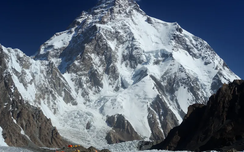
West Ridge (Japanese Route)
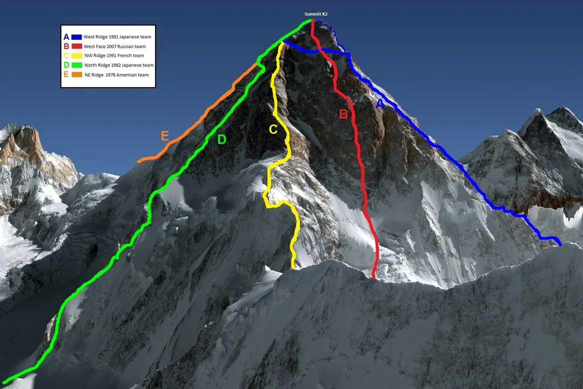
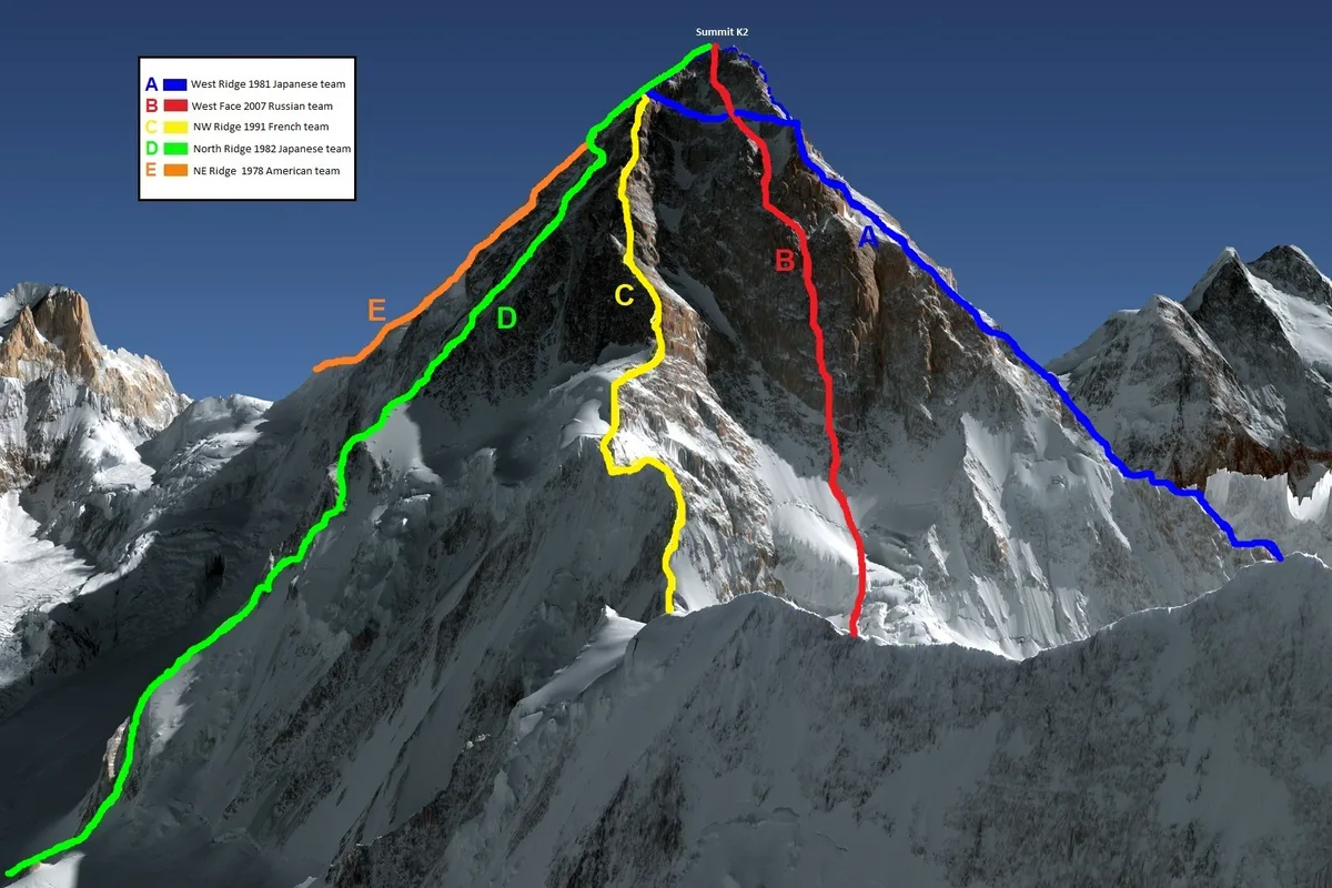
The West Ridge of K2 is one of the most formidable and sustained technical lines in high-altitude mountaineering. Pioneered in August 1981 by a joint Japanese-Pakistani expedition, it ascends directly from the Savoia Glacier along the exposed western crest before negotiating the severe Southwest Face directly into the Death Zone. Demanding immense commitment, it was first completed by Pakistani mountaineer Nazir Sabir and Japanese climber Eiho Ohtani after an epic bivouac near 8,500 meters.
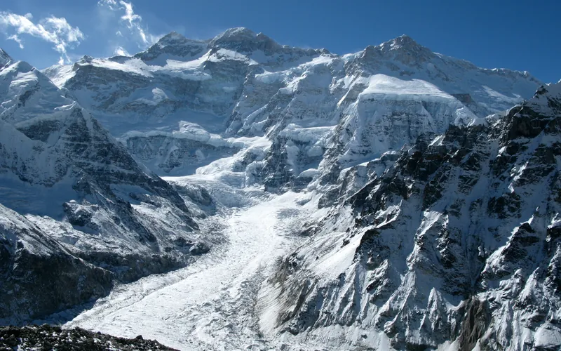
Kangchenjunga Southwest Face (Normal Route)
The Southwest Face route is the classic line of ascent on Kangchenjunga, climbing out of the Yalung Glacier cirque in eastern Nepal. First forged in 1955 by British mountaineers Joe Brown and George Band, the route negotiates heavily broken glacial icefalls, ascends the vast hanging snow terrace of The Great Shelf, and threads steep rock gullies in the Sickle Couloir before reaching the delicate summit crest.
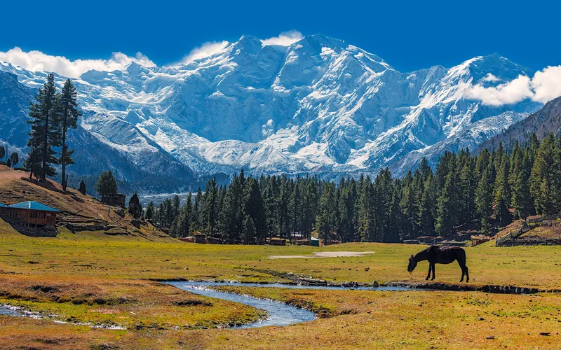
Kinshofer Route (Diamir Face)
The Kinshofer Route is the standard climbing route up the Diamir Face on Nanga Parbat's western side. First climbed in 1962 by German mountaineer Toni Kinshofer and his teammates, it is famous for its early vertical crux, the Kinshofer Wall, which sits low on the mountain between Camp I and Camp II. Once past the wall, climbers face a massive glaciated amphitheater leading up into the freezing upper Bazhin Basin and summit shoulder.
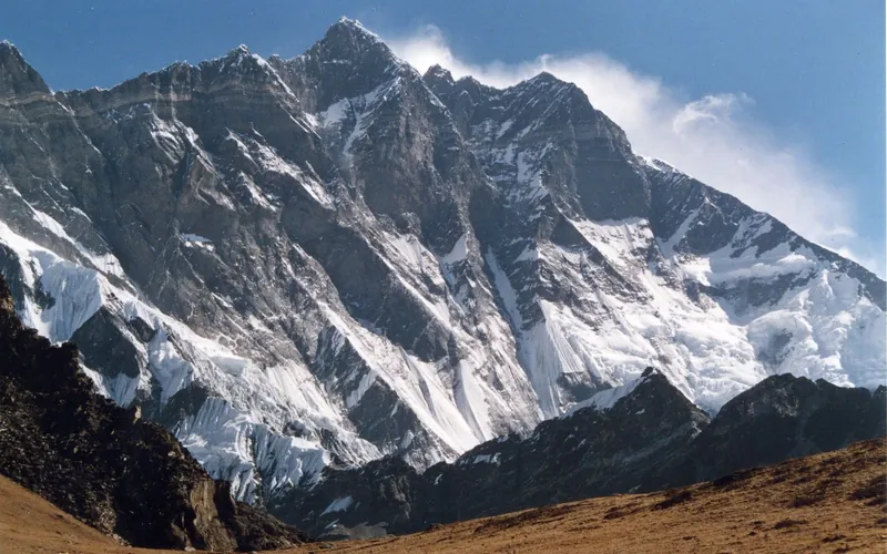
Lhotse Normal Route (West Face & Couloir)
The Normal Route on Lhotse shares the Everest South Col route through the treacherous Khumbu Icefall and across the Western Cwm up to Camp 3 on the Lhotse Face (7,200m). Beyond the Yellow Band, the route splits right from the South Col route and ascends directly into the notorious Lhotse Couloir—a narrow, 500-meter vertical gully of 45-to-50-degree hard blue ice funneling into the 8,516m summit.
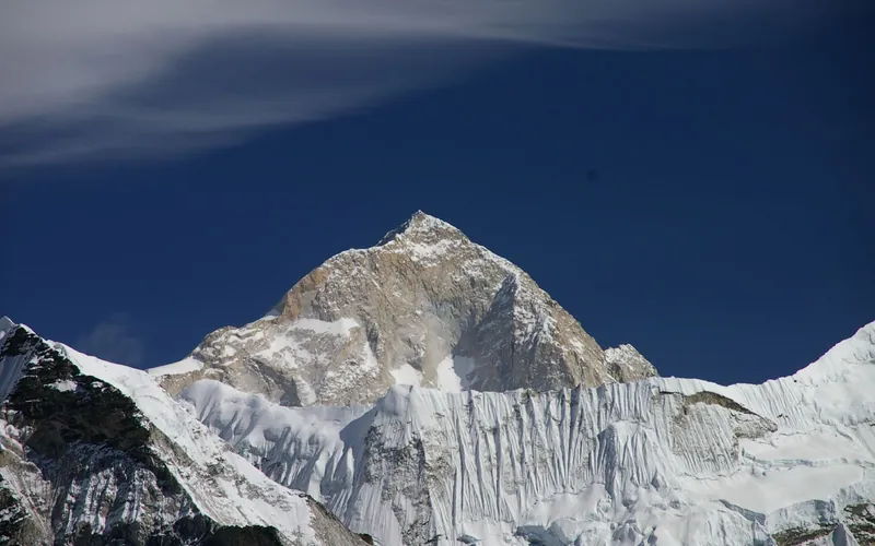
Makalu Northwest Ridge (French Route)
The Northwest Ridge is the classic pioneering line on Makalu, first opened by the historic French expedition of 1955. From Advanced Base Camp on the Chago Glacier, climbers ascend steep snow and ice fields to gain Makalu La (7,400m), a high, wind-blasted col connecting Makalu to Kangchungtse. Above Makalu La, the route climbs through the technical French Couloir—a mixed corridor of steep ice and broken granite—before emerging onto the exposed summit crest.
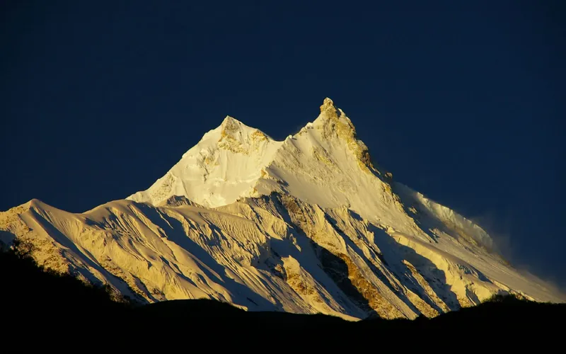
Manaslu Northeast Face (Normal Route)
The Northeast Face is the standard route on Manaslu, first forged in 1956 by a Japanese expedition. Ascending from the Manaslu Glacier above the village of Samagaon, the route climbs through an active, heavily crevassed icefall between Camps 1 and 2, traverses wide snow plateaus up to Camp 4, and culminates in a delicate, exposed knife-edge snow arête leading to the true summit pin.
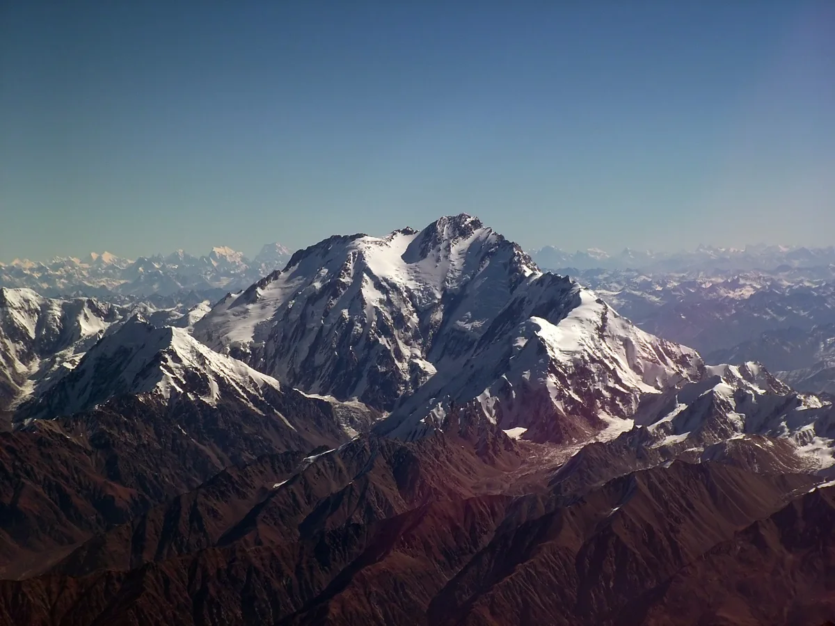
Mazeno Ridge Complete Traverse
The Mazeno Ridge of Nanga Parbat is widely considered the longest and most demanding high-altitude ridge on any eight-thousander, stretching an unbelievable 10 kilometres in length and traversing eight subsidiary peaks exceeding 7,000 metres before meeting the final summit pyramid. Long dubbed the last great problem of the Western Himalaya, it defeated numerous elite expeditions over three decades until British veterans Sandy Allan and Rick Allen completed the first full integral traverse and summit push in pure alpine style over eighteen heroic days in July 2012.
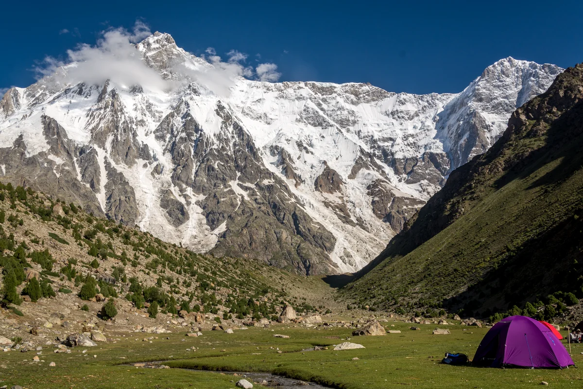
Central Pillar of the Rupal Face Direct
The Central Pillar of the Rupal Face on Nanga Parbat is the greatest vertical mountain wall on Earth, rising an astounding 4,100 metres from the Rupal Valley floor to the 8,126-metre summit. First attempted over decades, it was conquered in pure, lightweight alpine style between September 1 and 8, 2005, by American alpinists Steve House and Vince Anderson without fixed ropes, high camps, or supplemental oxygen, earning them the prestigious Piolet d'Or.
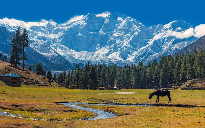
Rakhiot Flank & East Ridge (Original 1953 Route)
The historic original route on Nanga Parbat (8,126m), ascending from the Rakhiot Glacier over the heavily crevassed Rakhiot Icefall to reach the colossal Silbersattel (Silver Saddle) at 7,450 meters. From the saddle, the route traverses an immense high snow plateau for over three kilometers before negotiating the Bazhin Gap and climbing steep mixed rock ribs up the summit pyramid. Immortalized by Hermann Buhl's epic 41-hour solo summit without supplemental oxygen in July 1953.
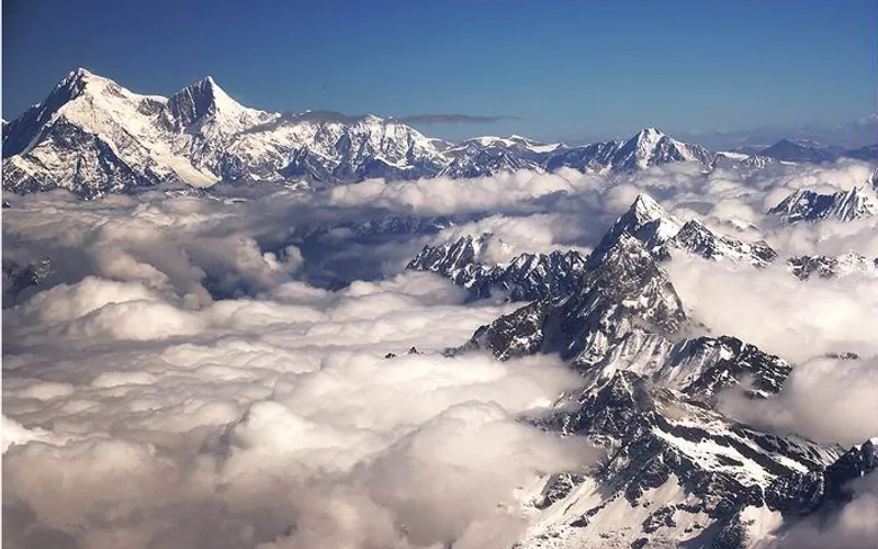
Shishapangma Northwest Ridge (Normal Route)
The Northwest Ridge is the standard route on Shishapangma, situated entirely in Tibet and first ascended by a Chinese expedition in 1964. Approached from the dry, high-altitude plateau of southern Tibet, the route climbs gently sloping glaciers to an upper plateau, gains the Central Peak (8,008m), and traverses a knife-edge snow arête with massive drop-offs to reach the true Main Summit at 8,027m.
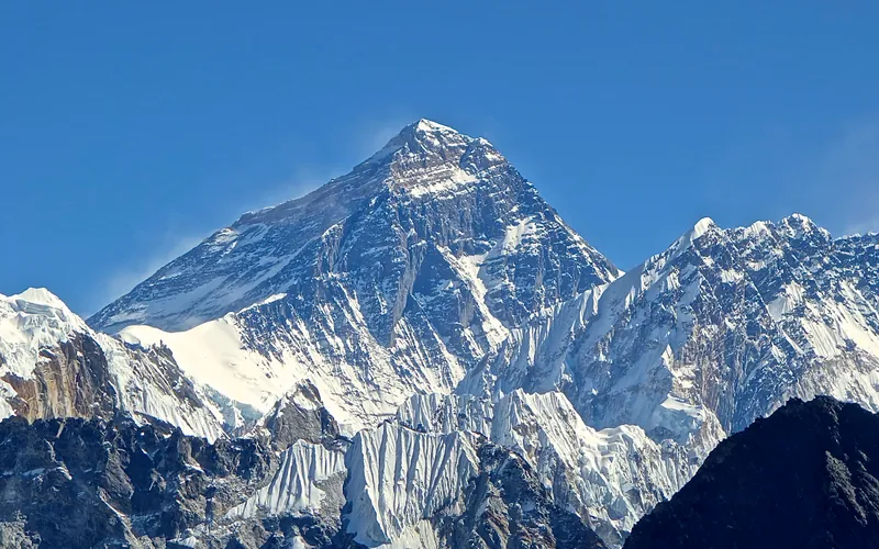
South Col & Southeast Ridge (Normal Route)
The South Col Route along the Southeast Ridge is the historic path of the 1953 first ascent and the most popular route on Mount Everest. Starting from Base Camp on the Khumbu Glacier in Nepal, climbers navigate the shifting seracs of the Khumbu Icefall into the Western Cwm. The route then scales the icy 45-degree slope of the Lhotse Face to the South Col at 7,925 meters, launching the final summit bid through the Balcony, South Summit, and Hillary Step to the summit of Earth at 8,848.86 meters.
Documented Expeditions (19)
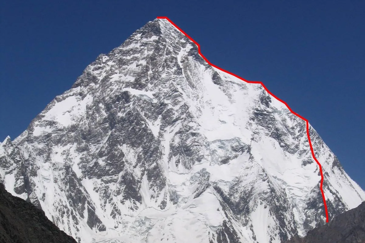
2019 Mingma David Sherpa: Youngest 14 Peaks Record & High-Altitude Speed Campaign
On October 29, 2019, Mingma Gyabu 'David' Sherpa completed all fourteen 8,000-metre peaks at Shishapangma, becoming the youngest person in mountaineering history to stand on every eight-thousander at 30 years and 166 days.
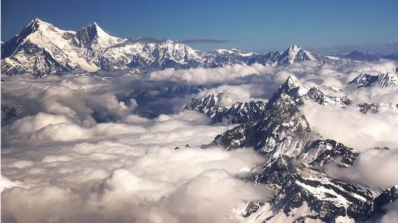
Project Possible 14/7: The 189-Day 14-Peak Odyssey
Led by former British Gurkha and Special Boat Service (SBS) operator Nirmal 'Nimsdai' Purja MBE, Project Possible 14/7 shattered the world speed record by summiting all fourteen 8,000-meter peaks in 6 months and 6 days (189 days), smashing the prior record of nearly eight years.
2019 Nirmal Purja Annapurna I Expedition
Nirmal Purja inaugurated Project Possible 14/7 on April 23, 2019, summiting Annapurna I (8,091m) via the North Face, before executing the daring high-altitude helicopter rescue of Dr. Chin Kin Wah.
2019 Nirmal Purja Broad Peak Expedition
Nirmal Purja summited Broad Peak (8,051m) via the West Ridge on July 26, 2019, just 48 hours after K2, successfully concluding his five-peak Karakoram campaign in an astonishing 23 days.
2019 Nirmal Purja Cho Oyu Expedition
Nirmal Purja launched the final phase of Project Possible by summiting Cho Oyu (8,188m) via the Northwest Ridge from Tibet on September 23, 2019, securing his twelfth 8,000-meter peak.
2019 Nirmal Purja Dhaulagiri I Expedition
Nirmal Purja conquered Dhaulagiri I (8,167m) via the Northeast Ridge on May 12, 2019, battling sustained hurricane-force winds and complete whiteout conditions to secure the second summit of Project Possible.
2019 Nirmal Purja Gasherbrum I Expedition
Nirmal Purja climbed Gasherbrum I (8,080m) via the Japanese Couloir on July 15, 2019, navigating heavily crevassed glacier fields to secure his eighth 8,000-meter summit of the year.
2019 Nirmal Purja Gasherbrum II Speed Ascent
Nirmal Purja summited Gasherbrum II (8,035m) via the Southwest Ridge on July 18, 2019, completing a blistering 72-hour double ascent across the rugged Gasherbrum massif.
2019 Nirmal Purja K2 Summer Expedition
Nirmal Purja and his Nepali team cracked open K2 (8,611m) on July 24, 2019, breaking trail through chest-deep Bottleneck snow after all international commercial expeditions had turned back in despair.
2019 Nirmal Purja Kangchenjunga Expedition
Nirmal Purja summited Kangchenjunga (8,586m) via the Southwest Face on May 15, 2019, just three days after Dhaulagiri, before sacrificing his personal oxygen to aid dying climbers at 8,400 meters.
2019 Nirmal Purja Lhotse Speed Ascent
Nirmal Purja summited Lhotse (8,516m) via the Reiss Couloir on May 22, 2019, just 10 hours and 15 minutes after standing on the summit of Everest, shattering the high-altitude speed record.
2019 Nirmal Purja Makalu Expedition
Nirmal Purja summited Makalu (8,485m) via the Northwest Ridge on May 24, 2019, completing an unprecedented sweep of Everest, Lhotse, and Makalu within 48 hours to conclude Phase One.
2019 Nirmal Purja Manaslu Expedition
Nirmal Purja reached the summit of Manaslu (8,163m) via the Northeast Face on September 27, 2019, just four days after Cho Oyu, conquering his thirteenth 8,000-meter giant.
2019 Nirmal Purja Mount Everest Expedition
Nirmal Purja summited Mount Everest (8,849m) via the South Col on May 22, 2019, capturing the historic traffic jam photo before descending immediately to launch his speed ascent of Lhotse.
2019 Nirmal Purja Nanga Parbat Expedition
Nirmal Purja inaugurated Phase Two of Project Possible on July 3, 2019, summiting Nanga Parbat (8,126m) via the vertical granite and ice of the Diamir Face's Kinshofer Route.
2019 Nirmal Purja Shishapangma Expedition
Nirmal Purja summited Shishapangma (8,027m) via the Northern Route on October 29, 2019, completing all fourteen 8,000-meter peaks in 189 days to rewrite mountaineering history.
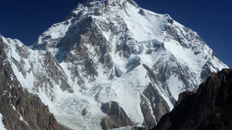
2021 Nepali K2 Historic First Winter Ascent
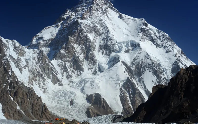
On January 16, 2021, a team of ten Nepali mountaineers accomplished the historic first-ever winter ascent of K2 (8,611m), conquering the last remaining unclimbed eight-thousander in winter. Nirmal Purja achieved the summit entirely without supplemental oxygen.
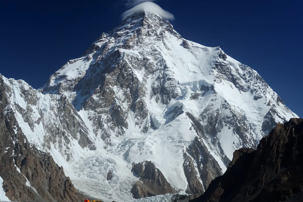
2021 All-Nepali Unified Team: Historic First Winter Ascent of K2
On January 16, 2021, ten elite Nepali climbers joined forces in the Karakoram winter death zone, braved temperatures below -50°C and hurricane winds on the Abruzzi Spur, waited 10 metres below the apex to gather in solidarity, and stepped onto the 8,611-metre summit together singing Nepal's national anthem.
2024 All-Time High-Altitude Capstone: The Modern Nepali Renaissance
The ultimate retrospective celebrating the modern generation of Nepali climbers who transformed high-altitude mountaineering from colonial client support into indigenous world leadership, culminating in the winter conquest of K2 and revolutionizing global alpine ethics.
Associated Chronicles & Stories (18)
Brotherhood in the Death Zone: The Historic 2021 Winter Ascent of K2
For over three decades, K2 in winter stood as mountaineering's greatest fortress. Every other 8,000-metre giant on Earth had surrendered to winter assaults, but...
Masters of the Vertical World: The Modern Nepali Renaissance
For nearly a century after the first European reconnaissance expeditions entered the Himalayas in the 1920s, the narrative of high-altitude mountaineering was f...
Annapurna I: The Crucible of Project Possible & Rescue
The dramatic story of Nirmal Purja's Annapurna I ascent, opening Project Possible and executing a miraculous high-altitude helicopter rescue.
Broad Peak: Capping the 23-Day Karakoram Blitzkrieg Run
How Nirmal Purja conquered Broad Peak two days after K2, completing all five Pakistani 8,000ers in a record 23 days.
Cho Oyu: Opening the Final Tibetan Phase of the Project
Nirmal Purja attacks Cho Oyu from Tibet, conquering the Turquoise Goddess at lightning speed to launch Phase Three.
Dhaulagiri I: Summiting the White Mountain in a Tempest
How Nirmal Purja and his Nepali team fought 70-knot summit winds and blinding whiteouts to conquer Dhaulagiri I.
Mount Everest 2019: The Viral Summit Ridge Bottleneck
The true story behind Nirmal Purja's viral Everest photo and his lightning summit push to launch the 48-hour triple crown.
Gasherbrum I: Navigating the Icefall to Hidden Peak
Nirmal Purja climbs Gasherbrum I via the Japanese Couloir, conquering the remote Hidden Peak on the Baltoro Glacier.
Gasherbrum II: The 72-Hour Karakoram Double-Header Climb
Nirmal Purja summits Gasherbrum II just 72 hours after Gasherbrum I, maintaining fierce momentum across the Karakoram.
K2 Summer 2019: Breaking the Bottleneck Deadlock on K2
When 60 international climbers quit K2 due to deadly snow, Nirmal Purja and his team broke trail through the Bottleneck to summit.
Kangchenjunga: Agony at 8,400m and the Oxygen Sacrifice
Nirmal Purja summits Kangchenjunga before surrendering his team's oxygen to save dying climbers at 8,400 meters.
Lhotse: Ten Hours from Everest's Apex to Reiss Couloir
How Nirmal Purja traversed from the peak of Everest to the summit of Lhotse in 10 hours and 15 minutes.
Makalu: Sealing the Unbelievable 48-Hour Triple Crown
Nirmal Purja completes Everest, Lhotse, and Makalu in 48 hours and 30 minutes, concluding Phase One of Project Possible.
Manaslu: Four Days After Cho Oyu, Thirteenth Giant Won
Nirmal Purja races back to Nepal to summit Manaslu just four days after Cho Oyu, claiming peak number thirteen.
Nanga Parbat: Conquering the Diamir Wall in Phase Two
Nirmal Purja opens Phase Two of Project Possible by tackling Pakistan's Killer Mountain via the Kinshofer Route.
Shishapangma: Diplomatic Triumph & 189-Day World Record
How Nirmal Purja secured special Chinese permission to summit Shishapangma, finishing all 14 peaks in 189 days.
First Winter Ascent of K2: The 2021 Nepali Triumph
How a unified team of ten Nepali mountaineers conquered K2 in the dead of winter, with Nirmal Purja summiting without supplemental oxygen.
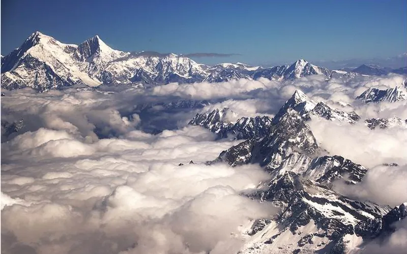
Project Possible 14/7: The 189-Day Himalayan Odyssey
How Nirmal 'Nimsdai' Purja and his Nepali team climbed all fourteen 8,000-meter peaks in 189 days, redefining the boundaries of human endurance.
Documented Sources & Archival Citations
- Beyond Possible: One Soldier, Fourteen Peaks(Nirmal Purja / Hodder & Stoughton)
Supporting claim: Autobiographical account of Project Possible 14/7 and military service
Accessed/Documented: 2020 - Himalayan Database Summit Archive(Elizabeth Hawley Archive / Alpine Club)
Supporting claim: Verified summit dates and speed records across all 14 eight-thousanders
Accessed/Documented: 2026 - K2 Winter First Ascent Dispatch(Alpine Club of Pakistan & Ministry of Information)
Supporting claim: Official verification of January 16, 2021 K2 first winter ascent without oxygen
Accessed/Documented: 2021